Search This Blog

Wednesday, December 30, 2015

Corkscrew Rail Trail(Stephentown)

Early sunsets and inclement weather can, at times, make this time of year a challenge for hiking. With this in mind I still try to use every opportunity I can to get out and do some exploring.  I visited the recently opened(June 2015) Corkscrew Rail Trail, which follows the old rail bed of the Rutland Railroad until 1952, in Stephentown after work today.  The trail can be accessed from either Knapps Road or Wyomanock Road(County 28), just west of Route 22.
I parked the car along the shoulder of gravel Knapps Road and began my walk south along the old rail bed.   
 The season's first snow blanketed the ground yesterday, leaving behind a coating of slushy mess. 
 A nearby red barn, as seen through the trees from the trail, on a dreary, drab afternoon.
The sounds of running water can soon be heard as the trail crosses a small stream, which passes through a culvert of some kind.
The trail is flat and wide with almost no elevation change at all.  The only recent tracks I encountered in the snow were dog, presumably coyote.  About .4 of a mile into the hike, the trail meets a small road for the Berkshire Mountain House.
After continuing along the Berkshire Mountain House Road for a short distance, I emerged at a road crossing.  This is Wyomanock Road(County 28), a county road that does see a fair amount of traffic, so be careful when crossing.  This spot also makes another option for parkin(please do not block the Berkshire Mountain House Road).
Continuing south, a large meadow becomes visible just off the trail to the east.
A bench provides a peaceful spot to rest and soak in a beautiful view of the nearby mountains across an open field, complete with a small pond.
The walk was nice albeit sloppy due to the mess left behind from yesterday's storm.
As of now the trail continues for about 2 miles to the New Lebanon town line.  I stopped a little short of about 1.5 miles south before turning around due to impending darkness.  Completed about 3 miles RT. on a murky Wednesday.

Monday, December 28, 2015

Sage Estates(Menands)

After leaving the Crossings of Colonie, Kalli and I warmed up for a bit and then headed over to Menands to visit a small preserve called Sages Estates.  I had never heard of this place, but saw it featured on another local blogger's page, so thought it would be nice to check it out. The preserve is literally found in a residential neighborhood, located between Broadway and Van Rensselaer Blvd, with the trail entrance located between two houses on Park Drive, across from Mountain View Rd. 
 The trail begins on a wide, easy to follow woods road.
After traveling north for a short distance, the trail turns at a steep ravine.
 Just around the bend in the trail is an open meadow.  Several yards to the right of the meadow is a fence and pond, created by damming a small creek, just past that. 
 The backyards and houses of nearby Sages Estates can be seen on the far shore of the pond.
 
 Just below the dam, the tiny creek flows into the deep ravine.
 The trails are all unmarked and at times hard to follow, as they wind through the woods.  Looking down at Kalli crossing a footbridge in a small ravine.
 We followed the trails west and then back south and east for about 1.4 miles total.


The Crossings of Colonie

With all of the hustle and bustle of the holidays, I haven't had too many chances to get out recently.  Finally had a brief window on Monday to get do some local exploring with Kalli.  We first stopped by the 130 acre Crossings of Colonie Park, located on the south side of Albany Shaker Road.  There are nearly 6.5 miles of bike and running paths that wind through the park, as well as a beautiful 3 acre pond.
We parked near the Meeting House and bundled up for a cold walk.  Loved this"accidental" picture of the flags near the memorial area.
Continuing south past Park Square, we entered the woodland area known as "The Ramble".
"The Ramble" passes through a natural hardwood forest, under pedestrian lamps and informational signs.
Emerging from the woods under clearing blue skies.  Unfortunately, the open areas left us much more susceptible to the biting winter wind.
Paved trails make this a haven for runners and bikers of all ages and abilities.
There are wide open fields near the south end of the park.
  Open views.
 Nearing a trail intersection.
Heading north past "The Rise".
 Several well placed benches provide resting opportunities along the perimeter of the lake. 
Ducks and geese crowded the lake waters on this cold winter day.
We stopped in to "The Barn" to use the restrooms and warm up.  While inside, I was fascinated by some of the informational signs hung on the walls.  Here is an interesting look at some old maps of the area.
We really enjoyed about 2.5 miles of easy walking on a cold and windy day at a beautiful park.

Wednesday, December 23, 2015

Foggy Morning

Early morning dense fog finally beginning to fade as the lunch time hour rolled in.  Enjoying a warm cup of coffee and the scene on the lake from the front porch.

Sunday, December 20, 2015

Newtonville Park and Environmental Center(Loudonville)

Our second stop for the day was Newtonville Park and Environmental Center, which is located right behind Colonie Town Hall off of Route 9 and almost directly across the street from Siena College.  From the back parking lot is a kiosk and trail head.
 Immediately beyond the kiosk is a small, but picturesque pond, where a path follows along the shoreline.
 Only a few yards up the hill above the pond is a gazebo and Christmas Tree.
 Continuing past the gazebo, the path winds through a park like area, complete with picnic tables.
 We followed the Nature Trail counter clockwise, passing by several backyards.  There is a main loop trail as well as lowland and upland shortcuts, with minimal elevation change the entire way.
 Skies began clearing out as the day wore on.
 The Nature Trail completes its loop by emerging at a water tower and access road, where a nice view of the pond and gazebo awaits you.
Completed a short half mile walk and made a perfect place to get out and stretch our legs.

Buckingham Lake(Albany)

Although it was a cool, overcast day, felt nice to get out with Kalli for a couple of locally short walks.  Our first stop was 5 acre Buckingham Lake, located off Berkshire Blvd in Albany.  There are several different ways to reach the lake, but our approach was to take Route 85 to the Western Ave(Rte 20) exit, where we turned left onto Daytona Ave and then another left onto Berkshire Blvd.  Then we stayed straight until the lake comes into sight on your right.  A small parking lot is found along the lake, next to a playground and across from Colonial Ave.
We saw many ducks congregating all along the shallow waters.  The mean depth of the lake's water is a mere 3 feet.
 A .75 mile foot path winds around the lake's shores, offering a mellow walk through a residential area.
 Several benches along the way offer chances to stop and relax.
 The path is wide and easy to follow.
 Kalli's keen eye caught this heart warming leaf.
 Passing through a woodland section of trail.
 After passing along a residential area on the southern end of the lake, the path turns north passing under lamps.
Crossing a small bridge by the west end of Buckingham Lake. This part of the lake becomes much smaller and chock full of weeds as well as encroaching vegetation.
Enjoyed a short and quiet walk on a cool and breezy day.

Tuesday, December 15, 2015

Mattison Hollow(Taconics)

After hiking Berlin Mountain from the east earlier in the day, I decided to hike up Mattison Hollow from the west in the afternoon.  The Mattison Hollow Trail provides access to the Taconic Crest Trail several miles south of Berlin Mountain.  To find it, take Route 22 to the small hamlet of Cherry Plain(not the State Park).  The hamlet is located just south of Berlin Junior/ Senior High School on Old Route 22.  Once on this road look for Mattison Hollow Road, which heads east.  Stay on this road until you arrive at a bridge crossing over Kronk Brook.  Park on the left just before the bridge, where there is room for 1-2 cars.  The trail begins on the opposite side of the road and is clearly marked.
After signing in at the trail register and initially along a pine covered trail, the trail climbs steadily up through a mostly hardwood forest, marked with yellow DEC discs.
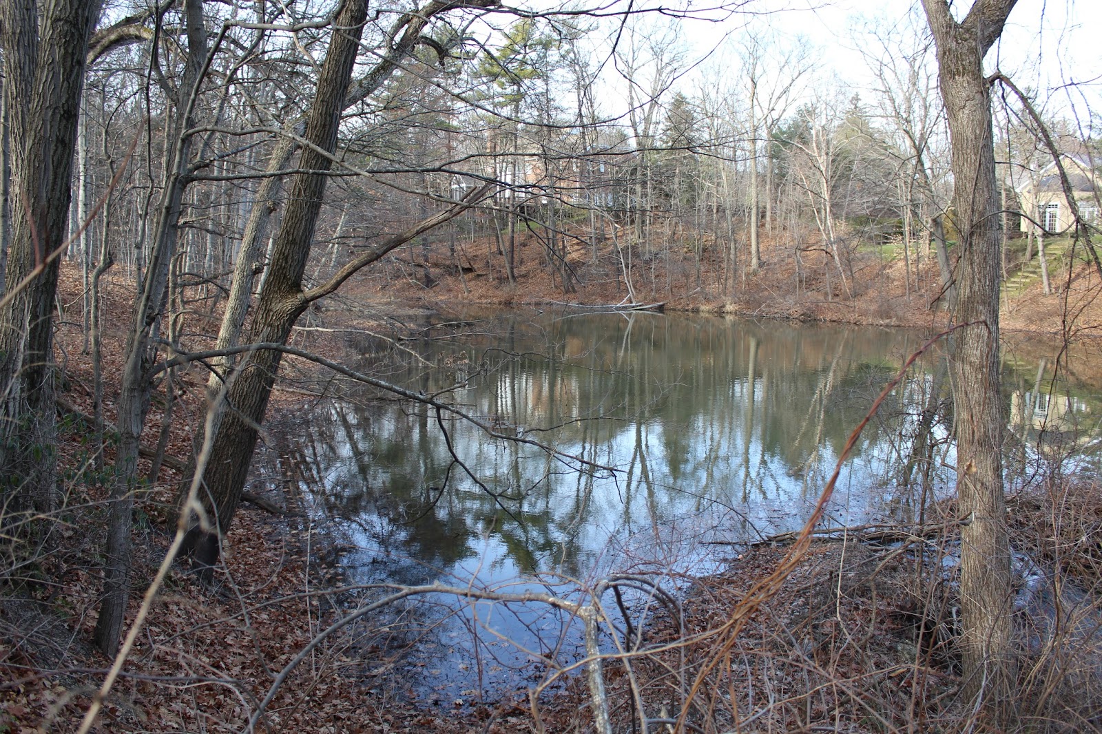
The cloudy, rainy weather gave the forest an eerie feel as I continued on.
Passing through a hemlock grove.
A somewhat foggy view to the north with one of the many shoulders of Misery Mountain rising above.
The trail is very mellow for quite a ways and makes for a nice, easy walk.
After about 1.4 miles, I arrived at the well known falls on Kronk Brook.  This is a very picturesque spot and makes for a nice place to stop and rest.
Just upstream of the main falls, the trail crosses directly over Kronk Brook.  This spot was easily rock hopped.
A view to the south at another of the many ridges of Misery Mountain.
The trail is actually an old road and is wide and easy to follow.
Continuing further into the hollow.
After 2.1 miles, I arrived at the state line, marked with a 1898 stone.
Recent rains have water flowing down the steep hillsides on several small tributaries along the way. 
Kronk Brook is almost a constant trail companion, with many cascades along the way. 
More nice cascades.
As the trail begins to get a bit steeper, the cascades on the brook become more regular.
At about the 2.3 mile mark, the trail gets very steep and continues that way until it reaches the ridgeline.  This steady climb offers interesting glimpses directly into the foggy hollow.
The final push to up to the Taconic Crest Trail.
Arriving at the Taconic Crest Trail, marked with blue discs and white diamonds, means the official end of the Mattison Hollow Trail.  My GPS marked this trail junction as 2110 feet in elevation and 2.75 miles of hiking, although the trail register says only 2.6 miles.
Retracing my steps back down into the hollow as the wind and rain really began to pick up at this point.
The sounds of rushing water on Kronk Brook as I continued along.
Darkening skies and wet woods.
Although it was only about 3:30pm, the early sunset and stormy weather had the woods looking awfully dark.
Arrived back at the car soaking wet, but feeling good.  Hiked 5.5 miles RT and about 10.2 total for the day between two stops.