Got up early to try to take advantage of a brief window of dry weather this morning to try to beat the rain moving in for the afternoon. I had to pull off to the side of the road to capture this picture of the early morning sun breaking through a thick wall of clouds and fog. This would be the only sun I would see all day, or for the last five days for that matter.
Headed down to the Catskills to hike Harding Road, a historical 19th century road that was commonly known at that time as "The Road That Couldn't Be Built". This road climbs up the steep eastern escarpment of the Catskills and was built to provide access to the famous Kaaterskill Hotel.
Today, the old road is now a DEC trail. A small parking lot can be found on the north side of Route 23A in Palenville just east of the Catskill Blue Line. Elevation at the parking area is just over 800 feet.
The old road is wide and easy to follow, ascending almost immediately with views through the trees beginning very quickly.
On the way, you will pass another trail, which climbs up the hill to the right. Continue past that to the DEC registration box at .3 miles.
The trail ascends steadily at a moderate grade, with a very steep drop off into Kaaterskill Clove to the left.
With the leaves still off the trees, there are some very nice views much of the way up.
To the right, the terrain is steep and rock strewn.
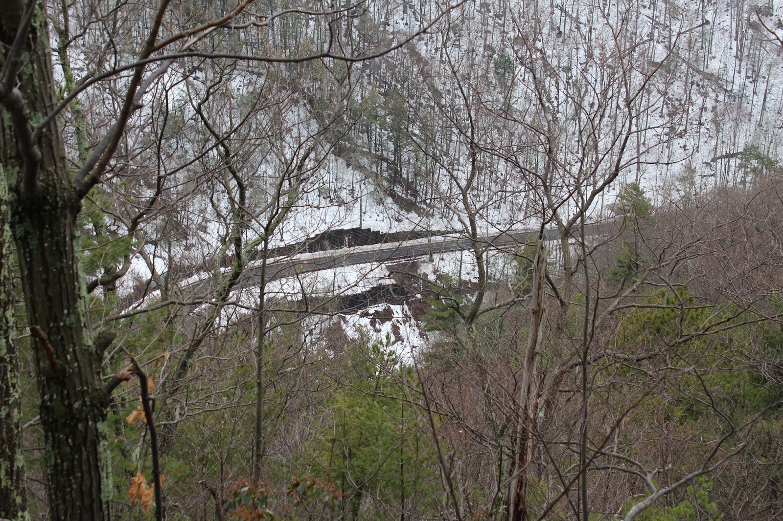
A fine look down into the Clove, with 23A easily seen winding below.
A zoomed look down to Route 23A.
Approaching a bend in the trail with an impressive drop off into the Clove just a few feet away.
A very nice viewpoint just past the bend. This is one of those spots you may want to pause and take some photos, appreciating the beauty of the Clove.
A small rock fireplace can be found near the lookout spot.
The trail continues to the north, with spectacular views behind you towards Poets Ledge across the Clove.
Winter is still holding on in the mountains, with some pretty impressive ice formations along the way.
Arriving at a stream crossing, which was running high due to the snow melt and recent wet weather.
Several small but pretty cascades can be seen just upstream at the crossing.
More cascades rushing down the steep slopes from above.
Took a few moments to enjoy the cascades and pools as I crossed over the stream. The crossing was tricky, but not overly difficult.
As the trail turns west, there are some very nice views behind you of Point of Rocks(Indian Head) high above through the trees.
Much of Harding Road passes beside some very impressive rock ledges and glacial erratics.
Huge boulders directly above the trail.
I bushwhacked a few yards off the trail to discover some extremely impressive ledges east-southeast.
Route 23A far below.
Looking directly across Kaaterskill Clove.
I explored these ledges, which had some very steep drop offs below.
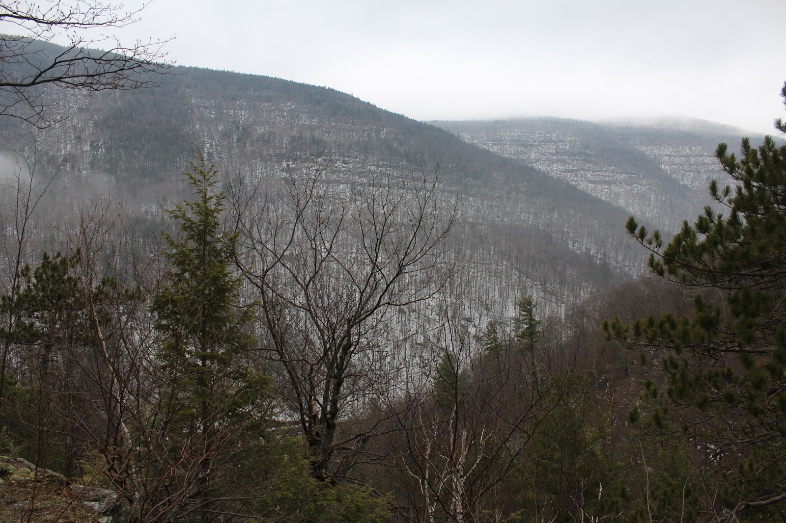
Looking across the Clove towards Hilyer Ravine.
A closer look at the impressive slopes across the Clove, with clouds and fog dropping down from the top.
Ascending past an early spring run off stream.
The snow had drifted to almost knee deep in several spots along the upper section of the trail.
Rock ledges high above the trail at about 2100 feet.
After about 2.7 miles and an elevation of 2150 feet, I arrived at a trail junction. I did a quick check of the radar and rain was knocking on the doorstep, so I decided to turn back here. Elevation gain at this point was over 1300 feet.
As I started to descend, I happened upon a sliver of a view through the trees towards Profile Rock(Indian Head).
I passed by several small caves just uphill from the trail. Wonder if any bears call these their winter home?
Light sprinkles and low clouds as I arrived back at the viewpoint.
Looking west into the Clove through a very light rain.
Dropping down towards the parking lot through a light mist.
Arriving back at the car, with the clouds and fog descending as well.
Hiked about 5.4 miles RT on a historical road up the steep eastern escarpment of the Catskills. As I pulled out and began to drive away, the rain caught up with me and became quite heavy within minutes. Got out in the nick of time.