Search This Blog

Thursday, December 28, 2017

High Falls Conservation Area(Philmont)

Took a short walk this afternoon at the Columbia Land Conservancy's 47 acre High Falls Conservation Area in the village of Philmont on a bitterly cold winter day.  Actually, we are in the midst of a bitterly cold stretch of weather that is forecast to last well over a week.  Air temps were in the single digits with wind chills far below zero as I stepped out onto the trail.  The sun may have looked nice, but did very little to warm things up.
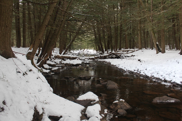
 Dropping down to a bridge crossing over a frozen tributary.
 I followed the green trail to the eastern blue trail, which drops down to the wintry Agawamuck Creek.
 As I walked beside the creek, you could almost see the water freezing into ice before your very eyes.
 Icy reflections.
 Although these dark and cold winter days can be uncomfortable, there is a pure beauty to this season that is unmatched the rest of the year.
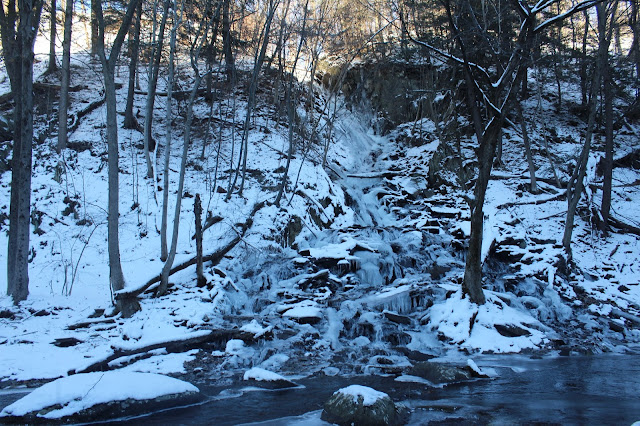
 Passing by "mini" High Falls, a drainage that has turned into a beautiful cascade.
 Looking up the gorge cut out by the Agawamuck.
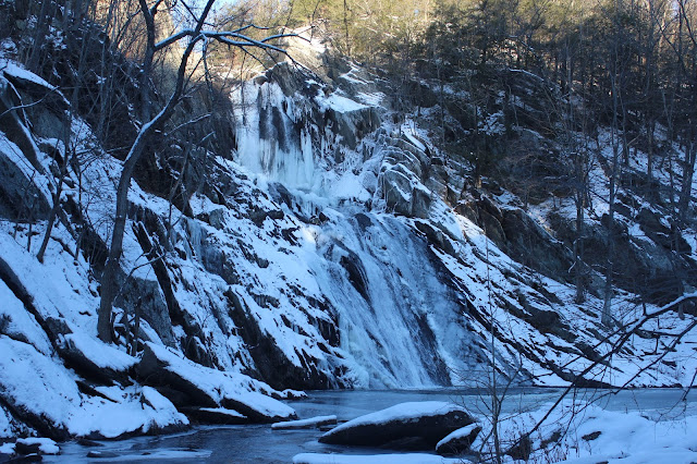
 High Falls, mostly frozen, but with a bit of open water rushing down, draped in its winter best.
 Frozen pretty much sums up the weather, as any kind of breeze at all made it dangerously cold.
 I looped up to the view of High Falls from higher up, along the green trail.
Took the half mile red trail through the wintry woods and back to the green trail, which leads to the parking area. 
Walked about 1.25 miles total at a brisk pace to keep the cold at bay.  Even with the frigid weather, the fresh air sure felt good.

Sunday, December 24, 2017

Cheshire Cobble(Berkshires)

Did a short Christmas Eve hike this morning to Cheshire Cobble in the central Berkshires.  I parked at the small parking area just east of the village of Cheshire along Notch Road on a comfortable 30 degree morning.  I've done this hike a couple of other times, but wanted to check out the east slopes of the mountain off trail as well this time.  I followed an unmarked woods road south, which climbs up above McDonald Creek.
 The woods road is fairly well traveled by locals and was shown a lot of recent activity in the snow.
 I left the woods road and began a more direct route to the Cobbles.  Much of this land is part of the Chalet Wildlife Management Area.
 As I gained elevation I began to enjoy some screened views back to the north of rural Cheshire and Adams.
 My route soon met back up with the marked Appalachian Trail, just below Cheshire Cobble.
 Directly below the Cobble.
 The sheer size of the shaved off boulders and ledges is quite impressive.
 The trail swings around the Cobble, with a short spur trail leading over to the view point.
The view from Cheshire Cobble, as always, is quite spectacular.  Cheshire Reservoir as well as the village of Cheshire sit directly below this vantage point.
The view southwest with Cheshire Reservoir sprawling out.
 The viewing area is quite large and can be explored a bit, with slightly differing views.
 The north end of the Cobbles, provides a fantastic view of Mount Greylock.
 After enjoying the views, I began a bushwhack southeast off the trail.  There was about 3 inches of crusty snow in the woods, but footing wasn't bad.
 Arriving in a small clearing, that looks like would make a nice campsite.
 I wandered the east slopes in search of views.  I remember seeing a small slide on this side of the mountain, but don't think I went far enough down to find it.  I did find some nice filtered views to the east towards Woodchuck Hill.
 Northeast views through the trees.
 I eventually headed back northwest, finding my way to the Appalachian Trail, which climbs up and over the true summit of Cheshire Cobble.  From there, a nice view to the Reservoir can be enjoyed.
Coming down off the summit on the icy trail.
Followed the woods road back to the car, passing this lonely beech tree along the way.
Hiked about 2 miles total on a comfortable Sunday morning.  Merry Christmas to all.

Friday, December 22, 2017

Kinderhook Creek Preserve(East Nassau)

It's been a good run of bad luck lately with car issues, work, and at times stormy weather, so I really haven't gotten out much recently.  Took advantage of a brief window between light snow and impending freezing rain on a stormy day(with heavy snow to the north), by heading over to the Rensselaer Land Trust's Kinderhook Creek Preserve, just down the road from my house.
 Did a loop on the white marked trail over to the black marked SAY trail, which drops down near the creek's shore.
 I wandered around beside the creek, checking out the cold waters. 
On my loop back to the car, a light snow and freezing rain began to fall.  About 1.3 miles total on a cold winter day.

Monday, December 18, 2017

West Stoppel Point(Catskills)

A late start due to an iffy morning forecast left me with only a few hours of precious daylight to explore today, so I decided to head down to the northeast Catskills(which is under an hour and a half drive). I chose to bushwhack 3100 foot West Stoppel Point, which is another Catskill Hundred Highest peak that I need on my list.  I parked in the very last parking area along Colgate Road(CR 78) and headed south into the snowy woods.  Snow depth at the road, which was just over 2100 feet, was about 4-5 inches.  No showshoes needed, but I brought them along just in case.
 A short distance in, I came to a crossing over the East Kill.  This proved to be a fairly easy rock hop.
 The wintry East Kill, which flows out of Lake Capra just upstream of here.
 Once across the creek, the woods turn into a beautiful, dark conifer forest.
 I chose to ascend West Stoppel's western sub summit first.  The woods are very open, with screened views nearly the entire way back north to the Blackheads. A snow squall can be seen moving in over Thomas Cole here.
 Blue skies began to emerge to the southwest as I continued my climb.  Clouds would quickly take back over and eventually win out.
 The East Kill Valley as well as most of the Blackhead Range can clearly be seen through the bare trees as I gained elevation.
 Typical steep slopes, as I gained over 900 feet in about one mile to the western sub summit.
 Arriving at the wooded 3040 foot sub summit.  Notice the yellow pain blazes just beyond, signifying the state land boundary.
 The true summit was a mere half mile away, so I began an easy drop down to a small clearing in the barely noticeable col.
 From the 3000 foot col, looking back at the 3040 foot sub summit.
 A quick, easy ascent up to the 3100 foot summit marked my 76th Hundred Highest Catskill.  There were about 6-7 inches at the summit, which is a fairly large flat area. 
 I wandered around a bit, looking for a high spot, and settled on this small stand of conifers as the true summit.
 I decided to basically head due north off the summit, then drifted back towards my bread crumb trail near 2500 feet.  From this area, I spotted a small opening in the forest canopy, with a nice view towards Black Dome.
An easy descent dropped me back down to the East Kill, in a shaded hemlock forest.
Crossed back over the creek, arriving back at the car at just under 4 miles RT, with over 1000 feet of elevation gain.  76/102 CHH.

Wednesday, December 13, 2017

Five Rivers Educational Center(Delmar)

Winter has finally arrived...and with a vengeance.  Unfortunately, the winter storms this week fell on my free hiking days, so I've been kind of cooped up recently.  Took advantage of a free window of time after work today though to do some exploring at the 450 acre Fiver Rivers Educational Center located off Game Farm Road in Delmar.  A bitterly cold day with wind chills in the single digits was not enough to stop me from getting out.  It was enough to keep most others away though, as there were only a couple of cars in the large parking lot when I arrived.  I layered up and headed out, heading towards my favorite trail on the property beside the Vloman Kill.  Along the way I spotted a relative of Frosty, who seemed happy despite the cold weather.
Dropped down to the Vloman Kill Trail near the western edge of the property, where the creek winds its way peacefully through a woodland.
The recent cold and snow have left the babbling Vloman Kill locked up in a wintry freeze.
Snowman #2 along the creek banks.
The power of erosion on display along the hemlock shaded banks of the Vloman Kill.
Left the Vloman Kill Trail and picked up the Big Pine Trail, which hugs the creek as well, before eventually climbing up and out of the ravine.  Just off the trail a very short distance I stumbled upon a Lean To shelter.
Soon picked up a trail marked as Larch Lane and then onto the Service Road Loop.  From a viewing platform, I enjoyed a pleasant, but freezing view across the open fields where birds dance and sing.
A tiny pond called "Skeeter Bowl" sits just a few yards off the trail.
Continued following the Service Road Loop east towards a group of ponds known as the Research Ponds.  The grouping of ponds are all huddled beside each other, each completely frozen over.
The Old Field Trail and a large, wide open field can be found along the far east side of the property. A viewing platform offers up a chance for visitors to quietly enjoy the nature setting around them.  Today, with its strong north winds however, wasn't the best day to be out on this exposed location.
A bench marks a quiet spot to enjoy Sunfish Pond.
Just before arriving back at the Visitor Center, I spotted Snowman #3.  He also seemed very friendly as he was smiling ear to ear. 
Arrived back at the car chilled, but not uncomfortable.  There was very little elevation change on the crusty snow and random ice that I walked on.  About 2 miles total, and I only saw one other hearty soul out on the trails.