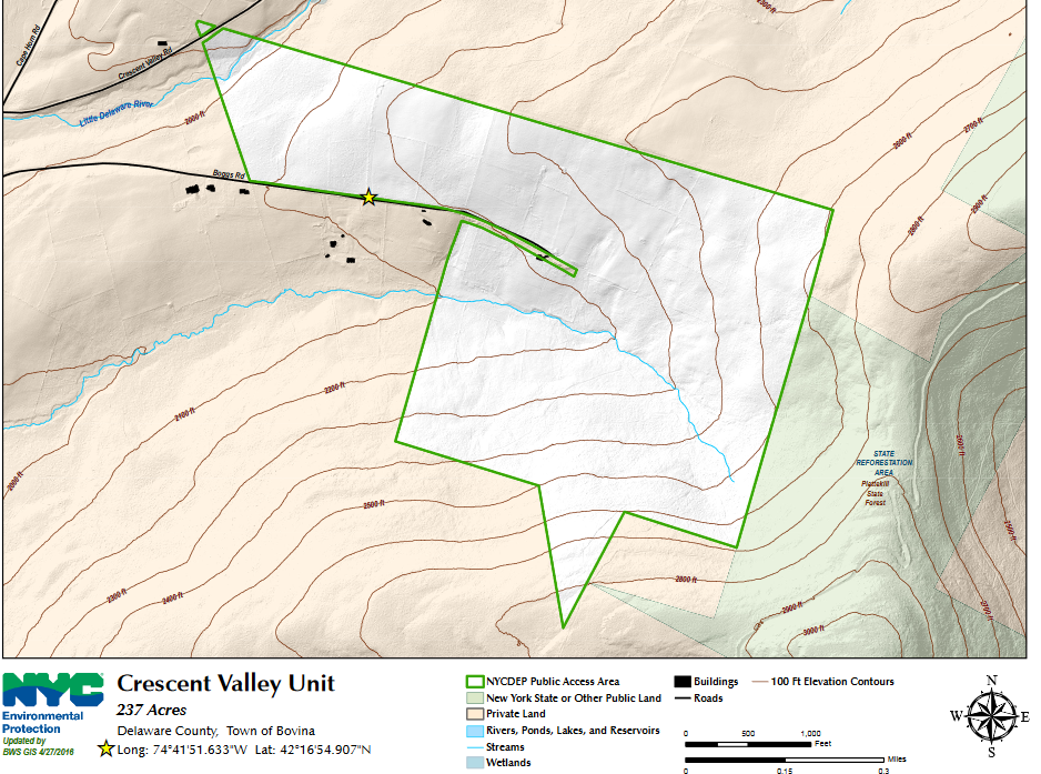
My buddy Jim and I are always looking over maps, studying public land and open routes to mountains. Recently, we spotted a nice swath of DEP land that connects with DEC land on North Plattekill Mountain's west slopes. North Platekill is the mountain with a ski area located in the town of Roxbury in the western Catskills. What many people don't realize is that there is much more to this mountain range than just a ski area, and makes up an area known as the Plattekill State Forest. Our starting point today was from the very end of Boggs Road, where DEP land starts beyond the dead end, at nearly 2150 feet elevation.
We opted to check out the large, wide open meadows that are on the north side of the road first. It does appear that these fields are active farmland, so we were respectful of the land, leaving no trace(other than our snowshoe tracks).
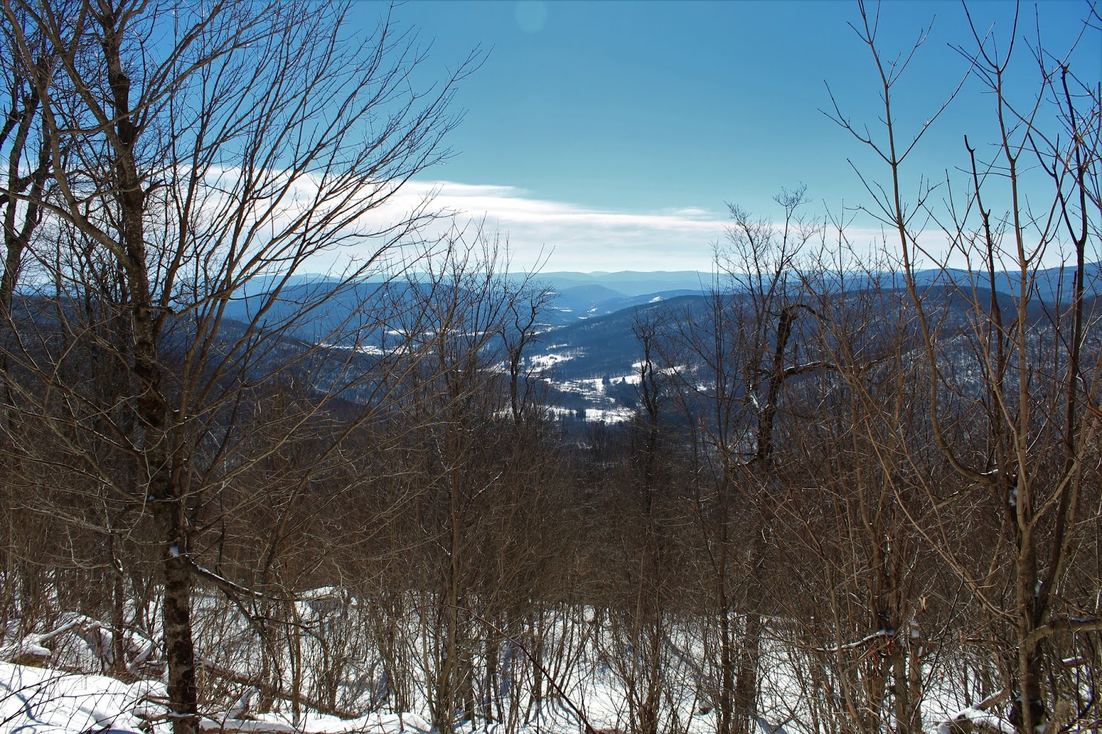
Ascending up through the meadow, we soon enjoyed great views to the west of Mill Mountain and many other smaller town of Bovina peaks.
Jim, taking a moment to soak in the great west facing view towards the peaks surrounding the Little Delaware valley.
A look back across the open meadow south towards our car and Round Top's long ridge towering above.
At the high end of the meadow, just below 2500 feet, we came to an area of apple trees, and views spreading out towards the Warren Range.
From a rock wall along the DEP property line, we enjoyed a terrific view north towards 3020 foot SE Warren Mountain(a Catskill hundred highest peak).
Once above the meadows, we found a series of old logging roads, which climb high up the west side of the ridge.
Jim leading the way as we ascended eastward, with the early morning sun doing little to warm the temps above the teens.
DEP land connects with DEC land and soon brought us up onto the ridge near the col between Round Top and North Plattekill.
As we headed north/ northeast high in the cirque above Thompson Hollow, we enjoyed many through the trees views to the south.
Life is hard over 3000 feet on a summit ridge. Just ask these hardwoods.
Through the trees we could catch occasional glimpses of Round Top Mountain to the southwest.
A sliver of a view towards Burnt Hill, rising above Thompson Hollow.
From over 3100 feet, looking almost due south over Thompson Hollow.
The true 3340 foot summit, laced in pricker canes and about 2 feet of snow.
A short distance past the summit, we soon arrived at the ski slopes, which were closed for the day. We took this opportunity to check out some of the views. A steep look down at the ski lodge, nearly 1000 feet below.
Snow art!
The views from atop the ski slopes are nothing short of spectacular. Here's a view northeast over Meeker Hollow Mountain.
You run out of superlatives to describe this amazing views. A far reaching view northeast to the peaks east of Route 30.
NW views.
A nice view east towards White Man Mountain and its ridge connecting north to Montgomery Hollow Mountain. Just beyond that is the Bearpen ridge.
Leaving the ski slopes, we found a series of other trails that meander around the summit ridge. Just off trail from a small clearing, we found this view spot to the NE.
Continuing SE, we soon arrived at yet another viewpoint. This small ledge provided interesting views back to the SW, above Thompson Hollow and towards the saddle between Round Top and North Plattekill.
Round Top, directly across the hollow to the west.
After climbing up and over a false summit bump on North Plattekill, we dropped down slightly to a spectacular view east over South Plattekill Mountain, with Doubletop and Graham in the distance.
After dropping off a series of steep ledges to the east towards the saddle, we began to head northeast, picking up yet another woods road.
It was a very steep descent in the darkening shadows on the north slopes of the ridge, where the valley floor loomed far, far below. DEP land once again met DEC land on this side of South Plattekill, and brought us down towards the road.
Deep down on the north slopes, we came to a pretty, partially frozen tributary crossing.
A short road walk along scenic Lower Meeker Hollow Road brought us back to our waiting car.
Arrived back at the car after 6 miles and over 1400 feet of ascent.
From there, it was a typical, gorgeous drive home through the heart of the western Catskills.