A continuous onslaught of cold, wet(and white) weather has taken hold of the northeast much of this month, leading many folks to dub this month "Snowvember". Winter has certainly arrived early in most locations, but especially for the higher elevations. This shot on my drive to Thacher Park today pretty much sums everything up.
As I arrived at Thacher, a heavy band of snow squalls was hastily departing, leaving behind a pretty blanket of white.
Snow covered woods.
Within a matter of minutes, the squalls were replaced with gusty NW winds and even some glimpses of sun and blue skies. I walked the edge of the escarpment, which I've done numerous times before, but still never disappoints. A glance across to Mine Lot Falls with the radio towers along Pinnacle Road in the distance beyond.
Several fresh inches of snow blanketed the ground and made for a picturesque walk. I bare booted it with no issues at all.
The view back across to the Horseshoe Lot.
While the high elevations along the escarpment were buried under several inches of drifting snow, the valley below took on a much different, drab, typical November appearance. This is a zoom shot towards the Albany skyline.
The dramatic drop off along the edge of the escarpment wall.
While certainly not attaining the great heights of its Catskill neighbors to the south or Adirondack brothers to the north, the escarpment is still an impressive site to behold. Whether its your first visit or 100th, the beauty of this place can leave you speechless.
Walked about 1.5 miles on this breezy, cold November day.
Adventures around the Capital Region area of New York State, as well as the Adirondacks, Catskills, Berkshires and Vermont
Search This Blog
Wednesday, November 28, 2018
Monday, November 19, 2018
Erie Canal Towpath Community Connector to Vischer Ferry(Halfmoon/ Clifton Park)
With another dreary day upon us, I decided to do an easy walk along the Mohawk River this morning, parking at the corner of Clamstream Road and Towpath Road, just east of the Twin Bridges in the town of Halfmoon. I was the only car in the lot when I arrived, on this overcast 35 degree day.
The view from the parking area is quite nice, looking northeast.
A bench makes this a quiet place to soak in the views.
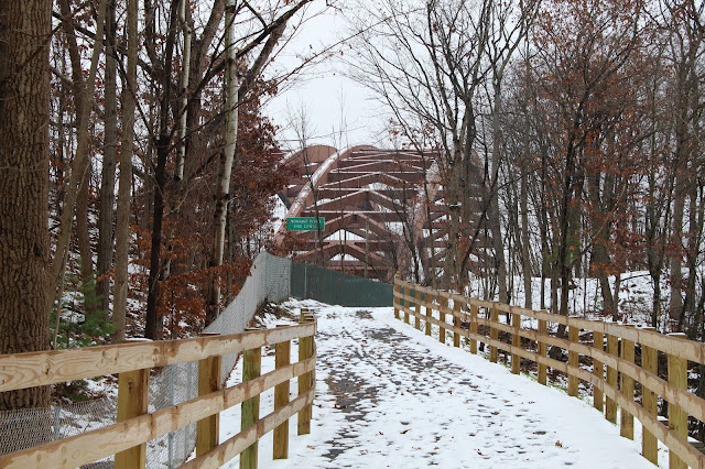
A short road walk on Towpath Road quickly brought me under the Twin Bridges. A very unique perspective on one of the busiest traffic spots in the Capital District.
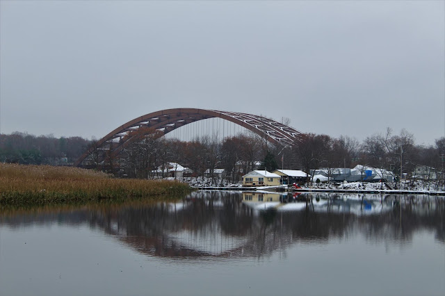
The Twin Bridges, which were opened all the way back in 1959, are not only one of the busiest parts, but also one of the most recognizable features of the Capital Region.
From under the Twin Bridges, the serene Mohawk view towards the town of Halfmoon, looking northeast. The constant pounding of traffic echoes from above, putting an end to any sense of solitude you may feel.
The trail quickly climbs up and away from Towpath Road, briefly passing by the rushing southbound traffic of the Northway, which sits only about 20 yards away. Within just a few moments however, the trail swings left(west) entering a much quieter area, with woodland on one side, and wetland on the other.
Much of the area immediately west of the Northway is wet, with a couple of small ponds and backwater areas of the Mohawk infringing on the trail.
Continuing west, with a sturdy footbridge crossing over
A large backwater area of the Mohawk, near an oxbow.
The inlet of Wagers Pond, which is actually part of the Mohawk.
Just beyond the bridge is a very nice river view from a power line crossing.
Reentering the woods, the trail parallels the a stretch of the orignal Erie Canal.
A very wintry looking scene.
From across the Canal, a decent look at Clute's Dry Dock, which is easily accessed from Riverview Road and is part of the Vischer Ferry Nature and Historic Preserve.
A short path leaves the main trail, leading to a view of the Mohawk.
A bench and very small clearing provide a view back downstream across the Mohawk.
South view towards the Mohawk View Water Treatment in Colonie.
This large area of cattails just off trail caught my attention.
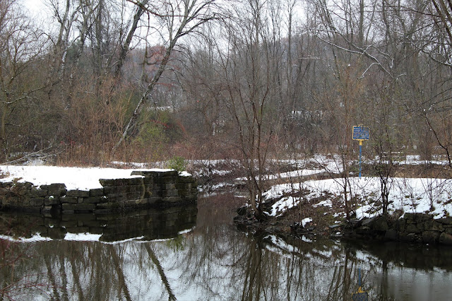
My turn around point was at these old bridge abutments, about halfway between Clute's Dry Dock and Whipple Bridge.
Retracing my steps, approaching the Twin bridges once again.
Arrived back at the car for a total of about 3 miles RT. Very easy walking and didn't see another soul the entire time.
The view from the parking area is quite nice, looking northeast.
A bench makes this a quiet place to soak in the views.
As I began my walk, heading southwest, I caught a nice glimpse of the Twin Bridges across the water, with about an inch of spotty snow underfoot.
The connector trail passes through a small, residential area, including the Diamond Reef Yacht Club and its docks. A picnic area is also found here, at what must be a popular summer fishing spot, aptly named Fishermans Cove.A short road walk on Towpath Road quickly brought me under the Twin Bridges. A very unique perspective on one of the busiest traffic spots in the Capital District.
The Twin Bridges, which were opened all the way back in 1959, are not only one of the busiest parts, but also one of the most recognizable features of the Capital Region.
From under the Twin Bridges, the serene Mohawk view towards the town of Halfmoon, looking northeast. The constant pounding of traffic echoes from above, putting an end to any sense of solitude you may feel.
The trail quickly climbs up and away from Towpath Road, briefly passing by the rushing southbound traffic of the Northway, which sits only about 20 yards away. Within just a few moments however, the trail swings left(west) entering a much quieter area, with woodland on one side, and wetland on the other.
Much of the area immediately west of the Northway is wet, with a couple of small ponds and backwater areas of the Mohawk infringing on the trail.
Continuing west, with a sturdy footbridge crossing over
A large backwater area of the Mohawk, near an oxbow.
The inlet of Wagers Pond, which is actually part of the Mohawk.
Just beyond the bridge is a very nice river view from a power line crossing.
Reentering the woods, the trail parallels the a stretch of the orignal Erie Canal.
A very wintry looking scene.
From across the Canal, a decent look at Clute's Dry Dock, which is easily accessed from Riverview Road and is part of the Vischer Ferry Nature and Historic Preserve.
A short path leaves the main trail, leading to a view of the Mohawk.
A bench and very small clearing provide a view back downstream across the Mohawk.
South view towards the Mohawk View Water Treatment in Colonie.
This large area of cattails just off trail caught my attention.
Retracing my steps, approaching the Twin bridges once again.
Arrived back at the car for a total of about 3 miles RT. Very easy walking and didn't see another soul the entire time.
Wednesday, November 14, 2018
Overmountain Conservation Area(Ancram, Columbia County)
Decided to pay a visit to the Columbia County Land Conservancy's newest land acqusition, the Undermountain Conservation Area, located at 138 Catalano Road in the town of Ancram after work today. The new area is the Land Conservancy's largest, at 1700 acres in size. I arrived at the brand new Kate Hill parking lot, complete with signage and a kiosk at an 1150 feet elevation.
Stopped by the kiosk to pick up a trail map, and then continued on to a nearby old barn and a pair of picturesque silos. From the barn, a right turn brings you onto the yellow trail.
I followed the yellow trail, which is actually an old farm road, up through a stately row of maple trees. Although pretty, this area is painstakingly open to the bitter winds that were crashing down from the northwest today.
The trail climbs to the top of a wide open knoll, with other trails breaking off in each direction. This part of the hike was made much more difficult to enjoy due to the harsh winds.
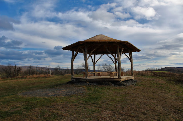
A gazebo sits atop the knoll, with spectacular views over the Harlem Valley and all the way west to the Catskills.
The rustic gazebo would make a perfect spot to watch the sun set.
The Catskill views from the gazebo.
Continuing on the yellow trail past the gazebo, the trail passes by a high meadow with distant views east towards the Taconics.
The yellow trail forms a loop in a large field at the far north end of the property.
Looping back south toward the gazebo, I turned left(east) onto a green marked trail, passing by a pretty pond.
The green trail passes through wide open fields, before meeting up with a black marked trail, which also stays in the open. This section of trail does offer up some nice views of the Taconic ridge, but leaves you terribly exposed on a cold, windy day such as this.
I traveled south on the black trail all the way back to the yellow trail on the farm road near the parking area. From there, I crossed Catalano Road and headed up the wide open slopes of Gentian Hill.
Gentian Hill is really just a large hill, at just over 1200 feet in elevation, but the views east towards the Taconics are quite nice.
From the top of the hill(and also the southern edge of the property), a nice view unfolds to the north, covering much of the trails I had just traveled.
Taconic views to the east as a steady drop brings you back down towards the hill's lower slopes.
A last sweeping view of the southern Taconic ridge, from the edge of the Conservation Area. I was quite impressed with the multitude of viewpoints that are offered.
Turning the corner, heading back towards the parking area, with a a mowed path passing through a large swath of green.
I took a moment to check out a section of the blue trail, which crosses Catalino Road and actually connects this area to two other Columbia County Land Conservancy properties, Round Ball Mountain to the south and Fox Hill Preserve to the north. The stone steps leading away from the road are just one example of the impressive amount of work put into these trails.
Arriving back at the pastoral red barn, complete with a green John Deere tractor.
I really enjoyed this brand new preserve in the southeast corner of Columbia County, covering nearly all of the trails for a total of 3 miles with just under 400 feet of ascent.
Subscribe to:
Posts (Atom)


