Search This Blog

Tuesday, February 26, 2019

Ginseng Mountain(Catskills)

Headed south to hike 2813 foot Ginseng Mountain in the far northern Catskills on a cold and very blustery late winter day.  After spending much of the morning doing storm cleanup from a fallen tree in my yard, it felt good to get out in the early afternoon to hike this (mostly)trailed peak.  I parked at the Elm Ridge parking area at the corner of Cross Road and Route 23 in East Windham, best known as the trailhead for Windham High Peak and the Escarpment.  After getting layered up, I headed to the other side of Cross Road, where the Long Path enters the woods.  Elevation to start the hike was about 1770 feet.
This section of trail seems to see far fewer hikers than many other Catskill trails and as suspected the last person to sign into the trail register was well over a week ago.  I signed in and continued along through about an inch or so of snow, passing by a picturesque old stone wall.
A long boardwalk helps keep feet dry through a damp area, with the sounds of rushing traffic on Route 23 nearby.
Within a few moments, and under half a mile into the hike, the sounds of the road quickly disappear as the trail winds its way through a conifer forest.
After leaving the conifers, the trail soon  comes to a quiet road crossing north to Jennie Notch Road.  This is not your normal road walk, as you pass by pleasant Mary's Hill Farm, soaking in the wonderful surroundings.
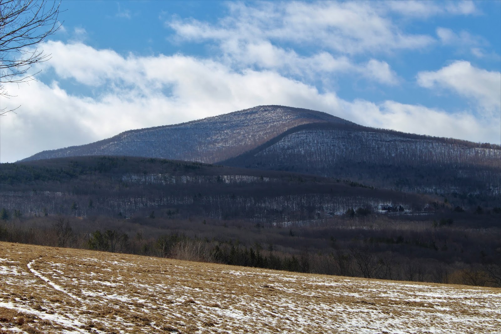
Across the fields and a small pond, I enjoyed the view of nearby Mount Zoar, with abandoned old farm equipment below.
I am usually not much of a fan of road walks, but I found the walk up gravel Jennie Notch Road quite agreeable.  Beyond the last house on the road is a gate and a small DEP parking area, where one could conceivably park to start this hike if they so chose.  As I mentioned though, I actually enjoyed this mostly flat 1.3 mile hike in.
Once on DEP land, the Long Path follows an old continuation of Jennie Notch Road, which was actually a 19th century turnpike connecting the mountains to the valleys to the east.
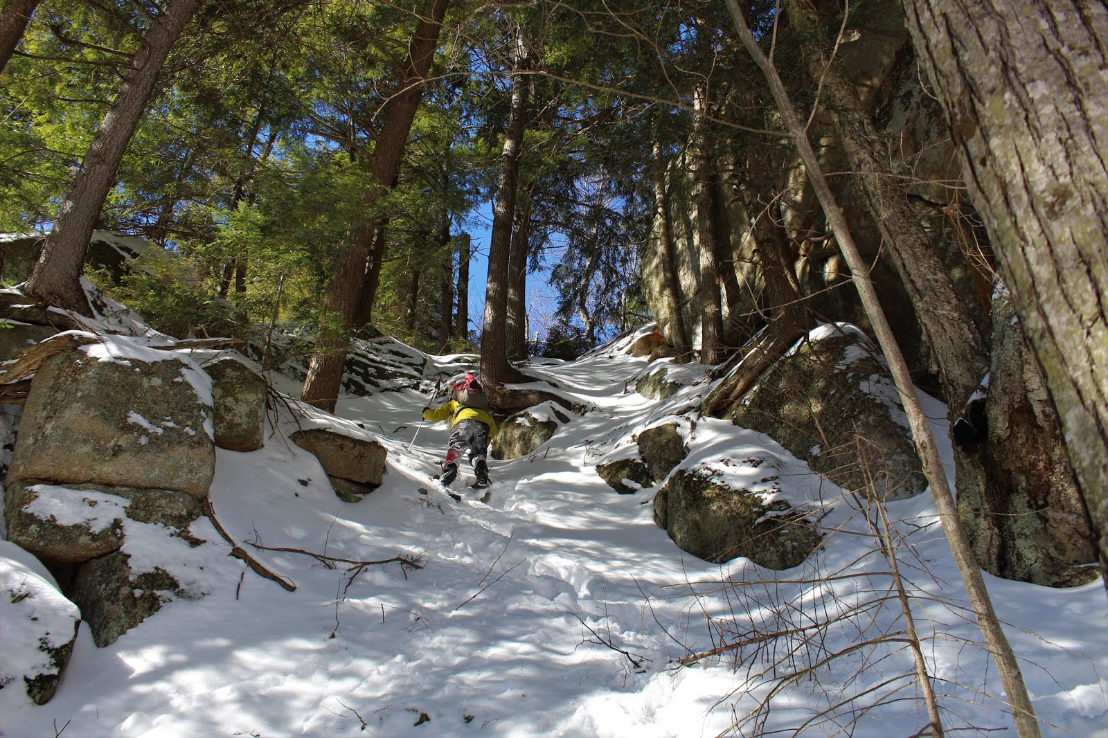
Just over 2 miles in, the trail passes through another old gate and enters into the notch.  The small cliffs and rock formations just off trail are quite impressive here.
Once in the notch, the trail turns sharply left, becoming quite steep on its way towards Ginseng's summit.
The Long Path actually hugs the north side of the summit area, with filtered views down into the Durham Valley plentiful.
While there are no wide open, unobstructed views, the valley views from this lofty elevation are still quite nice.
The Long Path completely passes by Ginseng's summit on its way towards Barlow Notch and Mount Hayden, so I decided to leave the trail here and bushwhack onto DEP land, up towards the top of the mountain.
I emerged into a large, open field at the 2813 foot summit of the Ginseng, which is located on DEP land.  While this was a neat area, there unfortunately were no views to be had from here.
Instead of heading back via the trail, I decided to continue my bushwhack SE off the summit, finding my way over to several nice sets of ledges. 
A zoom view towards the Blackhead Range, with Windham High Peak's ridge just in front of it.  Mount Zoar's ridge is the ridge in the foreground.
My favorite ledge was the open rock just above Jennie Notch, where a bit of a broader south view opens up. 
I dropped off the ledges soon picking up Long Path again, just below Jennie Notch.  A nice and easy descent brought me back down to a small stream crossing.
Sometimes the unexpected surprises are the very best part of these hikes and today was no exception. Just about 20 yards off trail, and slightly downhill,  I came to a quiet shoreline on a frozen beaver pond.  To the north, towering above the frozen water, is Ginseng Mountain.
The road walk out was just as nice as I remembered on the way in, with a spectacular view of Windham High Peak to the south across Mary's Hill Farm.
Mount Zoar to the NE from Jennie Notch Road,
Arrived back at the car with daylight to spare.  I'm really starting to love these lengthening late winter days, as sunsets near 6pm.  An easy 6 miles RT, with over 1300 feet of ascent.  Mostly trail, with a little bushwhack mixed in.
With the extra daylight, I opted to take the back roads home, dropping down into Cornwallville, in the shadow of the Catskills.
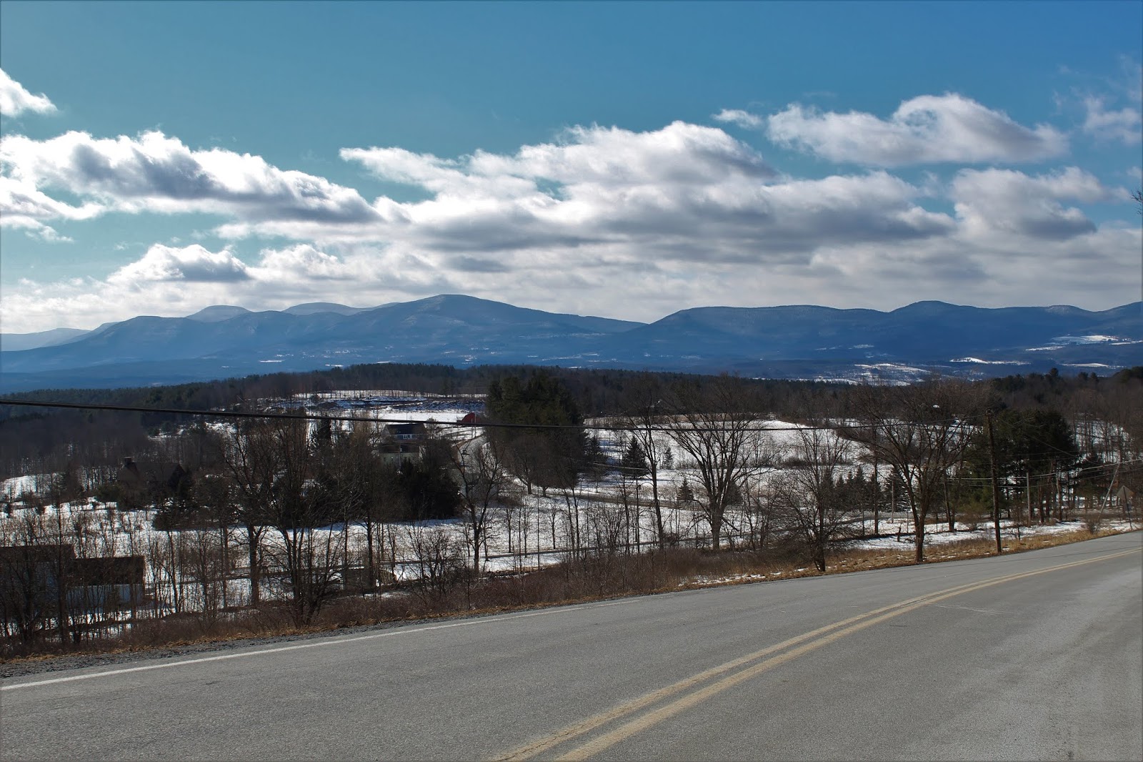
Windham High Peak towering above the Durham Valley. 
A bit further north, the tiny hamlet of Medusa provides an incredible, panoramic view of the northern Catskills.


Thursday, February 21, 2019

Albany County Rail Trail(Voorheesville)

While out and about this afternoon, I took advantage of a small window of time to get some exercise along a stretch of the Albany County Rail Trail.  I parked in a small parking lot where Grove Street and Voorheesville Ave meet and set out under mostly cloudy skies and temps in the low 40's.  A gusty north wind kept it feeling a bit cooler though.
 Heading east, the trail parallels businesses and homes before a crossing high above Vly Creek. 
 Wintry Vly Creek meandering along to the south.
This part of the trail alternates passing through woods and backyards, and even on a cool mid winter day, seems like a popular neighborhood walk.  Any sense of being one with nature is quickly halted at a bridge crossing over busy Route 155.
Continuing east, just beyond Hilton Road is the Hilton Barn, which was moved from the town of New Scotland back in 2016.  The barn was originally built in 1898 and is one of the largest post-and-beam structures ever built in Albany County.  This scenic spot made a perfect turn around point.
Just last year, this stretch between Voorheesville and Slingerlands became the second section of the rail trail to be paved.  You wouldn't know that today, as the pavement sat beneath several inches of snow and slushy ice.
If you look closely, you may see remnants from the old rail lines.
A quick, easy leg stretcher added up to about 2.3 miles total. 

Tuesday, February 19, 2019

Peak 817 "Kings Seat"(Siamese Ponds Wilderness-Adirondacks)

Met up with my buddies Spencer and Jim to hike a small 2680 foot peak which directly south of Chimney Mountain and NW of Puffer Pond.  The peak is labeled on USGS maps as 817 meters, but Spencer came up with the name "Kings Seat", due to the mountain's proximity to Kings Flow.  The draw for us on this peak was a series of steep ledges on the south side of the peak, which we hoped would provide views.  We parked at the trailhead for Chimney Mountain($2 for parking on private property) at the end of Big Brook Road, and got geared up.  Temperatures were in the single digits so it was going to be a cold one for sure.  Elevation to start is quite high at 1730 feet.  We headed out on the trail to Puffer Pond, where the trail was nicely broken out.
Although cold, the conditions were almost perfect for a great snowshoe hike.  The mileage on the trail went super fast as we climbed to a height of land.
At a height of land, we left the trail and began our bushwhack west climbing steadily up the unnamed peak.  Within a short time we began to get through the trees views towards Puffer Mountain.
 Bluebird skies and deep, fluffy snow greeted us as we neared the wooded summit area.
Continuing on beyond the summit, we dropped through a section of spruce before we found one of the ledges we were looking for.  The views did not disappoint.  We enjoyed a great view of 3450 foot Puffer Mountain towering across the valley.
An east view toward Puffer Pond provided us with a glimpse of Gore Mountain peeking out over Puffer's ridge.
 From our ledge we had a nice look through a stand of white birch back over at the summit we had just been on.
One last glimpse at our view before we headed back up, then down to another lower ledge.
The next view spot, a bit more than a hundred vertical feet lower, provided us with another view towards Puffer Mountain.  This open area was actually much broader than the higher ledge.
As we left the second open area, the summits of Humphrey Mountain could be seen poking out to the SW.
After dropping down a bit in search of hidden ledges, we found ourselves re-climbing.  An impressive rock wall made it difficult to find a way up.
 Spencer aims for a chute up..but the snow and ice were a tough challenge..
 ...Jim heads up next, in search of a way up..but to no avail.  We eventually had to give up and head all the way around these enormous rock walls.
All of our hard work and perseverance paid off, as we emerged at another impressive ledge, just off the west summit bump of this peak.
 
SW views towards Humphrey Mountain and Horseshoe Mountain just beyond.  In the foreground is the far west ridge of Puffer Mountain.
A nice and easy descent west through hardwoods brought us back down to the marked trail along the east shore of Kings Flow.  We left the trail briefly and took a few moments to enjoy the views across Kings Flow. 
Jim and Spencer soaking in the views and sunlight across Kings Flow to the south.
We hiked the trail back from there, emerging to an open view of the peaks just NW of Chimney Mountain, with Chimney Mountain Cabins below.
Our part trail-part bushwhack hike was short and sweet, with just under 5 miles and 1200 feet of ascent.