Search This Blog

Monday, December 31, 2018

High Nopit(Town of Bolton-Adirondacks)

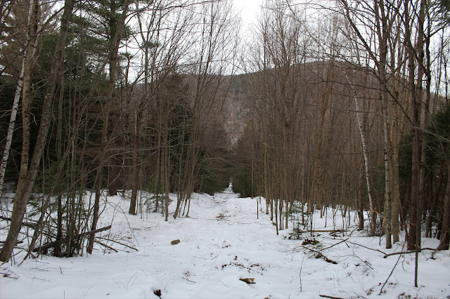
Decided to do a short New Years Eve part trail/ part bushwhack hike in the town of Bolton this morning to an open summit area atop 1660 foot High Nopit.  I started from the Lake George Land Conservancy's Amy's Park on Trout Falls Road, where a yellow marked trail crosses the road.  I fit my car onto the west shoulder of the road and headed into the woods, climbing steeply on the yellow blazed trail.  Elevation to start was about 1040 feet.
The Lake George Land Conservancy has done a phenomenal job making the trails here, literally building steps into some of the steeper areas.
At a trail junction, a red blazed trail turns south heading over to a nice ledge view.
Just past the ledge, the marked trail ends.  This is where the bushwhack began.  I passed through a couple of logged areas and found some woods roads in the 3/4 of a mile bushwhack to High Nopit.
As I approached the summit cone, the woods opened up very nicely to a wide open, meadow with south facing ledges.
From a wide open ledge, I enjoyed views west towards Crane Mountain.
Padanarum Road can be seen winding its way towards Lake George from the wide open ledges.
The open summit woods, under a canopy of oaks.
Sun and mist taking turns on Lake George.
East views provide a nice glimpse of the morning mist on the lake beyond the summit bump of Pole Hill.
Another south facing ledge, enjoying the view of the rolling peaks just west of Bolton Landing.
The true summit of High Nopit.
Lake George views, with the Tongue Range poking out just past Pole Hill.
From a slightly lower ledge, the views SW stretch far and wide.
The ski slopes on Gore Mountain can easily be identified to the west.
After soaking in the incredible views, I dropped off the summit ridge, circling the NW slopes, passing by a large wetland area.
I headed back the way I came, arriving back at Trout Falls Road, where a short road walk brought me over to a viewpoint of wintry North Pond. 
A quiet road walk brought me back to the car, for a nice and easy 3.5 mile RT hike, with 750 feet of ascent.
Once back in the car, I took a short ride over to Padanarum Road, where I caught a nice glimpse of High Nopit rising above the surrounding wetlands.

Thursday, December 27, 2018

Vosburgh Trails(Guilderland)

Checked out some new trails in the town of Guilderland, just east of the Watervliet Reservoir.  The trail system was opened earlier this year on 124 acres of town owned open space.  There are three separate trailheads, located on Vosburgh Road, at the end of the sidewalk on Millingstone Way, and at French's Mill Road.  I chose to start from French's Mill Road, the furthest west starting point.  There is no signage or official parking area here, but there is room on the shoulder of the road and a blue marked trail heads into the woods here.
Town of Guilderland trail markers.
The blue trail closely follows the Normans Kill, where you will soon see a bench in a small clearing in the brush on your right.
A very short distance beyond the first bench is a second bench, with a slightly broader creek view.
From a small side path, I found this slightly elevated view of the Normans Kill.
The town has done a remarkably good job clearing these trails through thick brush, and providing a great nature experience.  The only drawback I could find was a lot of old tires and trash sitting just off trail in the woods.
A grassy clearing at a bend in the creek would make a nice summer picnic spot.
Continuing along the blue trail, I dropped down into a bit of a ravine, where the character of the creek changed entirely.
Wooded slopes bring you up and away from the Normans Kill, and soon you will arrive at a small footbridge over a tributary stream.  This bridge is where the blue trail ends and a yellow, connector trail begins.
The tributary may be small, but its power of erosion is clearly on display from the bridge crossing.
Within just a couple of minutes,. the yellow trail comes to an informational kiosk.  This is where the Millingstone Way trails enters in from the left over another nice footbridge. 
After about 3/10 of a mile, the yellow trail ends, and a red marked trail begins.  This red trail forms a loop around a very large brushy meadow, just over a mile in length.  Turning right, I climbed directly up to a high spot in the meadow, with a view towards the nearby housing developments on Vosburgh Road.
The overcast, blah conditions didn't really showcase what this area probably has to offer on a nice spring day, with the sounds of birds in the air.  Today, a cold breeze and stale meadow views were what I found.
Passing by cattails near a wetter area as the trail nears its eastern edge and the Vosburgh Road trailhead.
Nearing the end of the red loop, where it meets back up with the yellow trail.
On my return hike, I chose to take the high road..literally...a split in the blue marked trails, heads high up on a steep, wooded crest.
Dropping back down towards my original route on the lower blue trail.
Once back at the car, I chose to walk quiet French's Mill Road for about 4/10 of a mile to a pedestrian bridge and a nice view of French's Hollow Falls. 
A nice, easy stroll along the road brought me back to the car, where I passed a local couple out walking their dog, enjoying the day.  Hiked a very easy 3+ miles at a nice new local trail system.
I attached a trail map below, which can be found on the town's website and also at the informational kiosk near the Millingstone Way trailhead.

Monday, December 24, 2018

Robert Ingalls Preserve(Stephentown)

Did a short Christmas Eve hike this afternoon at the Rensselaer Land Trust's Robert Ingalls Preserve in rural Stephentown.  A dusting of snow helped the woods look a little more Christmas like.
The trails follow both sides of wintry Black Brook for a bit.
The trails head up and away from the brook passing through dark hemlocks and into more open hardwoods.
 Small cascade near the site of an old mill.
 Did a full loop on all the trails, enjoying the quiet ambiance of the dark woods.
Hiked a nice and easy 1.5 miles on a cool, but comfortable afternoon,  Merry Christmas everyone.

Thursday, December 20, 2018

Bryant Mountain aka "Berkshire Snow Basin"(Berkshires)

Decided to check out an old abandoned ski area in the far eastern area of the Berkshires after work today.  The Berkshire Snow Basin served as a surface lift serviced ski area for nearly 40 years, closing for good after the 1989 ski season.  The ski area opened in 1949 and was built on the north slopes of 2080 foot Bryant Mountain due to its reliable year in year out snow pack.  Since 1994, the north slopes of this peak have been owned by the Commonwealth of Massachusetts and is open to the public.
For more information on this lost ski area, please check out https://www.newenglandskihistory.com/Massachusetts/berkshiresnowbasin.php for a wealth of information.
I parked in a small unmarked pull off on Route 9 in Cummington, just after passing Brown Ave on the left and just before West Cummington Road on the right. As I left the car, I crossed a fairly open meadow at the base of the old ski runs.  From this vantage point and at under 1200 feet of elevation, Deer Hill's 1900 foot south summit stands impressively to the north.
From the bottom of the meadow, the slopes above you don't really resemble abandoned ski slopes as much as they appear to simply be an overgrown field.  A little further up though, the ski runs are a bit more visible.
 
I headed straight up an old life line, ascending 550 feet in under half a mile.
Looking down on the steep slopes of the lift line, with Deer Hill towering above.
Near the top of one of the ski runs is a nice view north towards the small hamlet of West Cummington, tucked into the nearby hills.
Ski run view towards West Cummington.
A young pole stand grows where skiers once skied.
From almost all of the open slopes, Deer Hill is certainly the most impressive and dominating feature.
As nature continues to take over, anything man made gets buried further and further into the past...or into the snow.
From high up on one of the old slopes, I was able to capture a bit of a NW view towards the high ridges of Savoy State Forest.
Found an informal campsite in a clearing near a dark hemlock grove.
Stumbled across more random concrete near where the top of the old ski runs and lifts ended.  The summit ridge can be seen through the trees beyond.
From the end of any visible ski runs, it was a straight bushwhack up to the summit.  Open, mixed woods and a crusty snow made my ascent quite pleasant.
From the summit ridge, there were through-the-trees views to the north, but nothing of significance.
At the true 2080 foot summit sits a very large bubble, which is actually a Federal Aviation Administration Long Range Radar (Surveillance) station. The state forest ends just shy of this spot, so this was as far as I went.
On my descent, I tried to look around for any views, but really couldn't find much. 
Back down on one of the eastern most ski slopes, I found another view towards Deer Hill.
On different spots on the mountain, I found pink flagging and hand made signs.  Not sure if these are legit or not.
On my descent, I decided to hug the steep eastern slopes in hopes of finding some remaining equipment from the old ski days.  As luck would have it, I did stumble upon some of th eold T-Bars and rope tows.
After nearly 30 years, I'm surprised the equipment looks as good as it does.
There was a smattering of equipment in wavering levels of despair. 
In the classic battle of man versus nature, nature doesn't take long to win out. 
Back down at the base of the eastern side of the ski slopes, I took one last look back up at a once glamorous location, that will soon be gone forever.
Hiked about 2.5 miles RT with over 900 feet of ascent.  A fun little adventure from a forgotten page of the past.