Search This Blog

Monday, April 29, 2019

Beaverkill Range(Big Indian Wilderness-Catskills)

Met up with my buddy Jim once again to hike the entire Beaverkill Range, yet another Catskill Hundred highest peak on a pleasant spring day.  In my quest to hike the Catskill Hundred Highest peaks(technically 102 due to a three way tie), I came into the day sitting at 99, with only 3 left to go.  The Beaverkill Range sits tucked away in the southwest corner of the Catskills and has several different summit bumps, running southwest to northeast.  The highest summit rises to an impressive 3377 feet but can only be reached via bushwhack. Our route today would start and end at the snowplow turnaround on Black Bear Road, just before it enters the woods at a high elevation of 2600 feet.  The drive to the trailhead is quite scenic on this high elevation road which passes by several hunting camps as well as some long distant vistas.
Being careful to get beyond the private property, we hiked in about 4/10 of a mile,on the old road, which also doubles as the Neversink-Hardenburgh Trail, before heading into the woods NW and beginning our bushwhack. 
 The woods were very open and easy to negotiate, with several classic Catskill stair steps as we headed up.
Hiking in ideal spring conditions with no humidity or bugs to speak of. 
Our ascent up to the summit ridge was steady but never overly steep, passing by several nice overhanging rocks along the way.
Colorful rock bands only added to the beauty of this hike.
Classic Catskill stair step.
Another stair step, as we gained over 700 feet to the main ridge. 
Springs renewal is even coming to these high peaks....slow but sure.
Once on the ridge, we backtracked SW towards the first unofficial summit bump on the range. 
The woods are were thoroughly enjoyable to explore, with several small, open meadows along the way.
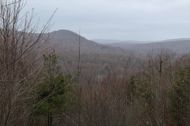
The range consists of at least 4 summit bumps, all over 3300 feet and gently rolling, with screened views to the valley below.  The hike brought us through a high ridge of yellow birch, beech, maple, and a few oaks.
Some snow from this past weekend persisted high up on the north slopes of the mountain.
Hugging the north slopes of the summit ridge, where we found large swaths of matted down fern glades.
Winter's grip is slow to release on these mountains, as evidenced by this snow and ice over 3300 feet.
Nearing the true summit, we encountered another wide open fern glade, this one the largest we had been to yet.
A single boulder, seemingly pointing to the heavens greeted us on our arrival to the summit area.
The matted down fern glade just off the summit is quite an impressive spot...
...with spectacular views towards Balsam Lake Mountain, the Schoolhouse Peaks and Graham.
Balsam Lake Mountain(left) and the Schoolhouse Peaks(right), which just miss being 3500 foot peaks themselves due to lack of prominence.
 Graham Mountain, some 500 feet higher than this summit, still wearing a crown of white.
Just above the view spot is the true 3377 foot summit, fully wooded and nondescript.  It was, however, a nice milestone.  My 100th Catskill hundred highest peak.
As always, we did our best to search for views, and did manage a sneak peek towards some of the higher peaks to the east.(Peekamoose, Table, Lone).
The wide open woods make for easy strolling atop one of the summit bumps.  Almost makes it hard to believe you are at such a lofty elevation.
A neat little ledge near one of the summit bumps.
We managed to find one last small viewpoint on the north summit, towards Balsam Lake Mountain and its fire tower.
A swift 800 foot drop off the north slopes of the range brought us down to a crossing of the gorgeous Beaverkill.  We had to search a bit, but managed to find a nice place to cross.
Once across the creek, we picked up the Neversink-Hardenburgh Trail, only to leave it quickly once again as we bushwhacked a very short distance to remote and wild Tunis Pond.
 Tunis Pond is truly a hidden gem in the Catskills, sitting at a high elevation over 2500 feet, tucked into the much bigger surrounding mountains.  The Beaverkill Range, where we had just been, can be seen from the shore here.

Once back on the trail, we wandered peacefully along the crystal clear water of the mountain's namesake.
 Turning the corner on the trail, heading south, and passing by the wetlands  of Tunis Pond at the base of Doubletop Mountain.
The last 3.5 miles went quickly, along the Neversink-Hardenburgh Trail...and past the Fall Brook lean-to.
Arrived back at the car with the clouds steadily increasing in front of some passing showers.  Another great day in the books, witha total of 9.5 miles with 1900 feet total ascent.  100/102!!

Saturday, April 27, 2019

Dutch Hill(Vermont)

Headed north this afternoon to hike 2657 foot Dutch hill, a small peak in Southern Vermont, and also the site of a former ski operation.  To access the peak, I headed north on Route 8 into Vermont, continuing up through Stamford and then into the town of Readsboro, before reaching a large parking area and kiosk across from Alpenwald Village.  Due to spring snow melt and recent heavy rains, the entire entrance area beyond the kiosk was submerged in deep mud and water.  Elevation to start was a lofty 1905 feet with an air temp hovering in the upper 30's.
Dutch Hill was a popular ski area that operated from 1944 to 1985 and some of its old slopes can still be seen and used today.  I began my hike by heading east, climbing gradually up an area known as Dutch Meadows, located at the north end of the ski area.  For an informative write up on the ski operation, refer to the fantastic write up provided by New England Lost Ski Areas Project  http://www.nelsap.org/vt/dutch1.html.
As I gained elevation, the views back to the west began to open up a bit.  The rolling bumps of the Hoosac Range are visible just over Alpenwald Village(not visible).
There are numerous woods roads, old and new hiking trails/ ski runs, as well as snowmobile trails that grace the slopes of Dutch Hill, so following just one can be a bit confusing.  I basically stuck with the old rule of thumb, which says, just go UP.  I soon hit what looked like the old lift line, which is the steepest, but most direct route up to the ridge. 
The old lift line certainly got me elevation quickly, as it heads very steeply up.  I took a couple of breaks on the way up to catch my breath on this section.
As the ridge got nearer, I began to see some white stuff on the ground.  Sporadic snow was beginning to appear at about 2300 feet.
Remnants from the old ski operation and lift lines.
Once I was on the ridge, the steep slopes gave may to much more forgiving terrain. I soon stumbled upon another woods road, which headed south towards the summit, so I followed it.
Yet another woods road that heads in the opposite direction that I wanted to go.  My best guess is that many of these are used by snowmobilers and maybe even ATV's.
Arriving at a large clearing and vista area, I quickly realized any long distant views today would have to wait.  Heavy snow squalls were moving in, obscuring nearly all of the nearby peaks.
With my hopes of any views waning, I decided to continue on towards the summit.  Once more, I found woods roads heading in the right direction so I followed them.
Unfortunately, the woods roads are extremely mud filled and waterlogged so I opted to head off trail and into the open hardwoods.  Once above 2400 feet, the snow began to stick.
Crossing over a woods road near the summit.  Take note of the mud and muck. 
There is no clear cut summit location, but there is a small view just off the NE side of the summit area.  This view was also washed out by snow squalls.
I wandered around aimlessly in search of a high spot, and found this wooded location that seemed to be just a bit higher than its surroundings.  The snow was also at its deepest in this spot, so I decided to call it the top. 
Heading back down, bushwhacking my way through a winter wonderland.  Howling winds only seemed to clarify that  while spring may have arrived elsewhere, the mountains don't let go of winter very easily.
My bushwhack brought me to down to a land boundary, which I followed briefly. 
After about 1/2 a mile, I arrived back at the open clearing that had been obscured by snow earlier.  This time, there was just enough clearing to afford some views.
To the west/ southwest are some of the Hoosac Range peaks.
Nearby ridges to the SW.
After enjoying some views, I continued on, heading north on more of the washed out woods roads.  Although nasty to hike through, I did find an eerie beauty to the dreary mess.
As I began to descend the north ridge of Dutch Hill, I caught a glimpse of the nearby Searsburg wind turbines atop the next ridge up.
A look back up at my route down.
My route down followed the Dutch Meadows ski run, where I caught a couple of more open views to the NW through more passing squalls.
Arrived back at the car for a total of 3 miles RT and 900 feet of ascent.
 As I headed back south into the Berkshires, the temperature began a steady rise back up into the low 40's and I seemed propelled back into spring.  This quick glimpse up towards snow capped Mount Williams from North Adams, however, reminded me how very close winter still holds on.
Continuing south, the spring progression is much more noticeable.  The open farm fields of Williamstown provide a spectacular spring setting, with the Greylock range as the backdrop.