Search This Blog

Saturday, June 29, 2019

Albert Community Forest(East Nassau, Rensselaer County)

Did an easy, local hike at the Rensselaer Plateau Alliance's Albert Community Forest in East Nassau after work this afternoon.  It was another warm, humid and buggy summer day as I headed out on the orange blazed Cascades Trail, passing through several picturesque fern glades.
 The Cascades Trail closely follows an unnamed babbling brook, with several small, pretty cascades.
 Completed the Cascades Trail loop, before continuing onto the blue blazed Homestead Trail.
Passed by numerous stoic old stone walls that lace these woods.
The trail momentarily skirts a large wetland area before heading back into the cool woods.
The trail winds its way through dark hemlock woods, crossing back over the unnamed brook that flows further downstream along the Cascades Trail.
At the north edge of the forest, the trail follows an old woods road that eventually leads to private property.
Nearing Hayes Road and my waiting car, I crossed over ta series of handsome, well crafted foot bridges that help keep feet dry in a small wet area.
Hiked a nice and easy 2 miles total and didn't see another soul the entire time.  What a great place to clear my head.  As I was leaving, I was fortunate to meet the property's steward, who helped me move a fallen tree that was blocking the road.

Thursday, June 27, 2019

Hand Hollow Conservation Area(New Lebanon, Columbia County)

Got out for a short, local hike in rural New Lebanon at the Columbia Land Conservancy's Hand Hollow on a warm summer evening.  Parked at the trailhead along Gale Hill Road and set out on beautifully maintained trails under a gorgeous sun filtered hardwood canopy.
I looped around the south side of the pond where several benches provide chances to relax and absorb the tranquility.
Stopped for a moment at a corner of Meizinger Pond near its outlet dam.
The green trail leaves the pond behind and immediately heads deep into the woods, eventually connecting to the property's eastern trails.  I crossed over babbling Hand Hollow Brook on a well crafted footbridge continuing a short distance beyond before turning back.
On my return hike, I stopped briefly at the west shore of the pond in a small clearing with gorgeous water views. 
Hiked a nice and easy 2 miles RT on a sultry, buggy evening.

Monday, June 24, 2019

Rocky Peak Ridge Bushwhack(Giant Mountain Wilderness-Adirondacks)

Just east of Giant Mountain sits Rocky Peak Ridge, which rises to a lofty elevation of 4420 feet and is the 20th highest of the Adirondack High Peaks.  There are two usual routes to the summit, either from the west or east, both on trail.  My buddy Jim and I had been eyeballing another, much more interesting and challenging route.  We wanted to bushwhack the entire route to the summit from Route 73, but finding the best starting spot was going to be the hard part.  We spotted a first car at the primary Giant Mountain Trailhead(via the Ridge Trail), then drove SE back to an unmarked pull off along Route 73 to get started.  At an elevation of just over 1600 feet we jumped into the woods, eager to find a way up through or around the 100 foot rock fortress that stood between us and the ridge.  We clawed and climbed our way through a jumbled, rocky mess looking for a way up, emerging at a steep set of cliffs, which stopped us dead in our tracks.  After almost an hour and a half of trying, we finally had to admit defeat and turn back down towards the road.  We were both a bit upset, but vowed not to give up. 
Once back on the road, we walked NW back towards the Round Pond parking area, where we once again entered the woods, this time finding a much easier ascent along a drainage.  The woods were mostly hardwoods down low and fairly steep.  Nearing the top of the first 2400 foot knob, we found an open set of ledges which offered up our first views of the day.  This view SE back down the Route 73 valley, actually provided a look at the rocky cliffs that marked our initial turn around spot.
A glimpse of the ridge just east of us.
Jim taking in some early views to the SE.
We proceeded to climb up and over the first knob, then continue north up the ridge towards RPR.  Within minutes of climbing, we stumbled upon more open rock slabs at about 2800 feet, providing much more impressive views.  The Great Range can be seen sandwiched between the crest of Round and Noonmark Mountains(L) and Giant Washbowl and Nubble(R).
Up, up and away!  We were both elated to see more open rock above us heading towards the sky!
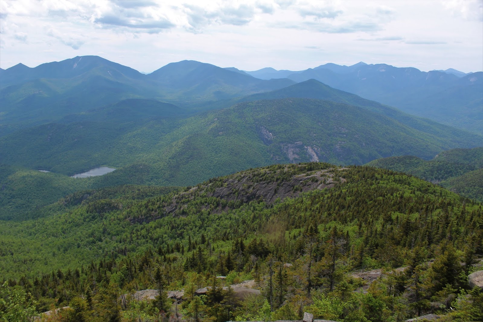
As we gained elevation, the views really began to open up, taking in a sweeping panorama to the south of many of the High Peaks.  Jim pauses here for a moment to soak in this look at the entire Dix Range.
After interspersing thick spruce with open rock slabs, suddenly we turned a corner and voila...we found this incredible  rock shelf with a vertical drop.  The view was literally jaw dropping. 
Dix and Nippltop to the south, with Hunters Pass between.
RPR's big brother Giant Mountain rises imposingly nearby to the west.
The Dix Range rising in the distance beyond nearby Round Mountain. 
Arriving at a bend in the ridge at 3300 feet, where an enormous open rock slab provided our broadest east facing views of the day thus far. 
From the open rock at 3300 feet, we could see our next goal, the 3925 foot bump leading up towards RPR's main summit ridge.  We knew we would probably be contending with thick spruce, but the open rock above gave us some promise.
After fighting through a half mile of dark, thick spruce and deadfall, we found the open rock!  Although the rock slab was steep and exposed, it was very grippy and provided excellent traction.
Running out of words to describe these views.
Jim leading the way, anxious to see what was around the next corner.
A peek back at the open rock we had just been down on at 3300 feet. 
One last look back at this large erratic in the open, before delving back into the dense woods.
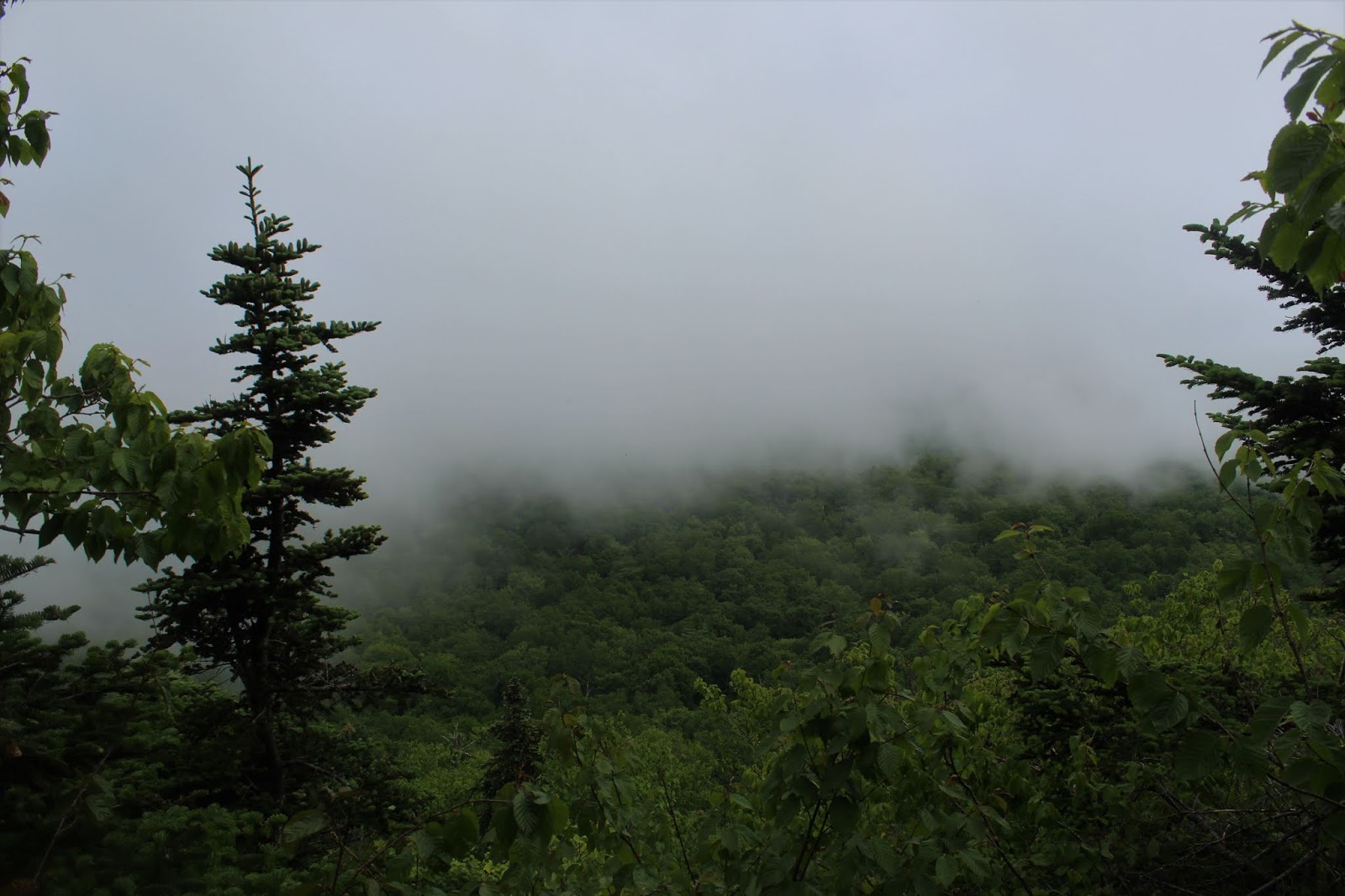
Only yards past the  open views, the woods immediately closed back up on us, as well as extensive blowdown.
The woods along the ridge heading north between 3900 feet and 4400 feet were some of the thickest, toughest spruce that I've personally ever had to contend with.  This stretch of one mile seem to take forever and this really took a toll.
 Finally, after a long and grueling fight, we emerged at a south sub summit about 150 feet below the summit.  Here, the lower alpine vegetation allowed us to catch our first glimpse of the summit.
One final push through a thick conifer stand brought us up onto the summit area of Rocky Peak Ridge.  The view back south at the sub summit and ridge we had just ascended was very nice.  Even from this perspective it looks challenging. 
Although it was nearly 5pm, there was a small crowd of about ten people at the 4420 foot summit.  The black flies were incredibly relentless at the top, so we didn't linger.  A couple of quick summit photos and then we were off, now heading back to the car on trail for the first time all day.
The summit views south towards the High Peaks is quite remarkable.
The west view towards Giant was daunting, because we both knew that the trail drops down to a saddle between these peaks, before rising almost all the way back up to Giant's summit.
The descent off RPR was steady down to 3750 feet, but the climb back up to Giant was tough.  700+ feet of climbing was not what were looking for after the blood, sweat and tears we had put forth already.  Once up on Giant Mountain, we quickly turned south descending the ridge.  The relentless climbing did provide us with some pretty spectacular views down towards the High Peaks.
Quite exhausted, the trail part of the hike seemed to go by fairly quickly, as we enjoyed the evening views down towards Giant Washbowl and Nubble.
Arriving at the Giant Washbowl was a good sign that our day was almost over.  The fact that it was 8pm and we were both wiped out, did not take away from the beauty that surrounded us. 
We arrived back at the car fully exhausted but feeling accomplished.  We had successfully completed our bushwhack hike of Rocky Peak Ridge!  Our route can be seen below.  Nearly 4100 feet of ascent and over 9 miles RT.  Blue=Bushwhack. Black=Trail

Monday, June 17, 2019

Long southern bushwhack to Lone Mountain then Peekamoose Mountain(Slide Mountain Wilderness-Catskills)

As always, my buddy Jim and I try to come  up with new and interesting routes to some of the Catskill's wildest locations, and one that has been on the radar for a while is hitting 3720 foot Lone Mountain from the south.  It is probably one of the least visited areas of the Catskills because it is almost completely surrounded by other large mountains, hence our interest in this route.  The usual route to Lone would be either from the Denning trailhead or from Table via a herd path.  Today's would be 100% true bushwhack from Ulster County 42 to the summit, a VERY long approach.  We spotted a car at the Peekamoose Mountain trailhead, then headed east to an unmarked, rough DEC woods road, slightly SE of Breath Hill.  Elevation to start was a touch over 1600 feet, and the woods were shrouded in a thick mist as we set out.
The woods had a mysterious, eerie vibe, which only enhanced our wilderness feeling.
From a woods road high up on Breath Hill's shoulder, we caught a fogged in view towards nearby Ashokan High Point(completely in the clouds-left) and Little Rocky Mountain(right).
Bushwhacking in the summer months means fighting through many, many spiderwebs. 
A nice and steady ascent soon found us at the wooded 2568 foot summit of Breath Hill.  Although temps were cool in the low 60's, the humidity was very high, and we were both sweating profusely.
After leaving the summit of Breath Hill, we dropped down steeply into the isolated valley of the Slide Wilderness.  As we neared a quiet tributary of Picket Brook, we stumbled across the remains of a long ago homestead.  Classic Catskill stone walls...
...as well as the remains of some kind of foundation.
After crossing a couple of small tributaries, we arrived at beautiful and wild Picket Brook.  We easily rock hopped across and continued NW heading towards Lone.
A short climb followed by a steady descent brought us to our next crossing, which was a bit tougher than our previous ones, near the headwaters of Rondout Creek, which were flowing steadily.
We followed the Rondout Creek north for a shot distance, to a split in the creek.  At the split, there was a beautiful 8 foot waterfall.
To keep heading in the right direction, we carefully crossed the creek here and followed the west branch up.  The going was quite tough in spots, but the falls were absolutely incredible.  We lost count of how many falls and flumes there were along the way.
We eventually had to head further up the ridge because the blowdown and steep, eroding banks along the creek became barely navigable and very time consuming.  Before we left, however, we managed to find several more spectacular sets of tiered falls along the way.
Once higher up on the ridge, we found the going much easier, climbing very steeply gaining nearly 1500 feet in less than a mile.  The woods were remarkably open hardwoods and no cliff ledges to contend with until we got above 3500 feet. 
We flanked the 25 foot cliff bands east for a few hundred feet and found an easy way up them.  Once above a second set of cliff bands, we arrived in a giant fern glade near the summit.
Arriving at the 3721 foot summit of Lone Mountain. 
We quickly signed in and moved along due to viscous black flies.
We were both quite shocked to see how developed the herd paths had become on these supposedly wild summits.  There was even a well defined herd path to the lookout near the summit.  Unfortunately the clouds had rolled in again, consuming the valley, leaving us with no view whatsoever.
We left Lone's summit and headed SW towards Table Mountain's east ridge via an easily followed herd path.  Near a bend in the path at a steep drop, we managed to fight our way onto a fallen tree for this view of Table's shoulder.
A short drop and then steep ascent brought us up towards Table Mountain's far east ridge, where we were able to locate a couple of good view spots back towards Lone. 
Taking these pictures was not as fun as it might seem, as you had to donate a pint of blood for each shot.  I kept this photo so that you can truly see the black flies swarming in front of the lens.
Lone Mountain in the foreground with Cornell(distant left-shrouded in fog) and Friday Mountain(distant right).
A rare look at Rocky Mountain, just right of Lone, with fog covering its summit.
Another short drop and steady ascent brought us up to 3843 foot Peekamoose Mountain.
The short herd path off the summit brought us out to more spectacular views.  This is the south facing view towards Spencers Ledge(L) to Samson Mountain and Bangle Hill(R).
Clearing skies provided a nice view east towards the Ashokan Reservoir as well Balsam Cap and Mini Cap.
The towering twin peaks of Ashokan High Point(L) and Little Rocky(R) to the SE.
Once on the marked DEC trail, we really made good time, flying along.  From a viewpoint on the SW flank of Peekamoose we enjoyed a great view of Van Wyck Mountain(my favorite CHH peak).
The  amazing west vista also captures nearby Woodhull Mountain with many more distant peaks beyond.
A long, steady descent brought us back down off Peekamoose Mountain to the car.  Thankful for good company on this seemingly never ending route out.
A tough and grueling day in one of the wildest Catskill locations.  11.5 miles RT(nearly 8 miles bushwhack) and 3400 feet of ascent.  We arrived back at the car exhausted but fulfilled.