Search This Blog

Monday, December 30, 2013

Schor Conservation Area

With the cold winter sun shining brightly outside, I was itching to get out and take a nice walk after work.  Unfortunately, biting north winds made it feel pretty uncomfortable out though.  Due to the early sunsets of winter, I chose to stay local and headed down to the Columbia County Land Conservancy's Schor Conservation Area in the town of Canaan.
This 233 acre property was bequeathed to the CLC by Jonathon Schor, an early trustee and passionate supporter of public conservation areas.  There are four trails totaling about two miles through the property, with the main highlights being a tranquil pond and a scenic overlook area, as well as pleasant woods walking.
From the parking area, there are several trail options.  At the far end of the lot is the start of the pond loop trail, which immediately drops you down to a clearing and pavilion area at the edge of Jon's Pond.  This is the trail I chose today.
 A delightful rocking bench swing makes for a beautiful setting on the shore of the pond.
 Jon's Pond, named after Jonathon Schor, the man who gave the CLC this property.
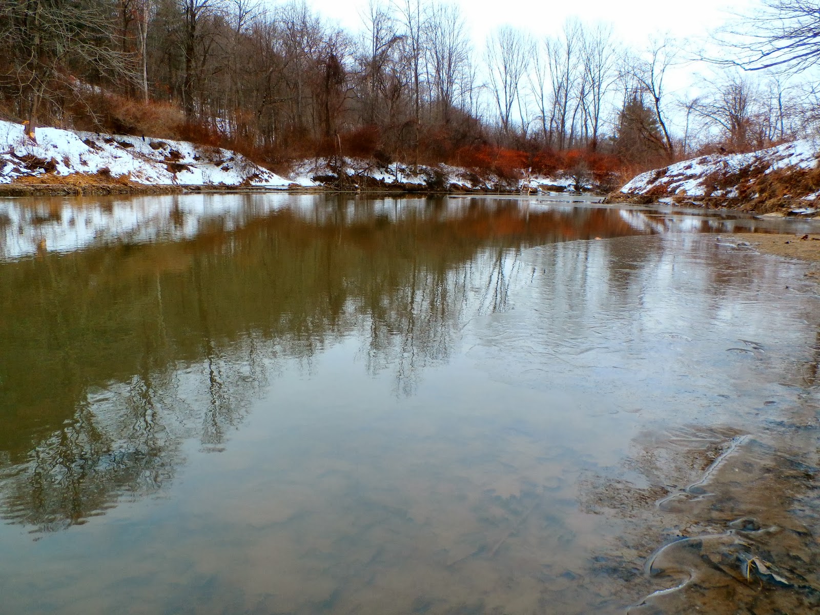
 Looking back at the frozen pond and pavilion.
After leaving the pond's shores, you head into the woods and start a slow but steady climb.  The wintry woods are so quiet and peaceful this time of year as the sun shines brightly through the cold, bare trees.
 I kept up a very brisk pace due to the cold and thankfully remembered to put on my ice cleats to keep from falling on the icy trails.
The final ascent.
The final few steps up to the summit area of the unnamed peak offering glimpses of the views to be had.
 The summit is a bare rocky area under trees and has fantastic views westerly.
 Beautiful vistas.
Distant views are spectacular on a clear day such as this.  Albany's skyline is clearly visible, some 25 miles away.
 Beautiful rural views of the wintry landscape.
Looking back at the rocky outcrop of the summit area.
It was a beautiful walk in the cold woods, as the sun shined brightly.
 Early sunsets make it challenging to get out this time of year without worrying about losing the daylight.
 The late afternoon sun was casting beautiful shadows on the parking lot as I got into my warm car.
 The Conservation Area is located on Shore View Drive, and is a marvelous spot to watch the sun slowly set behind the horizon.  Even the back roads make for nice walking in this area, as they see little traffic and offer beautiful views around every corner.
 On the way home, there is a wonderful pull off area on Cemetery Road that offers splendid views northward.
 Rural Columbia County from The Knobit.
Hiked a total of about one and a half miles today in the bitterly cold wind chills.  This area is a beautiful slice of rural heaven.  Excited that days are slowly getting longer, with sunsets creeping closer and closer to 5 O'Clock.


Friday, December 27, 2013

Wahconah Falls

Some places I go count more as a walk than a hike and today's stop would certainly qualify as a walk.  Wahconah Falls State Park is located in the beautiful Berkshires of Massachusetts in the town of Dalton.  It is a well known, yet well hidden treasure far in the woods off a dirt road.  It is a beautiful spot any time of the year, but today was even more so with a coating of fresh snow to brighten up the dark hemlock woods.
 After a short walk into a ravine you quickly come upon the main falls and a large pool below.
 With fresh snow and a little ice, the rocks surrounding the falls were slick and had to be explored very carefully.
 The falls flow from Wahconah Falls Brook and drop beautifully 40 feet below.
 There are a couple of trails and many informal paths through the woods that can be followed.  It is almost impossible to get lost because the rushing sound of water from the brook is always nearby.  There are also several other smaller falls and cascades further upstream.
 The brook is gorgeous in the deep, dark woods and can be followed at length both upstream and downstream.
 Running water could be heard spilling down the hillsides in very small streams flowing into the larger brook.
This is a very fun place to explore with the family and a favorite of kids.  In the warmer, drier months it is a little less slick and one can literally stone hop across the brook in many spots.  Swimming is not allowed in the large pool at the base of the falls, but every summer there are many folks who ignore these rules.  A quick, fun place to visit if you have a little extra time when visiting the Berkshires of Massachusetts.

Tawasentha Park

Decided to head out to Guilderland to visit Tawasentha Park off of Route 146, in hopes of burning off some of those extra holiday calories.  Tawasentha means "the place of many dead" and lies along the banks of the Normans Kill Creek.   Many Indians were buried here, as skulls and bones have been dug up through the years as evidence.  This was also a significant spot for American history as the Battle of Normans Kill, which took place five weeks prior to the Battle of Saratoga in 1777, was the only Revolutionary War battle to take place in Albany County.  For many years, it operated as a Dairy Farm before becoming a town property allowing access to all.  Today the 192.5 acre park is a great place to get out and hike, bike, swim or play ball.  On this day, I parked at the Winter Recreation Area, which offers several small loop trails as well as a connector trail over the Normans Kill to the main park trails.
Immediately after leaving the Winter Recreation Area(WRA) parking lot, there is a descent down a slippery ice covered hill through open meadows.
 Once down the first hill, there are several trail options.  The WRA trails go left and right and the connector bridge over the Normans Kill lies directly ahead.  I took the pedestrian bridge over the creek.
 Views downstream of the Normans Kill winding its way towards Route 146.
 Once over the bridge, there is a nice, quiet spot to sit on a bench and overlook the water.
 There is a red trail that follows the perimeter of the park in one giant loop, and closely follows the banks of the creek for a little while.
 There was some ice near the outside of the creek in a couple of spots, but nearly all of the water was open on this day.
 Along the banks, some interesting ice formations.
 The trails are mostly well marked with different color discs, depending on the trail.  Even in areas where the signage isn't as good, the trails are wide and clear due to foot traffic.  Much of this trail is actually part of the Tawasentha Cross Country course, and is the location of the annual Guilderland Invitational Cross-Country meet and the Schoolcraft Trail Run.
 Further along the trail, the sun made a brief appearance, lighting up the gray landscape.  It didn't last very long though, and we were back in the clouds.
 A large clearing provides wonderful views down over the Normans Kill valley and to the Heldeburgs to the west beyond the Vale of Tawasentha.
 A pleasant spot to sit and relax.
 Sunsets during the warmer months must be beautiful and dramatic here.
 Nearing the end of the perimeter trail, it swings back towards Route 146 from a hillside, with a view of the vehicular bridge over the Normans Kill.
Overall, I hiked roughly 2 miles today and only fell on the ice once, so I would consider it a successful day.  Unfortunately, this nice park has an in season fee so I probably won't be back once the weather warms up.  But it is a nice, local place to get out and explore nonetheless.  

Sunday, December 22, 2013

Wolf Creek Falls Preserve

Near record warmth was in the forecast for today and with temps climbing into the low 50's by the time I was out of work, I wanted to head out and enjoy some this unseasonably warm weather.  With rainfall overnight combining with snowmelt I knew the local creeks and streams would be running high, and therefore I decided to head out to western Albany County and visit Wolf Creek Falls Preserve.  The preserve, located just past the Guilderland town line in the town of Knox is owned by the Mohawk Hudson Land Conservancy and  is 145 acres in size.  There are over 3 miles of trails, mostly through woods, and also along the banks of Wolf Creek where numerous small waterfalls can be seen.  The snow, which had nearly all completely melted away at home, was still very deep in the hilltowns. In a strange turn of events the temperature, which was close to 60 degrees in Nassau, was only in the upper 30's here.  I decided to break the snowshoes out for the first time this year.  Unfortunately, the snow was deep and extremely heavy, due to the water content of the snow, making walking challenging.
 There are many stone walls throughout the preserve, dating back to the mid 19th century when the land was cleared and the Van Auken family built the stone walls to contain sheep, whose wool was sent to the Huyck Felt Mill in Rensselaerville.
 A tributary of Wolf Creek running high through the wintry woods.
 The Long Path, a 408 mile trail that runs from Fort Lee, NJ to the Adirondacks runs through these woods.
 There are many small cascades in this preserve, especially after heavy rains and during snowmelt times.
Picturesque falls.

 The trail crosses Wolf Creek in this area, which is nearly always low during the warmer months, but there would be no crossing today, with waters running swift and high.
 A small stone tower built along the red trail.
 Deep in the woods, a wooden bench sits alone, a perfect place to soak in the solitude of your surroundings.
I hiked about one mile total, which under normal circumstances wouldn't seem like much, but today, with the heavy wet cement like snow I was walking through, it was more than enough.