Search This Blog

Tuesday, October 29, 2019

Table Rock(Town of Manchester, Vermont)

After hiking Owls Head in Dorset, I headed south to Manchester to pay a visit to the Equinox Preservation Trust with my sights set on hiking up to Table Rock, a prominent rock outcrop on the steep east slopes of Mount Equinox.  There is no maintained trail to Table Rock, so this would be a part trail/ part bushwhack hike. Table Rock seen in a vintage postcard below.  It is nowhere near that wide open now.
I parked at the principle entrance to the Preserve at the end of West Union Street, and began my hike on the Red Gate Trail, just beyond....the red gate!  Elevation at the trailhead is just shy of 1100 feet.
There are a multitude of well maintained trails at the preserve, with maps at many of the junctions.  I saw many folks out enjoying the nice day, strolling along the various trails.
Followed several well marked trails SW before finally arriving at Robin's Lookout, a small view point at just below 1500 feet.  A bench offers a nice spot to relax and soak in the vista.
After the view, I began my bushwhack, heading steeply SW towards Table Rock, and was lucky enough to sneak a small sliver of a view up towards the next ridge line, towering above.
Once I left the trail it was like a tale of two separate hikes.I was alone in the woods once again, this time heading up the steep slopes covered in slick fallen leaves.
I was ascending very slowly on the very, very steep terrain.
As I neared Table Rock, I began to pick up a very faint herd path.  It lead me where I wanted to go so I followed it, soon arriving at my destination.  The views from Table Rock are outstanding, ranging nearly a full 180 degrees.  Although  just over 2200 feet, there is a feeling of being much, much higher.
West views, with Stratton in the distance.
The view south across Cook Hollow with Little Equinox just over the shoulder of the ridge.
South views down the Route 7 and 7A corridor. 
Mount Equinox's high ridge rises impressively above Table Rock, dwarfing the lower lookout.
After enjoying the spectacular views, I began my descent heading slightly more north, soon picking up a very good woods road. 
The woods road lead me right back to the trail system, where I picked up the white blazed Mount Bluff Trail.  From there I followed the purple blazed Trout Lily Trail steeply back down the mountain.  Stone steps offer help on some of the steeper pitches.
I eventually found my way down to the Pond Loop, which offers up incredible water views across Equinox Pond.
There isn't a bad view to be had from Equinox Pond, nestled snugly in the shadows of  Mount Equinox's steep slopes.
Passed by many folks on the lower sections of trail as I made my way back to the car.  Hiked about 4.5 miles total with 1200 feet of ascent.

Owls Head(Town of Dorset-Vermont)

For anyone looking for a trailed, off the beaten path hike in southern Vermont, Owls Head fits the bill.  This small peak has been on my radar for quite a while now, as the few trip reports I had read about it were quite glowing.  I decided that Tuesday would be the day I finally pay it a visit.  On a mostly overcast day, I headed north up to the quaint little town of Dorset, past the Quarry on Route 30 and onto Black Rock Road, then to Ken's Camp Road, thence to Owls Head Town Forest.  At the very end of a one lane dirt road I arrived in a parking area, where there is ample signage letting you know you are in the correct spot.  Up the hill from the parking area is the trailhead, with a historical board and kiosk.  Elevation to start was about 1240 feet.
The trail is well marked and easy to follow, climbing steeply up past cellar holes and old foundations from 19th century migrant workers housing.
After about half a mile, the trail arrives at Gettysburg Quarry, which is quite impressive.  Unfortunately photos do not do justice to its sheer size.  The quarry is so named because much of the marble quarried from here was used for headstones for soldiers who died in the Battle of Gettysburg in the Civil War.
Just a few yards away from the quarry is a spot known as Art's Bench, a marble seat with a great view across the Route 30 valley. 
 White birch surrounding the area of Art's Bench.
Looking SW towards Mother Myrick Mountain and the northern end of Equinox Mountain.
 Continuing on the blue blazed trail past the quarry, I found another framed view towards the SW.
 The woods were surprisingly holding onto some decent color, even as I neared 2000 feet.
As I continued to gain elevation, more and more trees were bare, and offered up my first views of the summit area of Owls Head.
I bushwhacked about 20 yards off trail to capture this nice view of Olwls Head summit area, covered in thick conifer, and rising steeply 300 feet above.
A short but very steep push up from the hardwoods and into the conifers got me to Gilbert's Lookout, a rock outcrop of the west slopes of the mountain with spectacular views. 
 From Gilberts Lookout, the view north.
 SW views down towards Route 30 heading into Manchester.
 The breathtaking west view across the valley, with Dorset down below.
The trail seemed to end at Gilberts Lookout, so I bushwhacked up to the summit area.  At first, the slopes were nearly vertical and covered in conifer but quickly leveled off, filling in with low brush and open hardwoods. With the leaves off the trees, I enjoyed nice screened views to the valley below.
The 2481 foot summit sat in a small spruce stand and was completely wooded(no picture).
I enjoyed a mostly pleasant hike back, but was careful on the steep area below the summit and had to watch for slick leaves in spots.  3.5 miles RT with over 1300 feet of ascent. A highly recommended hike for anyone who enjoys a little history.

Monday, October 21, 2019

Spruce Mountain(Wilcox Lake Wild Forest-Adirondacks)

Took advantage of yet another PERFECT fall day by heading north to hike 2650 foot Spruce Mountain, which is the peak just west of Hadley Mountain.  Parked beneath a DEC sign in a small pull off on Lens Lake Road beside pretty Middle Flow and just had to stop and soak in the crystal clear reflections on the water!  What a start to the day!
There is no marked trail to the mountain so this would be a bushwhack hike, starting from 1850 feet elevation.  Crossed the road and headed east into the woods, where abundant beech trees are turning the woods ablaze in orange.
 What a great gift when bushwhacking is this pleasant!  Extremely colorful and vibrant!
I knew there would be water crossing over Paul Creek, so I was a bit worried and indeed it was running fast and high out of Middle Flow.
 
I stayed slightly north of where the creeks converge and found an easy rock hop across. From there, it was a nice ascent north up through a handsome hardwood forest, complete with sections of pretty fern glades and sedge grass.
High up on the SW flank below the summit ridge, I came to an amazing view point, stretching nearly 180 degrees(south-west-north)
Just beyond the viewpoint, I stumbled across a trail/path, which actually had blue and/ or red markings.  This made it a very easy final push up to the 2650 foot summit, which sits in another clearing, marked with a large cairn.
Continuing NE past the summit, I stayed on the beaten down path, which leads shortly to a very large clearing.  The clearing is chock full of blueberry bushes and open rock, with over the treetop views towards nearby mountains.
 Dropped down the open clearing to an incredible front row view east towards Hadley Mountain!
A zoom look towards Hadley Mountain and its fire tower.
What a nice look at West Mountain(composed of Hadley Mountain and its long southern ridge).
 A small sliver of the Great Sacandaga Lake can be seen from the clearing as well.
 Heading back around the summit area, instead of over, passing through a pretty golden fern glade.
Even at 2400 feet+, there is still some very nice color hanging on.
Picked up another trail/ path on the descent and made it down in good time.  Once back down low, I left the path and headed more directly towards the car, stumbling upon a pretty beaver meadow.
Once across the small creek crossing, I went over to take a last look at the  branch of Paul Creek which was running hastily out of Middle Flow.  Turned NW, following the pretty creek all the way back to Lens Lake Road and my waiting car.
A phenomenal day in the woods, with about 5 miles RT and 1100 feet of total ascent.
Red=Ascent    Blue=Descent


Saturday, October 19, 2019

Mount Sherill from Deyo Road(Hunter Westkill Wilderness Area-Catskills)

Headed south to the heart of the Catskills today to hike 3550 foot Mount Sherrill, a peak I had previously hiked but from a different route.  Today, my starting point was a small DEP(NYC Watershed) parcel of land at Deyo Road, an old abandoned road just off Spruceton Road.  Today, there is no road at all, just DEP signage in a large meadow at about 1500 feet of elevation. I parked my car there and headed south across the very scenic meadow.  The views west up the Spruceton Valley towards South Vly Mountain are quite dramatic.
At the far edge of the meadow, I began my ascent in a mixed forest, passing by old stone walls.
As I gained elevation, I soon heard the sounds of rushing water, which was a pretty drainage tumbling down the north slopes of Balsam Mountain(the one that doesn't count due to prominence).
 
I crossed over the drainage and continued heading south/ southeast picking up several old woods roads along the way.
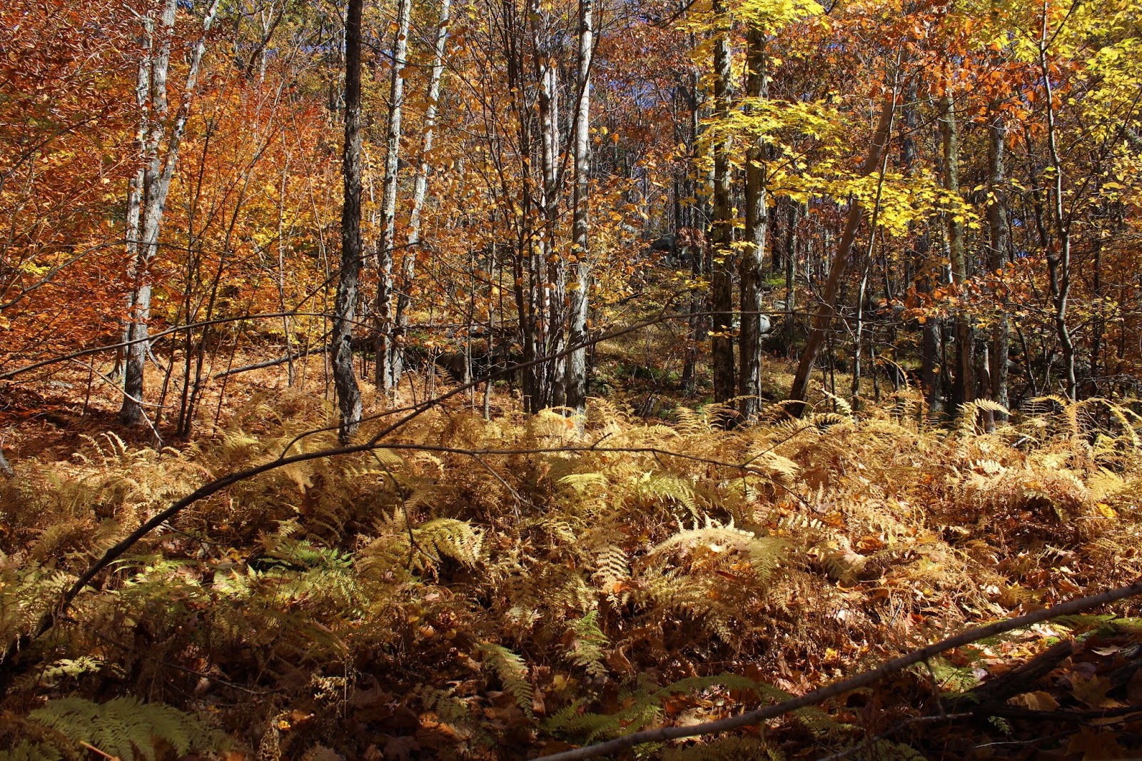
The steep slopes were covered in a canopy of gold.  An absolutely spectacular day in the woods.
While the slopes of the mountain were steep, there were almost no ledges or tricky areas to contend with so I made good time ascending.  Fallen leaves hiding slick, jumbled rocks was actually the biggest issue.  As I headed up and over 3200 feet, the trees became noticeably shorter and beech began to replace the maples.
Once atop the summit ridge, I found a myriad of herd paths and easily found the one that headed right up the summit.  Met the caretaker of the canisters, Jim Bouton and Margaret(who I had previously hiked with last week)at the top.  I signed in and caught up with them for a few, before continuing on.
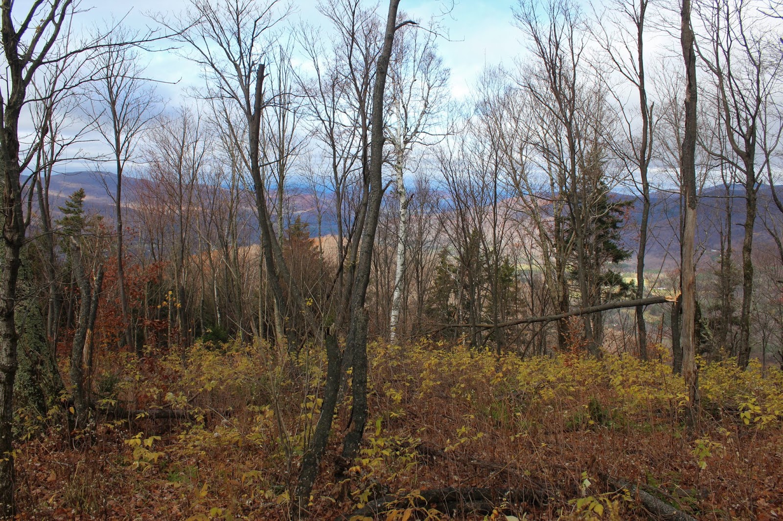
I continued on a short distance beyond the summit, dropping down to the near vertical slopes SE of the summit.  A small perch provides breathtaking views east towards neighboring North Dome.
SE views extend over the Broadstreets towards Mount Tremper and eventually all the way down to the Ashokan Reservoir.
After enjoying the views, I began heading back, crossing over the summit and continuing NW towards the saddle of Balsam Mountain.  I came to a large, flat area just below 3300 feet that I decided to call Sherrill's plains.
Before hitting the saddle, I decided to drop down into a steep cirque, heading back towards Spruceton Road.  From a drainage crossing at about 2600 feet, I found this sliver of a view towards Packsaddle Island.
The descent was very pleasant, as I dropped steadily north through a gorgeous hardwood forest.
Found a peaceful spot along one of the drainages which was quite swollen from this week's rain storm.
At about 2400 feet, I came to a spot where the drainages come together, eventually draining down into the West Kill.
Back down on the lower slopes, which leave DEC land and re-enter DEP land, I passed over a very good woods road that was in decent condition, but headed away from the direction I was going.
Finally emerging from the woods and back at the meadow I had started from, I was treated to this view of Packsaddle Mountain, a Catskill Hundred Highest peak.
A short walk back across the meadow got me back to the car and ending a wonderful day in the woods.  A little over 6 miles RT, with 2200 feet of ascent for the day.
Today's route below.  Red=Ascent   Blue=Descent