Search This Blog

Monday, July 31, 2017

Cheney Cobble(Adirondacks)

My buddy Jim asked me to accompany him on a very difficult, long bushwhack hike up to Cheney Cobble Monday and I gladly obliged.  He is an avid and very accomplished hiker, and is closing in on another one of his goals, to climb all of the hundred highest(102) Adirondack peaks.  Cheney Cobble, at 3683 feet, ranks as only the 70th highest Adirondack peak, but is notorious for being one of the most difficult summits to hit.  Until recently, the normal access route to Cheney Cobble was from the west, but with the state's recent purchase of the Boreas Ponds Tract, there is access from the east.  We met up at the beginning of Gulf Brook Road and then car pooled to the large parking lot and gate.  From there we geared up and got on our bicycles, riding in about three miles to a road junction and a no bicycles sign. 
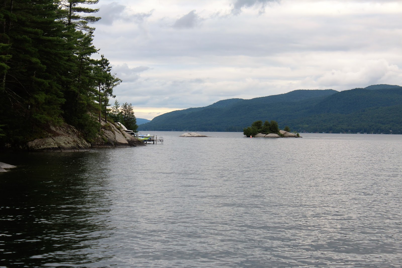
Once on foot, the road is a long and dull hike. Fortunately, there are some decent views along the way.  Here, at a bridge crossing, is a marvelous east view over Labier Flow towards Boreas Mountain.
On the west side of the bridge is a fine look at the Boreas River.
Continuing along Gulf Brook Road(accompanied by hordes of deer flies), we eventually caught some glimpses ahead towards North River Mountain first...
 ...and then Cheney Cobble, our intended goal.  The pronounced summit cone stood out, literally a mile away.
 Once across Slide Brook, the road turns sharply northeast.  A short distance beyond that is where we left the road to begin the bushwhack.  The woods started off open enough and we thought that maybe we'd have an easy go of it. 
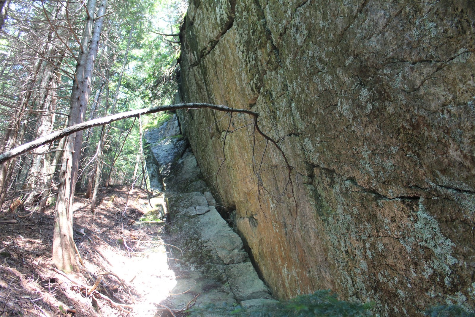
 Unfortunately, the woods closed in on fast and we began hitting towering bands of rock cliffs, driving us further to the south.
 Jim, in a typical rough stretch with blowdown and duff.  I've never seen the duff so bad before, as the soft ground would swallow our legs nearly every other step, sometimes all the way up to the knee.
 As we passed 2700 feet in elevation, we began to hit larger and larger rock cliffs, which rose up to 0 feet above us.
 We kept circling south, hoping for a crack in the fortress, but as we winded our way further up, we ended up hitting extremely thick spruce.  Fleeting glimpses of blue sky above were enough to make us smile, although briefly.
 Jim, pushing through thick spruce ahead of me.  At one pint, the conditions were so tough, that we barely got .2 of a mile in an hour. 
 We did manage to find a rather large clearing along the way to the ridge.  I climbed up onto a fallen tree to garner this southeast view.
From the same fallen tree, looking south at neighboring North River Mountain.
Back in the woods as we approached the south summit bump of Cheny Cobble.
 More screened views south, a bit further up in elevation.
 After hitting the top of the south summit bump, we dropped into the saddle between the two, before continuing a less difficult final ascent to the true summit. The 3683 foot summit is totally wooded with no views.
 A short bushwhack northeast, provided us with the best views of the day.  Many high peaks are visible from here.
White Lily Pond is the body of water, with Moose Mountain hovering directly above. The Dix Range is in the distance, with Colvin Range in front of that.
Allen Mountain's hulking summit looms large directly north of here(in the shadows on the left). 
Due to the extreme difficulty of our ascent, we decided to go over other options for the descent.  Unfortunately, north and east looked treacherously steep and west took us too far away from where we needed to go. So we decided to drop south-southeast off the summit and hopefully avoid the worst of the spruce and cliffs.  Luckily, we did just that, making it down with much less stress.  It was almost as if we hiked a totally different mountain down.
Once back on Gulf Brook Road, we hastily moved along, finding the bikes and headed back.  Stopped at Labier Flow again, to soak in the incredible views.  A stray shower looks like it was hovering just east.
The final push back to the car along Gulf Brook Road.  Didn't see another soul the entire day.
Close to 10 miles RT on foot, with 6 miles of bike riding on top of that.  A long, tough day.  A lot of blood, sweat and tears went into this hike.

Tuesday, July 25, 2017

Gull Bay Preserve/ Last Great Shoreline Preserve(Eastern Adirondacks-Lake George Area)

Once the weather finally cleared up on Tuesday, I decided to head north to do some hiking on the east side of Lake George at a couple of Lake George Land Conservancy Preserves, both in the town of Putnam.  In looking over maps online, I saw that the two preserves are now connected by a 1.25 mile trail, meaning I could hike most of the trails at both preserves in one stop.  I drove to the Gull Bay Preserve parking lot which can be found by continuing north for 15.4 miles past Whitehall to Gull Bay Road on the left, where you turn left and stay straight for 1.75 miles to Sagamore Road on the right.  From there, just over half a mile down the road on the right is a sign and dirt driveway leading to the parking area.
 I parked the car and began hiking up towards the kiosk, where I was quickly ambushed by a swarm of bees.  Not exactly sure where they came from, but I believe they must've built a hive somewhere around the kiosk and I bothered them.  I was stung once and quickly scampered away, luckily escaping any further stings.  Slightly shaken, I gathered myself and decided to continue on.
I followed the blue marked trail, which climbs up towards a lookout in .3 of a mile on the southern portion of the preserve.
 The lookout at the end of the blue trail is a fine spot to rest and soak in the views over Lake George.  Unfortunately, the clouds were hanging pretty tough at this point.
 Continuing on an orange marked trail, which heads east and then north on an old logging road passing closely along the shores of a beaver pond and swamp.
 The orange trail travels north for one mile passing through some wetter spots and one overgrown, somewhat confusing spot in particular near a beaver dam.  Here's the start of re-route area.
 The red trail continues north/ northeast where the orange trail ends.  Wildflowers along the red trail.
 On its way north the red trail passes another large wetland, this one being part of the southern end of Sucker Brook.
 Crossing over the outlet of the wetland.
 Once across the outlet, the red trail swings back southeast, directly up a steep slope.
 From the top of the ledges are some pleasant views over the wetland and towards some distant peaks.
 Views to the southwest.
 Northwest views from the ledges.
 I retraced my steps back off the red trail to a junction with a yellow marked trail.  I followed that west to the connector trail(also blazed in yellow) and headed north to the Last Great Shoreline Preserve.
 The first section of the connector trail follows a woods road, before turning off into the woods on a rough foot trail.  A couple of sections are quite steep, with one spot actually having wooden steps to help.
 Once on the grounds of the Last Great Shoreline Preserve, I soon picked up a blue marked trail which winds its way southwest down towards Lake George.  A small clearing provides a view down towards the lake.
 A rustic bench lends itself to unwinding for a few.
 Just beyond the bench and view, the trail drops abruptly down through a deep ravine down towards the lake.
 Arriving at the shores of beautiful Lake George.  A view south towards a couple of very small islands, known as the Rock Brothers.
 A view up the north shore.
 A dock juts out into the water, offering the chance to get quite intimate with the lake.
 A last look at the dock.
 I climbed back up the blue trail, eventually meeting up with a red marked trail loop, which leads to a spot referred to as the "Vermont View". 
 
With daylight waning, I picked up my pace, heading back south to the Gull Bay Preserve.  As I arrived back at  the wetlands, I noticed clearing skies and sunlight on the far shore.
 Instead of heading back to the car, I decided to take advantage of the sunshine bu heading back up the blue trail to the Lake George view spot, only .3 miles past the kiosk.
 The fleeting evening sun made for perfect conditions.  It was hard to tear myself away from this spot.
Hiked about 7.5 miles total at a couple of beautiful preserves.  Didn't see another person the entire time.

Friday, July 21, 2017

Burger Hill Sunset(Rhineback)

There is nothing quite like a summer sunset, and one of the very best places to catch one is from Drayton Grant Park at Burger Hill in the town of Rhineback. The 76 acre park is owned and managed by Winnakee Land Trust and has a short half mile trail up to the top of a 550 foot hill, with spectacular views. The park is located on the right, 2.5 miles south on Route 9G from the intersection of Route 9 and 9G in Rhineback.  As we began our walk, the sun was beginning to set, behind a hazy cloud clover.
 Lazy, hazy days of summer.
 A more south-southwest view from the clearing atop the hill.
 The sun tried to break free from the clouds and provided some pretty nice views.  The best views are west towards the Catskills.  Unfortunately, the clouds won out, chasing us back to our car somewhat disappointed.
A nice, short and romantic one mile walk.  Arrived back at the car under the stars.