Search This Blog

Tuesday, September 30, 2014

Bushwhack to and around Vanderwhacker Pond(Adirondacks)

Headed north to the Adirondacks again today to do a bushwhack hike from Boreas Road to Vanderwhacker Pond with my dad.  There is actually a rough, hard to follow foot path that leads the 1.1 miles into Vanderwhacker Pond from the small, unmarked pull off of the road.  Looking back near the start of the path.
  A more clear area of the path.
Low bushes and brush mark the way.
Entering a deciduous forest, we did our best to follow the path, which was buried under leaves.
The path crosses Vanderwhacker Brook three times on your way to the pond.  Due to a lack of any recent rains, water levels in the brook are very low, making it easy to cross.
The path is mostly level, with a slight elevation gain as it wanders through beautiful woods.
Another brook crossing.
We encountered a large beaver meadow where the brook meanders along.  Apparently this area must've been dammed up by beavers at some point, creating this meadow.
Foliage along the beaver meadow.
Fallen leaves in Vanderwhacker Brook.
Beaver activity has created a large beaver swamp and meadow just to the west of the pond.
A large pool area that the beaver's have dammed up.
Our first glance out at Vanderwhacker Pond.
We found our way to the pond's shore, where a superb view awaited us.
Ghostly skeletons of spruce line the perimeter of the pond.
We continued around the pond on a true bushwhack.  We had to find our way through branches, bushes, fallen trees, wet areas and uneven terrain.
Fall colors appear to be just past peak here, but still very nice.
Fallen trees line the pond, framed by a nearby unnamed peak.
Reflections.
Brilliant fall colors.

A downed tree on the northeast side of the pond.
There were a couple of areas that were extremely difficult to get through.
A clearing provides a glimpse across Vanderwhacker Pond
Returning back to the rough foot path through dense brush.
It was a nice hike to and around remote Vanderwhacker Pond, and no maintained trails provided a feeling of solitude.   Total mileage was about 3 miles RT.

Friday, September 26, 2014

High Falls Conservation Area(Columbia County)

Got away from work for a couple hours this morning and took advantage of a beautiful autumn day by visiting nearby High Falls Conservation Area in Philmont.  It was gorgeous even in the parking lot before I began my walk.
 The golden leaves dancing in the breeze above the fence.
It was a delight, strolling through the beautiful autumn woods.
 Many trees have already began to shed their leaves, littering the trail below.
 The Agawamuck creek adorned in fall reflections.
 The blue trail provides access to the water's edge. 
 Water levels are generally low this time of year, allowing you to get up close and personal with the creek.
 The trail follows along the babbling creek for a distance.
 At high water levels it is very tough to access the large pool at the base of High Falls, but I was able to rock hop over to a beautiful view due to the low water.
 High Falls, the highest waterfall in Columbia County, framed by beautiful fall colors.
Returned back on the blue trail, as it climbs back up the glen and meets the green trail. Couldn't have asked for better weather.  The sun was shining brightly as the clock neared noon.
 The canopy of maples bathed in sunlight and foliage.
 The green trail leads to a viewing area of High Falls from a higher perspective.  There is a picnic table and bench there as well, making this a pleasant spot to stop and linger.
 After finally leaving the overlook, I returned through the woods via the red marked trail. Really took my time, soaking up the beauty of my surroundings. 
 Unfortunately, the walk had to end eventually.  Crossing the footbridge on my way back to the car, with leaves crunching underfoot.
A very easy, pleasant 1.5 mile hike through the woods and along the creek.

Wednesday, September 24, 2014

Moreau Lake State Park(Saratoga County)

I went north to hike Moreau Lake State Park in the Adirondack foothills after work today.  There are an abundance of trails throughout the park, with the most popular day use areas and trails surrounding the lake.  Today I would be hiking the more rugged and longer trails on the north side of the park along the Palmertown Range.  A small access road off of Spier Falls Road leads to a parking lot in the woods and a couple of trailheads.  I chose to begin my hike by ascending the green blazed Baker Trail, which climbs steadily for about one mile up to the Ridge Run Trail.
 A wide woods road is easy to follow on the climb.
 Another lovely September afternoon in the woods with steep banks along the trail.
 After following the red blazed Ridge Run Trail for a short distance, you arrive at a gorgeous overlook of Moreau Lake and far to the east.
 Afternoon sun dazzling through the trees at the rocky overlook.
 A closer look provides views down over rural Saratoga County, Washington County and all the way to Vermont's Green Mountains in the distance.
 Moreau Lake and its small cabin on the shore, which can be rented.
 Beech leaves turning yellow.
After leaving the fine eastern vista, I continued along the Red Ridge Run Trail through a darker hemlock forest, where the sun struggled to come in.
 After a little more than a mile on this trail, the forest began to change back to hardwoods and became much brighter as I arrived at the Yellow blazed Western Ridge Trail
 The trail zig zags back and forth and up and down on its way along the northern ridgeline of the Range. 
 There are numerous overlooks along the Western Ridge Trail, as it continues for almost 6 miles along the range.  The first view point is a gorgeous view north and west over the Hudson River and to the southern Adirondacks.
 Spier Falls Dam is easily visible from this vantage point, even through the hazy late afternoon sun's rays.
 A breathtaking view to the northeast of the Hudson River winding its way through the many peaks.
 A closer look at the calm, clean waters of the Hudson flowing between the Luzerne Mountains and Palmertown Mountain.
 Southern Adirondacks peaks as far as the eye can see to north.
 The West Ridge Trail bathed in late afternoon sunlight.
 One of the many bends in the trail.  Even the screened views through the bushes and trees is pleasant from the steep ridgeline.
 There are several clearings and rocky outcrops which provide incredible views from the trail.  Here is another clearing with a nice north facing vista.
 Spier Falls Dam.
 A beautiful view at the last viewing spot that I would visit today.
Looking at the cutout for the powerlines up the Luzerne Mountains.
 The trails are all identified by easy to follow colors.  There are many trail markers along the way, helping to prevent anyone from getting lost.
 Unfortunately, I was running out of daylight, so had to turn back, even though I would have loved to continue all the way to trail end.  The hike back was nice and quiet through dark ravines and then bright, sunny exposed clearings.
 Met a few folks out on mountain bikes, enjoying the beautiful evening as I neared the car.  Much of the West Ridge Trail is flanked by very steep, wooded slopes.
 The sun's fleeting rays.
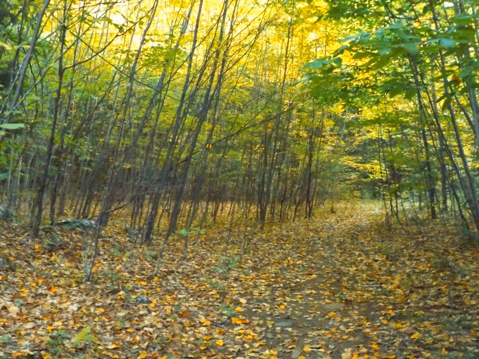
 Just before arriving back at the car, I came to a spot where the trail was literally covered in leaves.
 Just down the road from the parking area, there are multiple public access spots to the Hudson River.  The river is much, much cleaner and peaceful at this northern location. 
A very nice early autumn day, which I was fortunate to get out and enjoy for a while after work.  Hiked about 6.7 miles total RT at a pretty good pace.