A hint of fall was in the air today, as temperatures held in the 60's with a comfortable breeze and low humidity, so I was very happy to get out exploring. The Open Space Institute has worked to protect over 500 acres of land between John Boyd Thacher Park and Thompson's Lake State Park, with numerous hiking opportunities throughout. This is the much less known access area to many of Thacher Park's popular trails along the escarpment. I parked at the end of Ryan Road today in the large parking area(trail maps available) and had the woods to myself. A pair of yellow marked trails leave the parking lot heading in different directions. I headed east on the well marked trail.
Stone walls line many of the trails throughout these woods.
The trail changes quickly between fields, hardwoods and woods roads.
Skies clearing as the afternoon wore on. I was able to move at a nice, brisk pace without getting too hot due to the comfortable temps.
After about .4 of a mile the trail joins the Aqua marked Long Path. Trail marking is very good in this area along the wide, easy to follow trail.
Subtle hints of fall in the woods. Continuing past the Long Path and onto Hang Glider Road lead me towards the escarpment.
After about 1.3 miles I arrived at Hang glider Overlook. This is a large clearing and an amazing spot to soak in the views.
Not sure who this is for but it seems to be some sort of tribute.
The views from Hang Glider Overlook rival those in the southern part of the park, but with much more solitude.
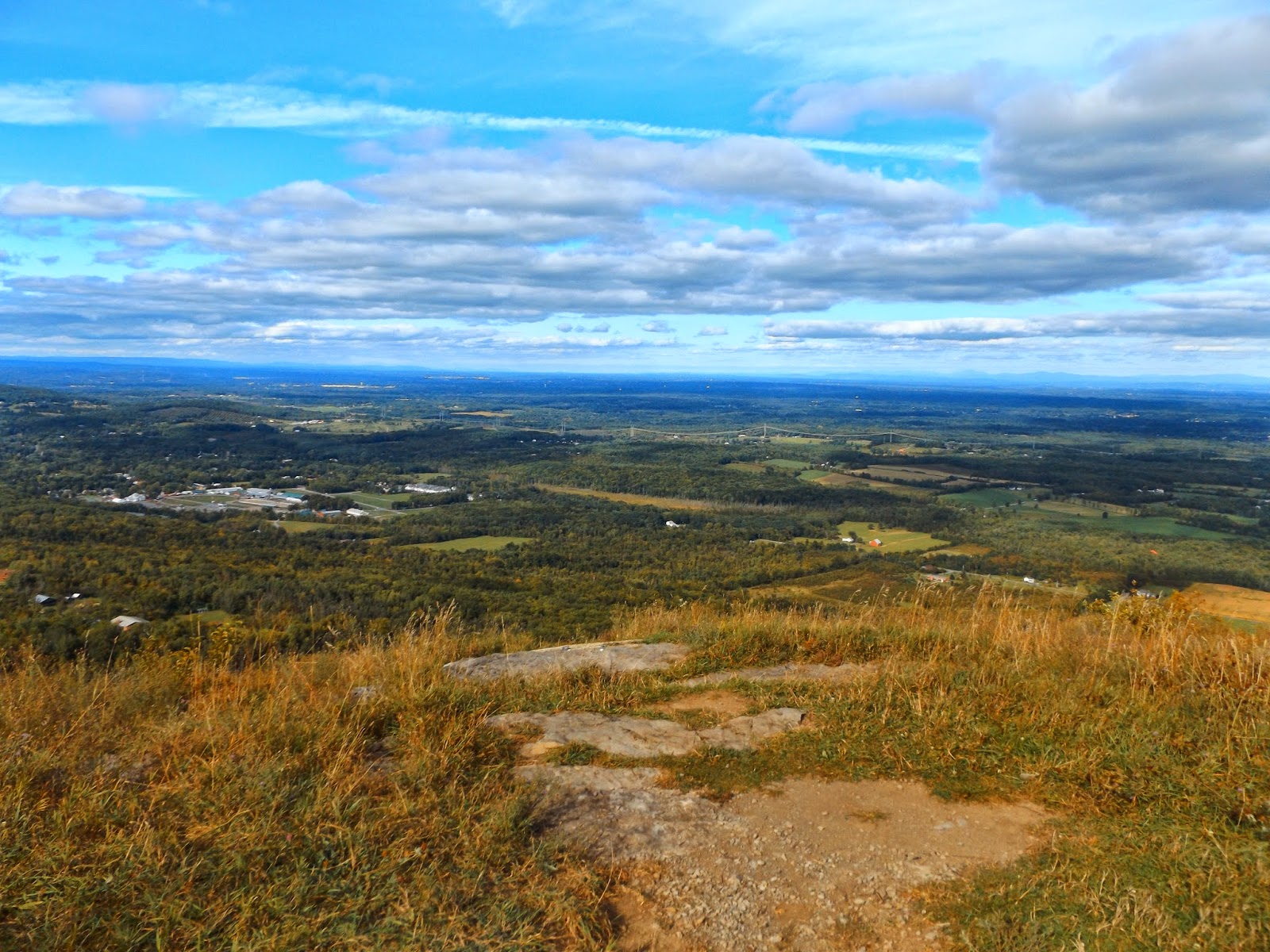
Looking south and east over Albany County.
Rural country roads.
Altamont Fairgrounds far below.
The Albany skyline clearly visible, with the Taconics rising in the distance.
A look north up the escarpment at High Point.
A panoramic view from Hang Glider Overlook.
Unlike the southern, tourist part of the park, there are no fences or rails along the extremely steep cliffs in this area.
A zoomed in look at the village of Altamont.
One last look north and east. So very beautiful!
After finally leaving the Hang Glider Overlook, I took an unmarked but clear footpath through the woods along the escarpment. A small side path leads to another amazing view from a rocky clearing.
Limsetone along the trail.
The unmarked foot trail creeps awfully close to sheer drop offs, so good footing is essential.
It is a very pretty ridgeline walk towards High Point. You must pay close attention to the trails because there are many forks and bends, some marked, some not.
Arriving at High Point, the scenic vistas are there to greet you. Here is a view back towards Hang Glider's Cliff.
Hang Glider's Overlook Cliffs, where I had just been. The clearing is easily visible.
Sensational views from High Point's steep cliffs.
Southern views of the escarpment. A path follows rocky cliffs along High Point. Once again, footing is extremely important.
Rocky cliffs near High Point.
A view far to the north.
Very relaxing.
A view of rural Albany County and well beyond all the way towards Vermont.
There are numerous(too many to count) small holes and large fissures found along the trails throughout these woods.
What a beautiful day!
A good map or knowledge of the area is essential if one is to truly explore this area, as there is a maze of trails throughout.
There is a much more "wild" feeling to these trails, as well as solitude.
Although the trail here looks like it is paved, it is actually stone.
The Perimeter Trail follows old roads. Trail marking is a bit tricky in this area, so you must be careful and pay attention.
Shortly before arriving back at Ryan Road and my vehicle, I came across this serene little pond.
Stunning reflections.
A small bench allows one to relax and soak in the views, while the trail skirts the pond's shoreline.
A last look at the lovely pond, before finishing the last .3 of a mile to the car.
After leaving Ryan Road, I headed a short distance down the road to the Emma Treadwell Nature Center, along the shores of Thompson Lake. The Nature Center has many trails and lake views, without the crowds of Thompson Lake's State Park.
A short trail leads down to the lake's shoreline and provides canoe/ kayak access.
Thompson Lake shortly before sunset.
Fall colors along Thompson Lake's shores.
Really enjoyed a very gorgeous late summer day, while only seeing one other person on the trails all day. Hiked a total of about 4.6 miles RT.


No comments:
Post a Comment