Went to the northern Berkshires today to hike in the Monroe State Forest in remote Monroe, Massachusetts. Monroe is a very rural town and has the second lowest population in the entire state. Much of the town is made up of state forest and protected land. Today our destination would be the summit of 2730 foot Spruce Mountain.
We parked at the main entrance to the park on Raycroft Road and followed the road for a few hundred yards until it meets gorgeous Dunbar Brook. Dunbar Brook Trail heads off in the woods along the brook here and we followed it down for a short distance.
There are large rocks and boulders that provide interesting glimpses of the brook and several cascades.
A glacial pothole.
A beautiful cascade that drops down through huge boulders.
Dunbar Brook downstream.
Walked back up the brook to Raycroft Road and crossed a sturdy bridge that does allow for vehicular traffic. The road heads away from the brook but it was hard to tear myself away from the crystal clear mountain waters. Here is a look upstream at the Raycroft Road bridge.
Raycroft Road proceeds about .2 of a mile until you see a blue marked trail that heads off into the woods.
The blue marked Spruce Mountain Trail begins its climb through a mixed forest.
We found several newts along the trail and they seemed friendly enough.
There were many different mushrooms along the way.
A couple of mushrooms on the forest floor.
Looks like someone took a bite.
The trail showed signs of little usage in certain areas and was overgrown making us double check our maps and walk around blowdowns. Another interesting looking shroom.
After about 1.7 miles of deep woods walking we arrived at Spruce Mountain's second summit, which provides beautiful southern views. The true summit is wooded with no views.
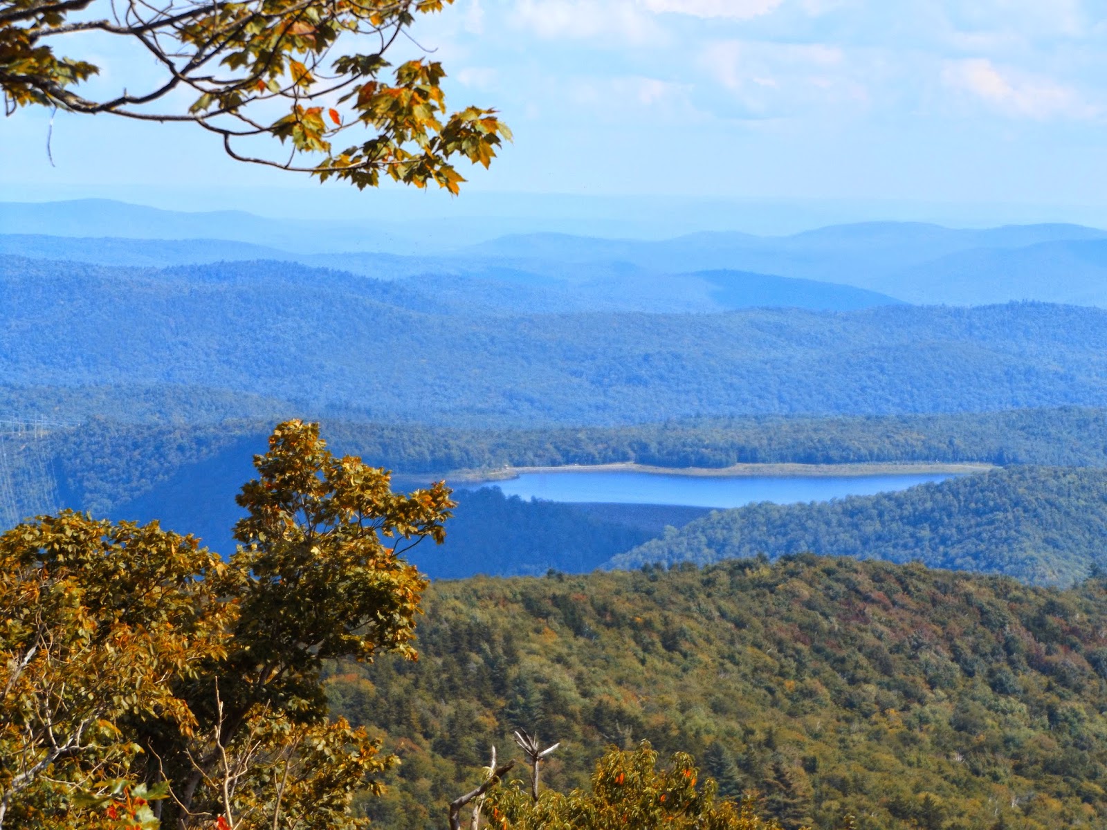
The southern views over the Deerfield River Valley from this vantage point are beautiful.
Rolling peaks of northern Berkshire County as well as Franklin County.
Power lines can be seen rolling up and over many peaks near the reservoir.
After 1.7 miles of climbing on a hot, humid day, it felt great soaking in these views from the rocky lookout.
Upper Reservoir Bear Swamp.
A sea of nearby peaks as far as the eye can see. The ski slopes of nearby Berkshire East in Charlemont can be clearly seen from here too.
After lingering at the summit area for about 20 minutes, we retraced our steps back down the trail and along Raycroft Road. The sun was shining bright through the deep woods.
Hiked a total of 3.4 miles RT on a humid but nice, sunny Labor Day.


No comments:
Post a Comment