Search This Blog

Thursday, January 28, 2016

Lawsons Lake County Park(Coeymans)

Tucked into a quiet little corner of rural Albany County sits 420 acre Lawsons Lake County Park, situated near the Coeymans/ New Scotland town line.  This is a multi recreational park, with kayaking, fishing and hiking trails available to the public as well as a couple of parking areas found along Lawsons Lake Road(County Route 109). I parked in a large pull off just south of the lake, along the road near a park sign.
I first followed an unmarked path which basically shadows the county road before crossing a park access road and then leads to the east side of the lake.  This was one of the only areas I had to contend with ice all day.
The path is easy to follow and hugs the shoreline of the lake, offering up some nice waterfront views along the way.
The lake was frozen over, but temps hovering near 40 certainly wasn't doing the ice any favors.  I did stumble across a hockey stick someone appears to have stashed away in the woods.
After walking the length of the lake, the path turns up towards the road and eventually another small prking area. I turned back here and headed south towards the car, but crossed the county road here and arrived at a closed park road.  This is labeled on maps as Upper Camp Road, and I followed this until arriving at an area scattered with cabins.  These were old day camp cabins, which were frequented by summer camp users in prior decades.
Walking past the cabins, look for orange hiker discs which mark the beginning of the upper loop trail.
The upper loop is easy to follow on a wide trail which heads north before turning sharply west up a steep slope at a property line.  After a short but steep climb, the trail arrives at a large plateau area.  There are broken views through the trees, and soon the trail bends south closely following the top of the ridge line.  A better view down towards Lawsons Lake is available from a small clearing.
Looking west at a satellite tower on a nearby ridge.
The trail soon drops steeply back down to the cabin area.
Once back at the cabins, I followed the Upper Camp Road all the way down to County Route 109.  I then crossed the road and walked over to Lower Camp Road, which is located along the lake's south side. Turned left into the woods at the sign indicating the loop trail. Followed this trail south past a nearby backyard and eventually meeting up with a small unnamed stream, which was frozen over.
After crossing over the stream, the trail winds uphill to the west, with the stream meandering below.
Found a small cascase and some flowing water a bit upstream.
The trail crosses the stream again and makes a bend to the north and eventually meets back up with the Lower Camp Road. I followed the road past rustic Waldman Lodge and back to the car.
Hiked about 4 miles total for the day and didn't see another soul the entire time.

Tuesday, January 26, 2016

Comeau Property(Woodstock-Catskills Region)

Following my earlier hike in Phoenica, I stopped by the quaint village of Woodstock on my way home.  Near the town center(directly across from the police station) is quiet, unassuming Comeau Drive, which provides access to the 77 acre Comeau Property. Parking is available in the upper lot just before the municipal offices, where a trail heads west past a gate and through open meadows.
Enjoying a nice, quiet walk through a large, open field.
These fields provide marvelous views north towards Mount Guardian and Overlook Mountain.
At the end of the meadow, the trail bends left to the south and enters the woods and is marked with red signage.
Crossing a wooden plank section.
Much of the trail follows the banks of the Saw Kill. I followed a small informal path downhill for a closer look at the creek where I found these interesting rock cairns on a fallen tree.
Looking downstream at a calm section of the Saw Kill.
A view upstream.
Once back on the main trail, I continued east along the creek and soon arrived at a nice area of cascades.
Just below the first cascades the creek bends sharply to the north.  This section of the creek is marked by fast moving current, small cascades and frozen ice chunks.
Small cascade.
Eventually the trail bends away from the creek and turns back towards the parking area.  This makes for a peaceful, easy walk back to the car.  Hiked about 1.2 miles.

Tanbark Trail(Phoenica-Catskills Region)

Headed down to the Catskills to do a small hike on the Tanbark Trail, high above the village of Phoenica.  I parked along Main Street and then walked north past the grocery store on Mount Ava Maria Road and then turned right past the post office towards Phoenica Park/ Parish Field.  The trail begins at the far end of the field where a red bench and sign are posted.
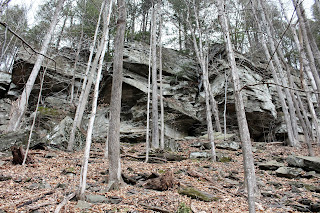
 The trail begins climbing almost immediately beneath towering cliffs.
 There wasn't any ice on the trail, but several huge icicles had formed along the cliffs.
 Passed by a couple of very informative historical signs about the area along the way.
The trail comes to a junction after a stiff climb, where you will have the option to hike right or left onto a 2 mile loop.  I turned left towards Phoenica Overlook, which I soon arrived at, where great views of the village are found.
 Looking left provides a dramatic view southeast towards the Route 28 cooridor, with Romer Mountain and Mount Pleasant rising high above.
 Southwest views above Pheonica.
 Southwest views towards Panther Mountain's steep slopes.
Moving along the trail, with one last look back towards the overlook.  The sign found at the overlook labels the prominent peaks in view.
 The trail drops down to the north before turning east and ascending up the lower slopes of Tremper Mountain again.
 The trail winds through the woods and soon arrives at a spectacular viewpoint at Grandview Ledge.
 From this vantage point(which is a bit higher than Phoenica Overlook) the tops of several other high peaks can be seen poking above the nearby ridge lines.
 Southwest views towards Phoenica with the Route 28 bridge crossing the Esopus Creek.
Enjoyed a snow and ice free hike down the steep slopes back down towards the trail junction again.  Then completed the last section of trail and arrived back at Parish Field for a 2.3 mile RT hike with about 800 feet elevation gain.

Thursday, January 21, 2016

West St/ Doll Mtn Trail-Pittsfield State Forest(Berkshires)

Took a ride with my dad to the Pittsfield State Forest after work yet again today.  There are over 30 miles of trails that wind through this state forest and I've been doing a lot of exploring through these vast woods this past week.  Once in Pittsfield, we drove past Berkshire Community College to the very end of West Street, which is gated at the entrance to the state forest. 
 Make sure to turn left at the fork at the end of the road. A sign indicates the way.  To the right are private driveways.
 Ice detail on the trail. 
A short distance into the hike, we passed a large meadow, which looks like it sees plenty of ATV traffic.
The trail follows a wide old road, which is considered "multi-use".  1930 foot Doll Mountain can easily be spotted through the trees about .3 miles into the hike.
 We soon arrived at babbling Lilly Brook.
 Lilly Brook.
 We crossed a footbridge over the brook and continued west onto the Doll Mountain Trail.
 Lilly Brook flowing southeast from the bridge.
 The trail skirts the lower slopes of Doll Mountain's north side, ascending steadily.  We came across an old oven, which was dumped here at some point and used for target practice.
We continued for about 1.5 miles to a wetland area near the Taconic Skyline Trail, before turning around.  Here, a small stream flows down each side of the trail and drops into a steep ravine just ahead of this spot.
There are screened views to the east as we dropped back down the old road towards the truck.
Hiked 3 miles RT on a cold January day.  The snow was only a couple of inches deep much of the way, with some deeper areas on the west side of Doll Mountain, where the snow had drifted.