Headed down to the Catskills on a bitterly cold morning to hike up 3600 foot Bearpen Mountain. There are no marked trails to the summit, but there are several different easy approaches following old woods roads. I opted to hike from the north, from Heisinger Road, which is the shorter but steeper way to the summit. From County 2 in Prattsville, continue south for about 2.7 miles to a fork in the road, where you will bear right onto Don Erwin Road. After only about .2 of a mile, turn left onto Heisinger Road. Follow this to the end and park along either side of the road.
Here is a view from County Route 2 north of Bearpen's long ridge line.
The end of Heisinger Road where parking is available. Do not block the private driveway at the very end of the road. The trail starts past the gate on the left side of the road.
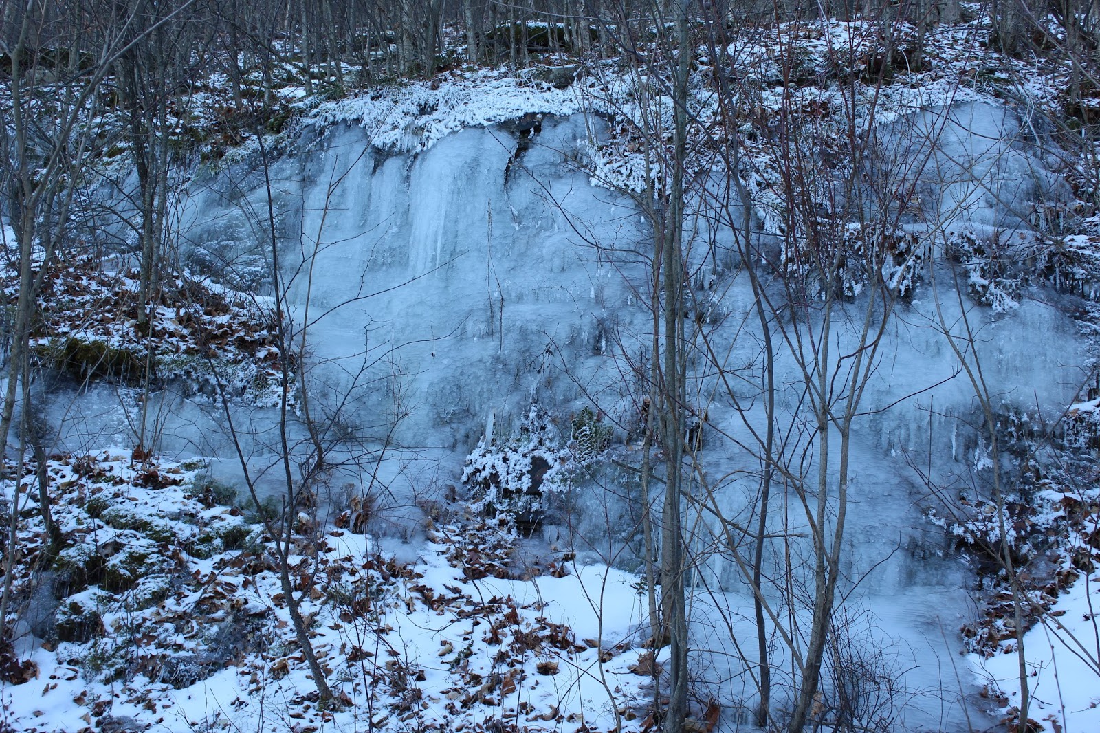
A beautiful, partially frozen stream flows beside the parking area.
The trail is actually just a woods road, that climbs steadily up over 1700 feet in 2.7 miles.
At a bend in the road, stay left, where the ascent continues. The only other tracks in the snow were canine.
The bright morning sun slowly warmed temperatures onto the plus side of zero. As I climbed in all my gear, however, I began to warm up quite nicely.
A switchback well up the mountain, where incredibly there was still only about an inch or so of snow on top of a crusty ice.
Arriving at a clearing with very nice views just below the summit area.
Great view north with the Schoharie Reservoir visible just over a nearby ridge line.
Bearpen Mountain was once a popular ski area, and even today, there are remnants of the old equipment still found rusted in the woods.
Looking directly down one of the old ski slopes, with County Route 2 easily seen winding below.
The top of one of the old ski runs with its incredible views.
A small clearing provides a fantastic view to the north towards Prattsville.
Great views to the west, with fierce winter winds blowing directly in my face.
Beyond the snow capped trees, Plattekill Mountain's ski slopes can be made out to the southwest.
Views down over rural Roxbury and Delaware County farmland.
The trees all along the summit area were covered in snow. The sun filled bright blue skies made a great contrast as the backdrop.
The snow filled view west from Bearpen's 3600 foot summit area. The true summit is a bit further back into the woods, but because it is such a flat area can be hard to distinguish the exact spot.
Northwest views towards Roundtop Mountain.
The sun shining brightly above the snow covered trees.
Ice covered slopes along the trail.
Even though the temps had only climbed up to near 10, the bright sun and lessening wind, made it feel almost comfortable.
Nearing the parking area on the lower slopes of the trail, with Bearpen towering above.
Arrived back at the car, ready to get some of my gear off. Hiked 5.4 miles RT on a very cold January morning.


No comments:
Post a Comment