Headed down to the Hudson Highlands on Monday to hike what my buddy Jim and I refer to as the high peaks of downstate. This is an area that neither of us frequent a lot due to crowds and traffic, but there is no denying that it is a beautiful area. Our goal for the day was to spot a car at the base of South Beacon Mountain and then drive down to Breakneck Ridge to begin a long hike of the entire ridge. Being less than 50 miles away from NYC as we got started, not surprisingly, there were several other groups beginning with us. What makes this hike so impressive is how low you start(less than 50 feet above sea level), and just how quickly you ascend(1250 feet in 3/4 of a mile). Numerous signs warn the average hiker that this isn't "just a walk in the park"...and that falling rocks are an ACTUAL risk.
As mentioned the climbing begins in earnest almost right away, up through jumbled piles of rock, following the white trail blazes and markings.
Within a few minutes, there are already views opening up behind you. There are many different options for climbing up through these steep spots, but generally the white paint blazes mark the easiest route.
After about 500 feet of climbing, you arrive atop a small knob, with perfect views towards Storm King Mountain across the river. The American flag makes this an extremely picturesque spot.
While the climbing done to this point has been aggressive already, a quick look to see what lies ahead shows that there is more rock scrambling to do.
The open rock provides many, many locations to take in the amazing views. The following is a view upriver towards Bannerman Castle.
Each steep ascent is followed by an equally tough and fun, rocky climb.
From the top of this perch, the drop off is jaw dropping. I actually got a bit nervous here, with the sheer 700 foot drop just a couple feet away.
Yet another climb, with more open rock.
Bannerman Castle.
Breakneck Ridge's west bump, with Storm King directly across from it.
A zoom view shows a solo hiker climbing up the ridge.
Spectacular river vistas.
The views of Storm King Mountain's dome like summit are as good as you will find anywhere.
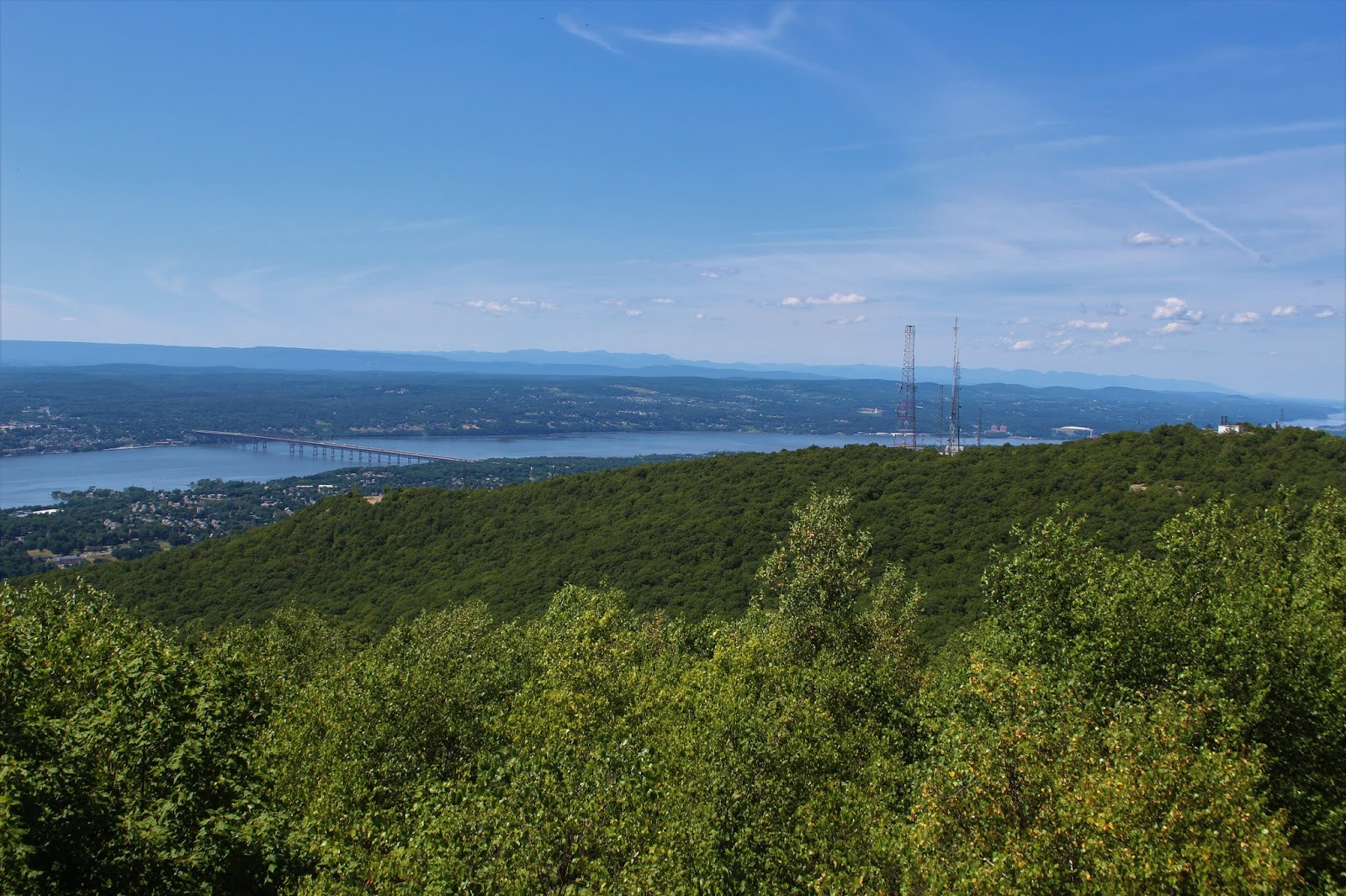
From high on a shoulder of the ridge, just a few yards off trail, we spotted this view of neighboring Sugarloaf Mountain, with the Newburgh-Beacon Bridge and the Catskills beyond.
Climbing around and then up and over one of the several summit bumps, we dropped down to a small clearing and our first view NE towards the fire tower atop South Beacon.
This grassy knoll made a perfect lunch spot to check out private Lake Surprise...
..and the mass of Bull Hill.
After refueling, we headed back out on the white trail between Breakneck Ridge and South Beacon, where we left the crowds far behind, passing through pretty, open woods.
Split rock!
We both noticed a spot on the map labeled Sunset Point and were looking forward to seeing it. When we arrived there, however, we were both let down and a bit confused. A small wooden platform is all we could find, with a treed in view towards the Newburgh-Beacon bridge.
Continuing along through the much cooler, wooded part of the hike, with several small ups and downs we were only able to find one water source. The barely noticeable flow of upper Squirrel Hollow Brook.
As we approached South Beacon Mountain's slopes, we weren't sure what to expect. What we got was more than either of us bargained for. A true ADK High Peak feel, with open rock scrambling and over 600 feet of ascent in less than 1/3 of a mile.
The steep climbing meant more terrific views. To the south, the ridge that we had just come off of.
Wildflowers in bloom. This lone wildflower really jumped out at us. Not sure if it is native, but certainly doesn't seem like it would be.
A little more ascent soon brought us up to the 1611 foot summit of South Beacon and its 60 foot fire tower.
From atop the 60 foot fire tower, which was restored and opened to the public back in 2013, the views are nothing shy of spectacular. The view NE takes in the Newburgh-Beacon Bridge, as well as the communication towers atop North Beacon. The Shawangunks and Catskills are visible in the distance.
A more northerly view provides this look at the Beacon Reservoir, hemmed in by North Beacon Mountain(left) and Schofield Ridge(right).
A zoom view of the Beacon Reservoir.
SE views stretching for many,many miles.
South view, encompassing most of our route up Breakneck Ridge.
A keen eye can even spot the NYC skyline, nearly 50 miles to the south.
The city of Newburgh sprawls out across the river.
After dropping off the summit, we continued north on the red blazed trail, before leaving the trail on a short, unmarked herd path down to the Beacon Reservoir. No swimming is allowed here, but there is an informal campsite and great water views.
Back on the marked trail,we suddenly came upon this collection of rock cairns, numbering well over 30.
The red trail follows a badly eroded, rocky, old road to the site of a former hotel and casino, dating back to the early 20th century.
From the casino site, looking back up at the fire tower.
The casino site provides even more spectacular views, and will leave no doubt in anyone's head as to why this location was so sought after.
The casino burned down back in the late 1920's and with the onset of the Great Depression, never ended up being built again. There are many remains to be seen, as well as lots of graffiti, unfortunately.
Much of the city of Beacon spreads out before you, some 900 feet below. The mountain and city both acquired their name from signal fires that soldiers set here back in the American Revolution to warn of British military movements.
Just a few yards beyond the casino site is the site of an old tramway, that pulled cable cars up the mountain. While enjoying its heyday back in the early 1900's, the tramway ran all the way until 1975. A 1983 fire permanently finally put an end to the tramway.
The impressive, very steep slopes where the cable cars ran down the west side of the mountain.
A steady drop down a rocky, rutted, old road brought us down to a series of metal steps and eventually our waiting car. Over 7 miles total with 2400 feet of ascent. A beautiful, but popular area to explore.