At 4180 feet, Slide Mountain is not only the tallest Catskill mountain, but also the first point north of Virginia to surpass the 4000 foot mark. It would seem that such a mountain would be visible to people from all around, but unfortunately its location among many of the other Catskill highest peaks, shield it from view. Due to this fact, the prominent peaks to the northeast, near the escarpment were often regarded as the highest mountains in the Catskills. The naturalist John Burroughs was one of the first people to recognize Slide as the tallest peak in the Catskills and even summited it, long before a trail was formalized. On Tuesday, my hiking buddy Jim and another fellow hiker, Stash set out to follow in the footsteps of John Burroughs, bushwhacking Slide's northern slopes up from Woodland Valley.
Below is an excerpt from Burroughs ascent of Slide:
We spotted a car at the Slide Mountain parking area along County 47, and then drove northeast to Woodland Valley to get started. The forecast was for sun and temps close to 50 in the valley, but it was a cool, nippy start as we headed off on the trail, crossing over the rushing waters of Woodland Creek. Elevation at the car was about 1400 feet.
We began to ascend via the trail, making sure to get above the private land of Woodland Valley, before entering the woods to begin the bushwhack. Heading west/ southwest, we side hilled much of the lower slopes of The Wittenburg, passing by many beautiful rock formations on the steep slopes.
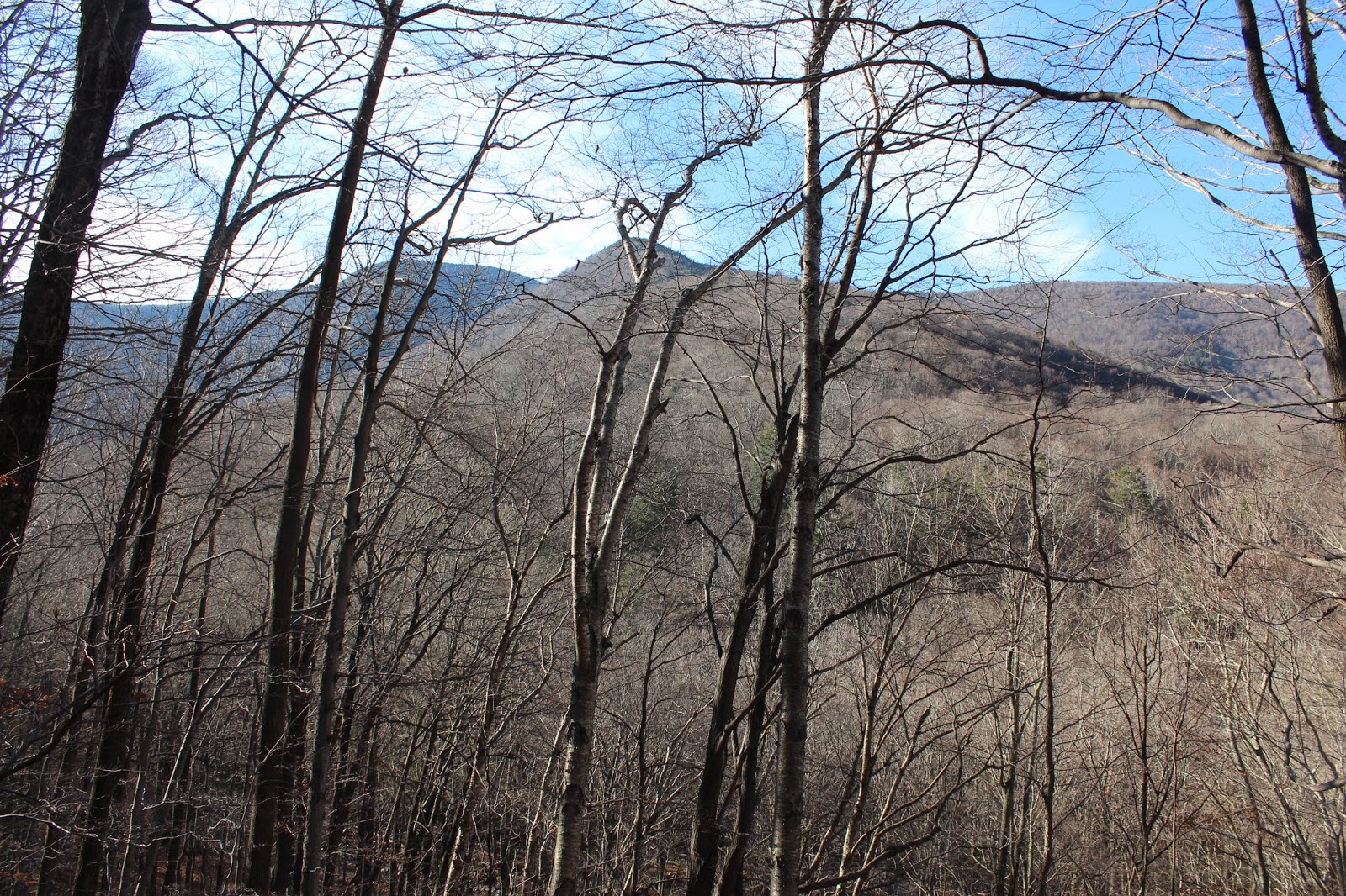
The side hill trekking was made more difficult from fallen leaves, which proved slick in spots. The great part of hiking this time of year though, is the screened views towards the surrounding peaks. Here is a filtered view towards Fork Ridge and Panther Mountain.
Giant Ledge's incredible rocky shelf could be clearly seen across the valley as well.
A mostly dry, rocky drainage has cut out quite an impressive path on its way down the steep slopes.
Looking up at the steep drainage area.
Jim, exploring the drainage, where a mere trickle was tumbling down.
Jim and Stash, continuing the long side hill adventure through a large pole stand.
Turning the corner on the steep slopes, we caught our first glimpse of the morning sun.
From a bit over 2000 feet, we unfortunately had to drop back down, steeply, more than 200 vertical feet towards a creek crossing.
From the bottom of the descent, we stood almost at the head of Woodland Valley, with fine views above towards the north snout of Slide. The second bump beyond is the true summit, which sits nearly 2500 feet above from the valley floor.
Arriving at a beautiful branch of Woodland Creek, which dazzled in the morning sunshine.
The creek had to be crossed, which proved to be quite an easy rock hop.
The climb up and away from the creek is quite steep, as we were careful to hit the snout.
An unrelenting ascent quickly gained us some serious elevation.
A glance down into the deep cirque just north of Slide's summit.
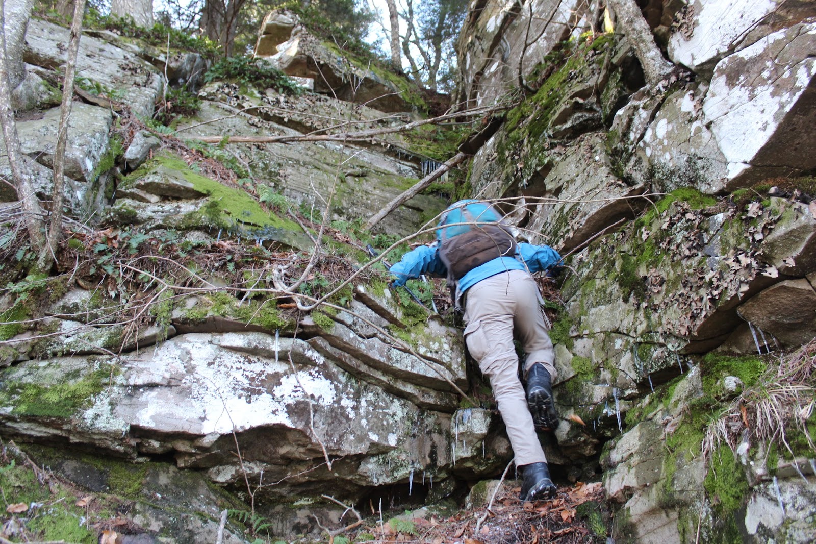
The "snout" proved to be extremely steep, with each rock ledge followed by another. There always proved to be a chute up, no matter how difficult it looked.
Stash taking a moment to collect himself before the next steep push.
Jim, climbing up through one of the steeper chutes, clinging to rocks and roots to pull himself up.
At the top of one of the many stair steps, we managed to find a hole in the forest canopy, providing a dramatic view back over the Woodland Valley towards the Devils Path peaks.
From the same vantage point, we found peek a boo views to The Wittenburg and Cornell.
Jim finding himself caught between a rock and a hard place.
Stash and Jim heading up the steep terrain, below yet another set of ledges.
Just shy of 3300 feet, Stash found a very nice rock ledge with phenomenal views north to Giant Ledge and Panther Mountain. Thanks to Stash's keen eye we dubbed this spot "Stash's Ledge".
Jim and stash soaking in the view from "Stash's Ledge".
As we continued our ascent, we decided to head back to the east side of the snout, directly above the steep cirque to see if we could spot any views. The only real view we could find was this peek towards Slide's summit ridge above.
Just below 3800 feet, we arrived at a fairly level table above the ridge. The scene up here was much more wintry, with snow and ice all around. Jim capturing a photo of some large icicles hanging off this rock ledge.
From just above 3800 feet, we circled the top of the cirque on our way to the summit, soon arriving at a GREAT view of Cornell and Wittenburg.
The Devils Path peaks to the northeast from the same vantage point.
The view way down into the Woodland Valley, some 2000+ feet below.
Jim and Stash taking in the wintry views.
After a steep push up through thick spruce for the last .2 of a mile, we finally arrived at the trail, which we followed up to the summit.
As we sat down to enjoy our lunch, the summit winds were really whipping about, bringing the wind chill down to very low levels. After only a few minutes we decided that we had enough, and headed back down via the trail.
On the descent, we stopped to a spot just off trail where we could look down on the ridge we had just came up. Not a great view, but the snout is clearly visible.
The hike on the trail back to the car was uneventful, but rockier than I remember. We made great time on the trail, leaving winter far behind back on the summit.
Arrived back at the car, feeling tired but satisfied. 8.5 miles RT with nearly 3000 feet ascent.