Headed down to the Catskills to do a small hike on the Tanbark Trail, high above the village of Phoenica. I parked along Main Street and then walked north past the grocery store on Mount Ava Maria Road and then turned right past the post office towards Phoenica Park/ Parish Field. The trail begins at the far end of the field where a red bench and sign are posted.
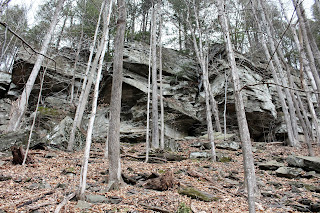
The trail begins climbing almost immediately beneath towering cliffs.
There wasn't any ice on the trail, but several huge icicles had formed along the cliffs.
Passed by a couple of very informative historical signs about the area along the way.
The trail comes to a junction after a stiff climb, where you will have the option to hike right or left onto a 2 mile loop. I turned left towards Phoenica Overlook, which I soon arrived at, where great views of the village are found.
Looking left provides a dramatic view southeast towards the Route 28 cooridor, with Romer Mountain and Mount Pleasant rising high above.
Southwest views above Pheonica.
Southwest views towards Panther Mountain's steep slopes.
Moving along the trail, with one last look back towards the overlook. The sign found at the overlook labels the prominent peaks in view.
The trail drops down to the north before turning east and ascending up the lower slopes of Tremper Mountain again.
The trail winds through the woods and soon arrives at a spectacular viewpoint at Grandview Ledge.
From this vantage point(which is a bit higher than Phoenica Overlook) the tops of several other high peaks can be seen poking above the nearby ridge lines.
Southwest views towards Phoenica with the Route 28 bridge crossing the Esopus Creek.
Enjoyed a snow and ice free hike down the steep slopes back down towards the trail junction again. Then completed the last section of trail and arrived back at Parish Field for a 2.3 mile RT hike with about 800 feet elevation gain.


No comments:
Post a Comment