Even though it was a holiday weekend, I was still quite surprised by the sheer amount of mountain bikers, but they mostly stayed in the woods on the extensive trail system that the resort has created. Almost immediately the access road heads east, swinging around to the NW slopes of the mountain. Views of Mount Peak to the west begin to rise above the trees.
A perfect fall day for a hike. The access road weaves its way around the NW slopes before finally turning south, following the mountain's north ridge to the top.
At a bend in the road high up on the mountain, a fine view to the north opens up.
As I arrived at the summit area, the ski lifts were unloading groups of mountain bikers, while several others were riding or just hanging around. Couple all of that with loud music playing, and I chose not to stick around there long. About 15 yards away, the true summit sits in the woods, with mountain bike trails all around it.
After hitting the wooded summit, I headed back down towards one of the ski lifts, which was not being operated. The slopes here were very steep and offered spectacular views to the NW.
The Deerfield Valley of Route 2 sits below, with Mount Peak to the left.
A slightly different angle provides a great view down towards the main lodge as well as Warfield Mountain and the peaks of the Monroe State Forest beyond.
The descent was quite steep, but enjoyable.
The perspective looking up a bit lower down the ski lift slopes.
Colors were excellent today.
The descent was spectacular, with peak foliage and great views. To the NW here, the Warfield House Inn can be seen sitting high up on the slopes of Warfield Mountain.
Enjoying one last view and a few last moments of solitude prior to arriving back down at the base near the crowds of mountain bikers.
A nice and easy 2.4 miles RT with over 950 feet of ascent.
After enjoying the great views on Mount Institute but not the crowds, I decided to head over to nearby Hawks Mountain, which is a peak that sits in the Mohawk State Forest, but has no trails. The short drive between the two mountains on Route 8A was extremely scenic, with great views of Mount Peak across the open fields.
I parked in a small unmarked pull off on Route 8A in the town of Hawley, which provides back door access to the Mohawk Trail State Forest. Elevation to start here was a little below 800 feet. Within just a few feet from the car, the terrain begins to climb steeply right away.The slopes on the east side of the mountain are very steep, gaining over 800 feet in under 4/10 of a mile. There were a few rocky cliff bands to negotiate, but I managed to find a way around them. Once on the ridge the canopy above was vibrant and made for very pleasant hiking.
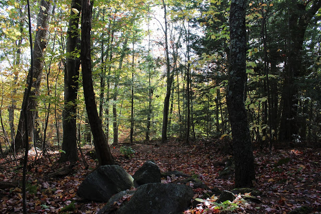
Wasn't really sure what to expect on this peak, but was quite surprised to not only find old woods roads but also a well built old rock wall.
The woods were mixed but mostly very open as I made my way north along the ridge.
After nearly 2.3 miles of bushwhacking, I arrived at the wooded 1853 foot summit. I checked out the steep NW end of the summit area in hopes of finding views, but it was covered in thick conifer.
Basically returned south via the same ridge I took up, but decided to drop down to the steepest slopes on the east side of the peak in search of potential views. I did manage to find one good view east from a small perch at about 1600 feet. Unfortunately the footing was tricky and the terrain dropped away vertically below so I carefully made my way back up to the ridge before making my way down a bit further away.
The descent was actually quite steep and fallen leaves made footing slick, but I managed. This was the final drop down towards the road, with a small drainage accompanying me.
About 4.5 miles RT with 1300 feet of ascent. Not a popular peak, but challenging.
Today's route to Hawks Mountain. Red=Ascent Blue=Descent
My drive home passes through the quiet and peaceful Berkshire hilltowns. While the scenic pull offs and hairpin turn were packed with crowds, I chose to visit the more stoic Town of Florida church and cemetery, which sit high on a hillside just off the road.
A bit further along and much closer to home, I enjoyed this serene view of Brodie Mountain at peak fall color, high above Starobin Pond in the town of Hancock.


No comments:
Post a Comment