For anyone looking for a trailed, off the beaten path hike in southern Vermont, Owls Head fits the bill. This small peak has been on my radar for quite a while now, as the few trip reports I had read about it were quite glowing. I decided that Tuesday would be the day I finally pay it a visit. On a mostly overcast day, I headed north up to the quaint little town of Dorset, past the Quarry on Route 30 and onto Black Rock Road, then to Ken's Camp Road, thence to Owls Head Town Forest. At the very end of a one lane dirt road I arrived in a parking area, where there is ample signage letting you know you are in the correct spot. Up the hill from the parking area is the trailhead, with a historical board and kiosk. Elevation to start was about 1240 feet.
The trail is well marked and easy to follow, climbing steeply up past cellar holes and old foundations from 19th century migrant workers housing.
After about half a mile, the trail arrives at Gettysburg Quarry, which is quite impressive. Unfortunately photos do not do justice to its sheer size. The quarry is so named because much of the marble quarried from here was used for headstones for soldiers who died in the Battle of Gettysburg in the Civil War.
Just a few yards away from the quarry is a spot known as Art's Bench, a marble seat with a great view across the Route 30 valley.
White birch surrounding the area of Art's Bench.
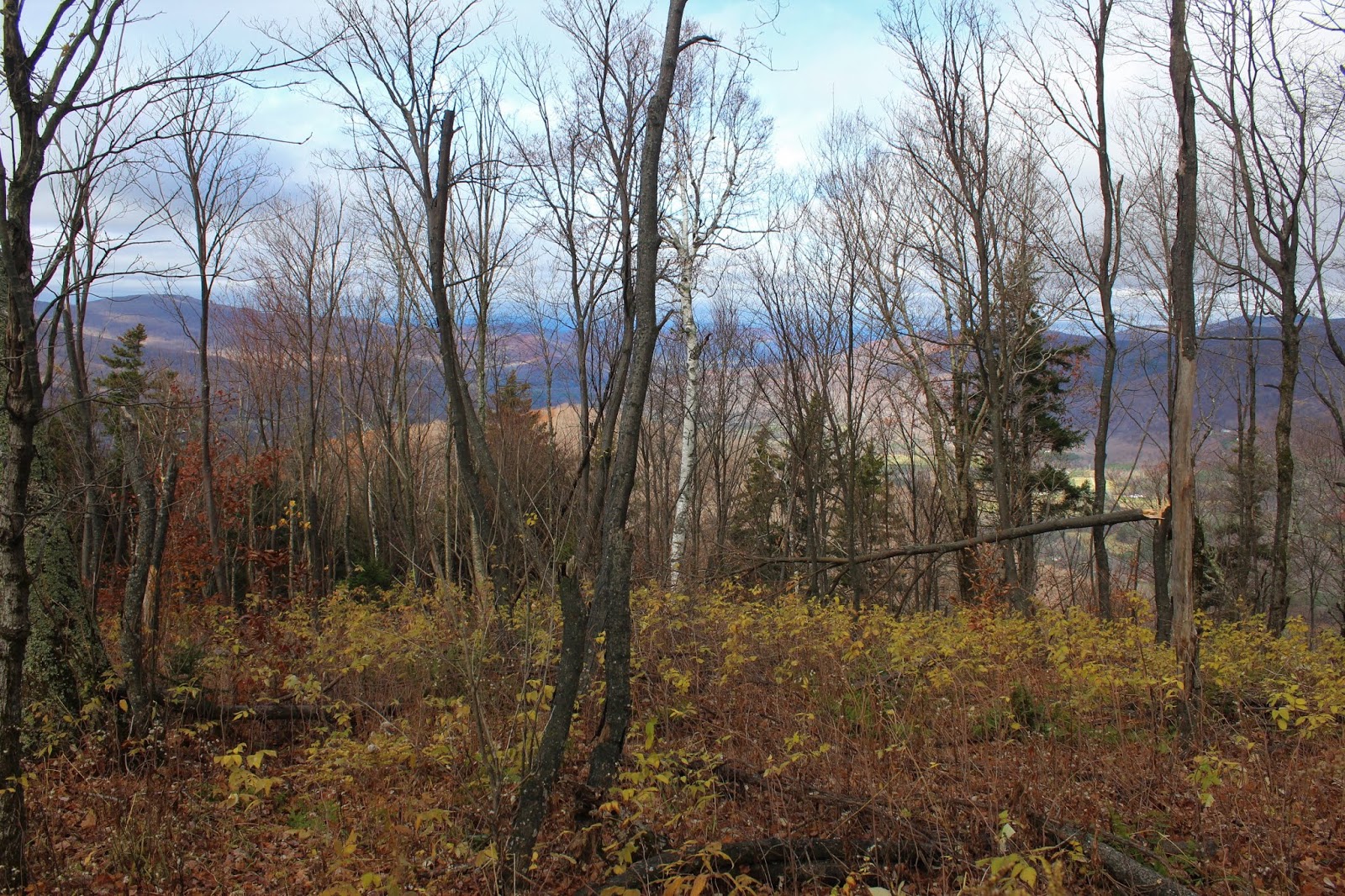
Looking SW towards Mother Myrick Mountain and the northern end of Equinox Mountain.
Continuing on the blue blazed trail past the quarry, I found another framed view towards the SW.
The woods were surprisingly holding onto some decent color, even as I neared 2000 feet.
As I continued to gain elevation, more and more trees were bare, and offered up my first views of the summit area of Owls Head.
I bushwhacked about 20 yards off trail to capture this nice view of Olwls Head summit area, covered in thick conifer, and rising steeply 300 feet above.
A short but very steep push up from the hardwoods and into the conifers got me to Gilbert's Lookout, a rock outcrop of the west slopes of the mountain with spectacular views.
From Gilberts Lookout, the view north.
SW views down towards Route 30 heading into Manchester.
The breathtaking west view across the valley, with Dorset down below.
The trail seemed to end at Gilberts Lookout, so I bushwhacked up to the summit area. At first, the slopes were nearly vertical and covered in conifer but quickly leveled off, filling in with low brush and open hardwoods. With the leaves off the trees, I enjoyed nice screened views to the valley below.
The 2481 foot summit sat in a small spruce stand and was completely wooded(no picture).
I enjoyed a mostly pleasant hike back, but was careful on the steep area below the summit and had to watch for slick leaves in spots. 3.5 miles RT with over 1300 feet of ascent. A highly recommended hike for anyone who enjoys a little history.


No comments:
Post a Comment