After my morning hike to Bearpen Peak and Long Tom Ridge, it was still fairly early in the afternoon, so I decided to squeeze one more small hike in. I headed up to the Eleventh Mountain trailhead on Route 8 with the intent of hitting a long set of steep, ledges on the far western slopes of the Eleventh Mountain ridge. A trail heads north towards the Siamese Ponds from the parking area, but I instead immediately entered the woods, bushwhacking straight up. The parking area's elevation is 1775 feet, and the ledges I was trying to hit sit a mere 4/10 of a mile away, but 700 feet up.
The climbing became steep almost right away, and only got steeper as I gained elevation. Within just a few minutes, I was already getting views back down towards the SW.
Nearing one of the first clearings atop the ridge.
After a steep 700 foot climb, I arrived at the first of several open view points. They were nothing short of astonishing. The Route 8 corridor can be seen threading its way to the SW.
Heading north atop the ledges, there are a string of three successive clearings, each with great views.
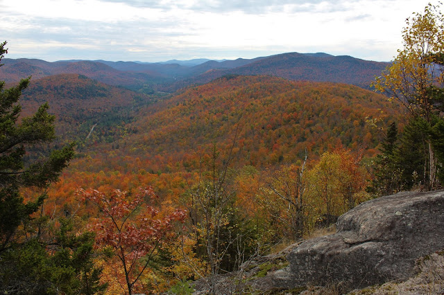
The foliage was outstanding from here!! A real treat!
South facing views across Route 8 down into the Wilcox Wild Forest.
After the first three clearings, I continued north along the steep west ledges, but the woods closed in quickly with spruce. The spruce was never thick enough to really slow me down, so I pushed on, eventually finding more views. From this vantage point, I found a more north facing view up the East Branch Sacandaga River valley.
Enjoying one more great viewpoint, just like the others, facing west.
After contemplating my descent route, I decided not to drop directly down the nearly vertical west slopes, but instead head back south towards my route up. As I moved away from the ledges, only about 1/10 of a mile east, I found the going much easier, through wide open hardwoods. In no time at all I was back at the car. A lot of bang for the buck on this little gem! 1.6 miles RT with 750 feet of ascent.
Route below. Red=Ascent Blue=Descent
On the way home, I took the scenic route, pausing briefly to take in this calm stretch of the Schroon River near Warrensburg, reflecting on a near perfect day.


Nice, those ledges have been on my 'visit list' for a while, but I haven't made it yet. I added a link to your blog on mine, hikes.adirondackforests.com.
ReplyDeleteYeah, it's a short but sweet little jaunt from the road that can be extended with a trailed hike along the East Branch, if you so choose. I took a look at your blog and was really impressed! Love that you get out to areas few others tend to go to. Very nice photos and write ups as well.
Delete