The trail starts off fairly benign but soon enough becomes incredibly scenic, hugging the right bank of Roaring Brook and a multitude of waterfalls as it climbs steadily.
The sound of rushing water accompanies you along much of the first couple miles of the hike, with several easy photographic opportunities as the trail literally brings you alongside the brook.There are so many different falls and cascades along the way that it is hard to pick a favorite. These falls were so scenic that it took my mind off the steady ascent, proving to be a great distraction.
After nearly 2 miles and over 1100 feet of climbing, the trail arrives at a corner of the North Creek Reservoir. Dark, ominous clouds began to move in over the ridges above, but within minutes...
.....the skies had cleared back out. This powerline crossing provides a glimpse up to the blue skies above. Keeping my fingers crossed that it would stay this way as I got up towards the top.
At about 3.4 miles in, I arrived at a spot known as Ives Dam. This was an old impoundment but today is mostly a dry meadow with a small stream flowing through. A tailings pile from the old Barton Mines can be seen high up int he notch, dating back nearly a century ago. I found this stream crossing to be a bit tricky with the water being a little deeper than it first appeared. I had to find a way around by heading right about 15 yards and finding a large rock to jump across to.
Once back on the trail, the woods change considerably, becoming much more coniferous and getting much steeper.
Just a few yards off trail I stumbled upon this old relic...well maybe not that old. Hop in...we're going to the top!
A little over 4 miles in, and a little over 3000 feet, the trail leaves the woods and hits a ski area access road. Not really what I was hoping for, especially with a light rain and darker clouds moving in again. I even noticed some flurries mixing in and spritzing down.
Luckily the rain stayed very light and even stopped within a matter of minutes. One of the best parts of hiking a ski area is the guarantee of nice views.
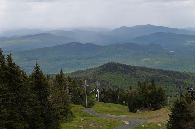
A spectacular vista to the north with sweeping views all the way towards the High Peaks, over 30 miles distant.
A zoom view towards the north with the rocky ridge line of Moxham Mountain clearly visible in the foreground and the High Peaks forming a jagged horizon far beyond.
Although I'm sure this is a busy spot in the winter, it was peacefully quiet today.
Changeable skies quickly brought clouds and showers in from the west, concealing some of the distant mountains to the NW. The Barton Mines are easily visible as well as Big and Little Thirteenth Lake Mountains with Peaked Mountain just beyond. Blue Mountain can be seen in the distance in the clouds.
A look across towards one of the other, slightly lower summit bumps and one of the ski buildings at the top.
Great views abound.
Storm clouds moving in to the north, obscuring distant views. Still, a very nice vista.
From the top of the ski slopes, the views are incredible. Here is the view SE, with Oven Mountain Pond(L) and Windover Lake(R) and a thin ribbon of Peaceful Valley Road running between them.
A zoom view even provides a glimpse down towards Huckleberry and Crane Mountains.
The ski lodge at the summit. I fully explored the entire summit area in search of a summit survey marker but unfortunately had no luck finding it.
A thermometer located atop the mountain showed what I had already known...it was darn right cold for June! 44 degrees with a stiff wind, meaning wind chills in the low 30's. At least it kept the black flies away all day!!
The descent was much quicker and fairly uneventful. As a steadier light rain moved in, the winds really began to ramp up, making me quite glad to be off the open ski slopes above.


No comments:
Post a Comment