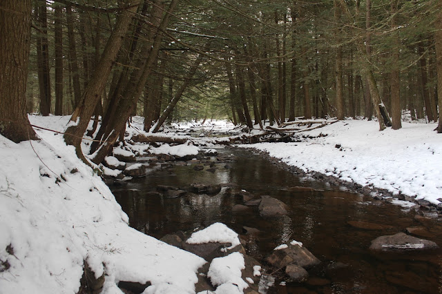
A short distance in, I came to a crossing over the East Kill. This proved to be a fairly easy rock hop.
The wintry East Kill, which flows out of Lake Capra just upstream of here.
Once across the creek, the woods turn into a beautiful, dark conifer forest.
I chose to ascend West Stoppel's western sub summit first. The woods are very open, with screened views nearly the entire way back north to the Blackheads. A snow squall can be seen moving in over Thomas Cole here.
Blue skies began to emerge to the southwest as I continued my climb. Clouds would quickly take back over and eventually win out.
The East Kill Valley as well as most of the Blackhead Range can clearly be seen through the bare trees as I gained elevation.
Typical steep slopes, as I gained over 900 feet in about one mile to the western sub summit.
Arriving at the wooded 3040 foot sub summit. Notice the yellow pain blazes just beyond, signifying the state land boundary.
The true summit was a mere half mile away, so I began an easy drop down to a small clearing in the barely noticeable col.
From the 3000 foot col, looking back at the 3040 foot sub summit.
A quick, easy ascent up to the 3100 foot summit marked my 76th Hundred Highest Catskill. There were about 6-7 inches at the summit, which is a fairly large flat area.
I wandered around a bit, looking for a high spot, and settled on this small stand of conifers as the true summit.
I decided to basically head due north off the summit, then drifted back towards my bread crumb trail near 2500 feet. From this area, I spotted a small opening in the forest canopy, with a nice view towards Black Dome.An easy descent dropped me back down to the East Kill, in a shaded hemlock forest.
Crossed back over the creek, arriving back at the car at just under 4 miles RT, with over 1000 feet of elevation gain. 76/102 CHH.


question, I want to do this as part of a great backpacking trip but would be in the summer. Do you think bushwacking will be feasibly without luxury of winter conditions?
ReplyDeleteI actually did this bushwhack today... not bad with summer conditions. I found some rocks to step over the East Kill and found my way up to the summit via the col. The forest was dense in many spots but I was able to get through without issue. I think this would be a nice backpack. I see you posted on July 18, 2023 and I just happened to come across this site today (Aug 2, 2023).
DeleteI actually did this bushwhack today... not bad with summer conditions. I found some rocks to step over the East Kill and found my way up to the summit via the col. The forest was dense in many spots but I was able to get through without issue. I think this would be a nice backpack. I see you posted on July 18, 2023 and I just happened to come across this site today (Aug 2, 2023).
ReplyDeleteHey, just seeing your comment now...glad you had a good trip up West Stoppel. Nice, little peak! I'm not a big fan of doing the Hundred Highest peaks in the summer but sounds like all went well for you!!
ReplyDelete