Search This Blog

Thursday, November 30, 2023

Lawson Lake County Park(Town of New Scotland, Albany County)

Finally had a little free time Thursday afternoon to do a little exploring at Albany County's Lawson Lake Park, located off CR 109 in the town of New Scotland.  It has been several years since my last visit here, so it was nice to rediscover these woods once again.  Parked in the lot on Lower Camp Road just south of Lawson Lake(Elevation 750 feet) and then walked the service road to its end to check out the lake itself.  This is the view north near the dock along the west shore.

Backtracked south to the Loop Trail, and then broke off onto a yellow blazed trail, which hugs the southwest perimeter of the park.  Even though I started my walk at about 2pm, daylight was already showing signs of fleeting in the late autumn woods.


After completing the western trails in the park, I crossed over CR 109 to the east side and picked up the Upper Camp Road.  This service road climbs quite steeply up to a campsite with several cabins, before a foot path heads up to a red marked "Summit" loop trail.  This trail hugs the outside of the small, flat summit of a 1003 foot hill, with decent views through the bare trees. 

From the red summit trail, I bushwhacked east, dropping down and crossing over a "Notch" trail on my way to a slightly higher hill.

There is no trail on this 1038 foot eastern hill, but the woods are quite open and easy to explore.  Unfortunately, public land doesn't extend all the way to the true summit, although it does hit the summit plateau.

Followed the edge of the steep western slopes of this hill, where I found numerous game paths but not much in the way of views. 

Explored the hill all the way to the south edge of public land before bushwhacking my way back down to Upper Camp Road and eventually my car.  A nice and easy 2.8 miles RT, with 500 feet of climbing.  

Map below.  Red P=Parking


Thursday, November 16, 2023

Tawasentha Park(Town of Guilderland, Albany County)

We've all heard of common phrases such as "No Shave November", but this year for me has been "No hike November". Finally had a brief window of opportunity so did a short hike at Tawasentha Park off of Route 146 in Guilderland on a gorgeous mid November afternoon.

There are several different colored trails that meander through the woods of the park, with the highlight being the ones along both sides of the Normans Kill.
Covered a little over 2 miles on a beautiful, short sleeve fall day.  Shockingly only saw one other person in my travels.

Tuesday, October 31, 2023

Lookout Point(Mohawk Trail-Connecticut)

My second stop for the day in the Litchfield Hills of NW Connecticut was a short trail hike to Lookout Point on the Mohawk Trail, a large set of rock ledges easily visible from Route 7 in Canaan.  I got started by parking along the Warren Turnpike(Elevation 575 feet) just north of the Housatonic Valley Regional High School and headed east on the trail. The start was a bit tricky, as I had to cross train tracks and then travel through a wooded area near people's backyards, before emerging at a road crossing of busy Route 7.

Once on the east side of Route 7, the trail climbs quickly and becomes quite rugged.  The ascent is short but relentlessly steep and rocky.

Once on the ridge, the trail mellows out nicely and becomes a gorgeous woods walk.  A carpet of freshly fallen leaves made for perfect hiking.

After a very brief down and then up, I emerged at Lookout Point.  The views south down the Housatonic Valley are very nice.

To the west, the large, bulking mass of Sharon Mountain looms large above Route 7 winding below at its foot.

A fine place to kick back and soak in the views.

From Lookout Point, I retraced my steps back towards the car, including a very steep descent.

A pretty crossing over the outlet of nearby Childs Pond on a sturdy footbridge.

A nice and easy 2 miles round trip with over 600 feet of ascent.  Short, steep but sweet.  

Map below.  Red P=Parking  Blue Line=Route taken


Mine Mountain(Housatonic State Forest-Connecticut)

Headed over to the NW corner of Connecticut to do a little exploring on a pleasantly cool Halloween.  My first stop would be untrailed Mine Mountain in the Housatonic State Forest starting from Eggleston Road in the town of Sharon, where an unmarked pull off(elevation 900 feet) provides access for 1 or 2 cars.  As I entered the woods, I was immediately greeted with a "Closed Area-No Trespassing" sign, but upon closer inspection it showed that it's only for April 15-October 17th for some reason.  I was safe to proceed.

The climbing is steep right out of the gate but I was able to pick up a good hunters path up to aid the way.  On my climb I passed by an enormous "Aircraft Carrier Rock" akin to the one in the Catskills.

Mine Mountain consists of several small high points and I first hit the SW high spot which had filtered views and a lot of low brush.

From the SW knob, I headed north to the NW summit knob, which was fully wooded.  This is marked as the summit on some maps but is clearly not he high spot.  From this knob, I proceeded east and then up a rocky slope towards the true summit.

The summit ridge was surrounded by mountain laurel, but the 1395 foot true high spot itself sits in a nice clearing.

From the summit, I pushed east through some thick mountain laurel before hitting more wide open hardwoods and many through the trees views.  There is one nice southeast facing view up the Carse Brook valley with Pine Swamp Hill on the left.


Although fleeting, there was a bit of fall foliage hanging on.  Sometimes, if the conditions are right, the woods themselves can be even prettier than the long distance vistas.

My final "high spot" on the mountain was the SE knob, which sits in a very large, grassy clearing.

The views from this knob are very open and quite nice.  This is the view south.

SE views.

 SW views are a bit obscured, but still okay.

From an even broader and flatter rock slab, just below the other ledges, there are more scenic views to be enjoyed.

After enjoying the views, it was an easy bushwhack back down towards the car on Eggleston Road for a total of 2.2 miles RT and over 500 feet of ascent.  A lot of bang for the buck on this small mountain. 

Map below.  Red P=Parking   Red X's=Views


Tuesday, October 24, 2023

Huckleberry Point(Kaaterskill Wild Forest-Catskills)

Ventured down into the Catskills to do a short hike to Huckleberry Point via an unmarked but obvious footpath along the upper rim of Platte Clove.  Being short on time, this was the perfect hike, with a lot of bang for the buck.  Parked in an unmarked pull off along the north shoulder of Platte Clove Road(Elevation 1760 feet) and quickly picked up the "secret" path, heading east.  The tread on path is quite obvious and easy to follow.

Stone wall from an old quarry.

After a short, steep ascent I hit the first view point of the day from a small informal campsite, complete with stone seats and fire pit.  This view takes in a unique view through Platte Clove, with Huckleberry Point on the left.

There are numerous great views along the edge of the Clove, with fleeting fall colors adding to the display.

This unmarked path, while much more scenic than the marked trail, is also not for the faint of heart.

After about one mile, the path meets up with the marked trail at Huckleberry Point.  The views here are nothing short of spectacular, looking south towards Plattekill Mountain and Overlook Mountain just beyond.

Looking SE from Huckleberry Point, across the Hudson Valley, with the lower portion of Platte Clove far below.

I continued along the edge of the escarpment to the east/ northeast, following on again off again herd paths and hit a few more good views and ledges.  This is the view due east with the Hudson River easily visible running north-south.

A bit further north along the escarpment, I came to this grassy ledge. Believe it or not there was a small fire pit on the other side of this boulder, only a couple feet away from the edge.

After taking in the east facing views, I back tracked to the unofficial path and followed it along the edge of the Clove, taking in the breathtaking views and foliage.  This view captures Indian Head, Twin and Sugarloaf Mountains across the Clove.

A nice and easy hike back through the colorful woods got me back to the car in no time.

Covered about 2.2 miles total with 600 feet of ascent.  A much shorter, easier, and better alternative than the marked DEC trail.  Didn't see another person the entire hike.

Map below.  Red P=Parking  Blue=Tracks


Wednesday, October 18, 2023

Hot Point(Florida State Forest-Berkshires)

Headed over to the Berkshires to do a little exploring north of Route 2 along the Hoosac Range to an open ledge known as Hot Point in the little known Florida State Forest.  Utilized an unmarked woods road off of Route 2 to park my car a short distance in. (Elevation 2010 feet).  From there, I continued on foot north along the rough, damp and muddy woods road under cloudy skies.

After about 3/4 of a mile on the woods road, I bushwhacked a short distance east over to a sprawling beaver pond.

There are actually two large beaver ponds here, but the northern one sits on private land, so I crossed the wetlands between the two to stay on state land. 

Continued my bushwhack north for another 3/4 of a mile, criss-crossing more woods roads along the way before beginning my descent west off the steep slopes of the Hoosac Range.  Crossing a small but fast rushing drainage just prior to the big drop.

Due to the odd layout of state land, I was forced to bushwhack back south another 4/10 of a mile, while dropping 300 feet on some very steep slopes.  This was by far the toughest part of the entire hike.

Sitting unassumingly at about 1800 feet of elevation, high above the rugged slopes carved out by Canyon Brook is a wide open rock ledge called Hot Point.  The view west/ southwest towards the Greylock Range is spectacular.

This view looks more southerly with the fall colors clinging to the Hoosac Range, as well as the Greylock Range fighting off some low clouds to the right.  A careful eye can pick out Ragged Mountain's long ridge just in front of Greylock.

The west view from Hot Point, with the Greylock Range(left), North Adams down in the valley and Bald Mountain(Clarksburg State Forest) to the right.  The Taconic Range is in the distant center.

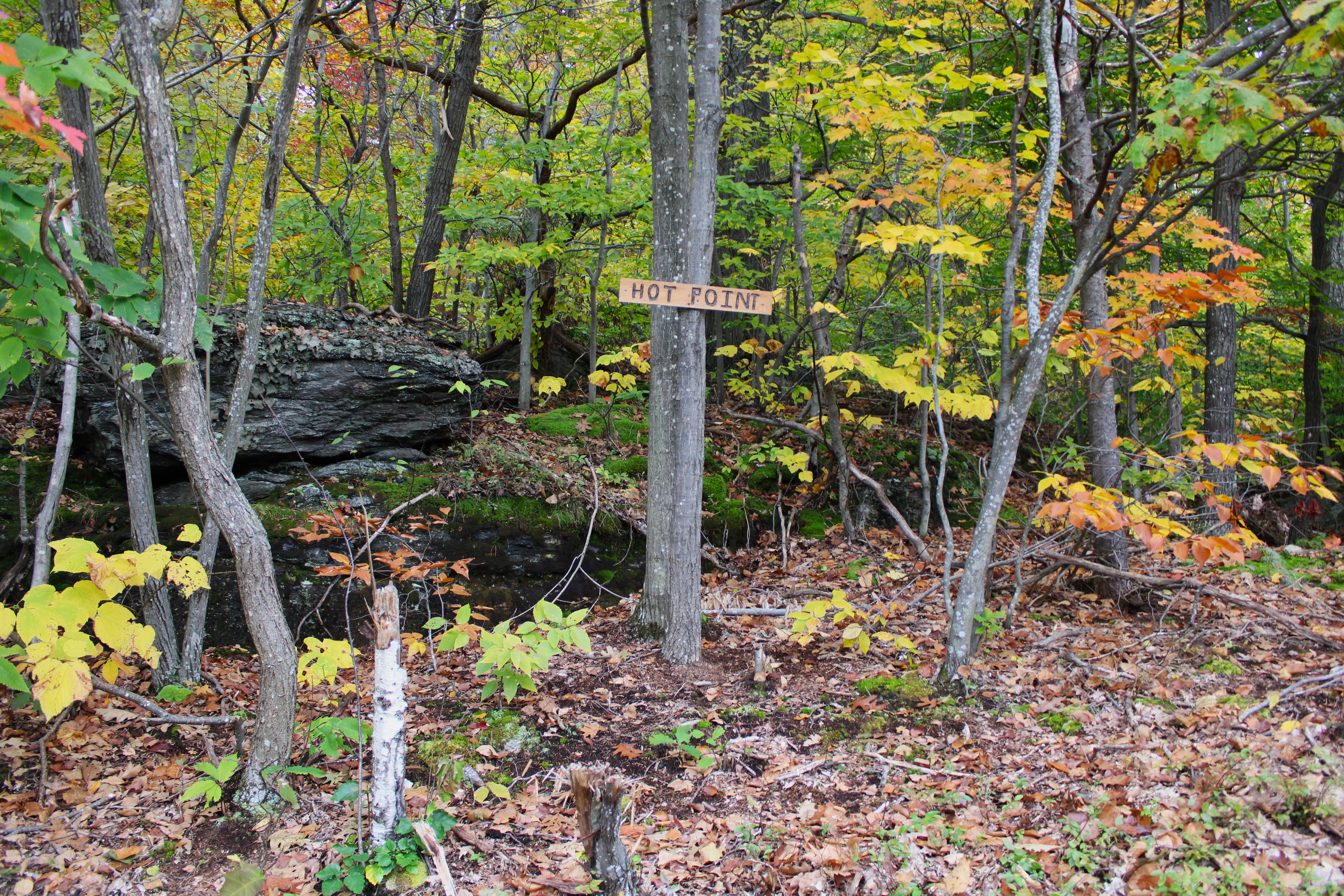
Surprised to find a sign at the point.

After enjoying the views from Hot Point I headed back north, bushwhacking my way up through open hardwoods, and passing by some interesting rock formations.

In a small clearing, back up over 2000 feet, I found some more nice views west over the Clarksburg countryside and into southern Vermont. 

SW views from the clearing, partially blocked by one tree.

Once back over 2200 feet, it was a nice and easy bushwhack east to a series of woods roads that headed south.

A woods road crossing over Canyon Brook.

Autumn splendor deep in the quiet forest.  While tame here, Canyon Brook comes thundering down the Hoosac Range's steep west slopes less than half a mile from here.

Continuing my way south, from the edge of state land, I was able to get a through the trees view towards the fully private, northern beaver pond.

Firmly on state land, I enjoyed exploring the east shoreline of the large, southern beaver pond.

Combined a bushwhack with a myriad of woods roads to make my way back to the car for a total of 4.2 miles RT, and over 800 feet of total ascent.  Unfortunately the clouds never broke up as they were forecast too, but the nice views and remaining fall foliage more than made up for that.

Map below.  Red P=Parking  Red X=Hot Point