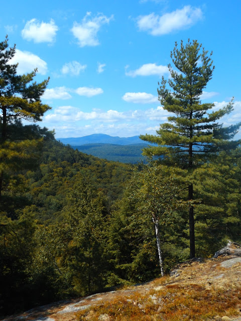
My first stop today was Kipp Mountain, which can be accessed from a small pull off on the north side of Ben Culver Road(County Route 75), one mile west from Landon Hill Road. A kiosk and trail map are found near the parking area, which is surrounded by private land.
The trail leaves the road and winds through an open hardwood forest with new trail markers and flagging showing the way.
After about .8 of a mile, with a couple of steeper sections, the trail nears south facing cliffs, with incredible views over Loon Lake.
Continuing on the trail along the cliffs.
Looking directly down over Loon Lake towards many southern Adirondack peaks.
Retraced my steps back down off the mountain, for a nice, easy 1.8 mile RT.
My next stop was the nearby Meade Mountain & Beckman Mountain Trail. There is a parking lot with room for about 4-5 cars on the south side of Igerna Road on the northwest side of Loon Lake.
My next stop was the nearby Meade Mountain & Beckman Mountain Trail. There is a parking lot with room for about 4-5 cars on the south side of Igerna Road on the northwest side of Loon Lake.
The trail system here is criss crossed by many woods roads winding up the mountain, so you must be careful to watch for trail markings.
Although not a long hike, the ascent is pretty steep for a short distance, making me break a sweat.The top of Meade Mountain affords a nice view west towards Gore Mountain.
Gore Mountain's ski slopes are clearly visible in the distance.
Continuing past the summit, the trail drops into a small col on its way to Beckman Mountain. Beckman Mountain is basically right next to Meade Mountain and doesn't appear on any topographic maps, but does provide a great view east over Loon Lake and Kipp Mountain.
The trail bends north from here and heads to a couple of other clearings to the north and east. Here is a view over the southern basin of Schroon Lake.
A very short distance away from the last lookout is another small clearing to the north of several nearby mountain peaks.
Finished up a nice easy 2.1 mile RT hike and headed back to the east shore of Loon Lake to bag Stewart Mountain. Stewart Mountain is a very short hike found on the east side of White Schoolhouse Road, where a small parking area provides room for 4 cars. The trail climbs just over .4 of a mile directly up to a small cliff.
A small rocky cliff area provides outstanding views to the south.
Retraced my steps back to the car again, completing another short .84 mile RT.
My last stop for the day was to be Palmer Pond, which is found by driving west on Route 8 past Loon Lake until you arrive at Palmer Pond Road to the south. Take the gravel road all the way to the end(it is a bit rutted and rocky) where a large parking lot is found. The trail is actually a continuation of the road, past a large red gate.
After a short distance on the road, the trail forks, where you have an option to hike to the east or west side of the pond. I stayed to the right first.
The right trail leads to a large clearing, where the north end of the pond is found near its outlet. This part of the pond is more of a marshy area than actual pond.
The outlet winds through swampy wetlands where wildflowers blow in the wind.There are very few views of the pond on the west side unless you bushwhack through the woods. Instead I went back to the fork and hiked up the east shore of the pond, which winds around a swampy section of the pond before arriving at several nice campsites on the south side of the pond.
A view to the west from the southern shoreline.
Completed 4 different trails in the town of Chester today, all with nice views, none particularly difficult. Round trip mileage for the day was about 6 and a half miles on a beautiful August day.


thanks dude, this was very helpful
ReplyDelete