Decided to do a little off trail adventure today to 2927 foot Noble Mountain in the Giant Mountain Wilderness, which sits just south and east of Rocky Peak Ridge. The weather forecast was calling for early afternoon thunderstorms so I got an early start under mostly cloudy conditions. Parked on the north side of the road in a large, unmarked pull off(Elevation 1520 feet) less than a mile before the parking area for Round Pond.(Spanky's Wall P.A.)_
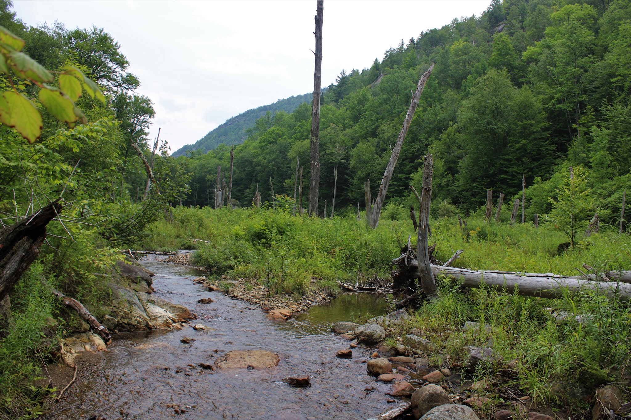
From the parking area, I followed a well trodden herd path down a very steep hillside to an open area along the North Branch of the Boquet River.
Crossed the North Fork with an easy rock hop and continued on my way, climbing north. Found an abundance of fungi in the woods...it's a banner year for mushrooms!
Followed a fast flowing drainage up the mountain for a little ways and was treated to a couple of nice, little cascades.
As I neared the top of a 2204 foot SW knob of Noble, I hit some open rock slabs with excellent south facing views of the nearby Dix Range. The slide on Dix was quite notable, even through the milky air.
South views.
The SE views from this open slab were great, although somewhat tainted by the thick haze.
A small drop off the 2204 foot bump brought me down to a fern filled, wet depression area with just a hint of foliage.
Within just a few minutes of descending the first bump, I was back to climbing steadily towards Noble's summit. The woods were fairly open and easy to negotiate until about 2500 feet, when the character of the forest changed dramatically to spruce.
Although there was quite a bit of spruce on the ascent, it never got too thick so I enjoyed a pretty easy climb.
Just before hitting the summit, the woods changed once again..this time to a mix of spruce and hardwoods, with a bit more undergrowth. The 2927 foot summit was completely wooded with no views and for some reason marked with a red paint.
After hitting the top, I turned back southwest, retracing my steps down for a bit, before turning more due south in search of additonal views. At about 2600 feet, I found more open rock slab with similar south views towards the High Peaks as the ones down on the lower knob. The only difference at this point was the clouds and haze had increased from earlier. The 2204 foot knob is actually the peak in the foreground.
Southeast views through the haze.
On the descent, I headed down a slightly different route, hitting the drainage just west of my route up. The woods were steep but mostly easy going all the way back down to the North Fork. From there it was an easy climb back up to the road on the herd path. 3.5 miles RT with over 1500 feet of ascent and of course didn't see another soul.
Map below, with red X=parking Blue X=Open rock slab on lower peak Black X=True summit


Wow, great views of the high peaks, even with the clouds/haze/smoke...I loved seeing that little bit of fall foliage; it gives me hope for getting back into more enjoyable hiking soon!
ReplyDeleteYeah, I couldn't agree with you more...looking forward to some great fall hiking!!
Delete