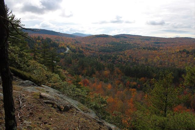
Barton High Cliffs has been on my list of hikes to do for quite a while now and a day off work meant today would be the day! There are absolutely no trails here meaning it would be a 100% bushwhack hike from Route 8, just east of Brant Lake. I parked in a scenic pull off on the north side of the road(Elevation 1030 feet) and headed into the woods, climbing generally east/ northeast towards a steep area of ledges near Brace Hill's south slopes. In about 4/10 of a mile and a pretty easy ascent I hit some open ledges overlooking Route 8 at about 1400 feet. Views were surprisingly good for being so low. West/ southwest views with nice fall foliage.


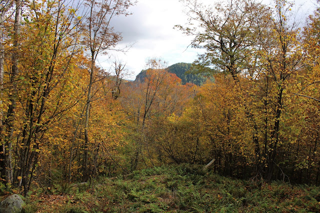
After hitting the summit, I began to descend to the north, veering slightly NE. I hit a little clearing on the way down which provided a decent view towards Barton High Cliffs just over the tree tops.
The slopes off of Brace weren't too steep and I easily made my way down to a low spot between peaks, where a pretty stream drained down towards Spuytenduivel Brook.


Standing almost directly below the cliffs, I found a couple of decent views looking up. These cliffs are the real deal! Very, very impressive!!!

I tried my best to stay directly below the cliffs but the jumbled, large boulder fields were pretty tough to get through so I kind of cheated a bit up the north slopes in the pass. I found more great views of the cliffs from here though, so it was a success.


I circled all the way around towards the east end of the ridge, finally finding a route up that I could manage. As expected, the views from the top were incredible!!

I literally cannot say enough good things about these views! I was completely blown away by the rugged beauty of these cliffs. NE views from one of the numerous open ledges.


The slopes below are incredibly steep and dangerous so of course exercise caution if visiting here.

After enjoying the amazing views, it was time to head back. I would've liked to have continued south for the descent where the terrain looked more forgiving but unfortunately state land ends almost directly over one of the steepest parts of the cliffs. All of this meant I had to climb all the way back down and around the way I had come up.
Once around the jumbled boulder fields, I enjoyed a nice hike through mostly open woods. Briefly stopped at a small stream to soak in the peaceful ambiance of true solitude before continuing on.

Instead of climbing back over Brace Hill I simply side-hilled around the summit on my way back, cutting out extra unnecessary climbing. Checked out the ledge views over Route 8 once again but a light rain began to fall so I quickly moved on. An easy descent from there brought me back down to the car for a total of 5.5 miles RT and 1500 feet of total climbing. A really spectacular area...easily one of the most impressive spots I've ever been to in the Adirondacks.
Map below. Red X=Parking Black X=Ledges overlooking Route 8 Blue Circle-Barton High Cliffs

Very impressive: Both the cliffs and you for finding a way up them! A huge cliff wall sure makes a hike memorable...Of course the views were great too because it's in the Brant Lake area!
ReplyDeleteNed, this place was really great..steep doesn't begin to explain these cliffs! There is literally no way up them(without some equipment)so it was just a test of patience and contouring all the way around the ridge until I found a way. Frustrating part is that the south end of the ridge would be much, much easier to climb/descend but is all private.
Delete