Search This Blog

Showing posts with label Adirondacks. Show all posts

Tuesday, September 22, 2020

Stark Hills(Blue Mountain Wild Forest-Adirondacks)

After my earlier hike of Moose Mountain in the Wilcox Lake Wild Forest, I wanted to head further north to see how far advanced the colors were up by Indian Lake.  One of the best foliage experiences I've had was from a couple years ago at Ledge Mountain, which sits NW of the hamlet of Indian Lake.  Today I wanted to visit part of the ridge that make up the Stark Hills, which are Ledge's northern neighbor.  Stark Hills are actually a cluster of peaks with the highest point rising to a modest 2283 feet.  The easiest access for Stark Hills is from the Rock River Trail which heads north from its trailhead off of Route 28.  Elevation at the trailhead was 1960 feet.

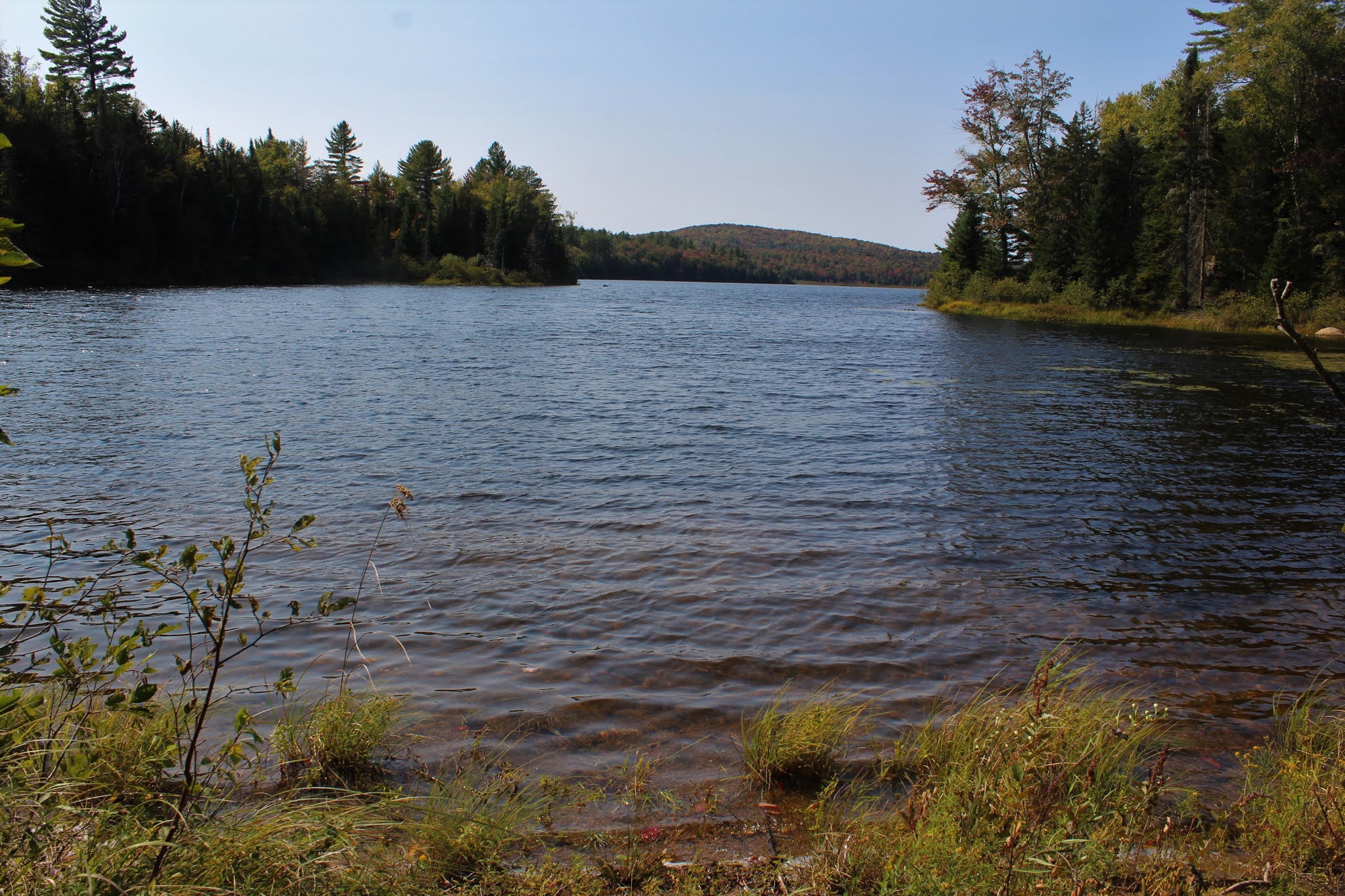
After my early morning bushwhack, it felt good to be on a trail for a bit.  I zipped along quite nicely covering ground quickly and before I knew it I was near Rock Lake.  A very short off trail excursion brought me down to the lake shore.  From this small cove on the east side of the lake, I enjoyed a nice view.
After enjoying the lake view, I headed back towards the trail but crossed over it and began my bushwhack ascent up towards the long ridge of south end of  the Stark Hills.  At first it was nice and easy, but soon the ascent got quite steep. 
From a set of steep ledges, I caught an early view SW towards Blue Ridge Mountain, with a corner of Rock Lake visible to the right.
From the same ledge, looking more south, with the large, sprawling wetland below.
These ledges were no joke.  A near vertical drop made good footing a must. 
I closely hugged the steep ledges, which were actually quite fun to explore.  There were many nooks and crannies to check out, each with halfway decent views. 
Although not the high spot of Stark Hills, the high spot on the long south ridge sits at 2273 feet, but is treed in.
While a lot of the hiking was fun, it wasn't all rainbows and butterflies.  There were several scratchy sections such as this to contend with.
From the far SE bump on the ridge, I found an open set of ledges, with the best views of all. 
West views.
South views from the ledge towards Ledge and Sawyer Mountains.  This made a perfect lunch spot, taking in the views and enjoying the serenity. 
On the descent, I had to backtrack a bit, dropping down SW carefully on the steep slopes.  Once down off the steepest section, I hit the first of two large beaver meadows.
Passing by the second beaver meadow as I continued SW.
Once beyond the two meadows, I had to slowly regain elevation, passing through an open forest on my way out. 

Out of nowhere, I hit the trail, almost literally at the trail register.  Signed out and got back to the car feeling great.  A fantastic, dare I say, perfect start to fall today.  Hiked 4 miles with 1300 feet of total elevation gain.  The route below. 

Red=Ascent    Blue=Descent


Moose Mountain(Wilcox Lake Wild Forest-Adirondacks)

Decided to head up into the Wilcox Lake Wild Forest in the Adirondacks to check out some early fall foliage on this first day of fall.  There are about a million Moose Mountain's in the Adks, but the one I would be hiking today is the one that can be found just south of Route 8 along the East Branch of the Sacandaga River.  There is no trail to these mountains so my goal was bushwhack to the east and west summits, which both appeared to offer up good views from open, burned over areas in my prior scouting of the peak.  I parked in a small, unmarked pull off on the shoulder of Route 8, just west of the western peak, elevation 1325 feet.  There was a definite chill in the air, with temps hovering around 40 as I crossed Route 8 and dove into the woods.

I began climbing instantly and within a scant 20 minutes I was near the open patches on the shoulder of the west summit.  As I pushed up through an open area I began getting good views right away.  Here was the first look I got, facing the multiple summits of Buckhorn Mountain to the NW.
Golden ferns and bright early foliage made the route up almost perfect.
I skirted around the steep slopes below the summit area, catching many solid views.  A window to the Buckhorns. 
I'm almost always amazed at not only how this section of the Adk always peaks first, but the amount of red that pops in this particular area.  Another great view NW towards the Buckhorns.
A great view SW above the East Branch valley.
After enjoying the west summit's views, I dropped SE down towards the col between the two peaks.  Much to my surprise, when I hit the col, I also hit the Georgia Creek Trail, which runs between the two summits.  I completely forgot about this trail so it really startled me when I saw trail markers.  Unfortunately, the trail was not going the direction I needed so I crossed over it and continued along.

A nice and easy ascent brought me over to the east summit, which sits at 2053 feet and just a tad higher than the west summit.  Both true summits are fully wooded and offer no views.
Mellow Yellow!  While many sections of the woods were still green, there were small sections that were near peak.

Dropping down to west edge of the summit, I could see some of the open rock that I was aiming for down below.  I carefully made my way over to the open rock, which at first only offered glimpses through the trees.  A little further descent bought me out to a wide open area of mostly open rock and incredible views.  From this vantage point, the fall foliage took it up a notch.  The wetland is a part of Georgia Creek, which sits at the foot of 2444 foot Georgia Mountain.
The colors were amazing!  Even better than I thought they'd be!!

Fire down below!  GeorgiaMountain towering above an unnamed ridge, with a fire red maple near the open rock slide.
One more view before I head down..this was a tough spot to drag myself away from.  The peaks near Speculator can be seen off in the distant west.
After finally tearing myself away from the views, I made a nice and easy descent off the mountain, even picking up a game path for a bit on my way out.  Once back to the car, I dropped down below the parking area to check out the East Branch, which seemed to have more rock than water in it.  Some color was beginning to pop down here as well.
A wonderful, fun packed little adventure for part one of the day.  3.5 miles RT, with over 1200 feet of ascent.  

Today's Route below.  Red=Ascent   Blue=Descent


Saturday, September 12, 2020

Catamount Mountain East Ridge(Lake George Wild Forest-Adirondacks)

Headed up to the Lake George region on a picture perfect late summer day to do some off trail exploring.  While all of the popular trailheads were packed(and then some), I was the only car parked at the state land access road on the west side of Route 9N in Sabbath Day Point(just north of the Tongue Range on the west side of Lake George).  My goal today was to head up a long ridge to the 1850 foot unnamed peak that sits just east of Catamount Mountain. Elevation to start here is quite low at only 370 feet, so I knew there would be some considerable climbing ahead of me.  I parked in the large lot where an old gravel pit was located and began heading west on a good woods road.  A very short distance in, I left the road and headed up the ridge, which was covered in sedge grass, a very unique characteristic of an Adk ridge. 

From a low set of ledges on the east side of the first bump I came to, I found good views down over Sabbath Day Point and the lake.  Hogback and Sugarloaf are the mountains across the water.
From the same ledges looking SE towards Sugarloaf, Elephant and Black Mountain across the lake, with the lower slopes of Bloomer to the right in the foreground.
The woods were hardly even woods as I ascended through mostly rock filled meadows.  There are a number of small bumps to ride on the way to Catamount's east peak, but each had something nice to offer.
Although down low I had some glimpses of Lake George and the surrounding peaks, as I climbed up to about 1100 feet on one of the bumps, I began to get my first real good views.  The small bump in the foreground is the lower end of the ridge I had climbed.  From this vantage point, Spruce and Hogback Mountain take center stage across the lake.
I almost feel guilty calling this bushwhacking...almost.
The woods couldn't have been any more open and inviting than this.  A true pleasure to wander through.
Hard to beat views of Lake George like this...especially off trail, when it's yours alone to enjoy.
Rising up to one of the false summits, which was almost like a stroll in the park. 
 As I made my way up above 1500 feet, I hit a vast clearing.
 

From this clearing came some of the very best views of the day, taking in a large swath of Lake George and many of the peaks on the east side of the lake.  This made a perfect break spot, with a light breeze keeping it cool.

As I guzzled down my drink, I gazed south across the notch at the double summits of Bloomer Mountain to the south.

Above the views, I continued to climb up and over another bump on the ridge, soon coming to a false summit at about 1725 feet.  From there, the east summit registered a mere 1/3 of a mile away.  Easy right?  Nope!  The col between these two was deep...and I mean deep. 

After carefully descending the near vertical slopes, it was a short but stiff climb up towards Catamount's east summit.  Just prior to hitting the summit, the woods opened up to a gorgeous area of wide open south facing ledges.  To the east/ southeast, I could see the mountains of Vermont on the distant horizon beyond the Lake George east peaks.  The ridge in front of that was the false summit I had come up(and also had to return on).

SW views.
The view from these ledges stretched nearly 180 degrees!  This view to the south takes in part of Bloomer's west ridge as well as part of the Tongue Range hovering above.
A short distance away from the view point was the wooded summit, elevation 1850 feet.
After a steep descent off the summit, I had to claw and scrap my way back up the false summit.  The photo below is actually the gentler slopes above the worst of it.
There weren't many signs of fall in these woods, which are loaded with oaks, but I did capture this one maple, ablaze in red.
The route back was fairly benign, save the steep boulder filled descents.
Although the descent through the steep, boulder fields was slow it was still fun.
Basically retraced my steps east, back over the multiple small bumps on the ridge, soaking in the beautiful day.  Got back to the car feeling pretty good, and actually ready for more.  Hiked about 5.3 miles RT with over 2400 feet of elevation gain along the way.

Today's route below.  Red=Ascent   Blue=Return(Descent)