Warm weekend temperatures and a dowse of heavy rain has left everything muddy, damp and local creeks and streams rising steadily. Seems as if winter has taken a vacation and has left us with some late March weather in its wake.
After work today, I drove down to the Columbia County Land Conservancy's High Falls Preserve in Philmont. Although it is a relatively small preserve at only 47 acres, it offers several trails totaling 2 miles, with its centerpiece being a 150 foot waterfall, the tallest in Columbia County.
A tributary of Agawamuck Creek flows down the hill and under a footbridge as the trail enters the woods.
Along this tributary there were several pretty, small cascades.
Agawamuck Creek, meaning "creek of many fish" is the main creek that runs through the property and was running extremely high and fast today.
Houses and small sheds sit atop the banks of the very steep gorge, as evidenced by this picture.
The blue trail runs along the banks of the creek and comes to a small area opposite this waterfall charging down the walls of the gorge.
The water was extremely powerful as it crashed down through the steep hillsides.
Along the blue trail there were many large boulders with a bright green moss covering many of them.
Looking further upstream towards the actual spot where High Falls plunges down.
Retracing your steps and then taking the green trail to the red trail leads to a large overlook area further up the hillside. The view of High Falls from this clearing is extremely impressive.
The dam above High Falls, which was built in 1845, played an integral role in the local community, and is still visible from the viewing area.
These stone steps lead up out of the woods to the kiosk area and parking lot.
Had some daylight left so headed a bit further south to another Columbia County Land Conservancy property in Ancram. Drowned Land Swamp is a 114 acre property consisting of woodlands, a small meadow, wetlands a perennial stream and views from a 350 foot knoll named "Old Croken".
Most of the summit trail is an old road that is wide and clear, and moderately steep as it climbs the knoll.
A small path breaks off from the summit trail and provides an overlook spot, with views reaching to the north and west.
A steep climb continues up the knoll and provides marvelous views eastward towards the Taconics and Berkshires. The late afternoon sun was breaking through clouds and streaking down the mountain slopes.
Great views of the Taconic Mountains just north and east.
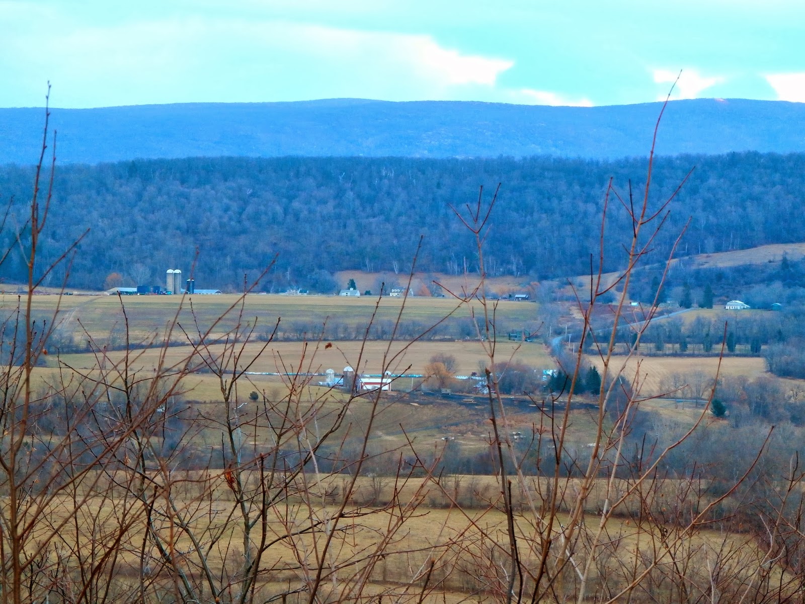
From the summit of "Old Croken" are beautiful views east of rolling hillsides and farmland.
Although the summit trail is only .6 miles long, it is a moderately steep 350 foot climb up, so these views are earned.
The viewing platform at the top of the knoll.
Descending the trail with the sun shining on the hillsides as the backdrop.
The swamp trail is half a mile long and runs along the base of the knoll while skirting the swamp. A small path leads up the hillside to a view of the swampland.
The winter sun still sets early, but the days are getting noticeably longer. Caught this beautiful sunset in the western sky as I drove home on County Route 3.


No comments:
Post a Comment