Having hiked the northern end up the 35 mile Taconic Crest Trail recently, I thought it fitting that I hike the southern end Friday afternoon. I had gotten out of work and it was about 1:30pm so I knew I wouldn't be able to go too far before turning around. Talked my dad into going as well, so we parked at the trail head in a large pull off on Route 20 in Hancock, just east of the state line. The strt of the trail can be hard to find, but look for an opening in the fence, and a small sign reading "Taconic Crest Trail".
Heavy rainfall and temps in the 50's the last couple days left the woods snow free for much of the hike.
The hike starts at an elevation a little over 1450 feet and climbs north slowly up to the ridge line, where there are many screened views west down into the Lebanon Valley.
The drop off to the west is quite steep along this part of the trail as it continues along the ridge. Unfortunately the bare winter trees did little to protect us from fierce northwest winds that battered us, making it quite uncomfortable at times.
Typical views through the trees just off the trail.
Areas sheltered from direct sunlight preserved some of its snow, but even then there wasn't much.
After about 1.6 miles, we arrived at the shoreline of frozen North Twin Pond.
North Twin Pond combines with South Twin Pond to form Twin Ponds. South Twin is a little off the trail over a small hill on the back side of North Twin, so we bushwhacked through the open woods, skirting North Twin. Here's a good look down onto North Twin Pond.
In the area between the ponds we stumbled across a fire pit and large, primitive shelter. It was actually quite impressive and looks like it took quite some time to build.
Dropping down to the north shore of South Twin Pond, which is actually the larger of the two ponds.
South Twin Pond showed more signs of beaver activity and we explored the shore, looking at beaver sign.
Spotted a beaver dam across the frozen water.
After enjoying the ponds, we continued north along the Taconic Crest Trail, with more broken views through the trees.
A closer look down into New Lebanon.
Recent rain and snow melt meant there was plenty of run off in the drainage areas. This in turn, meant some pretty small cascades. The trail crosses several of these little streams, which are crossed quite easily with a small leap.
After nearly 2.5 miles, we decided to turn back due to the early sunset. After discussing it briefly, we opted to hike back on the Taconic Skyline Trail, which is used by ATV's and runs basically parallel to the Taconic Crest Trail.
The Taconic Skyline Trail sees a lot of legal Off Road Vehicles, and therefore passes through many wet, rutted areas.
Running water freezing on contact below the old dam on North Twin Pond.
The Skyline Trail meets the Crest Trail at North Twin Pond before breaking away again, heading further east and eventually passing by Cranberry Pond.
Frozen Cranberry Pond is the smallest of the three ponds we passed today, but still held its own beauty.
The Skyline Trail had many icy sections that the foot travel only Crest Trail did not.
Passing by picturesque old stone walls in the late afternoon sun.
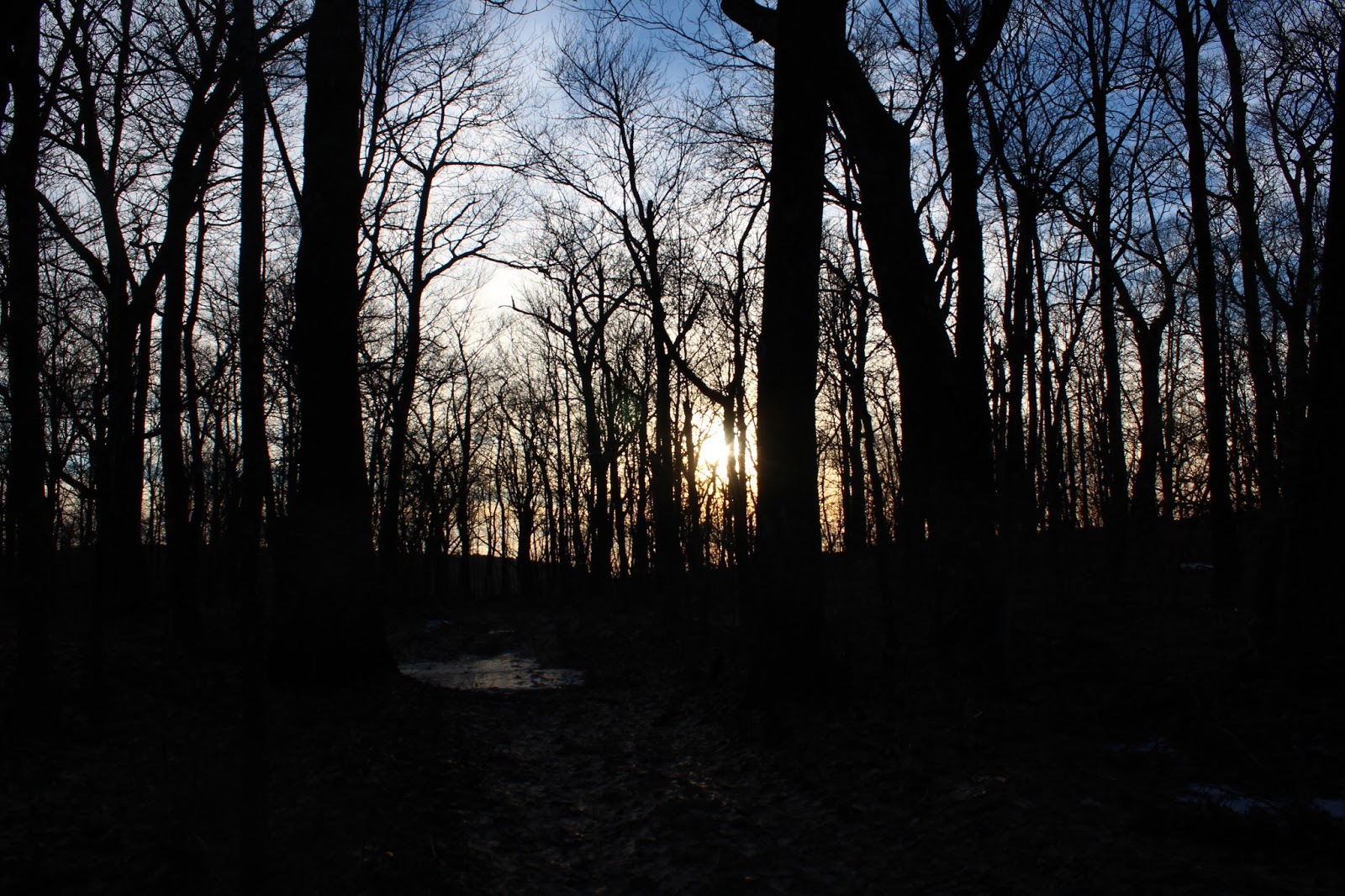
Strolling through the quiet northern hardwood forest, slowly descending in the fading light.
Sunsets come early this time of year and as we crested the last hill before dropping down to the car, the sun seemed to disappear altogether.
Arrived back at the truck after about 5 miles RT. Elevation gain of a little over 500 feet.


Thanks for the photos! This helps as a way of gauging the average conditions in January for my thru-hike to Petersburg, NY from Rt. 20.
ReplyDelete