Finally broke out into real spring weather today with bright sunshine and temps climbing into the 50's, so I headed south after work to hit a couple small peaks in the northeast Catskills. My first stop was along High Peak Road off Route 23 where there is DEP access to Kate Hill. Kate Hill is the 2390 foot bump just north of Windham High Peak. Elevation was just over 2000 feet where I started.
The woods were wide open and easy to bushwhack.
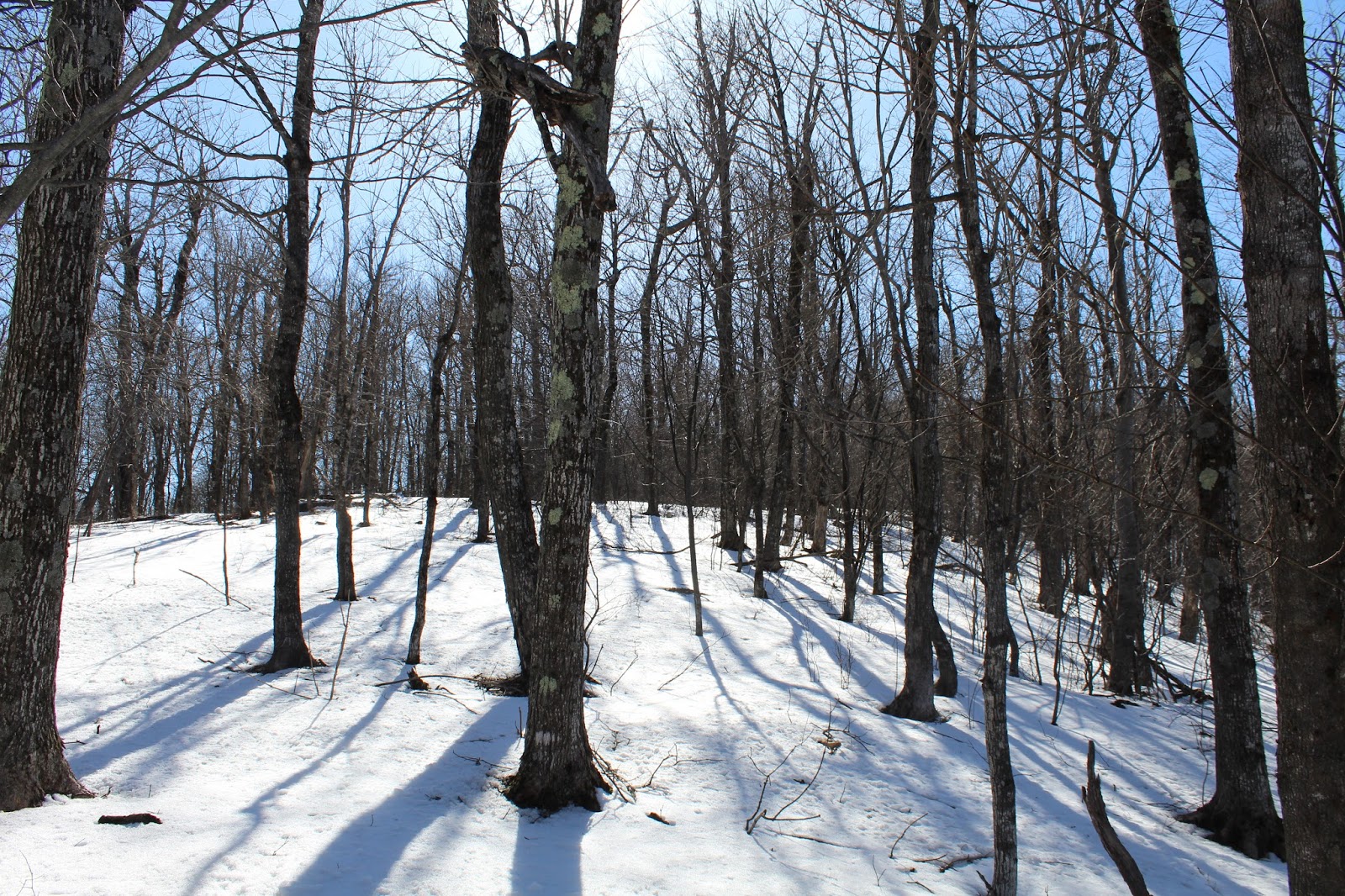
Even though it is April 21 and the temperature is in the low 50's, snow still remains in the shaded areas.
Although it was a short route up, it was steep and provided screened views north to Mount Zoar.
The woods on the summit ridge of Kate Hill are incredibly open and make for pleasant strolling.
I wandered around the summit area, being careful to stay on DEP land, and found an amazing up close and personal view of Windham High Peak, towering above, just a mile away.
On my return I hugged the property line on the west and managed a small view to Mount Zoar with Route 23 winding below.
Although Kate Hill was very nice, it was incredibly short..not even 7/10 of a mile total. With time still available, I decided to head down the road just a bit to hike Mount Hayden from the state access at the end of Nauvoo Road. Elevation to start the hike was around 2000 feet.
Just beyond the gate is a continuation of the old road, which I followed for the first .4 of a mile.
A side woods road leads up to a large quarry, which I decided to visit.
From the quarry, I decided to make it interesting and left the woods roads, beginning the true bushwhack. I passed through many wet, soggy areas where recent snow melt has saturated the ground.
The bushwhack was steep, with many cliff bands to contend with. They were all easily dealt with though.
As I ascended up and over 2500 feet, wintry conditions began to really take hold.
Once up on the summit ridge, the snow got a bit deeper. While only a few inches in most spots, it was even deeper in others.
The 2924 foot summit is wooded with no views, but is pronounced.
Once I hit the top, I decided to wander along the northeast escarpment checking for views. Most of the views I got were through the trees, but I did manage to spot a couple openings down towards the Durham Valley.
Another valley view near the summit.
I eventually found my way to the Long Path, which crosses close to the summit. I followed the trail back southeast towards Barlow Notch. Almost immediately upon losing elevation, the snow quickly vanished.
The view south over partially frozen(still)Lake Heloise and towards the Caves(Ski Windham).
Dropping down towards the notch, I crossed over this high elevation woods road.
Once down in Barlow Notch, I had a nice, screened view at the next small bump to the southeast.
From the notch, I left the Long Path and descended the extension of Nuavoo Road, which was very muddy and wet in many places.
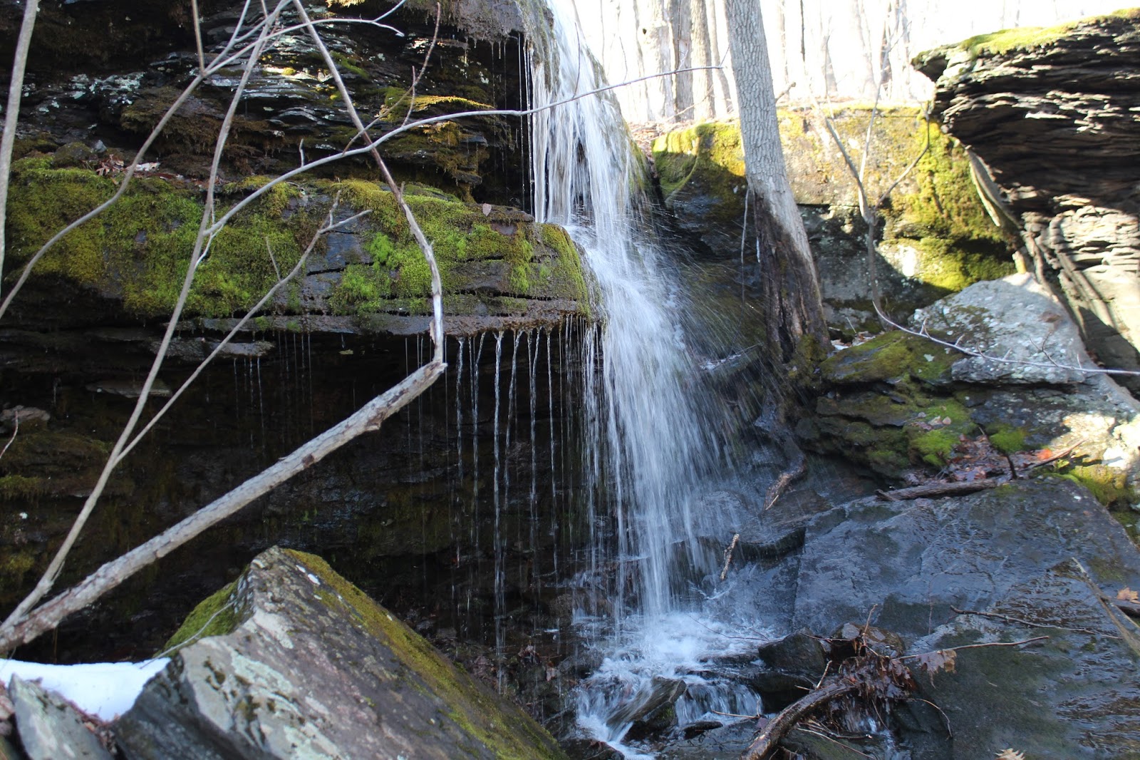
Melting snow and warming temps means lots of water draining off the mountain. I managed to spot this pretty cascade on a bigger drainage area.
Took my time heading back, strolling along the woods road, which was much drier down low.
Sure felt good to have a nice spring day after a lot of unseasonably cold weather recently. Hiked about 4.3 miles RT, with 940 feet elevation gain. (5 miles total for the day with over 1300 feet of ascent)


No comments:
Post a Comment