Met up with my buddy Jim again today to explore The Saddles, a 2465 acre State Forest in the town of Whitehall. An access road is found on the west side of Route 22 just prior to reaching the village of Whitehall and is marked with a large DEC sign.
The access road was driveable all the way to the parking area(even in my low clearance sedan), which sits about 3/4 of a mile uphill from Route 22. Once parked, we found a small herd path heading SW into the woods, and soon turned into a good woods road. Elevation to start was about 525 feet. We followed this woods road SW towards the southern edge of state property. Several other woods road branch off the main road, but we stuck with the most traveled one.
Near the southern edge of the state land, we skirted a large beaver pond.
Just beyond the first beaver pond, we found a smaller, prettier beaver pond.
The woods road turns NW, soon arriving at Clear Pond. A portion of the woods road has been washed out, meaning we had to head up into the woods for a bit to get around it.
The main woods road turns west, following the north shore of Clear Pond, while another woods road goes right(north). We followed the woods road west and found a small cabin just uphill.
Once we were clear of the pond, we turned south heading to a high point on the woods road, before we began our bushwhack west towards the first of three summit bumps on the Saddles southern summit. The bushwhack was very pleasant, through wide open hardwoods.
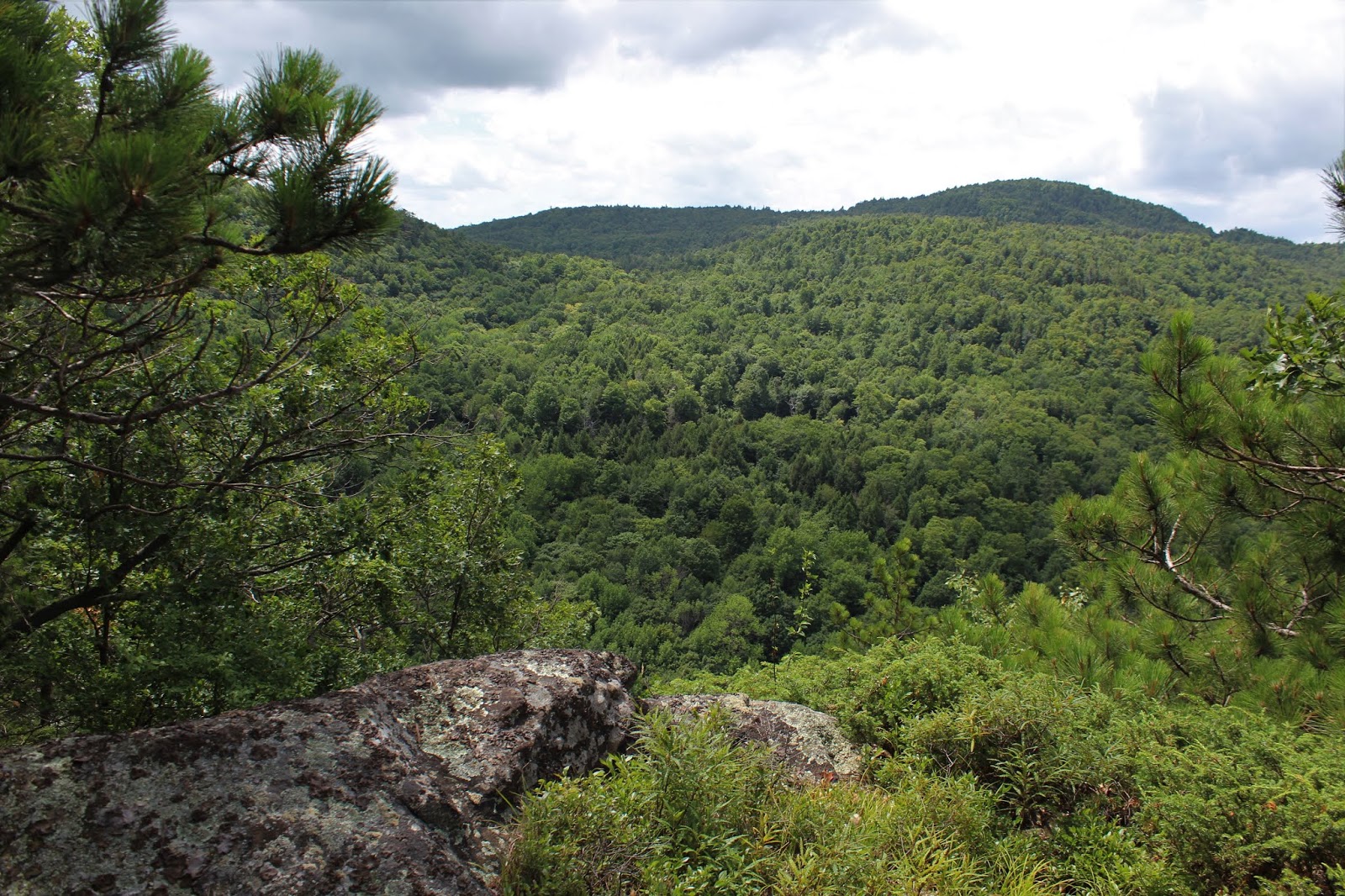
Just below the top of the first bump, we found our way to a small viewpoint northeast towards Rutland County, Vermont.
From the same vantage point, a view more to the east.
Making our way over to the west side of the summit bump, we managed to find our way to an impressive set of ledges.
Wandering around the south facing ledges.
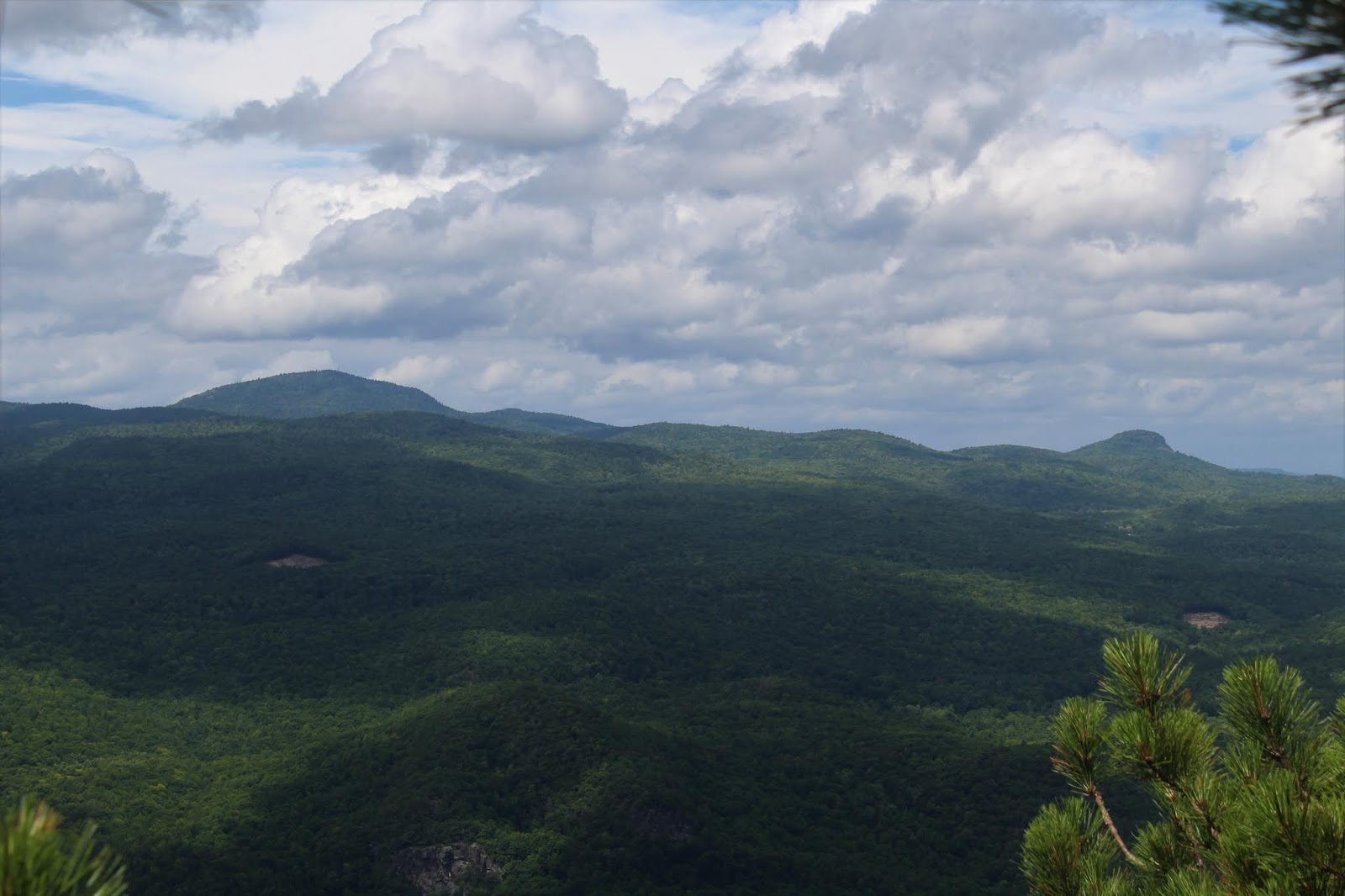
From the ledges, we found this view west over to the open rock of Sleeping Beauty(right of center).
SW views towards Pilot Knob and Buck Mountain.
These ledges made a perfect resting spot. A nice breeze helped cool us off as well.
The open woods between the summit bumps.
From the second summit bump, a view
The third summit bump(furthest NW) also had open rock ledges.
From the NW rock ledges, we enjoyed amazing views towards an area known as "The Diameter", which stands directly above South Bay Creek.
After finally leaving the the Saddles southern summit area, we bushwhacked steeply NE down into the cirque between the south and north summits. From there we side hilled our way towards the rock face of the northern summit bump.
We managed to thread the needle perfectly, hitting the base of the rock face.
Unfortunately the rock face and area around it was simply too dangerous to explore without proper climbing equipment, so we got as close as we could, enjoying the view.
We carefully made our way up the steep route around the rock face, basically flanking it. From atop, the views were simply breathtaking.
A hazy view SE into Vermont towards Woodlawn Mountain and Dorset Mountain.
Ascending towards the next set of ledges just above.
We found this view of the three southern summit bumps to be kind of neat. For perspective, those are the three bumps we had just hiked on before coming over to this summit.
West facing views over the Diameter.
Circling over to another vantage point, we found Black Moutain rising in the distance well beyond South Bay's water below.
A zoom view towards Black Mountain(L) and Sugarloaf(R).
Another view towards the Diameter and the mouth of South Bay Creek.
The gnarled red pines atop the ledges.
Crossing over the high spot on the Saddles north summit, we stumbled upon a white blazed trail.
In the barely noticeable low spot between the Saddles north summit and West Mountain, we passed by this small beaver pond. We noticed a porcupine scurrying up a tree here, but didn't get a clear photo.
A very short, but stiff climb brought us up the 150 feet to the summit West Mountain. We picked this large glacial erratic to be the high point.
A quick and easy bushwhack brought us back to our woods road. With clearing skies, we stopped once more to capture a last look at Clear Pond.
A bit further along, we stopped off a last time at the inlet to the last large beaver pond. A nice spot to wash some of our dirt, sweat and grime off. It was a fairly uneventful hike back from there.
Arrived back at the car hot and sweaty, but feeling good. Hiked about 7.6 miles RT, with over 1500 feet elevation gain.
I took the back roads of beautiful Washington County home, enjoying this farm view in the serene town of Hartford.


From parking area, you can take a blue trail westerly for a mile or so and then the white trail to the northern summit. I think the white trail continues down to the South bay.
ReplyDeleteYeah, we saw the white trail heading down off what I called the northern summit towards South Bay. Never saw the blue trail though.
DeleteThe blue trail branches off the woods road on the right side - not far from the parking lot.
ReplyDeleteOh ok thanks. I think maybe the summer growth hid it from us
Delete