Search This Blog

Tuesday, August 27, 2024

"'Northeast" Crane Mountain(OSI/ Wilcox Lake Wild Forest-Adirondacks)

Took advantage of a rare free day to do some exploring in the southern Adirondacks on a warm, late August day.  Today my explorations would be to a rarely visited NE ridge on popular Crane Mountain. The Open Space Institute has protected the land north of Crane Mountain, which allows access to state land on not only Crane, but Huckleberry Mountain as well(which I had visited a couple years ago). I parked at the gated access road off of South Johnsburg Road(Elevation 1205 feet) and headed south, making good time on the old logging road.


After about 1.2 miles, I came to a crossing over Crystal Brook, which was an easy rock hop across.


Continued on the logging road beyond Crystal Brook for a little under half a mile, when I began my bushwhack up through open woods.


At first I headed south, before turning more SE over towards a series of steep, rocky cliffs.

From these rocky cliffs, I was able to find several very good view points to the north and east.  This is the view east towards the large wetland at the foot of Number Twenty Six Mountain, with Partridge Mountain just beyond.


To the north, the rocky, lower slopes on Hucklberry Mountain's east ridge can be seen.  In the distance are (L-R) Mill, Stockton, Pine and Gage Mountains.
Climbing along the NE slopes of the ridge was a fun experience as I passed over many large areas of open rock slab.

Circling around the east face of the ridge, I found more open view points stretching far and wide to the SE.

After enjoying the multiple view points, I dropped south down into a small col, before ascending up to an even higher ridgeline, which was thick with spruce but fairly easy to penetrate through.

After a steep climb through the thick spruce, I arrived at a large area of open rock just below the "summit".

Wandering around the open rock at just over 2600 feet, I managed to find a good view SW towards the north facing slopes below Crane Mountain's true summit.

From the open rock atop this ridge, at nearly 2650 feet, I found even more stellar views.  Here is the view east. 

To the north, a look at the lower ridge I had just been on.
A broader view north, again with Crane's far NE ridge in the foreground.


From the high ridge, I bushwhacked back down to the lower ridge once again(which sits below 2500 feet).  Near the top there are several large patches of open, moss covered slopes.

From the top of the lower ridge, I headed northwest on an obscure foot path for a short distance before bushwhacking north/ northeast back down to the logging road near Crystal Brook.  Once on the old road, it was easy walk out to the car.  Covered a touch over 6 miles RT, with 1600 feet of ascent total.

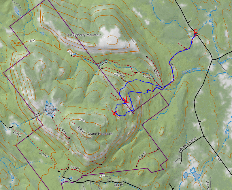
Map below.  Red P=Parking off South Johnsburg Road   Red X's=high point on each small ridge I hit  Blue=Route taken

Friday, July 19, 2024

Knob Lock Mountain(Giant Mountain Wilderness-Adirondacks)

Headed north to do a fun bushwhack hike to 3192 foot Knob Lock Mountain(Elizabethtown No. 1), which sits just south of well known Hurricane Mountain and Route 9N in the town of Elizabethtown.  This was my first hike in nearly two months so I wasn't sure what kind of stamina I would have but I was able to get an early start so I could take my time if needed.  Parked at the trailhead for Owls Head Lookout(Elevation 1260 feet) and set out on the trail, following it south for about half a mile, slowly gaining elevation along the way.

Once firmly on state land I left the trail and began my bushwhack up Knob Lock's long east ridge.  The woods began very open and easy going, with occasional areas of open rock offering up solid views.  Here's an early view SE towards Owls Head Lookout.

Early views on the east ridge towards Route 9N and Elizabethtown.

The bushwhack was pretty straightforward, with areas of moderately thick spruce interspersed with open rock, and many good views.  Most of the views were facing south towards neighboring Green Mountain, an Adk Hundred Highest peak that is just shy of 4000 feet itself.

Continuing west along the long east ridge, I finally emerged in the open rocky sub summit with great views west towards Knob Lock's true summit, more than 400 feet higher and less than half a mile away.

Dropping into a small col, the spruce and deadfall became increasingly tougher to get through.

Pushed my way through the widespread blowdown, soon arriving at this viewpoint straight up towards the open rock atop Knob Lock's summit.  From here, I had to weave my way around several enormous cliff bands before finding a way up.

Once atop the summit area, the views were simply breathtaking.  Views are nearly 360 degrees from several different vantage points, such as this view east towards Elizabethtown and Lake Champlain in the distance.


Directly below, slightly SE, is the ridge I had just bushwhacked up, with the open rock I had jsut been on visible to the right.

From the other side of the summit, views stretch far and wide to the NW, with Route 9N running through the valley.  The high point on the horizon is Whiteface Mountain.

The west view encompasses a broader view towards the High Peaks, with Knob Lock's slightly higher neighbor, Tripod Mountain in the foreground.
Directly across Route 9N sits the very popular and well known Hurricane Mountain and its fire tower. 

While I had the incredible summit views atop Knob Lock to myself, I could see numerous cars lined up at the trailhead for Hurricane Mountain down below.

Summit cairn and views.
An up close view of 3980 foot Green Mountain.  This perspective gives an incredible view of the sheer size of this peak.
After enjoying the summit views for about a half hour, I began a long and slow descent off the mountain, leaving the ridge and dropping more directly NE towards the trail.  The woods never really opened up until I got much lower but I still enjoyed the solitude and fresh air that I had been missing so much.
 

Covered about 5.8 miles total with over 2000 feet of combined ascent.  The humidity and bugs weren't too bad and it was a great day in the woods.

Map below.  

Red X=Parking    Blue X=Summit


Friday, May 24, 2024

Seven Hills, Buckwheat Hill & Stump Pond(Cowee Lands/ Capital District WMA)

Checked out a brand new, large area of public land (and soon to be part of the Capital District WMA) up on the Rensselaer Plateau this afternoon.  This swath of land is located just west of the original Capital District WMA and dotted by small peaks and many wetlands, which are mostly easily accessed by rough forest roads.  I parked at the gated end of Fire Tower Road in West Stephentown(Elevation 1717 feet) and headed east, following the road on foot.  The sun was shining, a light breeze was blowing, and humidity was low making for perfect spring conditions.

Within just a few minutes of walking, I felt as if I was a million miles away from civilization, with the tower atop nearby Seven Hills easily visible above to the east.

I followed the service road up to the 1949 foot summit of Seven Hills, where an enormous tower stands in a grassy clearing.  Not the most scenic summit, but interesting anyways.  Old maps label this as "Seven Hills Firetower", but it is certainly no longer a fire tower.

From the summit clearing, I bushwhacked south back down to a former Cowee logging road, which made for easy travel.  I passed a NYS Forest Ranger Truck parked in this area, but didn't see the Ranger until much later at Stump Pond.


Further along the road to the SE, I came upon this beaver pond, near the source of Roaring Brook's headwaters.

The old road continues SE. deteriorating further along the way, but still easily passable on foot.


Eventually I turned right, south, onto Williams Road, which is an abandoned town road that soon splits again.  At the split on Williams Road, a large meadow and foundation can be found, suggesting that this was probably a farm and homestead 100 years ago or so.

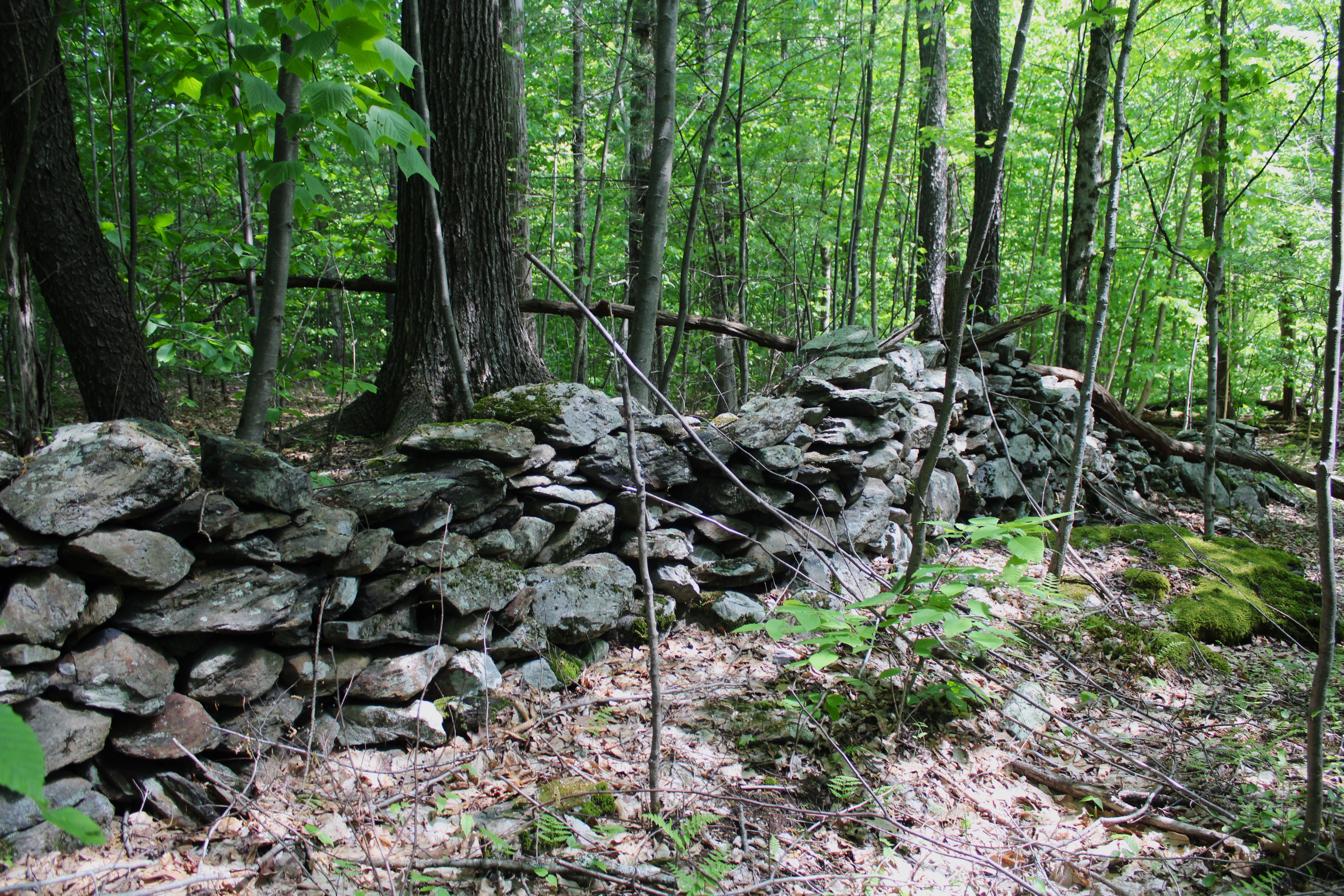
Further evidence of human activity are nearby stone walls on each side of Williams Road.

I decided to stay south on the original route of Williams Road, which gradually climbs up towards the 1736 foot summit of Buckwheat Hill.  The summit area sits just east of the road, with the true summit sitting in a large swath of hardwoods and littered with old, rusted garbage.

A few yards away from the summit is a large, grassy meadow.

After hitting the top of Buckwheat Hill, I continued a short distance south whereI was able to pick up a road along the power lines that swings back NW.

Once off the power line road and back into the woods, I bushwhacked over towards Stump Pond, where I first encountered the beautiful outlet area just SE of the pond itself.


A few short strides away from the outlet was stunning Stump Pond.  This high elevation pond has a very Adirondack vibe to it and a sense of solitude. 

The solitude was briefly broken up by a Forest Ranger, whose truck I had seen earlier and  was also visiting the pond.  We chatted for a bit and he seemed to be a real nice guy.  He told me that there was another pretty wetland just north of Stump Pond that sits well off trail.  Of course I had to pay that a visit too..and he was right...it sure was pretty.

From the weltand. an easy bushwhack NW through mostly hardwoods,brought me back to the Cowee logging road and eventually my car.  A grand tour of this new public parcel, high up on the gorgeous Rensselaer Plateau. Covered 6.9 miles total with 900 feet of total ascent.  

Map below.  Red P=Parking    Blue X's=Summits Hit and Stump Pond View       Red X's=Wetland Views 


Saturday, May 18, 2024

Wachoosik Park(Town of Nassau, Rensselaer County)

Visited 22 acre Wachoosik Park today, Rensselaer County's newest park located in the town of Nassau.  The official ribbon cutting occurred earlier this morning, meaning I was lucky enough to be one of the very first people to visit here. 


Hard work put in by the town and volunteers on these trails is evident, such as this well built foot bridge.

Calico Brook, a small, babbling stream meanders its way throughout these woods.
I took the red and white loop trails, which pass by handsome old stone walls and mixed forest.  The red trail is the perimeter loop, which covers about 7/10 of a mile,  The white trail forms an interior loop and traverses about a half mile.
There are three small stream crossings and a little bit of climbing in the woods, but all very easy and pleasant.
It's so nice to have a local spot to explore as this park is less than 5 minutes from my house.  The only drawback I could find is that the sounds of traffic from busy Route 20 are a constant.  Covered about 1.2 miles on a beautiful, bug free Saturday evening.  A big thank you to David Fleming and the town of Nassau for making this happen!!!