Search This Blog

Tuesday, March 31, 2015

Noonmark Mountain(Dix Mountain Wilderness/ Adirondacks)

Noonmark Mountain is one of the most popular mountains in the Adirondacks, even though it isn't even one of the highest peaks.  Actually, not only is it not a 4,000 footer, its 3556 foot summit ranks it number 86 in the Park.  Had sunny skies and temps in the upper 30's, making for great conditions to get out and explore.  Parked in the first lot off of Ausable Road just off Route 73 in the High Peaks.  Followed the road for about a half mile and then turned left beginning my walk in the woods.  Took the Stimson Trail up the north side of the mountain through the wintry woods.
 While the calendar may read March 31st, the Adirondack landscape clearly hasn't gotten the message.  Icy run off along the trail.
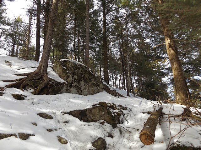
 There are several steep sections to traverse along the trail.  Slowly melting snow and a thin coating of ice underneath made it a bit more difficult.
 A bend in the trail as the ascent continues. 
 Tricky spot due to the hidden ice.  The micro spikes were a HUGE help in this section.
 After about 2 miles of hiking, the first of several awesome views of the Great Range unfolds just to your west.
 A steep section of trail affords views back to Giant Mountain's snowy summit.
 North views towards Giant and Rocky Peak Ridge, with a shoulder of Round Mountain in the foreground.
 Typical climbing along the trail.
 Clearing skies.
 Panorama to the west.
Looking northwest beyond the Keene Valley.
 A rocky perch about .25 miles before the summit allows a clear view of Noonmark's summit.
 Several rocky lookouts afford jaw dropping views of the entire Great Range. 
 Looking back down after a tough climb through the snow.
One of the very last steep climbs to the summit, completing an elevation gain of 2175 feet in 2.6 miles. 
 Mount Marcy's wintry summit a short distance away.
 Approaching the open summit.
 A nice view of Giant Mountain from the summit area.
 Looking down at the steep drop off below.
South views are dominated by Dix Mountain and its slides.  Noonmark is well known for its nearly 360 degree views from the open summit, providing arguably some of the finest views in the entire Adirondacks.
 Panorama to the south and west.  Dix, Nippletop, Dial, Haystack, Little Haystack, Basin, Saddleback, Sawteeth, Gothics, Armstrong, Upper and Lower Wolf Jaws before you.
 A panorama from(L-R) Snow Mountain and the Keene Valley all way to Giant Mountain, Rocky Peak Ridge and further east.
 East facing panorama.  Not a bad view to be found.
 Instead of returning the way I came up, I decided to follow the Felix Adler Trail down.  After descending more than 1000 feet in a mile, I arrived at the bottom of the Felix Adler Trail.  I hooked a sharp left there and followed the yellow blazed Old Dix Trail back to St Huberts.
Hiked a total of 6.3 miles RT on a beautiful winter/ spring day.  Tough climbing in the steeper sections with the ice and snow, but well worth it for the incredible views.

Sunday, March 29, 2015

Mount Greylock via Cheshire Harbor Trail(Berkshires)

Had a nice, sunny day to get out and do some exploring in the Berkshires this afternoon. I've hiked Mount Greylock several times over the last few years but never from the east side.  The east side of the mountain offers a few different trail options, with most being moderate to strenuous climbs.  I took the Cheshire Harbor Trail from the trail head at the end of West Mountain Road, just west of the town of Adams.  The 3,491 foot summit of Greylock can easily be seen here, from West Mountain Road.
There were a few other cars in the lot as I arrived on this gorgeous weekend afternoon.  Not a cloud in the sky as I began my ascent.
 I brought the snowshoes, but the trail was well broken in by snowmobiles, making for pleasant walking. 
 The trail borders Pecks Brook ravine, which drops off steeply to the right.
 After one mile of climbing, the Cheshire Harbor Trail turns to the right, where Old Adams Road goes left.
 Fresh snow covered evergreens.
 The bare winter woods provide screened views down to the east.
  The climb isn't ever overwhelming, but remains aggressive most of the way.
 A footbridge crossing one of Pecks Brook's tributaries.
 Eventually the Cheshire Harbor Trail meets seasonal Rockwell Road, which is closed until Memorial Day.  After crossing the road, I continued the climb up the Appalachian Trail.
 Above 3000 feet the fresh snow clung tight to the trees.

Climbing up through the winter woods on a spring day.
 Emerging from the woods near the summit, a large radio tower rises directly above.
 Cold winter weather is holding a tight grip on the summit area.
 Fresh snow covered trees.
 The War Memorial Tower at the summit, marking the highest point in the state of Massachusetts.
 The views to the east from the clearing by the summit are incredible and far reaching.
 A panorama from the windy summit.
 A zoomed in look at the town of Adams far below.
 Views to the northwest over the Hoosac Range.

It was pretty quiet at the top today, with only one other hiker and a couple snowmobilers enjoying the views.  This is in direct contradiction to the large summer crowds that usually assemble.
Had a fantastic Sunday afternoon!! Hiked a total of 6.6 miles RT up to Mount Greylock with an elevation gain over 2100 feet.

Friday, March 27, 2015

Esopsus Bend Nature Preserve(Saugerties)

Went down to Saugerties down in the Hudson Valley after work today to visit 161 acre Esopsus Bend Nature Preserve.  The Preserve is owned by the Esopsus Creek Conservancy and is located at a dramatic bend in the creek, less than a mile away from the Hudson River.  It can be a bit tricky finding the trail head. You must drive through a housing development(Barclay Heights) off of Overbaugh Street, just south of the village, staying mostly west in the development until you arrive at a small dead end street named Shady Lane.  Just past the last house, a kiosk and gate mark the start of the trail.  A very short distance past the gate, the trail splits with an option to go right or left.  I stayed left, heading down into a deep gorge.
 Near the bottom of the gorge, the Esopsus Creek becomes easily visible and the trail splits again.  I stayed left on the red marked South Trail which immediately crosses a sturdy footbridge over a small stream.
 This small stream winds its way through the woods on its way to the Esopsus.  This picture clearly shows that winter and spring are still dueling it out.
 Nice views of the Esopsus Creek and waterfront homes on the west shore.
 Waterfront property.  The gazebo looks like it makes a nice place to relax and enjoy the creek.
 The South Trail climbs steeply through the woods away from the creek to the high point of the property.
 The meandering stream flowing quietly through the ravine.
 This land was former farmland, owned by the Schroeder family well over 40 years ago.  Hence, the blue marked trail is known as The Schroeder Trail and forms a loop on a wide old road.
 Many sections of the trail were sloppy, with a combination of mud, melting snow and ice.
 More waterfront property reflecting in the placid, partially frozen creek.
 A small yellow marked spur trail breaks away from the Schroeder Trail and provides a great view of aptly named Stony Point, a large rock formation at the bend in the creek.
 A bench provides a peaceful place to enjoy the woods and glimpses of the creek near the Village Beach.
 The trails here are part of the Hudson River Greenway Trail, a New York State agency helping to link cultural, historic sites and natural areas, as well as providing public access to the Hudson River.
Felt good to get out for about 2 miles of walking on yet another dreary day with temps in the low 40's and mostly cloudy conditions.