Search This Blog

Wednesday, August 31, 2022

Tyringham Cobble/ Appalachian Trail(Town of Tyringham, Berkshires)

Back from a nice vacation getaway, I headed into the southern Berkshires this afternoon to do a little hiking in bucolic Tyringham.  Conditions were nearly perfect as I parked at the Trustees of Reservations Tyringham Cobble Trailhead along Jerusalem Road(Elevation 995 feet) and headed through the open meadows on the mowed Cobble Loop Trail.

The Cobble Trail Loop, circles north below the summit, with a nice view of the peak directly above.
Old stone walls lace the woods here. 
Arriving at view #1- a cleared view northeast.
View #2 sits just off the summit, and is usually the best view over the Tryingham village.  Unfortunately, summer growth has infringed on the vista.
A short descent brings you to View #3, which is a unique vista to the east.
At a trail junction below the view, I stayed on the Appalachian Trail, which continues SE, dropping down to a scenic crossing of Jerusalem Road.
Crossing over an unnamed tributary of Hop Brook, which had a mere trickle in it-but even that was nice to see amidst our drought.

The AT soon emerges in a gigantic meadow, with wildflowers all around.  This is the valley of Hop Brook, and a long boardwalk passes through this scenic stretch, with mountain views all around.

Spotted this bear scat on the boardwalk near Hop Brook, and it was LOADED with berries.  As I soon found out, there were a ton of blueberries near the north end of the boardwalk, right beside the Main Road crossing.


Crossing over Hop Brook, with a view south towards the unnamed hills of Tyringham.

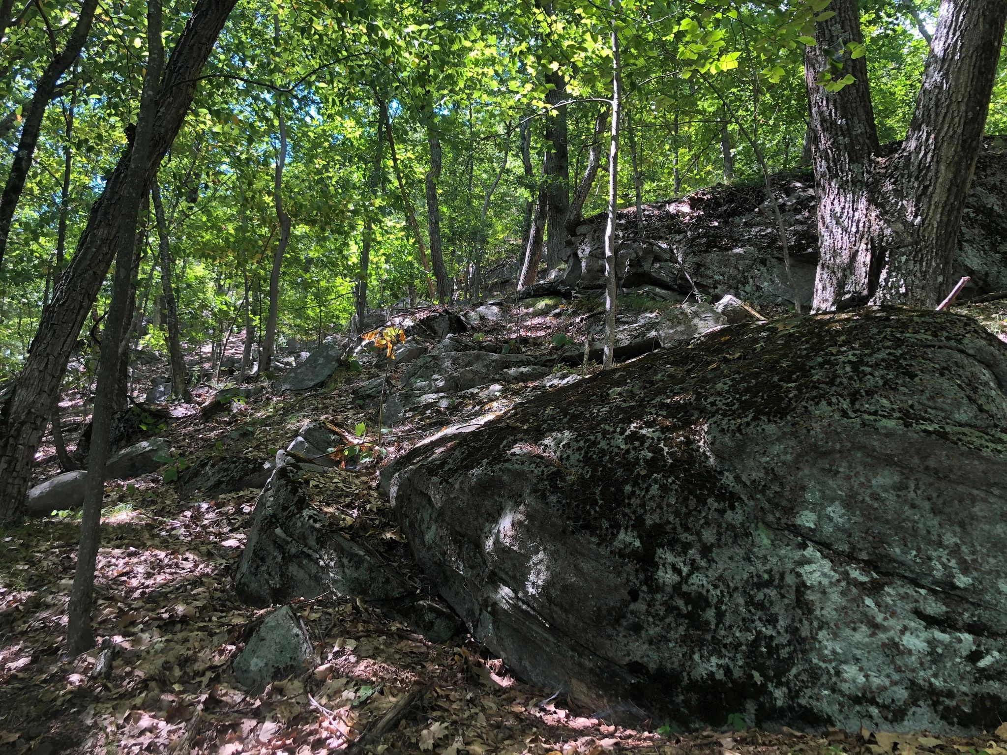
From Main Road, I turned back, retracing my steps on the AT back over Jerusalem Road to the junction with the Cobble Loop Trail.  Once on the Cobble Loop Trail, it was an easy walk back to the car, passing by "Rabbit Rock"-a large sandstone outcrop-along the way.

Evening shadows are sneaking up quickly this time of year, a reminder of the fleeting daylight that comes with the approaching autumn days.  Hiked about 4.5 miles total, with 500 feet of climbing and only saw one other person all day.


Friday, August 19, 2022

Mount Prospect via Pattison Road(Mount Greylock State Reservation, Berkshires)

Headed to the Berkshires after work today to re-visit a peak I'd hiked before-but from a different route this time.  Although dwarfed by some of the surrounding peaks in its range, Mount Prospect is a prominent peak in the northern Greylcok Range, rising to 2690 feet and boasting some decent views to boot.  I would be hiking today from the north, taking the Appalachian Trail up to the Mount Prospect Trail and then onto the summit.  I parked in the small parking lot for the Appalachian Trail along Pattison Road(Elevation 1000 feet) and headed south into the woods, with the sounds of gunshots ringing through the woods.  Not to worry, this was only near the start of the hike and soon went away altogether.


 The AT as always, is well marked,climbing steadily up Mount Prospect's northern slopes, as it passes through watershed property before arriving in the Greylock Reservation.

The trail gets a bit steeper as it nears a trail junction at a small high spot on the ridge and the first view point on Prospect. 
From just over 2500 feet-roughly 1500 feet higher than the trailhead-is a great view reaching from the SW to the NW over much of Williamstown.


The view is quite nice, stretching across Williamstown to the Taconic Ridge.


From the view point, I continued south/ southwest on the blue blazed Mount Prospect Trail for just under a mile to the true 2690 foot summit, which is marked with a giant rock cairn.


While the summit is unfortunately wooded with no views, there is another view to be enjoyed in a small clearing about 1/4 of a mile further south on the trail, nearly 300 feet below the summit.  This view is not quite as broad as the earlier view, but still unique, facing west.  To the right is the ridge of Stony Ledge, with Brodie Mountain's north ridge just beyond, and the long Taconic ridgeline of Misery Mountain in the distance.


After enjoying the views, I turned back, climbing back up to the summit and continuing north with the sun shining bright and a light breeze to boot.

I really enjoyed the hike back, taking my time and enjoying the conditions.  The descent off Prospect's north ridge on the AT is deceptively steep and more rugged than I had remembered going up.

A great afternoon in the woods, hiking 6 miles with about 2000 feet of combined ascent.

Saturday, August 13, 2022

Unnamed Moreau Ledges(Moreau Lake State Park-Town of Corinth, Warren County)

Did a short bushwhack hike this afternoon to a set of ledges in a very quiet, forgotten corner of the Moreau Lake State Park.  There is an unmarked pull off along the north side of CR28 on the north side of the Hudson River(Elevation 430 feet) where I would get my start.  Conditions were nearly perfect with comfortable humidity and temps in the mid 70's as I headed into the woods.  There are remnants of some woods roads, but it is a pretty straightforward bushwhack so I chose to make my own path, climbing steeply almost immediately. 

The climb is short but very steep, and in no time I hit the beginning of the boulder covered slopes under a canopy of oak.  The trickiest part of all was the slick fallen oak leaves that covered the ground on the steep slopes.
Emerging onto the open rock ledges, with blue skies above!
The views from these ledges are outstanding!  To the south, Palmertown Mountain and Grant Mountain tower above the Hudson River, snaking its way down through the valley.  At only about 1100 feet this is quite an incredible view for such a low elevation.
SW views.
SE views stretching beyond Palmertown Mountain and across much of Saratoga and Washington Counties, reaching all the way towards Vermont.
I hung around the open rock enjoying the views for a bit, before a steep descent back down.  A nice and quick little hike, only about 1.7 miles RT, but with over 700 feet of ascent.
 

Tuesday, August 9, 2022

Kinderhook Creek Preserve(Town of Nassau, Rensselaer County)

Did a short, local walk a the Rensselar Land Trust's Kinderhook Creek Preserve this afternoon, hoping to put the past week's heat wave in the rear view mirror.  Although temps were much cooler today, the humidity was still hanging around as I set out on the maze of trails at the preserve, quickly making my way down to the Kinderhook Creek.

As I explored the SAY trail and then an unmarked herd path along the creek, a passing rain shower blew through, cooling me off briefly.
Checked out many of the various trails at the preserve, including the newest-Erica's Overlook Trail.
Erica's Overlook Trail is nice and rugged, hugging the steep hemlock covered slopes of each side of the ridge, while passing through a gorgeous oak forest up high.  While there are no real "overlooks", there may be some filtered views once the leaves are off the trees.
Classic stone walls from the past.
Wandering the white trail, enjoying the quiet solitude of the woods.
Hiked about 2.5 miles total and shockingly didn't see another person.  This preserve is a real gem-kudos the Rensselaer Land Trust on the wonderful job they've done here!
 

Monday, August 8, 2022

Schenectady County Forest/ Duanesburg Forest(Town of Duanesburg, Schenectady County)

Tried to beat the worst of the heat today by doing an early morning jaunt at the high elevation Schenectady Forest off of Lake Road in Duanesburg.  Parked in the empty(yay!), well marked lot off of Lake Road(Elevation 1420 feet) and headed north into the woods.  Within just a couple minutes of easy strolling, I arrived at a large, picturesque pond, the Forest's centerpiece.

Beyond the pond, I took the blue trail around the perimeter of the Forest, passing by several areas of handsome old stone walls along the way.

From the north end of the County Forest, a green blazed trail forms a 1.1 mile loop in the Duanesburg Forest through quiet woods and briefly along an abandoned town road.

Back on the blue blazed trail, I crossed over the marshy east end of the pond I had passed by earlier, with just the hint of some storm clouds beginning to form nearby.

The footbridge crossing the marshy area.

Passing through a gorgeous alley of trees, planted back in the 1930's, during the height of the Depression.

A small spur path leads to the Wiggins Family Cemetery-a small plot of 12 graves dating back to the 19th century.

Stopping back by the pond one last time before surrendering to the humidity and bugs.


Hiked about 3 miles total with only minimal elevation gain along the way.  Didn't see another soul all day, but between the pesky bugs and tropical humidity I was happy to be back in the AC of my car.

Wednesday, August 3, 2022

Long Path-Partridge Run WMA/Gifford Hollow(Town of Berne, Albany County)

Did a fairly benign hike along the Long Path in rural Albany County after work this afternoon, on yet another hot, sunny day.   Thankfully humidity was tolerable and there was even a light breeze to help ease the heat.  Parked at the intersection of Gifford Hollow Road and Switzkill Road(Elevation 1085 feet)and walked less than 2/10 of a mile west on Gifford Hollow Road, before turning at the Aqua Blazes and entering a large field with a nice view at the eastern escarpment of Partridge Run, which I would soon be climbing.

Made a brief pit stop, about 1/10 of a mile off the Long Path, where a Lean To and fireplace sit at the edge of a field.


Just a few short yards away from the Lean To a barely noticeable herd path heads down to the Switz Kill.  As is typical during the height of summer, the creek was nearly 100% dry and filled with rocks.

Back on the Long Path, the trail crosses a couple of large fields heading almost due west, with views towards nearby East Hill and Cole Hill State Forest to the north.

The trail eventually enters the woods, climbing steadily up the eastern escarpment of Partridge Run.
There are no real steep sections to hike, just gradual climbing with a steep drop off right beside the trail.
There are a  couple of small dips and re-climbs along the way as the elevation generally stays between 1400 and 1500 feet.

The trail basically skirts the edge of the steepest slopes, circling around the escarpment and eventually up to a good woods road, that quickly leads to Kingfisher Road(driveable dirt road).  Once on Kingfisher Road, it was all road walking from there.  Kingfisher Road drops steadily down to an abandoned section of Partridge Run Road(no longer open to vehicles)that hugs a tributary of the Switz Kill. There are numerous opportunites to check out the creek, although the water levels are very low..  The old road is is now not much more than a wide foot path in a deep ravine and in about half a mile leads to Gifford Hill Road once again.

 Partridge Run WMA sign near the entrance to the abandoned section of Partridge Run Road.

Once on Gifford Hollow Road again, I road walked all the way back to the car and was shocked to not even see one car pass by.  Covered about 4.6 miles RT with about 600 feet of total ascent.

Map below.  Red P=Parking    Blue=Route