Search This Blog

Saturday, May 29, 2021

Unnamed Hills East of Square Falls(Siamese Ponds Wilderness-Adirondacks)

Headed north this afternoon to explore a quiet little area in the Siamese Ponds Wilderness along the East Branch of the Sacandaga River north of Route 8.  My goal was to check out Square Falls and Upper Square Falls as well as bushwhacking up to the unnamed hills that rise steeply above the river to the east. 

 I parked in the large unmarked lot near the Fox Lair Campsites off Route 8(Elevation 1440 feet) and just south of the Eleventh Mountain Trailhead. From there I headed into the woods, in search of the informal East Branch Gorge Trail which was quite easy to find and is in very good condition.  Just a few minutes in, I made a quick pit stop along the highly scenic East Branch to take a peek.  Although only a few minutes in, I felt like I was a million miles away from everything.


 Once back on the "trail" it was only a few moments until I came to rock hop crossing of Martha Brook.


The "trail" is very obvious and in great condition for most of the way, with just a couple of minor areas of blowdown.

Another quiet, peaceful little spot on the East Branch just a few yards off the trail.
The trail basically stays just a few yards off the East Branch nearly the entire way, with many water plumes and scenic river views just a few steps away.  One neat little spot in particular is the cable crossing, high above a tiny gorge area.

A bit over a mile in, the trail comes down to the rocky spot on the East Branch known as Square Falls.  While not highly photogenic, it is a very pretty spot with a large swimming hole just below. 
From Square Falls, the herd path nearly disappears several times, only to reappear again...while some parts were true bushwhacks.  In any case, about 6/10 of a mile further north from Square Falls is Upper Square Falls.  These falls are located at a large bend in the creek and much prettier than the lower falls(IMO).

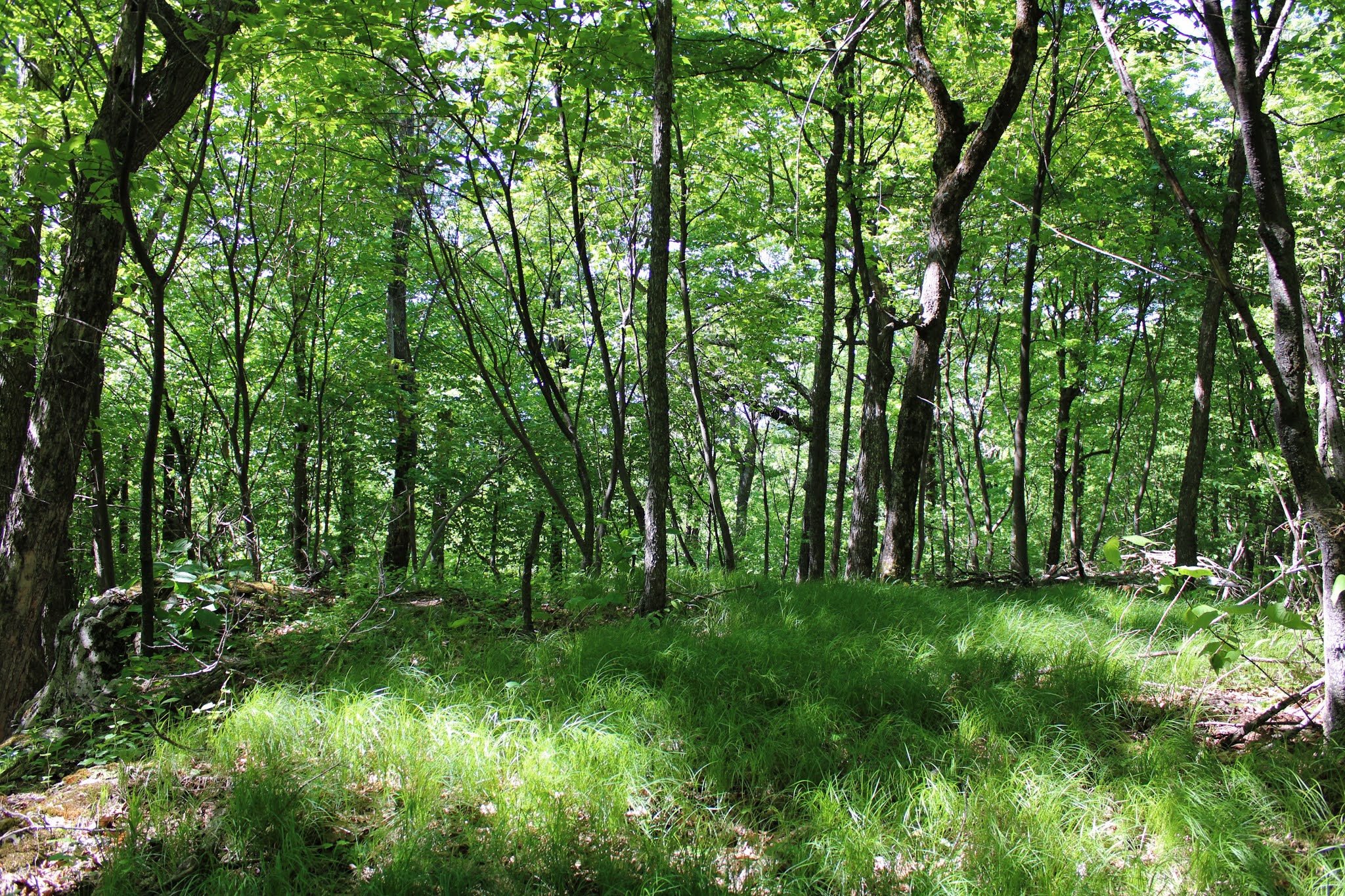
From the Upper Falls, I headed east into the woods, beginning a moderate bushwhack through a fairly open mixed forest.  It's amazing to see how in just a few weeks the woods have completely filled in with lush green and full summertime growth.

I continued a fairly easy bushwhack up to a series of cliff bands just below the summit area, which I was easily able to find a way around.  The true summit, elevation 2161 feet, is fully wooded with no views.
I wandered around the steep west facing slopes below the summit and caught decent views towards Square Falls Mountain(left) and a corner of Little Hopkins Mountain(right).
Sometimes it pays to look down...you might just find a friend.
Continuing to follow the steepest slopes on the west side all the way to the southern tip of the peak, where a broad view south towards the peaks across Route 8 can be seen. 
The view west from a nearby open ledge, was unfortunately blocked my the neighboring peak of similar height(which was in fact my next destination).
From ledge, looking south towards Kettle, Barker and Harrington Mountains.

After enjoying the views atop the first peak, I dropped a bit west before re-climbing up through an open forest towards the next peak.

The summit of the western peak, elevation 2151 feet, was wooded with no views, but a pleasant area to explore.
From a very steep set of southwest facing ledges I found stellar views out over the East Branch valley, with Black Mountain towering above to the west.
After enjoying the views, it was time to descend...but the drop off from here was almost vertical, so I would have to find a different way down.
As I contoured my way around the steep southwest facing slopes looking for a way down, I found more impressive views towards Black Mountain.

A steep descent SW brought me over one more small summit bump before I finally made my way back down to the East Branch Gorge path, which I followed all the way back down to the car.  Hiked about 4.7 miles RT with 1300 feet of ascent and didn't see another person all day.  

Blue X's=Falls     Red X's=Summits  Black X's=Ledges with views


Thursday, May 27, 2021

Unnamed Hogtown Ledges(Lake George Wild Forest-Adirondacks)

Headed north on a gorgeous late May afternoon to do an easy little off trail adventure to an obscure set of ledges just east of the Hogtown Parking Lot in the Lake George Wild Forest.  I parked in the large lot(elevation just over 1300 feet) and headed out, first following Dacy Clearing Road north, but just briefly.  Within just a few hundred yards along the road, I dipped off into the woods heading east over to Designated Campsite 1.  The site was wooded but open and flat, with a small fire pit in the middle. 

From the campsite I began my true bushwhack, heading northeast through a hardwood forest, slowly gaining elevation on the slopes of an unnamed peak.


As I neared the top of the small peak, I contoured over towards a set of steep west facing ledges in hopes of a view.  The woods really began to open up here and made for very pleasant hiking.

Unfortunately the trees are now all fully leafed out, obscuring what look like could be decent views.  I was able to capture one small peek a boo view west towards a sliver of Lake George, as well as a couple other ok views.

From the ledges, it was an easy bushwhack up to the wooded 1810 foot high point.  The woods on top were very pleasant and filled with abundant sedge grass.


A very small descent SE off the top brought me down into a large, wet area where I almost stepped on a quiet little porcupine. 

After losing just over 100 feet, I began a very steep but short climb up to the top of the SE bump.  The slopes here were covered in steep cliff bands and made for a fun little ascent.
Once atop the ledges, I swung over to a west facing view, that was quite nice and open. 

There was quite a significant drop off to the west from up here, so I took my time strolling through an absolutely spectacular, grassy set of open ledges.

On spot in particular was incredible, with amazing views.  This wide open perch provided wide open, unobstructed west views.

The view from these ledges stretched nearly 180 degrees!  The wetlands down by Shelving Rock Road, and Buck Mountain rise above.

Directly west from the open ledge is one of the most unique and wonderful views of Buck Mountain.

After enjoying the ledge views, I carefully descended back down towards the car, first making a pit stop at the edge of a large wetland, which is also on the very edge of state land.

Hiked about 2.5 miles(all bushwhack) with 750 feet of combined ascent. Happy to report that there were no bug issues today!

Map below with Red X's marked for summit and ledges.


Wednesday, May 26, 2021

Ann Lee Pond Nature and Historic Preserve(Colonie, Albany County)

Did a short walk at the Ann Lee Pond Preserve this sultry, summer like afternoon before the incoming storms before moved in.  The Preserve is owned and managed by Albany County and offers up a pleasant little nature walk amidst the nearby sounds of traffic as well as the neighboring airport.  Parked in the designated parking area near a bend on Heritage Lane and set out, with the heat and humidity packing a punch(apparently also keeping people away, as I had the preserve to myself).

The historical pond, named after the founder of the 18th century Shaker religious community, is very shallow but quite scenic and teeming in wildlife.

The trail circles around the edge of the edge of the pond and I saw plenty of small critters and creatures along the way. 

Once in the welcoming shade of the woods, I explored both the blue and red trails, as well as an unmarked but well defined foot path.  There was a profusion of large, waist to chest high ferns that dotted large swaths of the woods.

Found some showy azaleas in a few select spots closer to the pond.

Shelter from the storm?  With incoming sever weather possible, it's always good to have a place to escape to.

The last time I was here, several years ago, the foot bridge across the pond was in very rough shape.  Fast forward to today I was happy to see the bridge in good, functioning condition.

Covered a bit over 2 miles round trip, with a good sweat worked up in a short amount of time.  Dark, storm clouds were quickly moving in as I got to the car, with the promise of cooler weather to follow.


Friday, May 21, 2021

Landis Arboretum(Esperance, Schoharie County)

Headed out to rural northeastern Schoharie County after work this afternoon to explore the George Landis Arboretum, which was established back in 1951 and offers up to 8 miles of hiking trails open to the public.  There are a variety of trails at the Arboretum, with a little bit of everything mixed in along the way.  There are two visitor parking areas along Lape Road, which is located just north of the village of Esperance and west of the Schoharie Creek.  Interestingly enough, the location of this property is actually very close to a three county convergence, with Montgomery County just north and Scenectady County just east.   

I parked at the lower parking area(Elevation 1090 feet) across from the Visitor Center and set out on a steamy spring day.


 Fragrant lilacs greeted me near the start of the Fred Lape Trail.

Spring blossoms in a clearing.
Plenty of wildflowers along the various trails as well.
There are a lot of trails, ranging in length, with none being terribly long.  With the summer like warmth taking hold, the shaded woodland trails were especially nice today.

There are trails on both the east and west sides of Lape Road, and I wandered around on many of these.  The Pioneer Trail passes through woods and open meadows in the NW corner of the property, with the sounds of bird songs filling the air.


This is my second visit here, and like my first time, the highlight of the hike was the expansive view from the clearing by the Great Oak, which was struck by lightning several years ago.  The view stretches far to the east into the rolling hills and nearby farmland.

 There are several small ponds and wetlands to observe wildlife along the way.

A unique feature of the Arboretum is the educational and informative aspect of the hike.  Mailboxes filled with tree, plant and flower identification are found along different sections of the trail(each tied into a specific location as well).

Hard to beat the view from Willow Pond, with a classic red barn making for a handsome backdrop.

With the mid day sun really beating down, I decided to take a quick break on the deck of the Meetinghouse, where you can soak in a nearly 180 degree view from the comfort of an Adirondack chair.
Stone walls and colorful spring blossoms are what the visitor here will find. 
I explored about 2.5 miles of trails and meadows before the hazy sunshine chased me back to my air conditioned car.  A scenic, off the beaten path gem that has much to offer.  I'll be back again, just hopefully under slightly more comfortable conditions.