Search This Blog

Friday, September 29, 2017

Potash Mountain(Southern Adirondacks)

Potash Mountain in Lake Luzerne is one of those peaks that catches your eye when you are below it and has an absolutely incredible rock face on its south side.  It has always been a mountain I wanted to climb, but unfortunately it was private, so it was a no go.  Very recently, however, a private land owner generously donated 107 acres at the base of the mountain, forming the Harris Nature Preserve.  A second private land owner donated another 6.6 acres to connect the nature preserve to state land, meaning this peak is now open to the public!  A parking lot has been created at the corner of Dunkley Road and Potash Road.  A small sign for the Harris Preserve can be found at the back of the lot, but there is no other signage other than that.  Elevation at the trail head is about 650 feet.
A herd path with sporadic flagging leaves the parking lot and enters the woods, wrapping around the southeast side of the peak.
 The trail is pretty obvious and easy to follow, hitting state land about .3 of a mile below the summit.  The climb from there is pretty steep.
 A steep push up through open hardwoods, climbing nearly 500 feet in the last .3 of a mile.
 The steep ascent immediately begins paying off, with a nice view opening up behind you to the southeast.  I eventually lost the flagging, but the peak is so open that I had no problem negotiating my way.
I flanked the area just below the summit in search of the open rock above the south face.  Soon enough, the views really began to open up.
There are incredible views all over the place and one can truly have a fun time wandering around the entire summit area.
A north view up the valley of Stewart Brook.
Thomas Mountain's southern ridge towering above the valley below.  The power line cut out is clearly visible.
There is a nearly vertical 900 foot drop off the cliffs, so it is very important to keep back and be safe.
South view down towards Fourth Lake.
The final push up to the summit.
Potash Mountain's 1750 foot summit cairn.
The view southeast with Beech Mountain(L) all the way towards Bucktail Mountain(R).  The Painted Pony Championship Rodeo can be seen down in the valley.
Another breathtaking view south towards Fourth Lake.
The entire summit area is gorgeous with much of it looking more like an open meadow than a mountain top.
 After enjoying the summit for quite a while, I dropped back down to the flagged route, being careful to keep my footing in the steeper sections. 
 Near the parking lot, the trail travels beside a large rock filled drainage area, that was almost completely dry today.
Arrived back at the car after 2.6 miles of hiking with nearly 1000 feet of elevation gain.  A short, steep, but fun hike.  I'm sure this mountain will soon be extremely popular, with its beautiful views and relative short distance.

Thursday, September 28, 2017

Slides on Squaw Mountain(Central Adirondacks)

Goodbye heat and humidity.  Hello autumn!  Woke up to beautiful fall weather with comfortable temperatures and low levels of humidity, which put a huge smile on my face. The game plan for the day was to meet my buddy Jim to do a partial trail hike/ partial bushwhack to 3239 foot Squaw Mountain's slides, starting from the Snowy Mountain trail head along Route 30. 
On my way, I stopped off at one of the roadside campsites along Indian Lake, looking quite beautiful in the early morning light.
We met up at the Snowy Mountain parking area and got geared up and ready to go.  Overcast skies and a northwest breeze put quite a chill in the air, so Jim and I both donned our light jackets and headed off on the trail.
We hiked in a little under a mile, before leaving the trail and dropping down to a crossing over Beaver Brook.  Low water levels made for an easy rock hop across.
Once across the brook, we bushwhacked through open hardwoods where we found a herd path that lead to a campsite along the water.
Beaver Brook above the campsite.
After leaving the brook, we continued our bushwhack northeast into the deep notch between Squaw and East Squaw, slowly ascending through mostly hardwoods until we hit the base of our first rock slide. 
We wandered around the base of the nearly vertical slide for a few minutes, hoping to find a way up.
Jim, contemplating a route up the steep rock slabs.
We flanked the first slide north before we ran into another, smaller slide which also had to be flanked.  Finally we found a small, narrow passageway up through a gully.
As we ascended the steep slopes up through the gully, the enormous rock walls seemed to be closing in on us.
Jim heading onward and upward, gaining elevation very quickly.
As we neared the head of the steep gully, a look back over our shoulder revealed a nice view.
The rock walls were very impressive, towering nearly 30 feet above us.
Squaw's east summit across the notch.
We managed to catch a peek of Indian Lake from the top of the gully as well.
Once above the gully, the route opened up, entering a conifer forest at about 3100 feet.  Unfortunately, the summit is private, so we wandered the ledges, scratching and clawing our way through scratchy conifers to capture a pleasant view southeast towards Indian Lake.
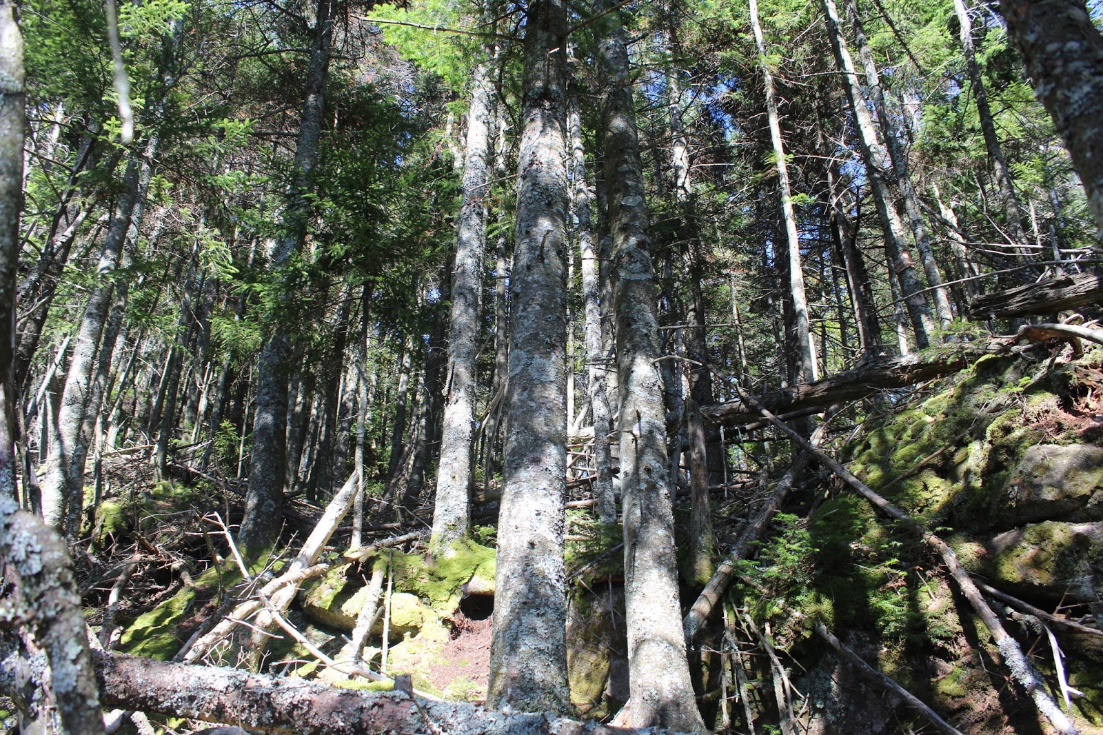
The woods above the ledges.
We side-hilled through the conifers, trying to drop down to the top of the rock slides we had seen earlier, and after a few minutes..
...we found one of the slides!  We secured good footing and enjoyed the amazing views.
Looking down at the slide, which caused a certain level of uneasiness.
The ridgeline to East Squaw.
We dropped down a bit further through the conifers and managed to fight our way to the side of one of the slides.  The pitch was still very, very steep.
We continued our drop southeast, until we encountered another, wide open slide that we hadn't seen earlier.  This one offered up the best views yet!
Snowy Mountain's east ridge line stretching down towards Indian Lake.
The incredibly steep slides.
Once below the last slide, we continued our descent back down into the notch, taking our time with a couple of tricky, steep spots.  We headed southwest through mostly hardwoods until we came to a quiet stream crossing.  We stopped here to relax for a few, as fallen leaves danced on the water.
Crossing back over Beaver Brook on our way back to the trail.  Once on the trail, it was a quick fifteen minutes back to the car. 
A great hike, with about 7.5 miles total RT and 1600 feet elevation gain.
On the way home, I pulled off near Speculator to enjoy the spectacular views across Kunjumak Bay.

Wednesday, September 27, 2017

Yokun Ridge -Baldhead(Berkshires)

Did a short evening hike today in the central Berkshires along a section of Yokun Ridge south to Baldhead, a 1677 foot subordinate peak which sits just east off the main ridge.  Parked at the gate at the end of the public access area along Reservoir Road and headed south on a series of unmarked trails.
A very confusing network of trails literally criss-cross all over the woods, but I found my way up to a beautiful scenic vista from an open rock ledge just north of Baldhead. The view is directly east over a large wetland known as "The Marsh".
The view stretches far to the southeast over the Lenox countryside with Lily Pond visible.
The Marsh sitting far below.
 The view to the northeast consists of the ridge of Kennedy Park.
I eventually picked up a BNRC trail, which actually follows Old Baldhead Road for a ways, before leaving the marked trail to head up to Baldhead's wooded summit.  Unfortunately, there were no views from the summit.
Back on the marked trail, I passed by the former John Gorman homesite, dating back to the late 19th century.
Headed back to the car on another series of unmarked Lenox Watershed trails, passing one mountain biker along the way.  Hiked about 4 miles total.