Search This Blog

Friday, October 28, 2022

Harvey Mountain & Pinnacle Point Loop(Harvey Mountain State Forest, Columbia County)

Headed into the nearby Taconics along the NY/ Mass state line to do a loop hike over Harvey Mountain and Pinnacle Point this afternoon.  The sun was out but the temps were much cooler(near 50 degrees) making for great hiking conditions.  Parked at the trailhead on East Hill Road(Elevation 1570 feet) and picked up the blue blazed trail for half a mile and then on to the red blazed trail.

 Made one pit stop off trail to check out some small falls on Baldwin Brook.


The falls sit in a deep ravine, which make them difficult to get down to, but they are very nice.


Back on the red blazed trail, which climbs steadily up to Harvey's summit.

Emerging into the blueberry barrens just below the summit, with great views SE into the southern Berkshires.

Zoom view SE towards Mount Everett.


From the blueberry barrens, soaking in the view SW into NY state.

NY/Mass border near the true 2065 foot summit of Harvey Mountain.
After hitting the top of Harvey, I descended the an old access road to the yellow blazed Pinnacle Point Trail, which climbs up and over the 1951 foot summit and eventually over to a seldom visited Lean To just off the summit.

Heading back to the car at the East Hill Road trailhead on a wide, well maintained trail.
Completed the loop for a total of 4.6 miles round trip and nearly 1000 feet of combined ascent.  I did see a couple of other hikers out on the trail today, but mostly had the woods to myself.


Tuesday, October 25, 2022

Pownal Overlook via Taconic Crest Trail(Taconic Ridge State Foest, Rensselaer County)

Took advantage of a mild and even a bit humid late October day by visiting the very north end of the Taconic Crest Trail just west of the NY/ Vermont state line on Route 346 in Petersburg.  When I arrived at the parking lot(Elevation 525 feet) in the late morning I was actually surprised to see so much color hanging on.  Here is a view north across Route 346 near the parking lot under clearing skies.

Headed south/ southwest on the Taconic Crest Trail, climbing steeply up on a carpet of freshly fallen leaves.
Conditions were perfect for this time of year!!  Temps pushing 70 degrees with a bounty of fall colors still lingering...the only drawback was that I had to pick several ticks off along the way.
I had forgotten just how steep this climb was and I had worked up a pretty good sweat under the suddenly mostly sunny skies.


 Mellow yellow.


A steeper section of trail made a bit more tricky with the bevy of fallen leaves covering the ground. 

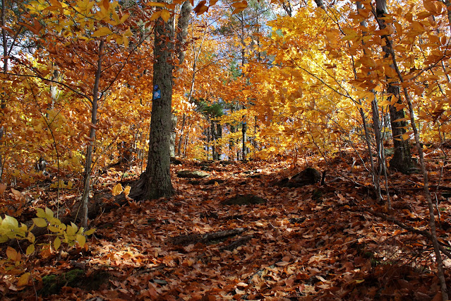
There is A LOT of beech high up on the this section of the Taconic ridge, which turns a bit later than the maples and extends the foliage season.

Arriving at the Pownal Overlook, at just over 2000 feet.  The view is quite nice, with Bald Mountain's east ridge in the foreground and the Valley of Vermont and the northern Berkshires beyond.


View east into Pownal from the Overlook.

East view across the valley towards the Dome, whose summit was completely clouded in.


On the other side of the ridge, just a short distance away, is a view west towards the Rensselaer Plateau.  Unfortunately this view is almost completely grown in now.

From the viewpoint, I turned back, retracing my steps back north on the trail.
A nice and easy descent under changeable skies brought me all the way back to the car for a total of 4.3 miles RT and over 1700 feet of total ascent.  Didn't see another soul all day.


Friday, October 21, 2022

Mud Pond Preserve(Town of Nassau, Rensselaer County)

Did an easy walk after work on a beautiful fall day just down the road from my house at the Mud Pond Preserve, located along Central Nassau Road.

The view from the end of the Mud Pond Overlook Trail.
Checked out the new Big Thunder Trail, which meanders its way through the woods to a small rivulet and wetland.
Some fall color is still clinging to life, although probably not for much longer.
Another new trail in the works?  Passed by blue flagging off the Mud Pond Loop Trail that climb up and over a small knoll.
A nice and easy 2.5 miles of woods therapy and didn't see another person.


Wednesday, October 19, 2022

Pine Mountain & Tilden Swamp(Pittsfield State Forest-Berkshires)

Had a free afternoon to get out, so headed over to the nearby Pittsfield State Forest to revisit Pine Mountain and high elevation Tilden Swamp on a blustery, overcast, and cool fall day.  Parked in the small lot across from the ski lodge (Elevation 1163 feet) and headed west, following various trails that climb up the steep slopes of the mountain.  Although many trees have already shed their leaves, fall color is still quite nice in much of the woods, making for perfect hiking.

A flat section of trail along Pine Mountain's summit area.
Near the summit of Pine Mountain, at about 2220 feet, a stone town boundary marker can be found denoting the spot where Pittsfield and Hancock meet.


Just prior to a steep drop down the west slopes of the summit area, a small clearing provides a nice view NW over Tilden Swamp and towards the hills of NY in the distance.

A slightly lower vantage point allowed me to take in the unnamed hill just north of Tilden Swamp, ablaze in fall color.

After a short, steep drop, I continued my way on a carpet of fallen leaves, turning right at two forks on my way over to Tilden Swamp.

Skies began to clear just long enough to provide nice reflections on beautiful Tilden Swamp. 

Looking north towards a beaver hut, which was very active!  An ornery beaver didn't like my presence much, as he smacked his tail several times to get rid of me.
Given the time of day-and the mostly cloudy conditions, I found that the views north from the south shore were the best...even though this spot sits well off trail.
From the dammed outlet of the swamp, I turned east, picking up the colorful Parker Brook Trail.
The Parker Brook Trail is quite steep as it descends, high above the steep walls of the ravine carved out by the creek.  It's hard to get down to the brook and its several small cascades without a little effort, but down lower it is easier to access some of them. 
Way down low, near the park road, I hit the paved Tranquility Trail which I followed back to the car.  A nice 4.3 miles RT, with 900 feet of ascent along the way.  Only saw a couple other people out on this cool, brisk day.


Friday, October 14, 2022

RRR Brooks Trail/ Shepherds Well/ Taconic Crest Trail to Smith Hill(Town of Williamstown-Berkshires/ Taconics)

Headed over to the Taconic ridge along the NY/ Massachusetts state line to check out the fall foliage on what was forecast to be a slowly improving weather day.  I parked on the Williamstown, Massachusetts side of Route 2 at the Sara Tenney Trailhead(Elevation 1560 feet) and set out, heading northwest on the RRR Brooks Trail, which hugs Route 2 as it climbs.

A thick fog hung over the woods behind the slowly departing system from earlier in the morning.  I actually enjoyed the eerie setting, as it really set a nice mood for my hike.
After about a mile and just over 1900 feet of elevation, the trail splits and I took the Shepherds Well Trail, which climbs steadily up towards a viewpoint on the ridge.  Unfortunately, an extremely thick fog and low clouds obscured any kind of view.  The red blueberry bushes were very nice however!

After just over another mile, the Shepherds Well Trail meets up with Taconic Crest Trail, high up on the ridge.  At nearly 2300 feet now, the trail was quite damp and shrouded in even more fog.
I continued north on the Taconic Crest Trail for about 3/10 of a mile before leaving the trail and heading up to Smith Hill's 2330 foot summit through a golden fern meadow.


As expected, the high spot was completely fogged in.  It is a very nice, large meadow though-that I think would provide okay views on a clear day.

After enjoying a quick snack in the thick fog on Smith Hill's summit, I dropped back down to the Taconic Crest Trail through open hardwoods, where I began to retrace my steps south.

As I arrived back on the Shepherds Well Trail, I began to notice a subtle clearing of the fog.  It didn't seem like much at first, but it was definitely fading away.

Arriving back in the view spot, I was very happy to see the fog finally burning off and allowing for my first good views of the day.  A nice look down at Route 2 as it climbs up to Petersburg Pass.
Fall foliage on full display, with blue skies way off in the distance.  Mount Raimer's summit(left) was still clinging to a dense fog.

Looking south down the Taconic Ridge, with Raimer in the foreground and Berlin Mountain in the distance.

An amazing spot to absorb the views into Berkshire County.  The blueberry bushes were ablaze in color as were the surrounding peaks. 
Skies finally clearing enough to reveal Mount Raimer's summit.

I hung out for quite a while in this spot, hoping for some of the clouds to burn off.  Met another nice hiker here, who was up there with her dog, and also hoping for additional clearing.  We were lucky to get these amazing views over Williamstown and towards the cloud capped Greylock Range.  Brodie Mountain's long ridge can be seen on the right.

Finally headed back down after a while, dropping down through the gorgeous autumn woods.

Got back to the car as the skies continue to clear out but I didn't mind...it was a great day in the woods.  A total of 5 miles RT, and over 1000 feet of combined ascent.