Search This Blog

Wednesday, January 11, 2023

Piney Point(Ticetonyk Mountain Unit, DEP Land-Catskills)

Ventured down into the Catskills to do an easy bushwhack up to 1680 foot Piney Point, the high point on Ticetonyk's far west ridge.  I parked in a small DEP pull off along Piney Point Road(Elevation 975 feet) and ventured south into the woods, initially following a drainage up.

Within a couple minutes of climbing I intersected the first of several old woods roads that dot these slopes.
I followed the woods road briefly but the woods were quite open so I simply bushwhacked straight up. This initially seemed like a good idea until I hit mountain laurel up high, which slowed down my progress.  At least I managed to squeeze in some okay views towards Mount Pleasant to the NW through the trees.
After pushing through a thicker area of mountain laurel, I hit the 1680 foot summit, which is marked by an enormous boulder. 
 

The summit area sits in a large plateau, and is very open and easy to explore.

I wandered down to the steepest slopes, just SE of the summit, where I found decent views to the south.

From the same area of steep slopes, I found screened view towards Torrens Hook(left) and a portion of the Ashokan Reservoir(right)

Heading north back up and over the summit, I carefully weaved my way around the mountain laurel for a pretty straightforward descent.

Nearing the car back down low, I once again hit the tiny drainage that I had followed up.  Mount Tobias can be seen through the bare trees further to the north.

A short walk brought me back to the car for a total of 2.2 miles RT and 750 feet of climbing.  A nice and easy bushwhack on yet another comfortable winter day!

Map below.  Red X=Parking   Blue X=Summit

Please note:  There are two other DEP parking spots available further west along Piney Point Road, as well as access from Bostock Road to the south.


Pecoy Notch Ledges(Indian Head Wildneress-Catskills)

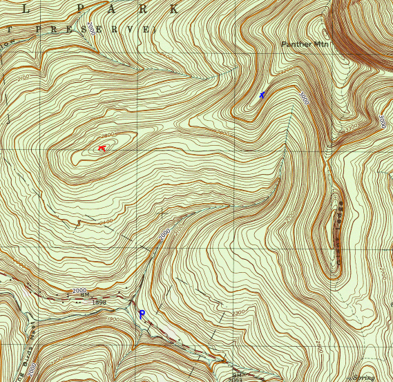
"What beautiful spring weather we're having this winter".  This was an exact quote from the only hiker I saw on the Pecoy Notch Trail this morning and it pretty much summed up the pleasant mid January conditions I experienced on my hike.  I wanted to do a little exploring around Pecoy Notch(the deep notch between Twin and Sugarloaf Mountains), so I parked at the trailhead along Roaring Kill Road(Elevation 1980 feet) and headed south, setting a good pace on the marked trail.

Made a brief pit stop at Dibble's Quarry, which I was surprised to have to myself.

Checking out the great views towards Roundtop and KHP from the Quarry.

Continuing past the Quarry, it is a gradual climb up towards the Notch, and the sizable beaver pond just below it.  Here's a view towards Twin Mountain, which was under a snow squall, from the mostly dried up beaver pond.

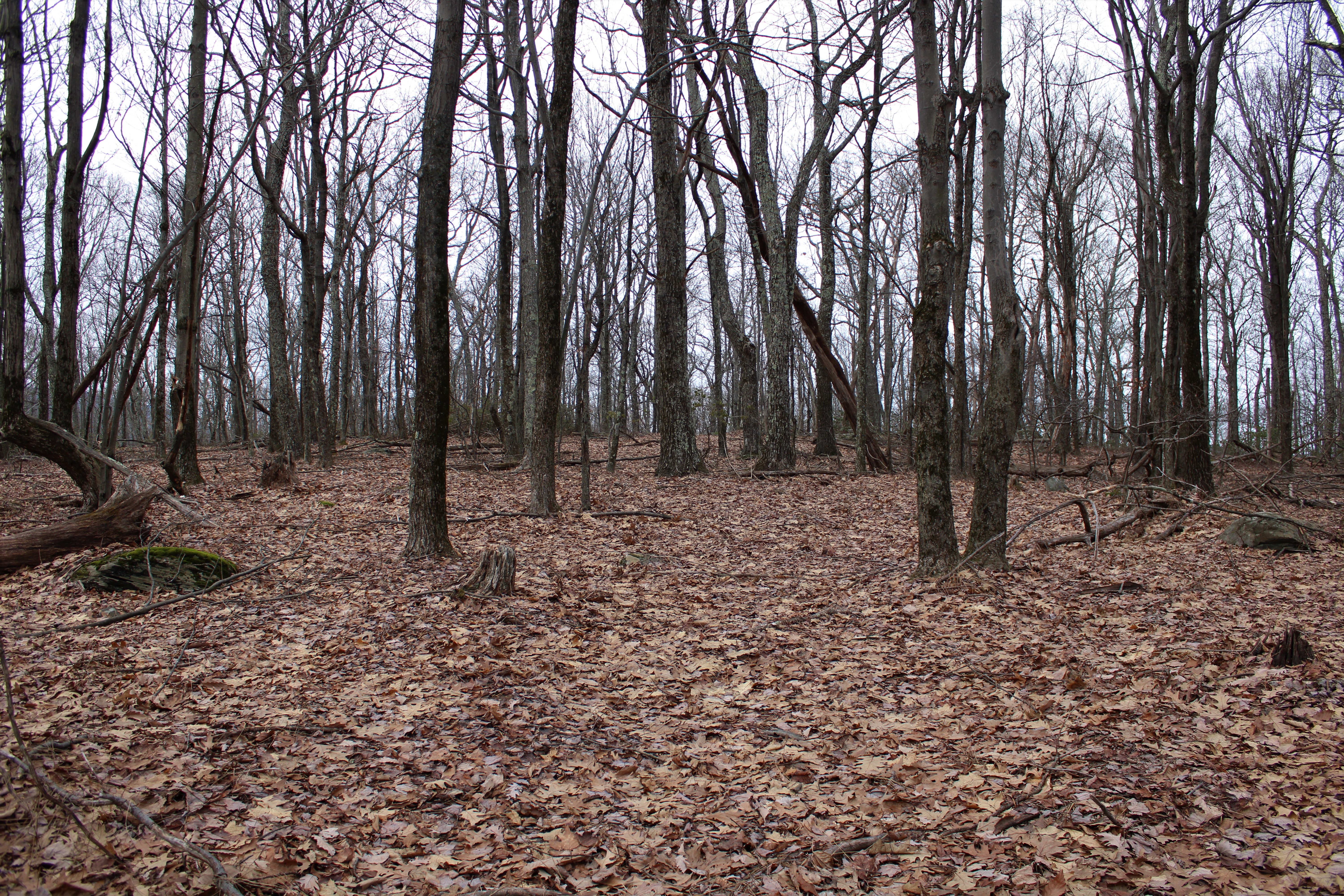
After nearly 2 miles, I arrived at Pecoy Notch, which sits at just a bit over 2800 feet. The area surrounding the notch itself is the only area I saw snow all day-and even there it was spotty at best.

I turned east from the Notch and began to climb up the Devils Path towards Twin Mountain for a couple minutes before diving off into the woods, circling over to a series of open ledges on the southwest slopes of Twin.  My first good view was a direct look across the Notch towards Sugarloaf Mountain, with the snow capped trees below. Notice that the higher slopes of Sugarloaf are completely devoid of snow.

Looking north beyond the Notch towards Sugarloaf's north ridge and the distant Blackhead range.

Icy views towards Sugarloaf's south ridge and a shoulder of Olderbark Mountain just beyond.

The ledges came fast and furious and the going was tough, as I made my ascent. 

The views only got better from each successive ledge, with the best being towards the SW.

While climbing up through one particular rock overhang, I was startled to find this old, rusted out bed frame and neat stone work.


The next three photos may look similar but are from three separate vantage point, each one higher than the last. 

Paused at this particular ledge to grab a quick snack, soaking in the sunshine and views and in disbelief at the incredible weather.
The cliff bands were tough to negotiate but all worth it for the views.
After enjoying the views, it was a careful bushwhack back to the trail, which I descended back to the Notch and then onto the beaver pond below.  I explored the woods just above the pond and did manage to find one unique view towards Roundtop and KHP.

Back on the trail, enjoying the great view of Sugarloaf towering above the beaver pond/ meadow.

I continued my descent north, heading off trail one more time to check out a couple of pretty waterfalls on the brook that drains the Notch and empties into the Roaring Kill.

Partially frozen waterfalls further down the stream.

Back on trail, I made one last stop at Dibbles Quarry to check out Twin Mountain and the steep slopes I explored to the right.

A final, easy hike out brought me down to my car.  There were five cars there when I left, but as I mentioned, I only saw one other hiker.  Trails were in great condition, with only very sporadic ice here and there that could be easily avoided.  Hiked about 4.5 miles total(trail/ bushwhack combined), with 1300 feet of total ascent.


Monday, January 2, 2023

Panther Mountain's West Ridge(Slide Mountain Wilderness-Catskills)

It has been extremely difficult finding free time with a newborn baby, but I was finally able to squeeze in a day of hiking down in the Catskills.  Headed out on an unseasonably mild winter day and wanted to explore the ridge west of Panther Mountain's summit. This entire area I'd be covering today has no trails and in addition would involve two water crossings of Giant Ledge Stream which drains the slopes above.  I managed(barely) to fit my car off on the shoulder of Oliveria Road(CR 47)in a small area where state land comes down to meet the road-about 9/10 of a mile west of Giant Ledge parking area(Elevation 1925 feet).

Once geared up, I headed NE into the woods, quickly picking up a decent herd path that parallels Giant Ledge Stream with almost no snow on the ground.

After about 1/3 of a mile, I dropped down steeply west into the gorge where state land expands on the other side of the brook.  I wasn't sure what to expect with the water crossing, but I was able to somewhat easily find a way across.
The slopes above the brook are quite steep, but manageable.  There was a lack of snow cover on much of the ground, until about 2400 feet.
The ascent NW towards the unnamed high west ridge "summit" was through open hardwoods with screened views all around.

Once up on top of the ridge, over 2700 feet, the snow cover grew in coverage, but views remained minimal.
Th 2880 foot summit sits in a large, flat plateau like area.  Unfortunately, it looks like this area might be covered in dense prickers come the summer time.
From the summit, I continued east, with a small drop into a 2710 foot saddle, with views towards Panther's ridge ahead.  This area saw the deepest snow cover, with an average of about 5 or 6 inches of depth.

The terrain east of the saddle is much more rugged and steeper, which of course made for a fun climb.

Up and over 3100 feet, the woods open up quite nicely, with an extremely deep drop off to the SE providing up close views of Panther Mountain's main ridge line.

From a small clearing in a meadow, a wonderful vista towards Giant Ledge opens up.  This view takes in Giant Ledge(R) and the shoulder of Panther(L).  Just beyond that, the ridge of Wittenburg, Cornell and Slide can be seen.
Spectacular view of Giant Ledge with Slide in the distance from the small meadow.

After enjoying the views, I headed back down around the steepest cliff bands I had just climbed up and began my descent south into the deep cut of Giant Ledge Stream.  This proved to be the toughest aspect of the entire hike, with snow covered terrain dropping nearly vertically into the stream on both sides.  Luckily I managed a safe water crossing and even took a moment to capture the beauty of this remote area of the stream.


The tough work wasn't over once across the brook, as I still had a steep climb and side hill out of the deep gorge.

Finally back up on higher ground, it was an easy walk south back to my waiting car.  Covered about 4.5 miles round trip with over 1500 feet of ascent.  Of course being so far off trail, I didn't see another soul all day-although I saw plenty of animal activity in the snow.

Map below.  Blue P=Parking  Red X=West Ridge "Summit"  Blue X=Vista