Search This Blog

Monday, February 28, 2022

Mud Pond Preserve(Town of Nassau, Rensselaer County)

Did a local walk today at the Mud Pond Preserve in a quiet little corner of Rensselaer County on a cold winter morning.  100% sunshine couldn't offset the wintry feeling of 4 inches of snow and temps in the mid teens as I set out through the peaceful woods from the trailhead located on (CR 16)Central Nassau Road(Elevation 790 feet).


The air was cold but wasn't too bad if you kept on moving. 

Wetlands surrounding Mud Pond from the end of the Overlook Trail.

Used all three trails at the Preserve and even noticed what looks like a new trail being marked with pink flagging?  This would connect the Casey Farm Trail with the current end of the Overlook Trail.

Walked about 1.6 miles total and didn't see another soul in the woods. 


Thursday, February 24, 2022

Partridge Run WMA(Town of Berne, Albany County)

Headed up into the Helderbergs this afternoon to do a little exploring in the eastern section of the Partridge Run WMA before a major winter storm moves in tonight.  I parked in a small, informal parking area on the shoulder of Ravine Road(Elevation 1545 feet) less than 2/10 of a mile north of Kingfisher Road.  Once I got all geared up I headed out under mostly clear skies and temps in the mid 20's.  

I first headed over to the area known as "The Gulf", an enormous, deep ravine, and followed its western rim via a rough herd path.

The slopes above The Gulf are extremely steep and quite impressive, but ice and snow kept me far back from the edge.

Followed the herd path south along the rim until the terrain eased up and allowed me to drop down to the frozen stream that flows through The Gulf.

A fairly easy rock hop(ice hop) got me across the creek and then onto Kingfisher Road, which I immediately left to follow a blue blazed trail.  This trail was quite icy as it drops down towards the east side of the Gulf.  Just prior to the views out across the Gulf, however, I found this picturesque wetland just off trail. 
The main event of this hike is the walk along the eastern edge of The Gulf, where a great view opens up across the deep ravine and to the north.
After enjoying both sides of The Gulf, I continued hiking the blue trail, which heads east then south, almost paralleling Kingfisher Road.


After re-emerging on Kingfisher Road, I followed it south for a short distance to the Long Path, which also doubles as the Wood Duck Path, heading west.  This trail, by no small coincidence, leads to beautiful Wood Duck Pond, which was 99% iced over today.

From Wood Duck Pond, I decided to venture off trail and into the woods, wandering past old stone walls and gorgeous forests.

I briefly followed a pretty little creek that drains the higher slopes above.  These sheltered parts of the woods were noticeably colder and had much more snowpack than the more open areas I had passed through earlier.

Passing by more old stone walls deep in the woods off trail.
Continuing NW, I soon emerged out of the woods and back onto Ravine Road, where I walked the rest of the distance back to the car.  Didn't see another person the whole day as I hiked about 3 miles total on what turned out to be a pretty nice, although cold, afternoon.  With nearly 100% sunshine, it's hard to imagine we will be getting close to a foot of snow starting tonight! 


Monday, February 21, 2022

South Mountain(DEP/ Sundown Wild Forest-Catskills)

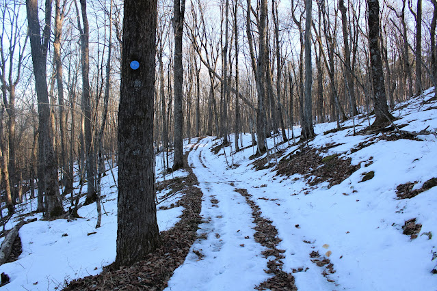
Wanted to take advantage of a gorgeous spring fever type day so decided to re-visit 2185 foot South Mountain, a trail-less peak located just north of Ashokan High Point that I had hiked several years ago.  My previous visit here was accessed from South Hollow Road on the mountain's west slopes so today I wanted to check out the east side of the peak.  Public access has really improved in recent years on the east side of the mountain, so I was anxious to check it out.  Parked in a small DEP parking spot(Elevation 890 feet) on High Point Mountain Road, almost directly below the northeast edge of the mountain's ridge and headed out, quickly locating an old logging road.

The climbing was fairly low key early on, as I passed through a couple of large meadows before hitting some steeper slopes and losing the woods road.  The sounds of running water beneath the ice filled the air as I began to head straight up the mountain.
The terrain was quite tough, with slick leaves and the still frozen ground making footing difficult, so I contoured a bit north towards a little easier slopes.  Once I began gaining elevation, I found some pretty nice views east out over the Ashokan Reservoir. 
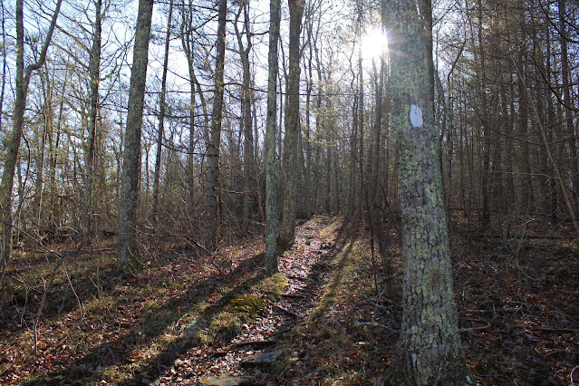
A little higher up the mountain, I was able to hook up with another good woods road, which lead me due south towards the summit(with Ashokan High Point visible through the trees).
The slopes drop off very, very steeply to the east below the woods road and provide some more nice views towards the Reservoir.
Unfortunately that woods road peters out at about 1750 feet, so I bushwhacked the last 435 feet of elevation in less than 3/10 of a mile.  It was a tough, hard earned climb up to the ridge, where I was greeted with a few inches of soft snow and mountain laurel.  Thankfully a herd path leads up to the nondescript 2185 foot summit.
From the summit, I continued on the herd path, soon leaving the snow and dropping south to a small clearing and wide open ledge that provides a spectacular up close view of Ashokan High Point.
Following the herd path along the ledges.

The herd path continues south and after a little elevation loss and then regain, a wonderful view opens up towards the Burroughs Range and South Mountain to the nearby right.(where I had just been)


An awesome view towards the Burroughs Range!

As the herd path begins to climb a bit more steadily up Ashokan High Point's north ridge, the snow reappeared and another wonderful view opens up in an even larger clearing. 

Looking back north at South Mountain.  What an incredible spot!!

After enjoying the great views, I headed back north, but descending via a different route instead.  In a low spot on the ridge, I picked up a steep woods road dropping directly north.  This was actually the original trail up to the Ashokan High Point Fire Tower-but has a lot of serious blowdown in its path now.

The old fire tower trail fades out down near 1300 feet, so from there I simply bushwhacked my way NE towards my car through wide open woods.  Once out of the deep shadows of the mountain, the bright sun and 50 degree temperatures really felt great.

A wonderful little hike and unknown gem of the Catskills(for now).  Didn't see another soul all day but did pick up my first tick of the year!  Ugh! 4.5 miles RT with nearly 1500 feet of combined ascent on a beautiful late winter day.


Romer Mountain Quarry & Ledges(DEP/ Slide Mountain Wilderness-Catskills)

 Headed south this morning to do a little exploring on Romer Mountain's lower slopes on a beautiful, sunny spring like day.  I parked in an unmarked state parking area along Route 28(Elevation 760 feet), about 1/3 mile south of the Pheonicia Diner, and walked the icy road the short distance in to public access.  Just across Route 28, Mount Tremper rises impressively above.

Left the road and jumped into the woods at a DEP access spot, beginning my bushwhack there.
There was very little snow or ice in the woods and I made good time hiking up the steep slopes, heading SW.  The slopes below began to really drop off as I gained elevation, with the sounds of traffic down on Route 28 becoming more distant by the moment.
Contoured my way over to a long series of impressive ledges, which were impossible to ascend. 
Continued all the way around the steepest ledges, soon picking up an old bluestone quarry road, which lead me directly to a small quarry.
Stonework near the quarry.
Followed a series of quarry and woods roads that dot the slopes of Romer Mountain.  The mild temps climbing through the 40's, are causing the impressive ice flows to begin melting.
Wandered my way over to the top of the steep ledges I had been below earlier, and found some decent views.  From a small clearing, I caught this southeast facing view along Route 28 and the Esopus Creek from a ledge just below 1400 feet.
Looking straight down, almost vertically down, at the small strip mall along Route 28, about 650 feet below with Mount Tremper directly above.
After checking out the ledges and exploring the woods, I circled around to the north, finding a more generous route down the steep slopes and back to my car.  A nice and easy-but steep-2.6 miles RT, with nearly 900 feet of ascent.

Map below.  Red P=Parking   Black X=Ledges


Friday, February 18, 2022

Sharon Mountain(Salisbury, Connecticut-Litchfield Hills)

Headed into the rugged Litchfield Hills of NW Connecticut to hike a section of Sharon Mountain along the Appalachian Trail after work this afternoon.  Parked along the shoulder of Route 7(Elevation 550 feet)  near its intersection with Route 112 and headed into the woods with a biting, cold wind offsetting the nearly 100% sunshine.  I wasn't sure how much ice or snow would remain in the woods, but I was surprised to find barely any ice at all!

Heading south, the trail immediately begins to ascend steeply up the ridge, passing over Belter's Bump, a small knob which reportedly used to have a nice view.  Today, there is nothing more than a small clearing with peek a boo views to the east.

The climb south continues at a steady rate, winding up through a rocky hemlock forest.

Once up and over 1000 feet, the slopes drop off drastically to the east, providing many good screened views out over the valley.

The trail meanders along with a couple of small ups and downs along the way as the trail skirts a high point on the ridge.  It was here, in one of these more sheltered locations, that I ran into the most ice I saw all day.  Spikes woould be helpful in this section.

After passing over the nondescript 1372 foot high point of Sharon Mountain's North Peak, the trail winds its way west, descending down to Hang Glider View, where a sharp drop off and clearing provide a great view.
The spectacular view NW takes in the nearby countryside, as well as the Taconic Ridgeline in the distance. 
After enjoying the vista(but not the bitterly cold winds) from the exposed viewpoint, I headed back, retracing my steps with the late afternoon sun shining brightly above.
Hiked about 5.1 miles RT, with 1400 feet of combined ascent.  I was pleasantly surprised to not see anyone else on this cold, but pleasant winter day.


Wednesday, February 16, 2022

Black Creek Marsh WMA(Town of New Scotland, Albany County)

Visited the Black Creek Marsh Wildlife Management Area this afternoon, which sprawls out to cover nearly 450 acres at the base of the Helderberg Escarpment near Voorheesville.  There are several trailheads and access points as well as a myriad of small, marked and unmarked trails that meander throughout the area.  My starting point was from the trialhead located off of School Road, where a kiosk and small designated parking area are located.  About 2 inches of very hard packed snow covered the ground throughout most of the hike, so I donned my spikes and set out.


Initially I followed the yellow blazed trail, which crosses a large clearing and meadow area, before dropping down into the woods.  Once in the woods, one way leads to a dead end at a railroad crossing and a second heads north to a junction with a blue blazed trail.

The blue trail forms a loop, closely hugging the east side of the marsh and providing many up close views of Black Creek, which is currently completely frozen over.
Across the wintry Black Creek Marsh is a wonderful view of the nearby Helderberg Escarpment to the west. This was really a nice spot!
After enjoying the trails along School Road, I then drove the short distance to the trailhead at the end of Kling Terrace, where there is a kiosk and room for about one or two cars to park.

The trails here are pleasant, but a strong wind kept me moving along.  The hard packed snow has almost become a solid ice, and was not softening much even on this 40 degree day.

Crossing beneath power lines, where an easement allows hikers to pass with clearing skies above.
Hiked about 2.5 miles total, with a couple hundred feet of barley noticeable ascent along the way.  Didn't see another soul the entire afternoon.  A hidden gem in plain sight!