Search This Blog

Friday, August 31, 2018

Lenox Mountain-Pleasant Valley Wildlife Sanctuary(Berkshires)

Headed east after work to the Berkshires to hike 2126 foot Lenox Mountain on a dreary, overcast afternoon.  This would be my second visit(and first since 2014) to the Pleasant Valley Wildlife Sanctuary, which is located at the foot of the east slopes on Lenox Mountain.
I paid a nominal fee and got a trail map at the office, before heading out.  There are a multitude of trails that wind their way through the property with many different hiking options.  I took a couple of the smaller trails that lead over to Pikes Pond, which makes a great spot to pause and take in the nature.
Deadfall in the water actually enhanced the pond view.
The trail passes tantalizingly close to the waters edge.
Soon enough, I found my way over to the Trail of the Ledges, a steep route up to the summit.
These rocks and roots on the trail made for a scenic ascent.
Nearing the summit, the first good view of the day can be found to the northeast.  It is a fine view, but nothing compared to what awaits at the top.
After about 850 feet of ascent, I arrived at the 2126 foot summit of Lenox Mountian.  A large, fenced in tower greets you, but the grand view is only a few yards away.  Northwest views, with Richmond Pond drawing the eye.
A zoom view down towards Bartlett Orchard in Richmond.
The view north is quite impressive as well.  In the distance, the peaks of Pittsfield State Forest(L) tower above Onota Lake. Yokun Seat, the next summit bump north on Lenox Mountain's ridge is in the foreground.
There is a sizeable clearing to explore below the summit on the west slope.  Here is a view back up towards the summit tower.
As the calendar prepares to turn to September, some of the leaves are getting a head start.
Southwest views over the Richmond countryside, stretching down into West Stockbridge.
After enjoying the summit views for a while, I continued north on a herd path towards Yokun Seat, the next summit on the ridge.  While not a  marked trail, it is wide and very easy to follow.
After about 7/10 of a mile, I arrived at the clearing at Yokun Seat(Bakers Peak), which is only a few feet lower than the summit.  The views west/ northwest from here are outstanding.
To the west sits Richmond Pond, from a slightly different perspective than back at the true summit.
A zoom view down to Richmond Pond, with the Interprint building being notable along the west shore.
SW views over Richmond and West Stockbridge.
There are a couple of different clearings on the west slopes below the summit(much like the true summit).
To the north, the city of Pittsfield sits peacefully in the valley.
For a different route down, I chose the Overbrook Trail to descend.  While not as steep as the Trail of the Ledges, this trail is a bit longer, and, staying true to its name, follows and literally crosses over the drainage several times.
Once back down off the steep slopes, I took a series of trails past some beaver ponds on my way back to the car.
A bridge crossing over Yokun Brook, which is much more like a large beaver pond in this location.
Arriving back at the main offices near the parking area.
Hiked about 5 miles RT with over 1100 feet of ascent...and thankfully the rain held off.

Monday, August 27, 2018

Old Clump & Hardscrabble Mountain(Catskills)

Headed down to the Catskills to do some more off trail exploring with my buddy Jim today.  One of my favorite parts of driving down to the Catskills is that I can get creative with my route, often exploring backroads and finding hidden off the beaten path views.  Today, I caught this early morning shot of mist rising over the rolling farmland of the northern Cats.
Our agenda today was to hit a pair of less traveled peaks in the western Catskills. 3000 foot Old Clump is one of the hunded highest Catskill peaks and has DEP access on probably 3/4 of the mountain, but unfortunately the summit is private.  Our approach today was to start from DEP land along Andrew Gray Road at about 1900 feet elevation.
A short distance into the open meadows, we stumbled across this beautiful small pond, accentuated by East Gray Hill in the distance.
A Catskill staple. Stone fences can be found throughout these forests, serving as a reminder to our past.
The woods were mostly open and easy going.
More stone fences.
The ascent was nearly 1100 feet in about 1.3 miles, but was never too steep.
Our route to the top was pretty easy and straightforward, but the summit was marred by thick pricker canes.
We continued to explore DEP land, even finding a small view back towards Old Clump's summit.
Old Clump summit with the valley of Roses Brook sprawling to the west.
The open woods made for very pleasant bushwhacking as I got my 94th CHH. 94/102.
Our second mountain of the day was a nearby 2900 foot peak with DEP access all the way to the summit on this one.  The mountain has no official name, but we called it "Hardscrabble Mountain".  DEP access is found on the north side of Duggan Hill Road.  There is virtually no room for parking so you must make sure your car is all the way off the shoulder.
Right from the start of the hike, across the open meadows, there is a great view west to the long ridge of Narrow Notch Mountain's east side.
Although the calendar reads late August, some of the leaves are already beginning to change color in spots.
A solitary red maple leaf.
One of the drawbacks to bushwhacking in the summer months is that you are constantly going through webs..while I'm not the biggest fan of these animals, they are still quite beautiful.
On the lower slopes of Hardscrabble Mountain, we passed through a stoic old pine plantation. 
Woods roads are abundant on many of these hundred highest peaks.  Sometimes they work to your advantage.
The woods road began to peter out in spots, only to return moments later.
The 2900 foot summit is mostly open hardwoods and completely wooded.  A 900 foot climb in just about one mile will get you to the top.
An easy descent got us back to the car feeling good. A bit humid and sweaty, but still good.  Nearly 2100 feet of ascent on the day.
As I said many times before, one of the perks of exploring this area of the Catskills, is the tremendous beauty all around you. Whether you are driving or hiking, the farmland and mountains are virtually all around you.  This is a shot SW off of Andrew Gray Road on DEP land.
Near the Woodchuck Lodge are tremendous views.  This SE view is towards Cator Roundtop, Vega Mountain, and Red Kill Ridge.
Woodchuck Lodge, built back in the mid 19th century, was the summertime home of naturalist John Burroughs and can be found on the south slopes of Old Clump.
SE Moresville and its radio tower from Mac More Road.
Purple Loosestrife along the East Branch of the Delaware River.
Once again, taking the scenic route home, I stopped by a DEC access to the Basic Creek in Greenville, washing off some dirt, sweat and grime accumulated through the day.


Friday, August 24, 2018

Jiminy Peak(Berkshires)

Not all ski runs make for great hiking.  Sometimes, there are too many people and distractions going on for you to feel in touch with nature.  Also, the slopes are usually relentlessly steep with no shade, especially on hot, sunny days. One thing, however, that all ski slopes do offer up are great views.  I decided to visit nearby Jiminy Peak, located a short distance across the state border in Hancock, Massachusetts, after work this afternoon to check out their views.  As I got started, the sounds of kids(and adults) enjoying all that the resort has to offer, as well as the Mountain Adventure Park resonated.
Elevation at the base of the Upper Lift Line was a touch under 1250 feet.
Right out of the gate, I headed directly up the steep slopes, quickly breaking into a sweat.
Almost immediately upon gaining elevation, I began to have views back down towards the resort, as well as nearby Vacation Village.
Continuing up at a steady rate.  The climb to the high point is 1150 feet in about one mile.
Crossing under the Upper Lift Line on an access road.
I quickly left the access road, heading up through the top part of the peak, through open fields.
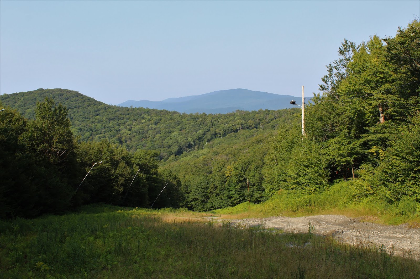
Near the top of the fields, and about 150 feet below the 2380 foot summit, I stopped to enjoy this view back to the north.
A zoom view down to the Hancock countryside. 
Turning the corner at the top of the run, I ran back into the access road, as well as the large wind turbine that faces Route 43 west.
Instead of following the access road up, I seized the opportunity to get some shade, following a woods road up to the summit.
At the 2380 foot summit, I came upon the top of another lift line.
The summit is a long, flat area with an off limits area I had to get around.  I found what I believe to be an ATV/ snowmobile trail that took me in the direction I wanted to go, so I followed it.
The ATV trail quickly came back out at a large clearing near the summit lodge.  The views from the lodge are outstanding!  Easily the best of the day.
You can easily trace the Taconic ridgeline to the west(left), with the Jericho valley of Hancock(center) and the southern end of Brodie Mountain's wind turbines(right).
A zoom view over 1100 feet below to my starting point at the resort.
One last look back west towards the Taconics.
Continuing east/ northeast, I passed by several other ski runs(Upper Whitetail, Jericho, Wild Turkey), each with great views.  Pictured here is the view at the top of the Jericho run.
My route along the summit followed a rough gravel road, labeled Left Bank, and soon began to turn slightly more Northeast then east, offering up a bit of a different perspective.  From here the wind turbines atop Brodie can easily be made out, as well as the access road.
Another view down towards the Jericho valley of Hancock, from a slightly different angle east.
The gravel road marked Left Bank drops down to a saddle between summit bumps.  Just above the treeline, Mount Greylock can be seen peeking out.
A right turn onto the Easy Does It trail got me up to the top of the next summit bump following rough ATV tracks.  Another lift line can be found there, with similar views asbefore to the north.
Just beyond the top, the trail begins to drop, where an incredible vista towards the Greylock Range begins to unfold. This marks the start of the Panorama trail.
Swinging around to the north, the Panorama trail lives up to its name, offering up lovely views.  Just prior to a steady drop, I enjoyed this look at the nearby 2350 foot north summit of Jiminy Peak/ Potter Mountain.
As the trail swings around to the west, dropping quite steadily, I found this great view through the late afternoon sun down towards Ioka Valley Farm. with Rounds Mountain rising beyond.
I followed a series of ski slopes all the way down, heading west, then NW, completing a large loop.
Hiked about 4.3 miles total, with about 1400 feet of elevation gain total.