Search This Blog

Wednesday, May 31, 2017

Laura's Tower(Berkshires)

Had to take advantage of a brief period of gorgeous sunshine this afternoon, so did a short hike up to Laura's Tower in the town of Stockbridge, just before severe weather moved in.  To access the property, which is part of the Laurel Hill Association, turn south on Route 7 in Stockbridge(at the Red Lion Inn), then proceed to Park Street, where you will bear left(east), and then follow that road all the way to the end.  A small parking area, with room for up to about ten cars is found here.
The trail begins by crossing the Housatonic River on the beautiful constructed Goodrich Memorial footbridge.
 
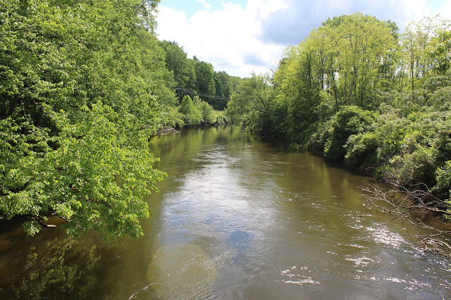
 The Housatonic River, just downstream below the bridge.
I basically took off running up the trail, determined to finish the hike before the stormy weather moved in.
 A trail split is well marked, where a right heads up to the tower, and a right heads down into the Glen.
 I took the Tower trail, continuing a steady ascent up through a gorgeous old pine and hemlock forest.
 After a scant .75 miles, and 600 feet elevation gain, I arrived at the metal tower.  Although it appears to be in some despair, it is sturdy and safe.
From the top of the tower, the views are very good.  A nice, open west view to the Taconics is the most open spot. 
 Looking down at the foot trail below the tower.
The north facing view provides an outstanding look towards Mount Greylock the highest point in the state.
 After enjoying the tower views, I quickly dropped down, retracing my steps through the spring woods.  Passing by a lovely fern glade here.
 Once back down at the railroad tracks, which sits beside the River at the trail's beginning, I could see the storm clouds building just to the south.
Would've loved to have gotten out and explored more, but within a half hour of finishing the hike, strong thunderstorms were pouring down.  Hiked about 1.5 miles RT.


Wednesday, May 24, 2017

Strawberry Fields Nature Preserve(Amsterdam)

Visited 118 acre Strawberry Fields Nature Preserve, the Mohawk Hudson Land Conservancy's newest preserve, located in the town of Amsterdam.  To find the preserve, I took I-890 to exit 26, then traveled 8.2 miles west on US 5 to Cranes Hollow Road.  Turning right, I followed Cranes Hollow Road north for .7 miles tot he Preserve sign.  A long, steep driveway heads up to the parking area.
 An informal parking area can be found beside an informational kiosk.
The main trail at the preserve is a 2.1 mile perimeter trail and can be followed from either direction.  I turned left, following the red marked trail to the west past the fields of the working family farm that also occupies this land.
 Stone walls line the woods near the deep ravine of the Evas Kill just to the west.
 Wildflowers swaying in the breeze on a mild spring day.
 Did I mention that this is an active family farm?  Roosters came by to greet me along the way.
 Red trail discs and a wide, mowed path skirt the perimeter of this beautiful, protected land.
 A foot bridge crosses a drainage.
 Trail junction.  While the main red trail runs the perimeter, there are a pair of yellow marked trails that run the interior of the Preserve.
 A gorgeous, shaded section of trail beside a deep ravine.
 While nearly all of the trails here are perfectly flat, there are several very wet and muddy areas to contend with.
Mid to late May is a beautiful time of year to witness nature come back to life, and the land looks so green and vibrant as a result.  Passed many wildflowers along the trail.
More wildflowers.

 
This Preserve should be a great place for birders and nature lovers, as the sounds of songbirds fill the air, and white tailed deer pranced around me.
 Along the southern boundary of the Preserve, there are very nice but fleeting views down into the Mohawk Valley.
 A break in the trees provides a very bucolic view into Montgomery County.
Walked about 2.1 very pleasant miles at this new preserve.  Looks like a real beauty!

Lledge Rock Park(West Galway)

While exploring some back roads on my way home this afternoon, I stumbled across Lledge Rock Park in West Galway. A very small pull off can be found on the south side of the West Galway Road, across from Cummings Pond.  There is barely room for one car, so I pulled off the road as far as I could and entered the woods.
 The trails at this park are wide and numerous throughout these woods, and look like they are used often by mountain bikers, as well as hikers.
 Moss covered stone walls can be found  near the first trail junction I came to.
 I passed by several trail junctions, keeping on all of the outside trails, hugging first the north then west boundaries of these woods.  I eventually came to wide open fields at the park's high elevation point all the way to the south.
 Wandered through the woods, soon finding my way back down to a blue marked trail that drops down towards West Galway Road again, and a view north, across the road to Cummings Pond.
The climb up away from the road is certainly the steepest section of trail, passing by some "rock
 ledges"(Perhaps the park's namesake?)
 Hiked many of the trails in the park, totaling probably about 1.75 miles or so.  While there isn't anything exceptional about these trails, it is simply a nice walk in the woods.

Tuesday, May 23, 2017

Grass Mountain(Vermont)

While looking over some satellite shots of 3109 foot Grass Mountain, just east of the New York state line in Arlington, Vermont, I noticed a large clearing near the summit which looked like it would provide some good views.  A closer inspection revealed that there is public access all the way to the top, so my buddy Jim and I decided to hit this peak on a pleasant spring day.  We drove to the very end of the driveable portion of Shaftsbury Hollow Road and parked on the side of the road at a fork where a private drive leaves left.  Right beside the car, we were treated to Little White Creek, a gorgeous brook that runs beside the road.  Elevation at the start of the hike was 1300 feet, and the peak sat 2.9 miles away almost due north.
We turned right and began our hike following Shaftsbury Hollow Road.
This section of the hike was easy-breezy as it follows Little White Creek further into the hollow.
A short distance into the road hike, we encountered a large field and abandoned(?) hunting camp.
I have read a couple of trip reports where people follow the road further up, but we left the road a short distance past the hunting camp, cutting left, heading up toward the the southern edge of the ridge.  The climb up to the ridge was pretty steep, but straightforward.  Once we gained the ridge at an elevation of about 2300 feet, we passed through a series of beautiful meadows.
We were both very impressed with the large, wide open meadows at this high elevation.
We followed the long ridge northeast gaining elevation the entire way.  Most of the bushwhack was very easy, but there were the usual sections of thicker beech and birch.
As we continued north, we found another small clearing which provided a nice view of Grass Mountain's summit ahead.
From a small opening in the trees, we found this pleasant view to the northwest.
Our GPS indicated that the summit was near this small clearing, but it is tough to tell because the entire summit is a fairly long, flat area.
We had to continue northeast a couple hundred yards to find the summit canister.  It sits beside an old ATV trail.
Crossing back over the summit to the south and dropping down a bit(roughly .2 of a mile), we found the clearing that we were looking for. 
A very unique, bald, meadow like field provided some very good views south.  West Mountain's long ridge line can be seen, but a bit of haze obscured the more distant peaks.
Stunted trees atop the summit.
Dropping back down off the summit, we basically retraced our steps back down the long ridge, hugging the west side of the mountain, in search of views.  We did manage to find a pretty a pretty 
nice view to the west.
A zoomed view down into the valley near the NY/ Vermont state line.
Bushwhacking through a field of ferns.
We picked up an ATV trail and followed it off and on for a bit, then dropped steeply down to Shaftsbury Hollow Road once again.  Back down on the road, we moved right along.
Arriving back at Little White Creek and the car, where we washed up, feeling quite satisfied.
Hiked about 7.5 miles RT with a little over 1800 feet elevation gain.  A very interesting and easy, pleasant bushwhack.