Search This Blog

Tuesday, December 13, 2022

Jiggs Highway/ Waterfalls Trail(Capital District Wildlife Management Area-Rensselaer County)

Took a break from changing diapers to do a little wintry exploring up on the Rensselaer Plateau this afternoon at the Capital District Wildlife Management Area.  Elevation to start at the north entrance to "Jiggs Highway" is well over 1700 feet, so as expected the snow was plentiful.  Bluebird skies and no wind meant very pleasant conditions for this late autumn walk.

Followed the tire tracks broken out on Jiggs Highway by a 4 wheel drive vehicle, stopping briefly to check out the large, picturesque pond that sits just off the road. This pond is a dyked pond originally built to provide water for the CCC crews that built the place in the 1930's.(thanks for the info PeterR)

Back on the "highway", it was a very serene walk through about 7 inches of snow in a wintry forest.
Temperatures have stayed well below freezing since the snowfall, meaning that most of the trees still cling to a decent snow cover.  A light breeze and filtered sunshine made for a neat look as the road passes through deep woods.

Near the south end of the Jiggs Highway, I broke off onto the Waterfalls Trail, which closely follows the Black River.  I followed this to the point where the trail crosses the creek, turning back there and retracing my steps back to the road.

Once back on the Jiggs Highway, it was a very short walk over to Miller Road, which is a town maintained road that would take me back to my car. 
Wetlands along Miller Road.
Miller Road is a very quiet and scenic country road that sees minimal traffic(I saw no cars my entire walk).
Followed Miller Road all the way back north to my car, completing a large loop. Hiked about 3.3 miles total with 400 feet of combined ascent, and didn't see another soul all day.


Monday, December 5, 2022

Torrens Hook(Phoenicia-Mount Tobias Wild Forest-Catskills)

Took advantage of some free time today by heading down to the Catskills to bushwhack Torrens Hook, an obscure 1696 foot peak that is unnamed on topographic maps and sits north of the Ashokan Reservoir. I parked along the shoulder of Bostock Road(Elevation 1195 feet), almost directly across from North Slope Road, where DEP land meets the road from the north.  Crossing the road here, I followed yellow blazes of a DEC easement that allows public access to state land further up the ridge to the south.

I tried my best to follow the easement, although it was quite difficult in spots and after nearly 1/4 of a mile I hit state land.  I clung tight to the steep east facing slopes and quickly found good views through the trees of nearby Ticetonyck Mountain to the northeast.
Continuing south along the steep east facing slopes, I found more through the trees views of a large chunk of the Ashokan Reservoir.


Most of the views were filtered, but some small windows provided slightly better view points.


I followed the ridge all the way south until I hit the edge of state land, where the woods are wide open.

Heading up to the wooded 1696 foot summit, with screened views all around.

From the true summit I headed west for about 3/10 of a mile to a slightly lower high point on the ridge.  To the north, Piney Point's ridge can be seen through the bare trees.
I continued SW off the summit, to a broad area of open woods and more filtered views to the southwest towards the Reservoir and Ashokan High Point.
One of the better views I found, towards West Shokan with South Mountain just beyond.

A nice and easy bushwhack back up and over the ridge north brought me easily back to the easement trail and then to the car.  A very pleasant 2.6 miles RT with 700 feet of ascent on a pleasant late fall day.

Map below.  Red P=Parking   Red X=Summit


Tuesday, November 29, 2022

Unnamed Mattison Hollow & Browns Hollow Peaks(Berlin State Forest/ Taconic Ridge State Forest-Rensselaer County)

What a ride it has been!  First of all, I would like to thank everyone that congratulated me on my newborn son.  My wife and I have been truly blessed and he is a healthy little boy! 

Today would prove to be the day I finally had a chance to get out for a hike in the Taconic woods near the NY/ Mass state line once again.  I wanted to check out some more new state land which would provide access to an unnamed 2135 foot peak that I had never been to.  I parked on the shoulder of Mattison Hollow Road near its end, where a small strip of state land comes down to meet the road(Elevation 1300 feet) and headed out, blazed in my bright orange vest.

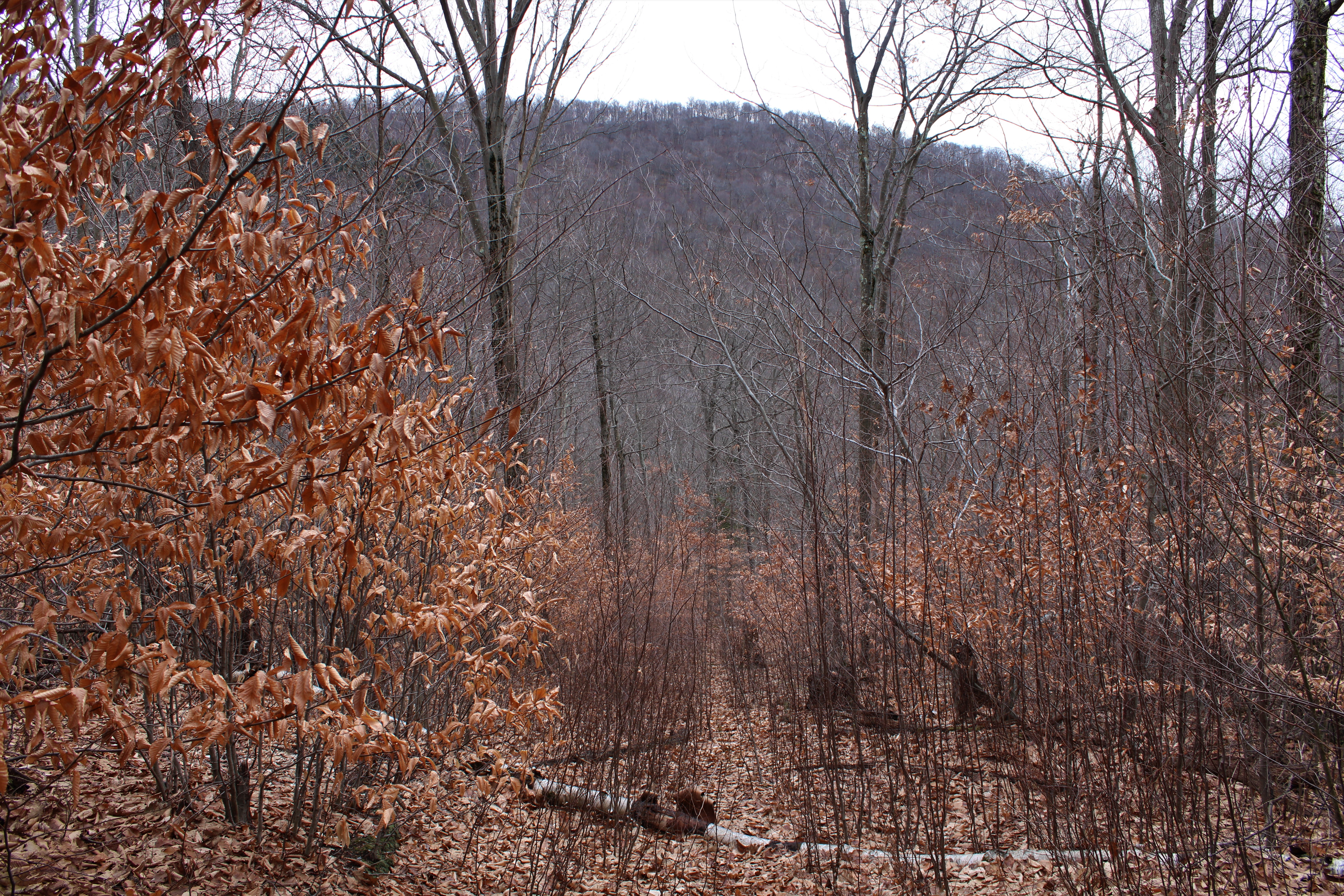
I headed north through the open hardwoods, closely paralleling a small stream, until a point where the state land opens up more.

Having already hit the top of the unnamed ridge north of Mattison Hollow before, I made quick time going up and over a small high point and continuing north down the steep slopes that drop into Browns Hollow.  As I descended, I was able to find some pretty good views at the summit ridge across the Hollow that I was aiming for. 


Although only 2135 feet, the ridge ahead began to look more and more daunting as I dropped down through northern hardwoods.

Down near the head of hollow, I picked up a good logging road, that lead up to a large clearing with views all around.  At just under 1500 feet, this is the view west back up browns Hollow towards the Rensselaer Plateau.

From the same clearing, looking south at the nearby ridge I had just descended.

Just below the clearing, down at the base of the hollow, I came to an easy rock hop crossing of picturesque Browns Hollow Brook flowing swiftly along.

Once across the brook, I picked up a good woods road that quickly dissolved into an overgrown foot path.  Turning around, I was able to enjoy a good view of the Mattison Hollow ridge to the south that I had just been on.


Following the state boundary straight up! This was probably the toughest part of the hike, gaining about 500 feet in less than 1/3 of a mile(on fallen leaves).


After a very steep climb, I finally hit the top of the ridge, where there were many filtered views north into Southeast Hollow.

You really never know what you're going to find in the woods, and especially on a bushwhack. I stumbled across not one but two very old cans of paint that must have been used to blaze property lines.

The summit ridge was nice and open and made for smooth sailing up to the wooded 2135 foot summit of the unnamed Browns Hollow Peak.


I continued east from the summit, dropping down on an old logging road with screened views towards Misery Mountain's ridgeline.

Down near the saddle, a small drainage flows down past white rocks, which are quite common for this area of the Taconics.


A short but steep climb brought me up the north slopes of Mattison Hollow's unnamed ridge, with filtered views back into Southeast Hollow.


Up high near the summit, there is one good but small view that takes in Berlin Mountain and its multiple ridgelines.

Just a few yards away from the true 2285 foot nondescript summit(which I had as the actual high spot on the Mattison Hollow ridge) sits a large meadow.  There are really no great views from here, but it is a really cool spot nonetheless.

From the summit meadow, I descended SW back towards my original route up, staying high above private land.  Arrived back at the car feeling great.  A very nice 5.5 miles bushwhack and nearly 2200 feet of ascent combined.  

Map Below.  Blue X=Parking  Red X's=Summit's hit


Wednesday, November 23, 2022

Life Changes

As some of you may already know, my wife and I welcomed our first child, Gabriel, into the world last week!  Obviously this will affect my ability to hike and maintain this blog, but I will still do my best to get out exploring as much as I can.  I look forward to many fun adventures yet to come!!!

Tuesday, November 8, 2022

Mount Raimer's West Ridge(Taconic Ridge State Forest-Town of Berlin, Rensselaer County)

With my wife being 9 months pregnant, I have been playing it close to the vest when it comes to hikes recently-not wanting to venture too far- just to be safe.  Again today, I "elected"(Election Day dad joke-sorry) to stay close to home and check out some newly acquired state land in the Taconic Ridge State Forest.  I wanted to check out the long west ridge of Mount Raimer from the south, beginning at the Green Hollow access point(Elevation 1310 feet) on a cool, breezy November morning.

Followed the marked trail east for less than 2/10 of a mile before beginning my bushwhack north, where a short and steep descent brought me down to the first of two drainage crossings.
Crossing stream number two. 
I headed north/ northwest up the steep slopes of Raimer's west ridge, gaining over 700 feet in about 3/4 of a mile.  I climbed towards the high point on the ridge, which sits over 2000 feet, but state land only comes to about 1/10 of a mile away.

Once on the ridge, I turned east with filtered views north into Petersburg as well as the northern Taconic ridge.
Dropping down into the col at about 1750 feet, I hit a good logging road(a former Cowee Forest woods road) and a clearing with a nice view SE towards the ridge leading to Berlin Mountain.

Further east, the logging road turned sharply north, where I managed to find more filtered views just off of that back towards the high spot I just been.

With some exploring in the woods, I was able to find some decent views northwest back into Petersburg and the valley of the Little Hoosic as well as the distant Rensselaer Plateau.


Following a well worn logging road up towards Mount Raimer.

From a small 2325 foot knob on Raimer's west ridge(about 2/10 of a mile west of the Taconic Crest Trail), I began a steep drop into the deep cirque west of Raimer's summit.  While side hilling, I found many screened views west on the steep slopes.

A view south towards Berlin Mountain's west ridge above Green Hollow.

There are literally a maze of logging roads on these slopes, many of which I utilized to make my way through the steep terrain.
From high above the drainage I had crossed earlier in the morning, I found this nice view west directly up Green Hollow.
Eventually I had to drop steeply down to the drainage, and then re-climb back up towards the marked trail. 

After a fairly steep ascent, I picked up a good woods road and followed it back to the marked trail, which was just under 2/10 of a mile from the car.  A real nice 6 miles and 2000 feet of total ascent without seeing another person. 

Map below from the updated DEC Taconic Ridge Sate Forest page.  

Blue X's=High spots on the ridge that I hit