Search This Blog

Friday, October 29, 2021

Moxham Mountain Cliffs via Route 28N(New State Acquisition-Adirondacks)

If you've ever driven along Route 28N north from North Creek towards Minerva, then you have undoubtedly seen the rocky cliffs that make up the long ridge of Moxham Mountain.  Although Moxham Mountain's true summit is public and even has a marked DEC trail, the entire south part of the mountain has always been, until recently, privately owned and off limits to the general public.  This all changed in the last couple of years, as the Adirondack Land Trust purchased this land back in 2019, before transferring it to the NYS DEC this summer.  What this means is that there is now public access to these cliffs, which can be reached via logging roads and a short bushwhack from Route 28N.

I parked on the west shoulder of Route 28N, just north of Del Culver Road, and directly above a clearing with an RV down below and a view of Moxham's cliffs above.(Elevation 1140 feet at car) 

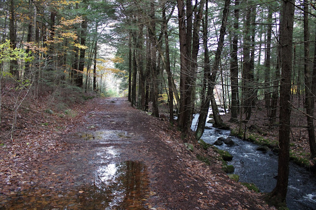
Just a few paces beyond the clearing and the RV, I picked up a logging road that enters the woods with occasional pink flagging.  The road is obvious and in good condition, but does split a short distance in. 

The main route heads left, but I wanted to make this a loop hike so I stayed on a lesser road, which breaks more north.  This road was quite muddy and a bit hard to follow, so at some point I simply opted to head straight up through the open woods.  A bluebird day with some lingering fall color made it a great afternoon to be in the woods.
I found some on again-off again pink flagging further up on some overgrown logging roads, which I followed part of the way up before bushwhacking through some crazy cliffs.
A break in the trees provided a glimpse up at some of the open cliffs on Moxham's ridge high above.
A fun, steep scramble brought me up to the first of several open cliff bands, where I was able to capture a nice look back down at my car along Route 28N.  While the views are nice through here, they only get better and better a bit further along, following the edge of the cliffs to the west.
The rocky cliffs are extremely steep and nearly vertical, so I actually had to climb around and then back down to the open ledges.
Unfortunately, just as I began to crest the open ledges the battery died in my camera.  I usually carry a backup battery but no such luck today!  Quite frustrating!!  The rest of the photos from the hike are via my I-Phone.

The walk along the cliffs is pretty incredible, with a bit of a herd path and some really awesome views.  My favorite shot was the view SW towards Gore and the open rock along Moxham's ridge.

There are several many spectacular views along the way such as this perfectly framed view of Gore Mountain to the south.

SE views stretching nearly 180 degrees.

South views towards Gore and Pete Gay Mountains.
Broad views and gorgeous weather found me lingering on these ledges for quite a while, soaking it all in..  This is the view SE towards North Creek.
West views from an open area of ledges.
The view west towards Moxham's nearby summit, which is trailed from the north side of the mountain.
The descent west/ southwest off the open ledges is actually quite pleasant through open hardwoods.  Within a short period of time I hit a very good logging road, which I followed dropping SE, following occasional pink flagging. Arriving in a clearing I enjoyed a pretty nice view back up at the open ledges I had just been on, nearly 400 feet above.
The logging road was in great condition and made for a very easy, scenic walk descending gradually SE.
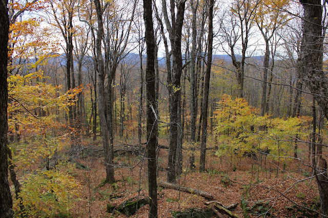
While the forest floor is buried in fallen leaves, there are still plenty of trees hanging on their fall color as we near the start of November.

After a nice and easy descent, I arrived back on the original logging road I had started on, which I followed back out to Route 28N and my waiting car.  An absolutely spectacular 4 mile loop, with 1200 feet of ascent and a perfect half day hike.

Map below.  Red Area=Ledges and Cliffs    Blue X=Parking


Wednesday, October 27, 2021

Cat Mountain and West Ledges(Cat and Thomas Mountains Preserve-Adirondacks)

I will preface today's trip report by first saying that I have always noticed-and wanted to explore- an open area of rock ledges high above the east side of the Northway just south of Exit 24.  When I dug a little deeper into these ledges I realized that they sit just west of the saddle between Cat and Thomas Mountains and are squarely on public land, meaning I could give it a go.  It has been several years since I last hit Cat Mountain, so I was really looking forward to revisiting it.  Parked at the trailhead along Edgecomb Pond Road(Elevation 1070 feet) and was a bit shocked to only find one other car there when I arrived.  

From the parking area, I headed west along the south shore of Edgecomb Pond on a wide, easy to follow road.  There are many opportunities to get down to the water's edge, with pleasant views to the ridge NW above the pond.  There are two options to climb Cat Mountain, but I took the red blazed trail for the ascent.

The red trail heads west/ southwest, steadily climbing up to Cat Mountain's 1946 foot summit, where the views are spectacular.  SE views take in a large chunk of southern Lake George and Trout Lake.  

East views towards the Tongue Range as well as many of the higher peaks east of Lake George.  Edgecomb Pond, where I had started the hike, is visible in the foreground.

SW views into the southern Adirondacks.

After enjoying the summit views-which I had to myself-I dropped down off the summit on the Cat Mountain Blue Trail, heading north towards Thomas Mountain.  I soon picked up the yellow blazed Richard Phillips Hayes Trail, where just prior to a steep ascent, I headed west into the woods on a pretty easy, straightforward bushwhack.  I slowly descended, heading towards the ledges overlooking the Northway through very open woods, stumbling across a pretty little vernal pond along the way.


Dropping down just below 1400 feet, I emerged at the open ledges that sit directly over the Northway.  They were actually more open than I suspected that they'd be, with solid views.  Crane Mountain was easily distinguishable as the high point on the west horizon.

To the SW, I-87 can be seen snaking its way far below.
NW views.

Between the west ledges and the marked trail there are a maze of old logging roads that meander throughout the woods.

Back on the trail, I enjoyed similar west facing views, but from a much higher vantage point.

Heading back down on the blue blazed trail, where there was some decent fall color still holding on. 

NW views across a wetland towards Thomas Mountain.


A bit further along, just a few yards off trail, is a very nice view of Cat Mountain looming high above a large beaver pond.

With it still being pretty early, I took my time on the descent, enjoying the remaining foliage in the woods.  The beech, in particular, seemed to really pop here.

Dropping down, the trail soon crosses over, then parallels babbling Finkle Brook, which feeds into Edgcomb Pond.  As expected following the recent rains, the trails were quite wet and muddy.


An easy hike back on the trail brought me to my car where-much to my surprise-there were no other cars in the lot!  Let me repeat that...there was nobody else there!  I only saw two other people on the trail all day, which was a shock.  A great day in the woods, but unfortunately did pick up a few ticks along the way once again.  Luckily not as many as my hike in the Catskills a few days ago though.  Hiked 5.8 miles RT, with 1500 feet of combined ascent.

 Map below.  Red X=Trailhead    Black X=West Ledges


Saturday, October 23, 2021

Unnamed Peak "2802"aka Broadstreet Hollow South Peak(Shandanken Wild Forest/ Hunter West Kill Wilderness-Catskills)

Headed down into the Catskills today to do an off trail hike to an unnamed 2802 foot peak that lies just north of Sheridan Mountain.  While the peak is officially unnamed, some folks refer to it as Broadstreet Hollow South Peak due to its proximity to nearby Broadstreet Hollow.  To get started, I parked in the fairly new Sawmill DEC parking lot off of Route 28 in Allaben(Elevation 940 feet) and headed north into the woods, soon picking up a good woods road.

Not being too sure about the weather, I was pleasantly surprised when the sun broke through the clouds providing delightful conditions.  Just a few minutes into my hike, I left the woods road I was on and crossed over a small brook, continuing NW.
The slopes were quite manageable, climbing gradually through wide open hardwoods.  At just over 1650 feet, I hit a large, wide open clearing that I had been aiming for.  Unfortunately there were no views to be had, but it was still a nice little spot complete with an informal fire pit.
Just beyond the clearing, I continued an easy ascent through deciduous woods, enjoying filtered views SE towards Sheridan.
As always in the Catskills, I picked up yet another woods road at about 1800 feet.  I was, however, a bit surprised to see just how good the condition of this old road was in, climbing north.
One of the best parts of the leaves falling this time of year are the views that open back up towards the surrounding mountains.  This is a screened view east towards the ridge that connects Sheridan and Peak 2802.
At just over 1900 feet, I arrived in the first of a couple of very large meadow like plateaus.  These types of areas seem to be unique to the Catskills, as I rarely find them in the Adirondacks.

In one of the meadows I found some old rusted relics.

From the meadows, I cheated NE before heading due east, climbing directly up the ridge through gorgeous autumn woods.


On my ascent, I picked up another woods road, which quickly brought me up what appeared to be the remains of an old quarry.

Continuing east, past the quarry, it was a steady climb through typical Catskill woods.  As I neared the summit the clouds began to roll in and with threatening skies above, I decided to pick up my pace.

Arriving at the nondescript, wooded 2802 foot summit. 

Instead of descending via the same ridge I came up, I decided to head south towards Sheridan on that ridge before a steep SW descent with more filtered views towards Garfield and Panther.

Although the foliage is past peak it is still very nice, with orange and yellows hanging on, even well up in elevation.
A steady drop SW brought me down to the main drainage between the ridges with some small, pretty cascades to enjoy.  On the west side of the drainage I picked up a good woods road, which I followed for a bit.
Utilizing different woods roads, it was a nice and easy descent back to the car for a total of 6 miles RT and nearly 2000 feet of ascent for the day.  Unfortunately I was covered in ticks once I got back to the car...head to toe.  It is 1000% tick season in the Catskills so a nice stretch of cold weather might not be such a bad thing.  Had a little bit of luck on my side, as a light rain began to fall almost as soon as I began to drive home meaning it had held off just long enough!

Map below.