Headed down into the Catskills today to do an off trail hike to an unnamed 2802 foot peak that lies just north of Sheridan Mountain. While the peak is officially unnamed, some folks refer to it as Broadstreet Hollow South Peak due to its proximity to nearby Broadstreet Hollow. To get started, I parked in the fairly new Sawmill DEC parking lot off of Route 28 in Allaben(Elevation 940 feet) and headed north into the woods, soon picking up a good woods road.
Not being too sure about the weather, I was pleasantly surprised when the sun broke through the clouds providing delightful conditions. Just a few minutes into my hike, I left the woods road I was on and crossed over a small brook, continuing NW.
The slopes were quite manageable, climbing gradually through wide open hardwoods. At just over 1650 feet, I hit a large, wide open clearing that I had been aiming for. Unfortunately there were no views to be had, but it was still a nice little spot complete with an informal fire pit.
Just beyond the clearing, I continued an easy ascent through deciduous woods, enjoying filtered views SE towards Sheridan.
As always in the Catskills, I picked up yet another woods road at about 1800 feet. I was, however, a bit surprised to see just how good the condition of this old road was in, climbing north.
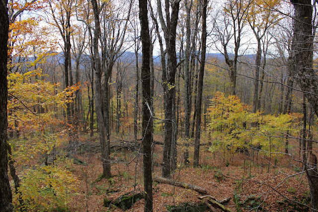
One of the best parts of the leaves falling this time of year are the views that open back up towards the surrounding mountains. This is a screened view east towards the ridge that connects Sheridan and Peak 2802.
At just over 1900 feet, I arrived in the first of a couple of very large meadow like plateaus. These types of areas seem to be unique to the Catskills, as I rarely find them in the Adirondacks.
In one of the meadows I found some old rusted relics.
From the meadows, I cheated NE before heading due east, climbing directly up the ridge through gorgeous autumn woods.

On my ascent, I picked up another woods road, which quickly brought me up what appeared to be the remains of an old quarry.

Continuing east, past the quarry, it was a steady climb through typical Catskill woods. As I neared the summit the clouds began to roll in and with threatening skies above, I decided to pick up my pace.

Arriving at the nondescript, wooded 2802 foot summit.
Instead of descending via the same ridge I came up, I decided to head south towards Sheridan on that ridge before a steep SW descent with more filtered views towards Garfield and Panther.
Although the foliage is past peak it is still very nice, with orange and yellows hanging on, even well up in elevation.
A steady drop SW brought me down to the main drainage between the ridges with some small, pretty cascades to enjoy. On the west side of the drainage I picked up a good woods road, which I followed for a bit.
Utilizing different woods roads, it was a nice and easy descent back to the car for a total of 6 miles RT and nearly 2000 feet of ascent for the day. Unfortunately I was covered in ticks once I got back to the car...head to toe. It is 1000% tick season in the Catskills so a nice stretch of cold weather might not be such a bad thing. Had a little bit of luck on my side, as a light rain began to fall almost as soon as I began to drive home meaning it had held off just long enough!
Map below.


It's tick season this week in the Helderbergs and Vermont too, believe me, ugghh...It gets worse every year it seems. Let's keep praying for some frosty temps.
ReplyDeleteThe ticks tend to ruin everything don't they?! Grrr. Great day otherwise!!
Delete