Headed back up into Vermont today to hike 3230 foot Mount Aeolus(aka Green Peak) located just west of Route 7 in East Dorset. I captured this nice profile of the mountain from the south along Morse Hill Road, where the hardwood line is pretty obvious, as well as the remains of Folsom Quarry to the right(east).


I continued south for about a mile up to a narrow, side road that heads right, climbing steeply uphill to a microwave transmitter and abandoned quarry. From atop an enormous rock pile, I caught a very steep glance down towards Route 7 and the nearby Green Mountains to the east. Mad Tom Notch is clearly visible to the right with Styles Peak being the high point on the horizon in the center.

A quick drop back down onto the main quarry road found me continuing a steady ascent south for about 1/3 of a mile more until I came to the remains of the former Folsom Quarry, at an elevation of 2060 feet. There are some very good views south from here overlooking the Manchester area towards Spruce Peak and Prospect Rock.
A very short spur trail heads directly into the abandoned quarry, which was opened back in 1854, with enormous vertical work faces reaching nearly 100 feet high.

The main quarry road skirts Folsom Quarry and now turns more north/ northwest, climbing steadily on a narrowing road. Less than a half mile past Folsom Quarry, turn right at an unmarked junction, where the climbing becomes a bit steeper and the trees become noticeably more bare.

About 2 miles into the hike, a small, unmarked but obvious path heads just a few yards into the woods to the Nature Conservancy's Bat Cave, which is currently closed to the public.

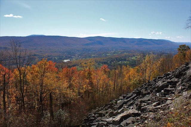
Just beyond the Bat Cave is a small clearing with perhaps the best view of the day, stretching to the south and east. Similar to the view at Folsom Quarry, this view is even better because it is 500 feet higher and a bit broader.

The SE view with Stratton Mountain poking out above the ridgeline in the distance.

The incredible view south out over the Valley of Vermont, with Mount Equinox rising straight up to the west(right) of Manchester.


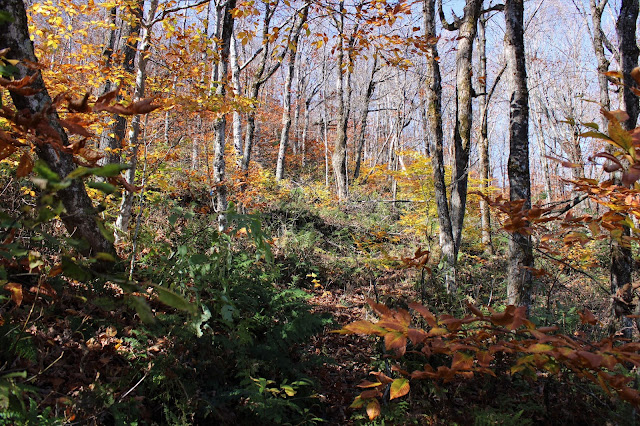
Beyond the view point, the road narrows even more, quickly becoming a very rough woods road, and then more a combination woods road/ herd path. At about 2800 feet, the woods become increasingly steeper and the trail becomes tough to follow. The beech trees appeared to almost be on fire at this elevation and were just about the only color left in the woods.

Found occasional blue flagging to aid in my attempt to stay on the herd path, but it almost seemed to peter out in spots, only to reappear moments later.

After about 2.8 miles, I arrived at the wooded 3230 foot summit. It was pretty chilly up here compared to the lower elevation and 100% evergreens.

Poking around the summit, I was able to find the summit jar, which I signed in on.

After hitting the top, I turned around and retraced my steps back down the mountain more easily following the blue flagging on the descent. Once back on the quarry roads, it was a peaceful, easy hike back with temps climbing up to about 60 degrees near the car.

Hiked about 5.6 miles RT with just under 2000 feet of total ascent on yet another beautiful fall day!
Map below. Blue X=Parking Red X=Summit

I could not get the lid off that jar.
ReplyDeleteYeah, I had a tough time of it too. Someone really sealed that lid tight!
Delete