Search This Blog

Friday, August 27, 2021

Thacher Park via Old Stage Road(Town of Knox, Albany County)

Did a nice and easy little walk today from a small parking area on Old Stage Road in one of the quieter sections of Thacher Park.  Tucked into the NW corner of the park, these trails aren't quite as well known to the general public and are quite popular with mountain bikers, as well as hikers.  From the parking lot(Elevation 1345 feet) I first headed east into the woods on High Point Road, enjoying the sounds of songbirds in the trees above.  The woods are a deep, lush shade of green as summer time humidity and temperatures fill the air.

I followed an unmarked herd path over to the edge of the escarpment and found unique NW views from a spot called "Flat Rock".

Flat Rock inscription. 

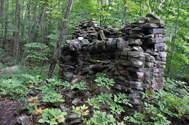
Back on the marked trails, I hit parts of the Long Path, Fred Schroeder Trail and Perimeter Trail, which are all fairly level(save one small climb on the red blazed Schroeder Trail).  Nestled amongst the trails throughout these woods are many old, handsome stone walls.

After hitting Carrick Road and its parking lot from the red trail, I followed the yellow blazed Perimeter Trail back north to the car, passing through wide open meadows, filled with wildflowers and fluttering butterflies.

A very pleasant, easy 3 miles round trip on this warm summer day.  Was surprised to only see a couple of other folks out enjoying the trails today as Labor Day and the unofficial end of summer slowly creep up on us.


Tuesday, August 24, 2021

Niagara Mountain(Former Dix Mountain Wilderness(High Peaks Wilderness Area)-Adirondacks

The trail-less peaks that reside just east of the Dix Range, and just NW of Exit 29 on the Northway, form a string of pearls, each with outstanding vistas to enjoy.  Several years ago I had climbed Nippletop(the non High Peak)and ever since then, its neighbor 3018 foot Niagara Mountain and its open rock has been on my radar.  Access to these peaks can be a little tricky, as you have to follow a right of way on a private road to a crossing of the Schroon River, and then finally pass through two culverts under the Northway to get to state land.  

I parked on the shoulder of Route 9 next to private Walker Road(Elevation 942 feet) and followed the road to a split, where the ROW heads right down to the Schroon River.  This could potentially be a tricky crossing, but on a hot sultry day like today, and only being shin deep, it was a non issue. 

Once across the river, there are a myriad of unmarked jeep roads, but it is fairly easy to stay on the correct one, which quickly leads to the walking culvert beneath the Northway.

After passing beneath both the north and southbound lanes of I-87, the first state land signs will come in to view. 
Just a few moments after hitting state land, the sounds of rushing water can be heard.  This is Walker Brook, and the unmarked but obvious foot path crosses the water here on a rock hop, continuing along the south side of the brook.  The path was in great condition and I made great time heading west up towards the saddle between Camels Hump and Niagara.
Our wet summer lead to numerous newt sightings in the woods today.
I stayed on the unmarked trail to about 1900 feet, where the trail begins to peter out.  From there, I headed SW into the woods, climbing steadily up towards Niagara's east summit.  There were several small areas of open rock on the way up, with some pretty good views to boot.
The climb up to the eastern summit was fairly straightforward, but steep and scratchy in spots.  This summit is the lower summit, rising to about 2930 feet.  The top has no views but...

..a short distance past the top I hit a large area of open rock.  The views here were very good!!  Looking north towards Camels Hump and Camel, which were both in the dark shadow of a cloud.

Enjoying a close up view of the true summit of Niagara, which sits less than a quarter mile away.
The woods between the two peaks was moderately thick but manageable.  Once near the top, the woods opened up to an area of low brush, which was a tripping hazard, but better than thick spruce.
After pushing through the brush, I soon arrived at the 3018 foot summit of Niagara, and an abundance of open rock slab.

The views from the summit were nothing short of outstanding!  To the south, Big Marsh Pond and Marsh Pond Mountain are on the right, with the Hoffman Ridge rising high above just beyond.  A sliver of Schroon Lake is visible in the near distance.
Slightly SW, the view opens up with Blue Ridge and Washburn Ridge being the high points.
A nice breeze from the open summit cooled me off on this hot and humid early afternoon.
What an amazing vista!!  To the west/ NW the Dix Range unfolds before you.
West views towards the neighboring Dix Range just across the Niagara Brook valley.

After soaking in the tremendous views, I headed down through some thick woods, but did manage to catch a nice view back up at the summit rock above.

On my descent, I headed north, then northeast dropping steadily down through some pretty thick woods, before I finally picked up the unmarked trail again.  From there it was a very pleasant hike back out to the car.  

A long and hot but fantastic day in the woods!  This peak was everything I hoped it would be!  Hiked about 9.5 miles RT, with 2400 feet of ascent.  

Map below.  Red P=parking   Blue X=true summit   Black X=east summit


Saturday, August 21, 2021

Unnamed Scribner Mountain South Ridge(Wilcox Lake Wild Forest-Adirondacks)

With a fairly nice afternoon shaping up but only limited time, I did a short bushwhack hike to an obscure, albeit nice set of ledges in the southern Adirondacks.  The ledges are part of the unnamed south ridge of Scribner Mountain(although oddly enough, the south summit is actually much higher than the one labeled on maps as Scribner Mtn) Parked on Creek Road in the town of Hope at a height of land(Elevation 1180 feet)and headed north into the woods, immediately dropping down to a small stream crossing.

The woods quickly transitioned from softwood to mostly hardwood and were very open.  Navigation on this short hike was not an issue.


Instead of heading right for the summit, I veered over to a series of small but steep west facing ledges.

NW views from a second ledge.
Exploring the ledges.
West views towards Cathead Mountain.
After enjoying the views, I headed back SE and up to the 1600 foot nondescript, wooded summit. 
A nice and easy return route to the south brought back to my car in no time.  A little humid and a little buggy, but pretty nice day overall.  Wish I had more free time but had to settle for 2+ miles(all bushwhack) and 550 feet of total ascent.

Map below.  Blue P=Parking    Black X=Summit   Red circle=Ledges


Wednesday, August 18, 2021

Upper Goose Pond(Appalachian Trail-Berkshires)

Back from vacation, I was looking to do a welcome home hike, but a wet forecast somewhat limited my options.  A glance at the radar showed me that heading east was my best option, so I initially headed up into October Mountain State Forest to attempt a bushwhack hike. Unfortunately some of the roads I hit were a bit too much for my car to attempt so I played it safe and headed down to Route 20 near the Becket/ Lee town line to hike a section of the Appalachian Trail to Upper Goose Pond.  It has been several years since my last visit here so I was looking forward to revisiting, although the overcast, muggy conditions were less than ideal.

Parked in the large lot on the south side of Route 20 and headed out(elevation 1355 feet), following Route 20 east for just under 2/10 of a mile before the AT dips into the woods.  From there, I headed a short distance south to a crossing of Greenwater Brook.

Just past the brook crossing, the trail emerges in a large clearing along the west end of Greenwater Pond, which is mostly privately owned.

The trail then crosses over both lanes of the Mass Pike, where the rushing traffic makes it feel like anything other than a nature hike.


 Just a few minutes back in the woods however, and the sights and sounds of the interstate quickly vanish.  The AT climbs up over a shoulder of Higley Brook Hill, before swinging west then dropping south towards the pond.
This mushroom caught my eye along the way.
At a trail junction, I followed the AT east along the north shore of the pond for a distance, taking in the views of nearby paddlers out on the water.
My turnaround point was the old stone fireplace located near a viewpoint. 
Headed back to the trail junction, then followed the trail to the cabin and camping areas along the west shore of Upper Goose Pond.  Unfortunately, due to Covid, the cabin is closed, but there is a caretaker there to assist hikers and even cook them breakfast.
Chatted with the caretaker for a bit, before turning back and retracing my steps to the car.  A sticky and buggy 4 miles RT, but thankfully the rain stayed away.
 

Mount Pelineo(Chios, Greece)

Enjoyed a wonderful vacation visiting my wife's family from her native island of Chios in Greece, and even squeezed in some hiking to boot.  Chios is the fifth largest island in Greece and is home to over 50,000 permanent residents.  That number increases significantly in the summer with the influx of tourists, but with Covid-19 still an issue, it wasn't nearly as packed this year.  

One of the main draws to the island are the numerous amazing beaches on the Aegean Sea.

The sunsets are truly magical...

...and the water is crystal clear!

What few outsiders realize, however, is that there are incredible mountains on the island.  

 My goal was to hike to the very top of the highest peak on the island, which is called Mount Pelineo.  This rugged mountain sits in the northern part of the island and rises to 4254 feet in elevation.  Hiking isn't really a "thing" in Chios, so it would be a rough, farm road for about 4 miles, followed by an even rougher, intermittent herd path through stone and loose rock for less than a mile up to the top.  We started the hike at about 7am at an elevation of 1400 feet, and while the views along the old road were very nice, the scramble up to the top was absolutely incredible.

The rugged, rocky summit fortress from the top of the old farm road.

Looking south over a smaller "bump", which has a small church atop it.  To the left is the long southern ridge of Pelineo.

This exposure on this hike was unlike anything I've ever hiked before.  There was literally no shade the entire day, with near hurricane force winds coming directly off the sea up high.  A careful eye can pick out the farm road way down low that we had used to access the peak.

This rugged terrain is suitable for mountain goats, which we actually found near the summit!

Once we clawed our ways up to the top, we were battered by even stronger winds and we had to really hold on tight.  The views from the top were indescribable!  360 degree views with the Aegean Sea visible to the east, west and north!!

Summit views towards Turkey in the east!

One of the most fascinating parts of the summit area, is a small church that is bolted and chained down along the spine of the ridge!!

Although the winds were unbelievable up high, nearly blowing us off the top, we still lingered at the summit for a while, soaking in the amazing beauty.  The descent was very steep but manageable. as we carefully took our time through the loose scree.  A long walk on the farm road brought us all the way to the car for a total of about 8.5 miles RT with over 2800 feet of ascent.

The nice part about an island vacation is the rest and relaxation post hike, with sea views to boot.