Search This Blog

Tuesday, December 15, 2020

Chalet Wildlife Management Area Ledges(Berkshires)

Headed east into the Berkshires today to do some exploring in the 5267 acre Chalet Wildlife Management Area, which consists of land in the towns of Dalton, Windsor, and Cheshire.  The only marked trail in the Chalet WMA, is the Appalachian Trail, which can be found in the west part of the area, running N-S along the ridge of North Mountain.  My goal today was to explore a vast area further east near the Windsor/ Cheshire town line, where no marked trails exist.  While checking out a slide on the east side of the ridge near Cheshire Cobbles back in August, I spotted an open area of rocky ledges across the valley that I wanted to check out.  Today proved to be that day, with a forecast for clear skies but cold and windy weather.  I stopped on my drive in on Windsor Road to check out the view south towards the area where I had spotted the ledges(although not visible in this photo)

I attached a photo below from the slide, looking at the rocky ledges to the SE from that hike back in August.

I parked in a small, designated parking area for the WMA on the south side of Windsor Road, elevation 1345 feet.  From the parking lot, I picked up a good foot path heading south across open meadows, with the higher terrain I was heading towards, looming just above.

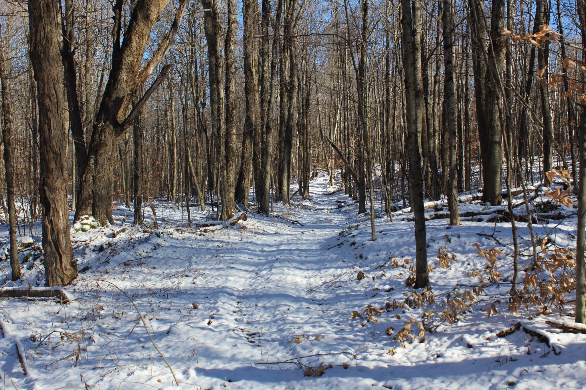
Once I hit the woods, the foot path became a good woods road ascending through a dark, hemlock forest.

Although no marked trails are found in this section of the WMA, there are a myriad of woods roads criss-crossing the forest.  I tried my best to stick to the ones heading the direction I wanted, while also not losing elevation.

 A small oxbow in a pretty stream that drains the slopes of the unnamed ridge I was on.


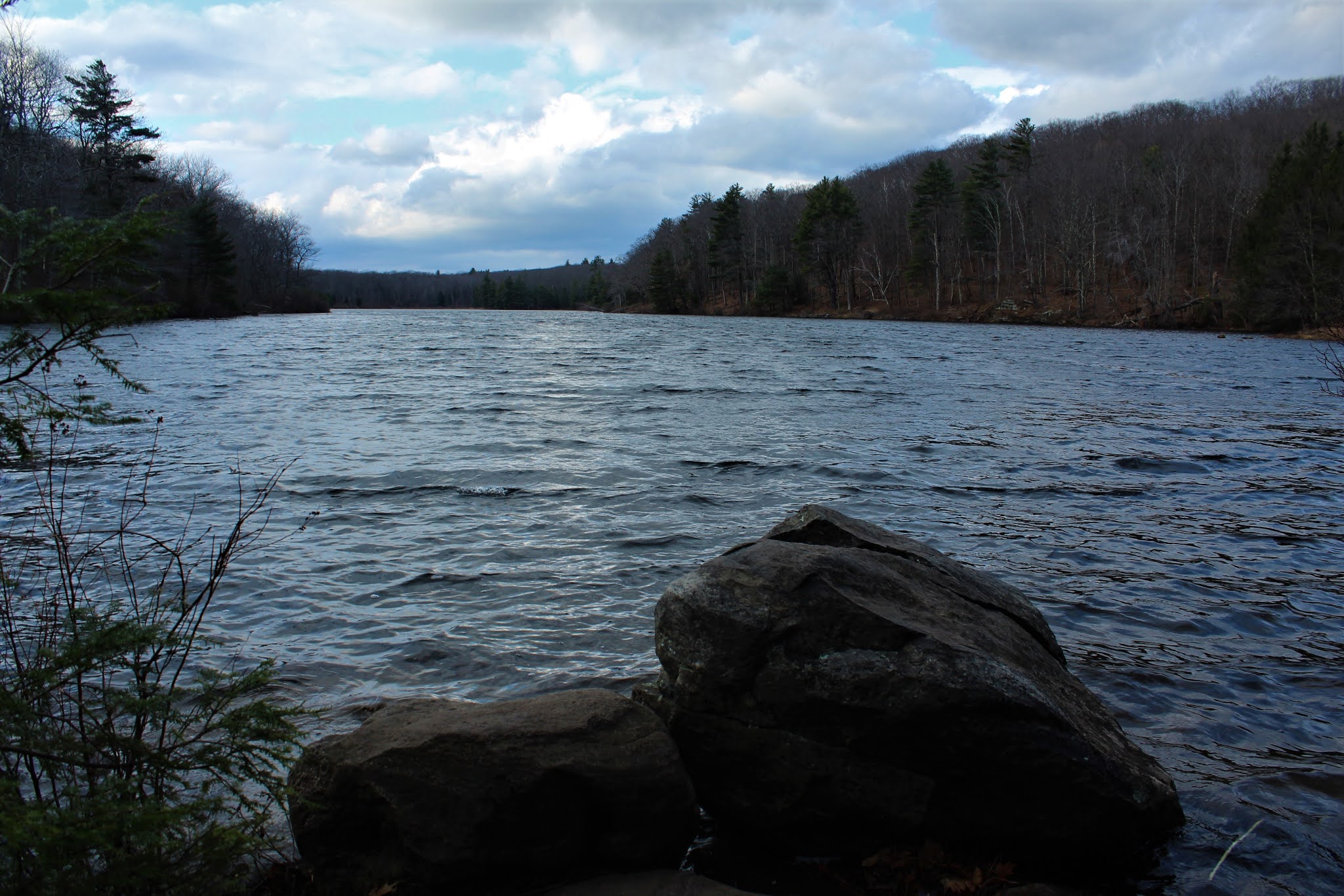
As I continued south on a woods road, I could see a large, unexpected clearing coming up on my left through the trees.  As I got closer, I realized that this was a pretty decent sized beaver pond, completely snowed over at 1950 feet.   I even spotted a small stove just a few yards away from the beaver pond, where someone set up a small campsite.

One of the small stream crossings along the way(off the woods road).
While I was able to stick to woods roads much of the time, I did try to save some time by bushwhacking down through a deep gorge where South Brook flows and was astonished by what I found.  A spectacular 40 foot waterfall from a tributary comes tumbling down the steep slopes to the east into South Brook, making for quite the dramatic surprise. 
From the falls, it was a true bushwhack west through mostly open woods.  The only real issue was  mountain laurel, just around the area where the ledges were.  I had to drop down to about 1525 feet to find the open rock, where the views were superb.  The ridge that makes up Cheshire Cobbles in on the left(with the slide I was on in August easily visible).  Front and center is the Greylcok Range with the valley of Cheshire and Adams below.
Same view, from a bit further up on the open rock.  Wow, what a spot!!
There are actually two separate open areas of rock right next to each other.  Climbing up the slightly higher, slightly east rock ledges, I was able to find this framed view of Greylock.
From the eastern ledges looking west, over at the long ridge of North Mountain, just south of Cheshire Cobbles.
On my return hike, I chose to bushwhack more instead of sticking to the woods roads.  This cut off some time but added some more up and downs, crossing several small, icy streams. 

The cold north wind kept me moving at a brisk pace, and soon enough I was back on my original woods road.  From there it was an easy rock hop across McDonald Brook just prior to hitting the open field and my warm car.

Hiked about 6.5 miles total, with 2050 feet of ascent.  It was a lot tougher of a hike than I initially thought it would be because of all of the small ups and downs, but a gorgeous untapped hiking area with much to see.

Today's route below.  Red=Route in     Black=Return Route     Blue X=Ledges


Tuesday, December 8, 2020

Ellis Ridge & Barton Mountain(Pharoah Lake Wilderness-Adirondacks)

To the northeast of Brant Lake stand a spectacular little group of small mountains and peaks that have much to offer the adventurous hiker.  Very few marked trails can be found on these peaks and the few that are here tend to lead to ponds instead of mountain tops.  Some of these trails do however provide access to the peaks in the far SE corner of the Pharoah Lake Wilderness.  Today's goal was to hike from the Springhill Ponds trail up to Ellis Mountain's ridge, before then leaving the trail and bushwhacking south to 2204 foot Barton Mountain.  I was the only car there when arrived at the trailhead off of New Hague Road, and was the first to sign in the trail register since last weekend.  Elevation to start the hike was 1160 feet, on a cold 20 degree morning.

The trail shares the first 1/3 of a mile with the Berrymill Pond trail, before leaving the blue trail and turning left onto a yellow blazed trail. From here, the trail ascends through a mostly hardwood forest, closely following and then crossing Trout Brook, a small stream that flows down the slopes of the mountain.
Although a very light snow was falling, the sun did attempt to make an appearance. This was all the sun that I would see for the day, however.
The trail gradually gains over 700 feet in just over a mile, before turning south and following the ridge of Ellis Mountain.  Once over 2000 feet, a good solid inch of snow coated everything white, with just enough conifers mixed in to make it very pretty.  From a high spot on the ridge, I caught a fleeting glimpse of Barton's north ridge poking out through the trees.
After a bit over 2.3 miles, the trail begins to lose elevation, and heads west towards the ponds.  This marked my jumping off spot, as I began my bushwhack heading south.  The woods were mostly open but cold and wintry.
There was really only one thick area of spruce to contend with but the closer I got to Barton, the tougher the terrain got.
A low spot in a rugged, boulder laden ravine.
Surprisingly enough, I picked up a pretty good herd path about 1/4 of a mile before the summit, so I stayed on that for a bit before regretfully leaving it too soon and hitting thick spruce and lots of blowdown.  Luckily this didn't last long and before I knew it I found the open, east facing ledges I had been seeking. 
The open ledges are quite nice, and even with light flurries falling, the view was good.  Wintergreen Lake can be seen to the right in the foreground, with Round Mountain just beyond that.  Off  in the distance, just past Round Mountain is part of Lake George.  A very careful eye can even pick out a small sliver of Lake Champlain far off in the distant left.
To the NE, the view takes in Barton Mountains private north summit ridge, with Trumball Mountain just beyond.  I can only imagine just how good this view would be on a clear day.
Just over 1/10 of a mile west of the view spot is the wooded 2204 foot summit, marked with a small cairn.
After hitting the summit, I decided to head more westerly off the slopes of the mountain, avoiding the thicker, rougher ups and downs up high.  A nice view here from below the rugged cliffs near Barton's summit.
I leisurely took my time, heading back towards the marked trail, avoiding the steep terrain through open hardwoods.  A quiet little wintry stream was my companion for several minutes as I soaked in the ambiance of the December woods. 
Once back to the trail, I retraced my steps uneventfully back off the mountain.  Hiked about 8 miles RT, with over 1900 feet of total ascent.   

Today's rough route below.  Red=Ascent   Blue=Descent


Wednesday, December 2, 2020

Old Mill Trail(Berkshires)

Visited the Berkshire Natural Resource Council's 127 acre Old Mill Trail property, which pretty much straddles the Hinsdale/ Dalton town line, after work today.  The trailhead is located just over the town line in Hinsdale on Old Dalton Road along the banks of the East Branch of the Housatonic River.  I was elated to have the place to myself, but being an after work hike, I knew I would have to keep up a steady pace due to the early sunset.  The trail begins at an informative kiosk along the East Branch, elevation 1340 feet.

After just a few moments, the trail comes to a well built bridge crossing of the river.  This offers up your very first good water views from the trail. 
The trail meanders along to the north, keeping the river within earshot, while passing by many historical artifacts in the woods.  Although not all easily visible, some of the mills date back to the 19th century, while other things, such as the rusted car pictured below, are only a generation or two removed.
The highlight of the trail, however, is without a doubt the East Branch of the Housatonic.  There are many good chances to enjoy the water..whether you are photographing, fishing, or taking a dip.  Gonna take a rain check on that swim for now though.
After about 7/10 of a mile, the trail comes to a road crossing of Route 8.  While not the busiest road in the Berkshires, it does see a fair share of traffic, so please take care crossing.  Once across the road, the trail closely hugs the East Branch, literally only a step away at times.  The trail is laid out beautifully through this stretch, with carefully placed stone steps along the way.
Trail signage along the way.
Following our heavy rainfall from Monday, the water was really rushing along today.  Looked bitterly cold, yet still so beautiful. 
Spotted some kind of old abutments in one spot on the river, near the end of the trail.  Not sure what these are from, but my best guess would be some kind of old bridge. 
Although not super high in elevation, the trail stays basically between 1200 and 1300 feet much of the way, meaning it was just cold enough to support a light coating of snow, while the valleys were getting just plain rain. 
The trail is an out and back hike for now, totaling 3 miles round trip.  I kept up a steady pace on the way back, arriving back at my car just before sunset.  A well crafted trail with a lot packed into a fairly small place.
 

Saturday, November 28, 2020

Beartown State Forest(Southern Berkshires)

Headed east to the 12,000 acre Beartown State Forest in the Berkshires after work this afternoon to check out Benedict Pond and a spot along the Appalachian Trail known as "The Ledges".  It's been several years since my last visit here, but I do remember it being quite scenic, so I was looking forward to it.  I drove to the boat launch parking area-which was nearly full-to get started, elevation 1585 feet.  Within moments of stepping out of the car I saw a jogger, several small groups of people walking and the sounds of dogs barking from both directions.  Even though it was a Saturday, I was still quite surprised that it was this busy on an overcast late November day.  I shrugged my shoulders and set out on the Pond Loop Trail, happy to see so many folks out enjoying nature, and stopping at several view spots to take in the water views.

Heading counterclockwise along the Pond Loop, crossing over a small outlet from the SE corner of the pond.
Although the forecast called for clearing skies, the clouds held firm.  The gray skies coupled with a biting wind made the water look about as uninviting as possible..although still quite scenic however.
At a spot where the Pond Loop continues left, I continued right on the Appalachian Trail, crossing a tiny bridge and heading NE.  From here, just off trail maybe 50 yards, sits a sizeable beaver pond and meadow, which I decided to check out.

Back on the familiar white blazes of the Appalachian Trail, it was a steep, rocky ascent up to the area called "The Ledges".  The drop off from here is nearly vertical, offering up splendid south/ southwest facing views.  The summit to the left is nearby Livermore Peak, with Butternut Ski Area just beyond that, and Mount Everett towering above on the horizon.

Turning slightly to the right, taking in more of the ridges to the SW.


After enjoying the views, I backtracked towards the steep, rocky ravine I had just climbed up.  From the top of this ravine, an informal path leads north to a large, picturesque beaver pond.  Unfortunately, there were several other people hanging out there so I decided to go off trail around the edges of the beaver pond to check it out.  The mountain laurel along the shore was pretty thick in spots, so I didn't explore too much.  Did catch this unique view from the opposite shore that probably doesn't get much attention.

Got back down off the AT and onto the Pond Loop, continuing all the way around Benedict Pond nearly in the dark as the sun was setting.  Hiked about 2.8 miles RT, with about 300 feet of ascent.


Monday, November 23, 2020

Misery Mountain South Peak(Taconics/ Berkshires)

Headed just over the state line east into the Berkshires this afternoon to explore Misery Mountain's 2656 foot south summit.  To get to the summit, I would be bushwhacking west through both the Hancock Wildlife Management Area as well as the E. Howe Forbush Sanctuary from Route 43 in the town of Hancock.  A small, unmarked woods road would be my starting point for the day, elevation 1210 feet.


Instead of just sticking to woods roads, I decided to explore some of the terrain, heading over to a  drainage at the far south end of public land.


Near the stream, I found the remains of a stone wall, likely marking an old boundary line.

The woods were almost 100 percent hardwoods and very open and easy to negotiate.  As I hit 2300 feet, I began to see a little snow scattered about on the ground, with screened views SE back towards Jiminy Peak's ski slopes.


From 2400 feet and above the snow began to not only stick to the ground, but the trees as well.

Skies slowly began clearing out as I headed up the ridge, with increasing amounts of snow covering the ground.
Couldn't have asked for more open woods to bushwhack through.  Literally wide open in spots.

Way up high on the ridge, over 2500 feet, I picked up a solid woods road heading towards the summit.


While plugging along slowly ascending NW, I spotted a small, almost unnoticeable wetland just a few yards into the woods so I decided to check it out.  Seemed so out of place, but was so pretty blanketed in a soft coating of white.

Back on the woods road it lead me right up to the 2656 foot nondescript summit.  Although wooded, there was a biting wintry wind cutting through the bare trees that kept me from lingering.

The screened summit "view" through the trees to the NE

Basically took the same route down, descending to the SE on various woods roads.  Back below 2300 feet all the snow vanished, and I was able to catch some more filtered views east over the Route 22 valley towards Brodie Mountain's south ridge.

 The final descent down a good woods road, with Brodie looming above.


Hiked just a touch over 4 miles RT(all bushwhack) with 1500 feet of ascent.  Today's route below.  Red=Ascent  Blue=Descent